Pimentel district
| Pimentel district | |
|---|---|
 The district of Pimentel is located on the coast in the extreme northwest of the province of Chiclayo (marked in red) |
|
| Basic data | |
| Country | Peru |
| region | Lambayeque |
| province | Chiclayo |
| Seat | Allspice |
| surface | 66.5 km² |
| Residents | 44,602 (2017) |
| density | 670 inhabitants per km² |
| founding | October 18, 1920 |
| ISO 3166-2 | PE-LAM |
| Website | www.munipimentel.gob.pe (Spanish) |
| politics | |
| Alcalde District | César Roberto Jacinto Purizaca (2019-2022) |
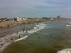
| Pimentel Beach | |
Coordinates: 6 ° 50 ′ 7 ″ S , 79 ° 56 ′ 4 ″ W.
The district of Pimentel is located in the province of Chiclayo in the Lambayeque region in northwestern Peru . The district has an area of 66.53 km². The 2017 census counted 44,602 residents. In 1993 the population was 18,524, in 2007 it was 32,346. The seat of the district administration is the coastal town of Pimentel .
The Pimentel district is located on the Pacific coast of northwestern Peru, west of the city of Chiclayo . About 6 km of coastline belong to the district. In the northeast, the district extends to the outskirts of Chiclayo. It is 13 km from the main town of Pimentel to the center of Chiclayo.
The Pimentel district borders in the north on the districts of San José and Lambayeque (both in the province of Lambayeque ), in the east on the districts José Leonardo Ortiz , Chiclayo and La Victoria and in the south on the district of Santa Rosa .
Individual evidence
- ↑ a b PERU: Lambayeque region - provinces and districts . www.citypopulation.de. Retrieved January 19, 2020.
Web links
- Municipalidad Distrital de Pimentel
- Map (7.2 MB) at escale.minedu.gob.pe
