Dornbusch (Hiddensee)

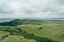
The hill country in the northern part of the German Baltic Sea island of Hiddensee is called Dornbusch . It mainly consists of glacial deposits that remained after the glaciers thawed. He is one of three island cores of Hiddensee, which are responsible for the formation of the lowlands.
The Dornbusch has a north-south extension of approx. 2.45 kilometers and an east-west extension of approx. 2.85 kilometers. The highest point is the Bakenberg at 72.7 m above sea level. NHN . Around 70 m above sea level The Schluckswiekberg, on which the symbol of Hiddensee stands, the Dornbusch lighthouse, is NHN high .
With its mostly still active cliff coast , it represents a valuable landscape in the Vorpommersche Boddenlandschaft National Park and is incorporated into protection zone II. Many hiking trails lead through the varied landscape.
history
The formation of the highlands goes back to the last phase of glaciation in northern Germany, the Vistula Ice Age . A small extension of the glacier tongue, which points to today's Little and Great Belt, created the thorn bush around 12,500 years ago. When the glaciers retreated, it remained as a compression moraine and was part of a large mainland area in the south of today's Baltic Sea for about 4000 years. During the first flooding phase of the Baltic Sea, the water did not yet reach the area around Hiddensee; the Littorina Sea only washed around the three island cores Dornbusch, Fährinsel and Gellen around 3900 years ago . Coastal erosion (land erosion , drifting and sedimentation) and the formation of the elongated shape of Hiddensee through sand alluvial only began 2900 years ago .
Under Wallenstein's orders , the oak and beech forest covering the entire Dornbusch was burned down from 1628 to 1630 in order to leave no more wood for the construction of ships for the Danes with whom there were armed conflicts in the area. Certainly, the forest was already at least partially damaged by these. The supposedly old thorn bush forest is still relatively young; it was only slowly reforested with conifers from 1861 after the first pine plantings had failed in 1780. From 1900 deciduous trees were also planted. Before that, the entire hill country was covered by treeless dry grass and arable land and was regularly sanded over in strong winds. The felling of individual trees in the newly planted forest to cover the need for firewood resulted in numerous clear areas with a lot of undergrowth.
In the 1960s and 1970s there were four oil wells on the northern Dornbusch, but these were stopped shortly afterwards. A separate pier was built at Schwedenhagen for the transport to and from the drilling rigs. In 2009 it was demolished. A landfill for municipal waste was set up at the highest drilling point (east of Swantiberg). From 1990, the landfill was rehabilitated before the area was included in the national park. It is still a problem, because as the highlands continue to be eroded, the waste will also reappear.
Until 2000, there were remains of the bunkers from the Second World War that had been blown up by the Soviet army.
geography
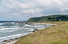
The Dornbusch stretches from its flat foothills in the southeast on the Vitter Bodden and near the monastery to a cliff that towers up to 60 meters and at the foot of which a more or less wide scree beach is formed.
To the south, the Hiddenseer Flachland joins with Vitte , the Dünenheide , Neuendorf and finally the Gellen . From the north-easternmost point, the end thorn , the two broad sand hooks Old and New Bessin, overgrown with sea buckthorn, stretch south.
The thorn bush consists predominantly of alternating layers of boulder clay , sand, gravel and writing chalk . Boulders on the scree beach still testify to the enormous forces of the ice masses. The largest is by far the Bismark rock on the Tiddenufer (north bank of the Hucke); others are the Zeppelin stone and the hall stones on the Hucke.
While the cliff between the village of Kloster and the north bank of the westernmost steep ledge ( Hucke ) is largely inactive due to the construction of a three meter high protective wall, landslides and demolitions often occur in the central and northern parts, here the bank continues to be cut back by abrasion . A distinction must be made between two types of coast of the latter variant. The high bank areas that are not in exposed places (i.e. in the middle part of the cliff) are slowly eroded, and sea buckthorn bushes sometimes form on them. In contrast, the lower northern banks drop sharply and are mostly exposed from all vegetation. Overhangs and surf caves often form here . Before the bank protection wall was built around the westernmost promontory (Hucke) there were also deep caves there.
The entire, not very hilly terrain in the southeast consists partly of peat deposits and a ground moraine . In the very south of this area, east of the port of Kloster, a point still rises above the surrounding area. The ridge is called Schwedenhagen; this is an indication of a pig fattening in earlier centuries (Schwedenhagen = Swinehagen = swine hagen ).
topography
The following coastal protrusions or bank areas are named on the entire Dornbusch outer coast:
- From southwest to northeast: Vorlege, Hucke, Tiddenufer, Rennbaumhuk, Klausnerbrüche, Klausnerhuk, Swantevitschlucht, Tietenufer, Signalmasthuk / Flederberghuk, Toter Kerl, Dornbusch (in the real sense), Enddorn.
As Huk or Hucke large cliff projections are referred to on the Baltic coast. The name "thorn bush" is said to come from several large thorn bushes that once stood on the upper edge of the cliff and served seafarers as landmarks. The term was later transferred to the entire highlands. The Enddorn, formerly Endur , end spike , or ducks Dorn , was named thus the (northeast) end of the bramble, and it still is today.
Hills and mountains (from west to east):
- on the lower thorn bush slope: Ecklingsberg, Rübenberg, Rabenberg
- in the highlands: Shoulder mountain, Hexenberg, Aschkoben, Lehmberg, Bakenberg, Schluckswiekberg
- Located on the edge of the cliff: Hübnerberg, Patzenhöhe, Sandberg, Tannenberg, Flederberg / Fliederberg / Sirenenberg, Swantiberg
Valleys are - also from west to east - Hexengrund, Nussschlucht / "Walhalla", Tannengrund and Honiggrund. All four emerged as periglacial dry valleys when the ice masses thawed at the end of the last ice age .
Several depressions, in which rainwater and meltwater collects, are distributed over the highlands. These are the Riedsal east of Kloster and the smaller swamps Ellesegen , Alten-Diek , Neuer Teich , Großer Grüm-Kierl and Kleiner Grüm-Kierl .
Cliff edge dunes
The cliff edge dunes are geologically and botanically interesting. Here the sand is blown from the beach up the cliff and is deposited again on the upper edge of the cliff. Accordingly, the sand is very fine-grained. Large cliff edge dunes lay everywhere between Signalmasthuk and the village of Kloster . The largest by far was the Bismark dune on Rennbaumhuk. However, they were set in the 1970s with dune fences to prevent the paths from being silted up and the cliffs from being removed more quickly. The formerly treeless dunes are now forested or covered with bushes (see section Flora ), but you can enter a small piece west of the Rennbaumhuks from the Kliffrandweg on a narrow path that turns sharply to the north, which leads to a preserved, albeit small, piece of such a dune .
Flora and fauna
The south-facing thorn bush slope has a corresponding flora and fauna.
flora
Large parts of the flatter area (on the south and north-east slopes) are used as grassland. Grazing by cattle, horses and sheep and on the former arable land has resulted in a poor grassland . Typical plants are cowslip , Cynoglossum officinale , downy brome , cracking strawberry , the rare Lithospermum arvense , the toxic Kornrade , herniaria glabra , aphanes arvensis , Sharp Mauerpfeffer , various mullein , Common Natternkopf , seed and poppy seed , centaury , Jakobs - Corn cabbage and golden thistle .
Another common type of vegetation is thorn bushes , consisting of sea buckthorn , black elder and sloe . In many places it is interspersed with nitrogen-loving blackberries and nettles, for example on Swantiberg and in Honiggrund.
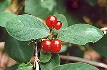
A mixed forest of forest pine , red beech , English oak , hornbeam , bird cherry , Swedish whitebeam , sycamore and Norway maple stretches from the village of Kloster via the Hucke to the Zum Klausner restaurant in Tannengrund . In the west - on the former cliff edge dunes - you will find predominantly field maple , hawthorn , silver birch , common hazel , willow , roses , red honeysuckle , purge buckthorn , sloe , eucoat and alpine currant . north of the monastery in the area of the former ornithological station there are also some summer and winter lime trees and hybrids of both species. The undergrowth includes common clematis , common hops , potted fern , forest twinkle , the great two-leaf , which has become extremely rare on Hiddensee, and the real moon rue , as well as the still common broad-leaved stendellum . Early bloomers are z. B. March violets , lesser celandine and speed ivy . However, the rich orchid flora that made Hiddensee famous in the past has disappeared.
The forest on the Schwedenhagen consists of oaks, common ash trees , mountain elms and many old wild pears . Early bloomers such as dwarf larkspur and medium larkspur are particularly common here . The broom bush land on the central thorn bush is also of botanical importance .
fauna
Around 1900, pheasants and roe deer were released as hunting game in the thorn bush forest, but the former could not establish themselves permanently. The previously large numbers of wild rabbits have declined sharply as a result of "rabbit plague" ( myxomatosis ).
Hiddensee is best known for its many breeding birds. Mention may be made for the briar bushes wheatear , Klappergrasmücke , Whitethroat , backed Shrike , skylark , yellowhammer and yellow scoffers ; for the bush forest Chaffinch , Song Thrush , Blackcap , wood warbler , spotted woodpecker and wood pigeon . In the cliff slopes nesting Bank Swallows and Black Redstarts which use often abandoned swallow caves. Common ravens also breed on the steep slope near the Klausner . The wren and the carminer prefer the overgrown slopes on the Hucke. The towering thorn bush is of great importance as a landmark for migrating birds. On the outer coasts, Nordic ducks, petrels and alken birds are occasionally blown in after strong north-westerly storms in autumn and winter. There is evidence of wave walkers (one bird each on December 31, 1961 and November 17, 1977), king eiders (spring 1901 and December 7 to 17, 1988), razorbills (for example around twenty specimens on December 1, 1852) and many others. The sunny slopes have an attractive effect on Mediterranean species, as is confirmed by observations of Alpine swifts , bee-eater , blue roe and hoopoe .
Coastal defense
Several measurements of the steep bank decline have been taken since 1899. The annual decline of 20 centimeters per year between the lighthouse and Swantiberg was consistently stated. At the end mandrel and before the construction of the wall on the Hucke, there were even losses of 60 centimeters per year. The material removed from the Dornbuschkliff is transported by the current to the southeast and southwest and allows both the Hiddensee lowlands on the Gellen and the Neubessin to continue to grow. A compensation coast is formed here. The entire thorn bush will probably be removed in several thousand years.
Along the edge of the cliff there are repeated large eruptions of glacial till clods. From the cliff edge path between Enddorn and Swantiberg, the erosion process can be clearly observed over several years. The last major crashes were in 2000 and 2004 on Toten Kerl.
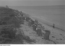
The only clearly prominent coastal protection structure is the 2 kilometer long stone wall between Rennbaumhuk and Hartem Ort, which has been expanded to a 3 meter high wall on the Hucke. From 1938 until the beginning of the war in 1939, the first section on the Hucke was built around 20 meters from the beach, the narrow water gap between the stone wall and the bank was quickly filled with sand. It was later extended to the south. At the Hucke and the beach of Kloster there had previously been extreme land recession. The result is not all positive, however. The cliff was successfully protected, but due to the weather, there were still further breaks that formed large cones of debris. Even with storm floods they could no longer be washed away because of the wall and gradually overgrown with bushes. Thus one of the most interesting cliffs of Hiddensee was not preserved.
In 1937 nine steel sheet piles were built on Swantiberg and one near the lighthouse. However, they were badly damaged in the decades that followed and are barely recognizable today.
The coastal protection forest on the western thorn bush, which was reforested from 1861 with pine, common oak, hornbeam and hazel, protects against wind erosion.
Settlements and structures
Kloster is located on the southern slope of the hill country . It is the cultural center of the island. A little further to the northeast is the smallest and oldest town in Hiddensee, Grieben .
There are a few other buildings in the highlands, such as the 18-meter-high Dornbusch lighthouse and the excursion restaurant and guesthouse Zum Klausner . From the beach below the cliff it can be reached via a staircase through the wooded steep slope; After the storms at the turn of 2018/2019, the staircase was closed for security reasons, and its entire length is now accessible again.
The Klausner is the central location of the award-winning first novel Kruso by Lutz Seiler from 2014.
literature
- Günter Möbus: How Hiddensee became an island. Helms Verlag, Schwerin 2001, ISBN 3-93118587-7 .
- Karin Blase, Bernd Blase: Hiddensee A – Z. Demmler Verlag, 2008 (4th edition), ISBN 3910150160 .
- Herbert Ewe: Hiddensee. VEB Hinstorff Verlag, Rostock 1983.
- Arved Jürgensohn: Hiddensee, the Capri of Pomerania. Verlag von Karl Haertel, 1924 (2nd edition).
- Erich Hoyer: Plant Guide Island Hiddensee. Publisher u. Nature photo archive , 1994, ISBN 3929192055 .
- Erich Hoyer: Beach guide Insel Hiddensee - stones, fossils, plants, animals. Publisher u. Naturfotoarchiv, 1995, ISBN 3929192071 .
- Erich Hoyer: Vogelführer Insel Hiddensee. Publisher u. Nature Photo Archive , 1996, ISBN 3929192128 .
- Frank W. Junge, Christof Junge, Gertraud Junge: Hiddensee through half a century. Boy dr Frank, 2008, ISBN 3000240713 .
- Insel Information Hiddensee (Hrsg.): Plants on Hiddensee. Insel Information Hiddensee GmbH, 2010, ISBN 978-3-9813408-2-2 .
- Hartmut Dittberner, Erich Hoyer: The bird world of the islands of Rügen and Hiddensee - Part I - Nonpasseres. Verlag Erich Hoyer, Galenbeck, 1993, ISBN 3929192020 .
- Hartmut Dittberner, Erich Hoyer: The bird world of the islands of Rügen and Hiddensee - Part II - songbirds. Verlag Erich Hoyer, Galenbeck, 1995, ISBN 3-929192-06-3 .
Individual evidence
- ↑ Topographic map 1: 25,000 1444 Vitte
Coordinates: 54 ° 35 ′ 50 ″ N , 13 ° 7 ′ 10 ″ E


