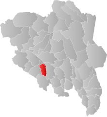
Etnedal
| coat of arms | map | |
|---|---|---|

|
|
|
| Basic data | ||
| Commune number : | 3450 | |
| Province (county) : | Domestic | |
| Administrative headquarters: | Bruflat | |
| Coordinates : | 61 ° 0 ′ N , 9 ° 36 ′ E | |
| Height : | 779 moh. | |
| Surface: | 459.15 km² | |
| Residents: | 1,279 (Feb 27, 2020) | |
| Population density : | 3 inhabitants per km² | |
| Language form : | neutral | |
| Website: | ||
| politics | ||
| Mayor : | Linda Mæhlum Robøl ( Sp ) (2019) | |
| Located in the province of Innlandet | ||

|
||
The municipality of Etnedal in Fylke Innlandet in Norway has an area of 459 km² with a north-south extension of 35.4 km and an east-west extension of 22.7 km. Etnedal has 1279 inhabitants (as of February 27, 2020).
geography
The municipality is located in the west of Innlandet and is administered by the place Bruflat. Etnedal is located between Dokka ( Nordre Land municipality ) and Fagernes , approx. 60 km west of Lillehammer and 175 km north of Oslo . The Etna River flows through the municipality's territory.
Etnedal's municipal coat of arms shows the old stone bridge Lundebru , which is Northern Europe's largest dry-stone bridge. It was completed in 1829 as a link on the royal road between Christiania (Oslo) and Bergen . The highest point is the Spåtind (Synnfjell) with a height of 1,414 meters.

