Os (Innlandet)
| coat of arms | map | |
|---|---|---|

|
|
|
| Basic data | ||
| Commune number : | 3430 | |
| Province (county) : | Domestic | |
| Administrative headquarters: | Os | |
| Coordinates : | 62 ° 28 ' N , 11 ° 14' E | |
| Height : | 662 - 1543 moh. | |
| Surface: | 1,040.41 km² | |
| Residents: | 1,891 (Feb 27, 2020) | |
| Population density : | 2 inhabitants per km² | |
| Language form : | neutral | |
| Postal code : | 2550 | |
| Website: | ||
| traffic | ||
| Railway connection: | Rørosbanen | |
| politics | ||
| Mayor : | Runa Finborud ( Sp ) (2015) | |
| Located in the province of Innlandet | ||

|
||
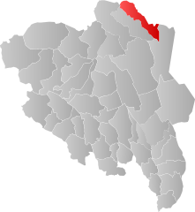
Os is a municipality in the Norwegian Fylke Innlandet . It is located in Østerdalen not far from the mountain town of Røros .
Geography and economics
Os is in the north-east of Fylke Innlandet and borders in the north-west with the municipality of Tynset , in the north-east with Røros (Fylke Trøndelag ), in the south-east with Engerdal and in the south-west with Tolga . The municipality includes the Vangrøftdalen , Nøradalen and Tufsindalen valleys across the Glomma River , with a small section of the banks of Lake Femund . In addition to the main town Os sentrum , which is about 14 km from the mountain town of Røros on the Glomma, the municipality also consists of the villages Dalsbygda , Narjordet , Narbuvoll and Tufsingdalen .
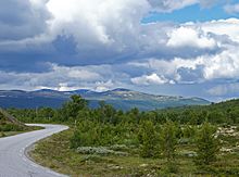
63% of the 1039 km² of the municipality are mountains. The rest is characterized by spruce and birch forests and pastureland. Only 3% are farmed. The tree line here is around 900 moh. With 25% of the workforce, agriculture is the most important branch of the economy. Today around 160 farms are still used, primarily for cattle and milk production.
The highest mountains are Sålåkinna (1594 m) and Håmmålsfjellet (1543 m). The area around the mountain Forollhogna (1332 m) in the west of the municipality is a national park .
history
As in the surrounding municipalities, history here essentially begins with the start of mining operations in Røros in 1644. The pits and smelters in the nearby mining town required wood and coal. That is why the farmers in the area were able to earn a good extra income through the charcoal burning and transport services. However, this also meant that both economic successes and lows in the ore business had a direct impact on the population of the area. With the commissioning of the Røros Railway in 1877, the burning of cabbage and transportation lost their importance for Os.
The municipality of Os was part of the Tolga -Formannskapsdistriktes (a historical administrative unit in Norway) from 1837 . In 1926 Os with 1,936 inhabitants was designated as a separate municipality. On January 1, 1966, the municipalities of Tolga and Os were merged to form the new Tolga-Os municipality (with a population of 2,015) to be divided again into the municipalities of Tolga and Os 10 years later. At that time the population of the municipality Os was 1,859 people.
traffic
Os train station is on the Røros Railway , the railway line from Elverum to Røros. The Reichsstraße number 30 leads through Os. Røros Airport is only 14 km away.
Landmarks, tourism
In Narjordet you can visit the Oddentunet farm from the 19th century, which is a listed building. Rasmus Knutsen Bager from Røros and his family settled here in 1747. The current main building dates from the first years of the 19th century when the old house was expanded. It is characterized by its rich carvings and paintings (the latter from the years 1822 to 1826).
Oddentunet is just as part of the Os Museum as the water mill in Narjordet from the mid-19th century, the school in Narbuvoll from 1876, Brofoss electricity station (1916) and Håmmåvoll train station (1915).
In the vicinity of Os sentrum there is the alpine ski facility Hummelfjell alpinanlegg with three ski lifts, a children's lift and several slopes, as well as a toboggan run. In summer there are good to very good fishing opportunities.
See also
- Os (Hordaland) , former municipality of the same name in Fylke Hordaland


