Kongsvinger
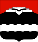
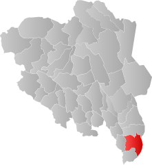
| coat of arms | map | |
|---|---|---|

|
|
|
| Basic data | ||
| Commune number : | 3401 | |
| Province (county) : | Domestic | |
| Coordinates : | 60 ° 11 ′ N , 11 ° 59 ′ E | |
| Surface: | 1,036.45 km² | |
| Residents: | 17,829 (Feb 27, 2020) | |
| Population density : | 17 inhabitants per km² | |
| Language form : | Bokmål | |
| Postal code : | 2212 | |
| Website: | ||
| traffic | ||
| Railway connection: |
Elverum – Kongsvinger Kongsvingerbanen |
|
| politics | ||
| Mayor : | Margrethe Haarr ( Sp ) (2019) | |
| Located in the province of Innlandet | ||

|
||
Kongsvinger is a city and municipality in the Norwegian province ( Fylke ) Innlandet . The small town lies on the Glomma , Norway's largest river. In 2004, Kongsvinger celebrated the city's 150th anniversary.
The town's landmark is the Kongsvinger fortress , construction of which began in 1681/82. It served as a defense against Sweden. Today it can be visited.
In April 1940, immediately after the German occupation of Norway , the city was the scene of important battles against the occupiers . Due to its proximity to the Swedish border, Kongsvinger was also an important bridgehead in the further course, both for Norwegian refugees and for the Norwegian resistance.
Kongsvinger is home to the Norwegian Women's Museum, which was opened by Queen Sonja in 1996 .
Since 1967 there has been a 163-meter-high transmission mast on the Holtberg for broadcasting TV and FM radio programs.
sons and daughters of the town
- Borghild Bryhn-Langgaard (1883–1939), singer and pianist
- Håvard Gimse (* 1966), Norwegian pianist
- Tore Andreas Gundersen (* 1986), Norwegian football player
- Levi Henriksen (* 1964), Norwegian writer
- Dagny Juel (1867–1901), Norwegian writer
- Ståle Solbakken (* 1968), Norwegian football coach
- Tove Strand (* 1946), Norwegian politician
- Tone Wølner (* 1978), Norwegian handball player
