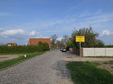
Fraßdorf
|
Fraßdorf
City of southern Anhalt
Coordinates: 51 ° 43 ′ 41 ″ N , 12 ° 6 ′ 41 ″ E
|
||
|---|---|---|
| Height : | 81 m above sea level NN | |
| Area : | 2.69 km² | |
| Residents : | 200 (Apr 13, 2016) | |
| Population density : | 74 inhabitants / km² | |
| Incorporation : | January 1, 2010 | |
| Postal code : | 06386 | |
| Area code : | 034977 | |
|
Location of Fraßdorf in Saxony-Anhalt |
||
Fraßdorf is a district of the city of Southern Anhalt in the Anhalt-Bitterfeld district in Saxony-Anhalt .
geography
Fraßdorf is located between Köthen (Anhalt) and Bitterfeld-Wolfen .
history
The place was first mentioned in 1266 as Wreciz . From 1644 the place was desolate and has only been inhabited again since 1708. In 1913 the Fraßdorf Volunteer Fire Brigade was founded.
Until the formation of the unitary community of Southern Anhalt on January 1, 2010, Fraßdorf was an independent community in the administrative community of Southern Anhalt . The last mayor of Fraßdorf was Roberto Peine.
Until November 30, 1994 the community was officially called Frassdorf .
Transport links
Federal highway 183 runs west of Fraßdorf , from Bitterfeld-Wolfen to Köthen (Anhalt) .
Individual evidence
- ↑ StBA: Area changes from January 01 to December 31, 2010
- ↑ StBA: Changes in the municipalities in Germany, see 1994


