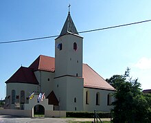
Gmina Przewóz
| Gmina Przewóz | ||
|---|---|---|

|
|
|
| Basic data | ||
| State : | Poland | |
| Voivodeship : | Lebus | |
| Powiat : | Żarski | |
| Geographic location : | 51 ° 29 ′ N , 14 ° 57 ′ E | |
| Residents : | see Gmina | |
| Postal code : | 68-132 | |
| Telephone code : | (+48) 68 | |
| License plate : | FZA | |
| Economy and Transport | ||
| Street : | Droga krajowa 27 | |
| Droga wojewódzka 350 | ||
| Next international airport : | Wroclaw | |
| Dresden | ||
| Gmina | ||
| Gminatype: | Rural community | |
| Gmina structure: | 11 school offices | |
| Surface: | 178.32 km² | |
| Residents: | 3157 (Jun. 30, 2019) |
|
| Population density : | 18 inhabitants / km² | |
| Community number ( GUS ): | 0811072 | |
| Administration (as of 2018) | ||
| Mayor : | Mariusz Strojny | |
| Address: | Pl. Partyzantów 1 68-132 Przewóz |
|
| Website : | www.przewoz.com.pl | |
The Gmina Przewóz is a rural community in the powiat Żarski of the Lubusz Voivodeship in Poland . Its seat is the village of the same name ( German Priebus , Upper Sorbian Přibuz ) with about 850 inhabitants.
geography
The community borders Germany in the west. The border river is the Lusatian Neisse . As the southernmost municipality of the powiat, it borders on the Lower Silesian Voivodeship in the south . The north of the municipality with Przewóz lies in historical Silesia ; the places in the south belong to the Polish part of Upper Lusatia .
Neighboring communities of Przewóz are Powiat Żary town Łęknica (Lugknitz) as well as the rural communities Trzebiel (Triebel) , lipinki łużyckie (Linderode) and Zary ( Sorau ; northwest to northeast), in żagań county the community Wymiarki (Wiesau) and the city Gozdnica ( Freiwaldau ; in the east), in the powiat Zgorzelecki the communities Węgliniec (Kohlfurt) and Pieńsk ( Penzig ; southeast to south) and on the German side in the district of Görlitz the town of Rothenburg / OL and the community Krauschwitz (west).
history
- Population development
| year | Residents |
|---|---|
| 1980 | 3181 |
| 1990 | 3354 |
| 2000 | 3462 |
| 2010 | |
| 2016 | 3208 |
structure
The rural community (gmina wiejska) Przewóz consists of eleven villages with Schulzenämter (sołectwa, German names until 1945 ):
- Bucze (Buchwalde)
- Dąbrowa Łużycka ( Dubrau , 1936–1945 oak forest )
- Dobrochów (Zessendorf)
- Lipna ( Leippa , 1936–1945 Selingersruh )
- Mielno (Mellendorf)
- Piotrów (Groß Petersdorf)
- Przewóz (Priebus in Silesia)
- Sanice (Sänitz)
- Sobolice (Zoblitz)
- Straszów (Large Rare)
- Włochów (Wällisch)
Four other localities are assigned to these school authorities: Dobrzyń (Dobers) , Jamno (Sichdichfür) , Mała Lipna and Potok . Deserted villages are now Wendisch Musta and Jamnitz .
Attractions
In Przewóz there is the Hunger Tower , a castle from the 13th century and the city wall from the 14th century. Churches or church ruins can be found in Przewóz (18th century), Straszów (13th century), Lipna (1807) and Piotrów (1376).
There is the nature reserve “Żurawie Bagno”, the forest reserve “Nad Młyńską Strugą” and the flora reserve “Wrzosiec”. The park in the main town is a member of the garden culture trail on both sides of the Neisse .
traffic
The national road DK27 leading to Zielona Góra begins in the capital Przewóz . The voivodship road DW350 runs parallel to the A 18 through the municipality. In Przewóz there is a border crossing into Podrosche in Saxony .
Web links
Individual evidence
- ↑ population. Size and Structure by Territorial Division. As of June 30, 2019. Główny Urząd Statystyczny (GUS) (PDF files; 0.99 MiB), accessed December 24, 2019 .


