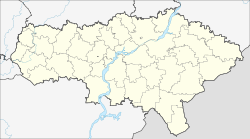
Gorny (Saratov, Krasnopartisanski)
| Urban-type settlement
Gorny
Горный
|
||||||||||||||||||||||||||||
|
||||||||||||||||||||||||||||
|
||||||||||||||||||||||||||||
Gorny ( Russian Горный ) is an urban-type settlement in the Russian Saratov Oblast with 5084 inhabitants (as of October 14, 2010).
geography
Gorny is located near the central Volga near the cities of Saratov and Engels in the southeast of the Eastern European Plain .
history
The place was founded in 1931 in the course of the beginning of slate mining and received the status of an urban-type settlement in 1934. Today it is the administrative center of the Rajons Krasnopartisanski.
The village was first known as a storage facility for chemical weapons and from December 2002 as an extermination site. In 2000, around 690 tons of chemical weapons (including lewisite ) were stored near Gorny . By 2005, all chemical warfare agents stored in Gorny had been destroyed.
Population development
| year | Residents |
|---|---|
| 1939 | 5598 |
| 1959 | 7174 |
| 1970 | 6238 |
| 1979 | 5713 |
| 1989 | 6578 |
| 2002 | 7098 |
| 2010 | 5084 |
Note: census data
See also
Individual evidence
- ↑ a b Itogi Vserossijskoj perepisi naselenija 2010 goda. Tom 1. Čislennostʹ i razmeščenie naselenija (Results of the All-Russian Census 2010. Volume 1. Number and distribution of the population). Tables 5 , pp. 12-209; 11 , pp. 312–979 (download from the website of the Federal Service for State Statistics of the Russian Federation)


