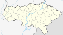
Novye Burassy
| Urban-type settlement
Novye Burassy
Новые Бурасы
|
||||||||||||||||||||||||||||||||
|
||||||||||||||||||||||||||||||||
|
||||||||||||||||||||||||||||||||
Novyje Burassy ( Russian Но́вые Бура́сы ) is an urban-type settlement in the Saratov Oblast in Russia with 5870 inhabitants (as of October 14, 2010).
geography
The place is about 70 km as the crow flies north of the Saratov Oblast Administrative Center not far from the source of the Malaya Medvediza (Little Medveditsa), a left tributary of the Medveditsa .
Novye Burassy is the administrative center of the Rajons Nowoburasski and seat of the municipality Nowoburasskoje gorodskoje posselenije, (km 10 northwest) which also includes the villages Alexandrovka and Bessonowka (5 km northwest) and the settlements Burassy (9 km north) and Znaniye (8 km north) include .
history
The place was founded in 1777 by residents of Burasskaja sloboda , 15 km to the north . His name means "New Burassy", while the Sloboda was later renamed Staryje Burassy ("Old Burassy") and is still called that today. The villages belonged to the Ujesd Saratow of the Saratov governorate .
On July 24, 1928 Novyje Burassy became the administrative seat of a newly created Rajons named after him. Since February 22, 1968 the place has the status of an urban-type settlement.
Population development
| year | Residents |
|---|---|
| 1897 | 5547 |
| 1939 | 4157 |
| 1959 | 3985 |
| 1970 | 4257 |
| 1979 | 4529 |
| 1989 | 5857 |
| 2002 | 6517 |
| 2010 | 5870 |
Note: census data
traffic
At the Burassy settlement belonging to the municipality, the station of the same name is located at kilometer 114 of the Atkarsk - Wolsk railway line, which was opened in 1895 .
A few kilometers southeast of the settlement, the regional road 63K-00009 runs from the federal trunk road R228 near Saratov to the district centers of Basarny Karabulak and Baltai . From Novyje Burassy to the north the 63K-504 leads via the Burassy railway station to Staryje Burassy, to the northwest the 63N-00612 to the neighboring district center of Petrovsk on the federal trunk road R158 .
Web links
Individual evidence
- ↑ a b Itogi Vserossijskoj perepisi naselenija 2010 goda. Tom 1. Čislennostʹ i razmeščenie naselenija (Results of the All-Russian Census 2010. Volume 1. Number and distribution of the population). Tables 5 , pp. 12-209; 11 , pp. 312–979 (download from the website of the Federal Service for State Statistics of the Russian Federation)

