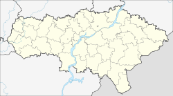
Pereljub (Russia)
| Village
Pereljub
Перелюб
|
||||||||||||||||||||||||||||
|
||||||||||||||||||||||||||||
|
||||||||||||||||||||||||||||
Pereljub ( Russian Перелю́б ) is a village (selo) in the Saratov Oblast in Russia with 4774 inhabitants (as of October 14, 2010).
geography
The place is about 300 km as the crow flies east-northeast of the Saratov Oblast Administrative Center and 150 km south of Samara in the steppe landscape to the left of the Volga . It is located on the upper reaches of the Kamelik , a left tributary of the Volga tributary Great Irgis (Bolshoi Irgis).
Pereljub is the administrative center of the Rajons Pereljubski and seat of the "municipal entity" Pereljubskoje munizipalnoje obrasowanije with the status of a rural community (selskoje posselenije), which also includes the village Baigundino (9 km south) and the five hamlets (Khutor) Brigadirowka (2 km southeast) , Fadin (13 km south), Konduktorovsky (9 km south), Sabljorsky (10 km north) and Tschapajewski (15 km northwest) belong.
history
The place was founded in 1848 by resettlers from the village of the same name Pereljub in the Ujesd Sosniza of the Chernigov Governorate (today in the Korjukiwka Rajon of the Chernihiv Oblast in Ukraine ) and named after him. The new village belonged to the Ujesd Nikolajewsk (today Pugachev ) of the Saratov governorate , which was formed in 1835 and was transferred to the newly established Samara governorate in 1851 . Within the Ujesds, Pereljub belonged to the Smolenskaya wolost from 1861, with its seat in the village of Smolenka, about 25 km to the northwest . After 1912, at the latest in the early 1920s, Pereljub itself became the seat of a Volost.
After the administrative headquarters were renamed, the Ujesd was also called Pugatschowski from 1918 . On July 23, 1928 Pereljub came to the newly formed Smolenski rajon, again based in Smolenka (initially until 1930 as part of the Pugachovsky okrug formed from the Ujesd ) of the Lower Volga region (Nizhne-Wolschski krai). In the early 1930s, the administrative seat of the Rajon was moved to Pereljub and the Rajon was renamed accordingly; from 1934 it was part of the Saratov region and finally from 1936 the Saratov Oblast.
Population development
| year | Residents |
|---|---|
| 1859 | 981 |
| 1897 | 3579 |
| 1939 | 2446 |
| 1959 | 2413 |
| 1970 | 4334 |
| 1979 | 4660 |
| 1989 | 5161 |
| 2002 | 5591 |
| 2010 | 4774 |
Note: from 1897 census data
traffic
Pereljub is the end point of the regional road 63K-00014, which comes from the west of Pugachev, where it branches off the regional road Samara - Engels - Volgograd (formerly R226, today on the territory of Oblast 36R-00002). The regional road 63K-00013, which is partly under construction, leads to the neighboring district of Osinki on European route 38, not far from the border with Kazakhstan .
The nearest railway station Novopereljubskaja at the settlement Novy Pereljub ("New Pereljub"), about 30 km to the northwest, can be reached via 63K-00014 , on the Sennaya - Balakowo - Pugachev line, which was completed in the 1980s on the section from Pugachev - Krasnogwardejets (near Buzuluk ). It is about the same distance by road to the Nowy Kamelik station , which is located north of Pereljub in the Samara Oblast on the same route , but on poorly developed local roads (up to the oblast border 63K-00578, 63k-00581); Via this connection there is a connection behind Nowy Kamelik in the direction of the district centers Bolshaya Glushiza and Bolshaya Chernigovka , both on the federal highway A300 (part of the European route 121 ) from Samara to the Kazakh border in the direction of Oral .
Web links
Individual evidence
- ↑ a b Itogi Vserossijskoj perepisi naselenija 2010 goda. Tom 1. Čislennostʹ i razmeščenie naselenija (Results of the All-Russian Census 2010. Volume 1. Number and distribution of the population). Tables 5 , pp. 12-209; 11 , pp. 312–979 (download from the website of the Federal Service for State Statistics of the Russian Federation)

