
Krenglbach
|
Krenglbach
|
||
|---|---|---|
| coat of arms | Austria map | |
 |
|
|
| Basic data | ||
| Country: | Austria | |
| State : | Upper Austria | |
| Political District : | Catfish Land | |
| License plate : | WL | |
| Surface: | 15.34 km² | |
| Coordinates : | 48 ° 12 ' N , 13 ° 57' E | |
| Height : | 310 m above sea level A. | |
| Residents : | 3,184 (January 1, 2020) | |
| Population density : | 208 inhabitants per km² | |
| Postal code : | 4631 | |
| Area code : | 07249 | |
| Community code : | 4 18 10 | |
| NUTS region | AT312 | |
| Address of the municipal administration: |
Municipality of Krenglbach Krenglbacher Strasse 9 4631 Krenglbach |
|
| Website: | ||
| politics | ||
| Mayor : | Manfred Zeismann ( SPÖ ) | |
|
Municipal Council : (2015) (25 members) |
||
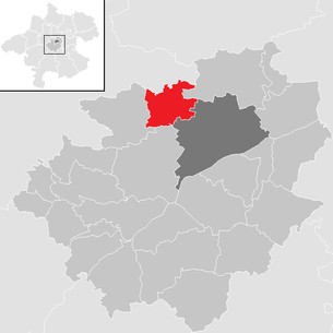
| Location of Krenglbach in the Wels-Land district | ||
  |
||
| Source: Municipal data from Statistics Austria | ||

Krenglbach is an Austrian municipality in the Hausruckviertel in the Wels-Land district in Upper Austria with 3184 inhabitants (as of January 1, 2020).
The responsible judicial district is Wels.
geography
Krenglbach lies at an altitude of 310 m above sea level. A. in the Hausruckviertel. The extension is 5.2 km from north to south and 4.7 km from west to east. The total area is 15.2 km². 14.5% of the area is forested, 71.7% of the area is used for agriculture.
Community structure
The municipality includes the following 22 localities (population in brackets as of January 1, 2020):
|
|
The community consists of the cadastral communities Haiding, Katzbach and Schmiding.
history
In 985 the place Chrenginpach was used as the site of a baptistery of St. Stephanus first mentioned in a document. Chrengelbach can be found in 1160 in a document from the Reichersberg am Inn monastery. At the time of the Reformation , many residents professed the Lutheran faith. The parish was subordinate to the sovereignty of the parish St. Marienkirchen ad P. During the Counter-Reformation , Empress Maria Theresa had a mission station built as a measure by the Catholics.
In 1784 Krenglbach became an independent parish again. The Kapsamer family provided the schoolmasters in the parish school run by St. Florian Monastery from 1688 to 1823 . Some members of this family were the creators of many painted country furniture known as Gunskirchner furniture.
In 1861 the Wels – Passau railway line was opened, from which the Aschacher Bahn branches off in the Haiding district .
coat of arms
Official description of the municipal coat of arms: In gold on a green, three-fold corrugated shield base, inside a silver corrugated strip, a red, abutting paw cross split by a pole. The municipality colors are green-white-green.
The municipal coat of arms was awarded in 1984 by the Upper Austrian provincial government. With the paw cross it shows the coat of arms of the St. Florian monastery, to which the parish Krenglbach belongs since the Middle Ages. The dichotomy symbolizes the two Christian denominations in the community, of which Protestantism was widespread at the time of the Reformation. The wave ledge stands for the eponymous Krenglbach.
Culture and sights

- Schmiding Zoo : Schmiding Zoo is the most visited attraction
- Schmiding Castle : first mentioned in a document in 1100, today owned by the Artmann family who built the Schmiding Zoo (formerly Schmiding Vogelpark or Schmiding Zoological Garden) on the adjacent area
- Parish church Krenglbach
- Haiding Castle : moated castle, first mentioned in 1340. After long periods of decline, it was renovated and opened to the public from 1970. So today - from around the end of summer to November - art is presented in the castle, literature, exhibitions, music and drama.
Sons and daughters of the church
- Anton Reidinger (1839–1912), pastor, dialect poet, author of the Christmas carol Es wird scho glei dumpa
politics
Manfred Zeismann (SPÖ) has been mayor since 2011.
Population development
In 1991, according to the census, the community had 2384 inhabitants, then 2644 inhabitants in 2001, and 3073 inhabitants in 2007
Town twinning
-
 Császártöltés , Hungary (since June 4, 1994)
education
- kindergarten
- Elementary school
Web links
- Community website
- Tourismus Info Krenglbach (oberoesterreich.at)
- 41810 - Krenglbach. Community data, Statistics Austria .
- Further information about the municipality of Krenglbach can be found on the geographic information system of the federal state of Upper Austria .
Individual evidence
- ↑ Statistics Austria: Population on January 1st, 2020 by locality (area status on January 1st, 2020) , ( CSV )
- ^ Herbert Erich Baumert: The coats of arms of the cities, markets and communities of Upper Austria, 7th supplement (1984-1987) . In: Oberösterreichische Heimatblätter, Heft 4, 1988, p. 229, online (PDF; 7.2 MB) in the forum OoeGeschichte.at
- ^ List of mayors. Website of the municipality of Krenglbach, accessed on August 16, 2018 .

Aichkirchen | Bachmanning | Bad Wimsbach-Neydharting | Buchkirchen | Eberstalzell | Edt at Lambach | Fischlham | Gunskirchen | Holzhausen | Krenglbach | Lambach | Marchtrenk | Neukirchen bei Lambach | Offenhausen | Pennewang | Pichl near Wels | Sattledt | Schleissheim | Sipbachzell | Stadl-Paura | Steinerkirchen an der Traun | Stone house | Thalheim near Wels | Weißkirchen an der Traun