
Hergisdorf
| coat of arms | Germany map | |
|---|---|---|

|
Coordinates: 51 ° 32 ' N , 11 ° 29' E |
|
| Basic data | ||
| State : | Saxony-Anhalt | |
| County : | Mansfeld-Südharz | |
| Association municipality : | Mansfeld Grund-Helbra | |
| Height : | 185 m above sea level NHN | |
| Area : | 9.54 km 2 | |
| Residents: | 1580 (Dec. 31, 2019) | |
| Population density : | 166 inhabitants per km 2 | |
| Postal code : | 06313 | |
| Area code : | 034772 | |
| License plate : | MSH, EIL, HET, ML, SGH | |
| Community key : | 15 0 87 210 | |
| Association administration address: | At the hut 1 06311 Helbra |
|
| Website : | ||
| Mayor : | Jürgen Colawo | |
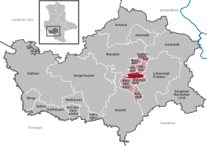
| Location of the municipality of Hergisdorf in the district of Mansfeld-Südharz | ||
  |
||


Hergisdorf is a municipality in the district of Mansfeld-Südharz in Saxony-Anhalt . It belongs to the Verbandsgemeinde Mansfelder Grund-Helbra , which has its administrative seat in the municipality of Helbra .
geography
The municipality of Hergisdorf is about four kilometers west of Eisleben .
The district of Kreisfeld belongs to Hergisdorf .
history
The community was first mentioned in a document in 1252.
On July 1, 1950, the previously independent municipality of Kreisfeld was incorporated.
politics
Municipal council
The council from Hergisdorf consists of twelve councils.
(Status: local elections from May 25, 2014)
mayor
The honorary mayor, Jürgen Colawo, was elected for the first time on November 15, 2015.
coat of arms
Blazon : "Split from blue over gold, covered with crossed, silver-black mine teeth."
The colors of the community are blue-yellow.
Culture and sights
Buildings
- Sankt-Aegidien-Kirche with fortified tower
- Saint Liborius Church
- Overhead line mast over the Berlin – Blankenheim railway line
Economy and Infrastructure
traffic
It is six kilometers to the east to federal highway 80 , which connects Sangerhausen , Eisleben and Halle (Saale) . The Hergisdorf stop was on the Berlin – Blankenheim railway line . The stop is closed and there is no longer any traffic on the railway line in this area.
Sons and daughters
- Bernhard Sowinski (1931–2005), Germanist
Web links
- Website of the association
- Website of the Hergisdorf Pentecostal Society
- Website of the SV Germania Hergisdorf
Individual evidence
- ↑ State Statistical Office Saxony-Anhalt, population of the municipalities - as of December 31, 2019 (PDF) (update) ( help ).
- ^ Election results for the 2014 municipal elections. Verbandsgemeinde Mansfelder Grund - Helbra, accessed on January 19, 2016 .
- ↑ Results of the mayoral election 2015. (No longer available online.) State Statistical Office Saxony-Anhalt, archived from the original on January 19, 2016 ; Retrieved January 19, 2016 . Info: The archive link was inserted automatically and has not yet been checked. Please check the original and archive link according to the instructions and then remove this notice.
- ^ Image in Günter Scheibe: Steam locomotive paradise Deutsche Reichsbahn. The last great years of the DR steam locomotives . EK-Verlag, Freiburg im Breisgau 1999, ISBN 3-88255-270-0 , page 78.
Ahlsdorf | Allstedt | Arnstein | Benndorf | Berga | Blankenheim | Bornstedt | Bridge minced puffle | Edersleben | Gerbstedt | Helbra | Hergisdorf | Hettstedt | Kelbra (Kyffhäuser) | Klostermansfeld | Lutherstadt Eisleben | Mansfeld | Sangerhausen | Lake Mansfelder Land | South Harz | Wallhausen | Wimmelburg