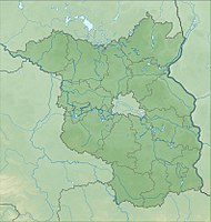
Kanonenberg and Schloßberg, Schäfergrund
|
Kanonenberg and Schloßberg, Schäfergrund
|
||
| location | Brandenburg , Germany | |
| surface | 90.5 ha | |
| Identifier | 1079 | |
| WDPA ID | 164017 | |
| Geographical location | 52 ° 49 ' N , 13 ° 57' E | |
|
|
||
| Setup date | October 1, 1990 | |
The nature reserve Kanonen- und Schloßberg, Schäfergrund lies in the area of the municipality of Falkenberg (Mark) in the district of Märkisch-Oderland and in the area of the communities of Hohenfinow and Niederfinow in the district of Barnim in Brandenburg .
The area with the identification number 1079, which consists of two sub-areas, was placed under nature protection by ordinance of September 12, 1990 . The approximately 90.5 hectare nature reserve extends south of the core town of Niederfinow, northeast and east of the core town of Hohenfinow and northwest of the core town of Falkenberg. The state road L 29 runs along the north-western edge of the northern sub-area and the B 167 runs along the southern edge of the southern sub-area . The Finow Canal flows north of the area .
meaning
The area is protected as a nature reserve "for the preservation and promotion of habitats of endangered animal and plant species, especially the communities of dry grasslands in the two areas".
See also
- List of nature reserves in the Märkisch-Oderland district
- List of nature reserves in the Barnim district
- List of FFH areas in Brandenburg
Web links
Individual evidence
- ↑ Ordinance on the establishment of nature reserves and a landscape protection area of central importance with the overall designation "Schorfheide-Chorin Biosphere Reserve" of September 12, 1990 ; therein: 42nd NSG No. 29 "Kanonen- und Schloßberg, Schäfergrund" on bravors.brandenburg.de, accessed on May 12, 2020


