Kuzma
| Kuzma | |||
|
|||
| Basic data | |||
|---|---|---|---|
| Country |
|
||
| Historic region | Übermurgebiet / Prekmurje | ||
| Statistical region | Pomurska (Mur region) | ||
| Coordinates | 46 ° 50 ′ N , 16 ° 5 ′ E | ||
| height | 218 m. i. J. | ||
| surface | 22.9 km² | ||
| Residents | 1,642 (2008) | ||
| Population density | 72 inhabitants per km² | ||
| Post Code | 9262 | ||
| License Plate | MS | ||
| Structure and administration | |||
| Mayor : | Jožef Škalič | ||
| Website | |||
Kuzma (German: Bonisdorf ) is a municipality and a village in Goričko , the hilly part of the historic Prekmurje region in Slovenia .
geography
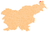
The municipality occupies the north-western area of the hill and ditch country of Goričko and is located directly on the triangle between Slovenia, Austria and Hungary . The municipality extends over an area of approx. 22.9 km² and borders on the Austrian Burgenland , the Hungarian Vas / Eisenburg county and the Slovenian municipalities Gornji Petrovci , Grad and Rogašovci .
The municipality of Kuzma has approx. 1685 inhabitants and comprises the wooded area around the upper reaches of the Lukaj brook with its numerous spring waters up to the watershed of Mur and Raab and is made up of the following five villages:
- Dolič (Hungarian Völgyköz, German Niedergrablen )
- Gornji Slaveči (Hungarian Felsőcsalogány, German Upper Slabitsch )
- Kuzma (Hungarian Kuzma, German Bonisdorf )
- Matjaševci (Hungarian Szentmátyás)
- Trdkova (Hungarian Turk, German Türkau )
The municipality marking is very varied; In the lowlands and along the streams, at heights of 250 to 300 m, meadows and fields alternate. Grain, maize and potatoes are grown on gently sloping slopes and ridges up to 350 m. Occasionally there are also vineyards for domestic use. Many fruit trees, bushes and hedges loosen up the cultivated areas. The heights, Vreje 381 m, Zalka 362 m and the triangle Tromejnik 390 m, the highest point in the municipality, are forested. The entire municipality belongs to the three-country park Raab-Goričko-Őrség .
history
The place is first mentioned in 1387 as Zalocha and Zaloucha and belonged to the Dobra lordship , today's Neuhaus am Klausenbach in southern Burgenland. With the acquisition of this lordship in the year mentioned, the Széchy rounded off their holdings in the region, because as early as 1365 they had become lords of the castle and lordship of Felsölendva (today Grad ).
In the 15th century the settlement is said to have received a chapel, which was then consecrated to the brothers Cosmas and Damian . In the land register of the Dobra / Neuhaus lordship from 1697, the village is mentioned among 26 listed localities. At that time, the estate was owned by the Batthyány family .
In a protocol of the Győr / Raab diocese the settlement is named Szent Kozma in 1698 and the village church of Saint Cosmas and Damian is mentioned as a branch church of the parish Felsölendva / Grad. The branch church was a pastoral care center for the population of Fölsö et alsó Dolics / Dolič , Mattyásocz / Matjaševci and Szent Kozma / Kuzma.
In 1890 the village was officially called Kuzma and had 407 inhabitants, 297 of whom claimed to be Slovenes, 88 as Germans, 4 as Hungarians, and 18 stated another nationality. The place belonged to the Muraszombat district (today Murska Sobota ) of Eisenburg / Vas county.
The Trianon Treaty gave the village to the Kingdom of SHS . For the place now officially named Kuzdoblanje, the following data were determined in the census on January 31, 1921: 471 Slovenes, 83 Hungarians and one other ethnic group; Of these 555 residents, 362 were Catholics and 193 were Protestants.
The 1931 census found 549 inhabitants, in 1961 there were 532 and the following figures are known for 1971: 500 inhabitants, 109 houses, 112 households and 385 villagers who lived on income from agriculture.
See also
literature
- Ivan Zelko , Historična Topografija Slovenije I. Prekmurje do leta 1500. Murska Sobota, 1982.
- Matija Slavič, Naše Prekmurje. Murska Sobota, 1999.
- Atlas Slovenije, Ljubljana 1985.
Web links
- Geopedia.si, map: Kuzma municipality
- Geopedia.si, map: Place Kuzma
- Website of the municipality (Slovenian)
- Tourist information
Individual evidence
- ↑ Lumtzer, Viktor / Melich, Johann; German place names and loan words from the Hungarian vocabulary. Sources and research on the history, literature and language of Austria and its crown lands; Publishing house of the Wagner University Bookstore Innsbruck, 1900.
- ^ Repertorium locorum objectorumque in XII. tabulis Mappae regnorum ... - János Lipszky (báró) - 1808


