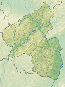
Lennebergwald
Coordinates: 50 ° 0 ′ 36 ″ N , 8 ° 10 ′ 29 ″ E
As Lennebergwald or Gonsenheimer forest a circa 700 will hectares large, including nature conservation standing forest area in Rheinhessen referred located between the Mainzer districts Finthen , Gonsenheim , the municipality Budenheim and the village Uhlerborn the city of Ingelheim am Rhein extends. Most of the forest is within the Budenheim district.
Characteristic for the Lennebergwald is its very dry, sandy soil and high soil temperature. As a result, you will mainly find pines and oaks as well as dry grass flora such as in the adjacent, diverse nature reserve Großer Sand .
The Gonsenheim Forest is of great importance in terms of ecology and as a local recreation area for joggers , Nordic walkers , mountain bikers and walkers, hundreds of thousands of whom use the numerous excellent hiking trails every year . In the Lennebergwald there are several cultural monuments of Budenheim , such as the Waldthausen Castle , the Old St. Wendelinus Chapel, the Lennebergturm (a neo-Gothic lookout tower with a stair tower, 1878-1880 by Philipp Johann Berdellé ), the New St. Wendelinus Chapel (neo-Gothic quarry stone hall, 1862–1866) and the Budenheim water reservoir (Art Nouveau rotunda, inscribed 1907, architect Wilhelm Lenz ) and Gonsenheim (Art Nouveau, inscribed 1909, also by Wilhelm Lenz).
See also
literature
- Monika Bub, Martin Löschmann, Klaus Meyer: The Lennebergwald near Mainz . Rhineland-Palatinate: Notices from the State Forestry Administration of Rhineland-Palatinate (No. 13). Ministry of Environment and Forests (Forests Department), Mainz 1996, 79 (V) p.
- The Lennebergwald ecosystem near Mainz, Ed .: Wolfgang Licht, Bad Dürkheim, 1991. - (Pollichia book; 23).
Web links
- Lennebergwald (map) on protectedplanet.net
- 339-190 Ordinance on the "Lenneberwald" nature reserve city of Mainz and the district of Mainz - Bingen of May 24, 1996 (PDF) on naturschutz.rlp.de
- www.lennebergwald.de
- Aerial photos of the Lennebergwald from Google Maps
- Article on the Lennebergwald in the Mainzer Allgemeine Zeitung ( memento from August 24, 2006 in the Internet Archive )


