Lindesnes
| coat of arms | map | |
|---|---|---|

|
|
|
| Basic data | ||
| Commune number : | 4205 | |
| Province (county) : | Agder | |
| Administrative headquarters: | Mandal | |
| Coordinates : | 58 ° 6 ′ N , 7 ° 17 ′ E | |
| Surface: | 934.32 km² | |
| Residents: | 23,046 (Feb 27, 2020) | |
| Population density : | 25 inhabitants per km² | |
| Language form : | Bokmål | |
| Website: | ||
| politics | ||
| Mayor : | Even Sagebakken ( Ap ) (2020) | |
| Location in the province of Agder | ||

|
||
Lindesnes is a municipality in the Agder province in Norway . It was newly built on January 1st, 2020. The largest city in Lindesnes is Mandal , which is the local political center. In the commune of the same name, which existed from 1964 to 2019, this was Vigeland .
local community
Surname
The name comes from the word Lidandi from the Old Norse language. Lida means "danger, end" and so Lidandi means "headland where the land ends".
coat of arms
The coat of arms of Lindesnes (old commune) showed a silver lighthouse on a blue background. It was supposed to represent the Lindesnes lighthouse. The coat of arms was approved since 1986.
Tusenårssted
The old municipality chose the Lindesnes lighthouse to be Tusenårssted .
Formation, border changes and neighboring communities
The old municipality of Lindesnes was created in 1964 by merging the previously independent municipalities of Spangereid , Vigmostad and Sør-Audnedal . It bordered Lyngdal to the west, Audnedal to the north, Marnardal to the northeast and Mandal to the east .
On January 1, 2020, a new municipality of Lindesnes was founded together with the municipalities of Mandal and Marnardal as part of the municipal reform in Norway .
| local community | Residents January 1, 2019 |
Area in km² |
|---|---|---|
| Lindesnes | 4,953 | 316 |
| Mandal | 15,659 | 222 |
| Marnaldal | 2,297 | 397 |
| Lindesnes (new) | 22,909 | 935 |
geography
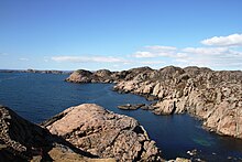
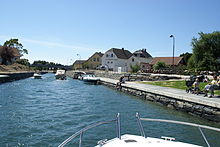
The landscape of the municipality of Lindesnes is hilly and rich in lakes. In the southwest lies the Lindesnes peninsula . It forms the southernmost mainland point in Norway. In the west it is separated from the municipality of Lyndal by the Grønsfjord and in the northeast by the Lenesfjord . The narrowest part of the peninsula is in Spangereid, where the Lenesfjord has been connected to the coast by the Spangereid Canal since 2007 . The coast has an offshore archipelago with several larger islands. The largest of them are Underøy , Østre and Vestre Imsa , Våre and Svinør . Furthermore, small fjords and bays cut the coastline, including the Rema and Syrdalsfjords as well as the Ramslandsvåg and the Tjømsvåg . The Audna River flows from north to south . Many small towns line up along it before it passes Vigeland and flows into the Snikfjord at Snig . The largest lake in the municipality is the elongated Tarvatnet , which is located southwest of Vigeland and southeast of the Rymtelandsheia . Solekringla is with 355 moh. the largest elevation.
Economy and Infrastructure
traffic
From Lyngdal to Mandal, the European route 39 crosses in an east-west direction through the municipality and passes Vigeland. Fylkesvei 460 starts from the southern tip at Lindesnes lighthouse. It runs north along the Audna to the municipality of Audnedal. In Spangereid, Fylkesvei 410 branches off to Jåsund in Lyngdal municipality. From Vigeland the Fylkesvei 407 heads south to Tjøm . To the north, the Fylkesvei 402 runs from Vigeland parallel to the Fylkesvei 460 on the western side of the Audna. At Buhølen, the road bends westward to meet Fylkesvei 460 in Tryland north of Vigmostad. Fylkesvei 404 branches off south of Skofteland towards Smedland (Mandal municipality). Fylkesvei 306 runs almost parallel north to Manneråk (Marnadal municipality). The roads Fv320 and Fv406 in the north also lead to the Marnadal.
Industry
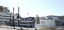
The main sector of Lindesnes' industry is the chemical industry with 3/4 of the employees. The main employer is the GE Healthcare plant near Spangereid. This is where the basic materials for X-ray contrast media are manufactured. Fishing is traditional in the municipality, but food processing , wood and textile industries are also located in the municipality. 13% of the jobs are in mechanical engineering .
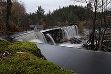
There are several hydroelectric plants in Lindesnes. The Grislefoss small power plant operated by Norsk Grønnkraft AS is fed from Lake Grislevatnet and produces 2.8 GWh annually. The Færåsen small power station between the lakes Eptevann and Brådlansvatn was completed in 2009. It produces 6 GWh and is operated by Agder Energi. The Tyrland power plant, also operated by Agder Energi, delivers 25 GWh and is fed from the Sundsvatn, Eptevatn and Lelandsvatn lakes. This power plant has existed since 1922. In addition, a wind farm with 5 turbines was built on the Lindesnes peninsula in 1998. This produces 750 kW.
tourism
The municipality is best known for Cape Lindesnes , Norway's southernmost mainland point (the southernmost point of Norway is the small, uninhabited island "Litleodd" (57 ° 57 '35 "N, 7 ° 34' 05" E) southwest of Mandal and south of Tregde ). It is 1,682 km as the crow flies from Cape Lindesnes to the North Cape . There is also Norway's most southerly sandy beach and Lindesnes fyr , the country's oldest beacon (built in 1655). Today's lighthouse dates from 1915. In the immediate vicinity of the lighthouse there are numerous well-preserved bunkers from the Second World War, most of which are freely accessible. Another attraction is the gallery by the sculptor Gustav Vigeland . In the area around Lindesnes, outdoor activities such as fishing, rafting or taking part in an elk safari are interesting for tourists.
Culture and sights
- Theaters and museums
- Buildings
- Lindesnes lighthouse
- Spangereidkanal
- Fjellhallen im Fels (Millennium Building 2000-2004)
- Bergstølsaga sawmill
- Parks and recreation
- Barnas animal park
Personalities
- Peder Claussøn Friis (1545–1614), clergyman and historical-geographic writer
- Emanuel Vigeland (1875–1948), painter from VIgeland
- Gustav Vigeland (1869–1943), sculptor from Vigeland
- Asbjørn Aavik (1902–1997), missionary in China from Åvik
- Ansgar Gabrielsen ( 1954 -), Mayor of Lindesnes, Stortingsrepresentant, Minister of Economics and Health
Web links
Individual evidence
- ↑ Statistisk sentralbyrå - Befolkning
- ↑ a b c d e f Lindesnes - commune i Vest-Agder. In: store norske leksikon. Retrieved July 8, 2014 (Norwegian).
- ↑ Om vår commune. (No longer available online.) Lindesnes kommune, archived from the original on July 14, 2014 ; Retrieved July 8, 2014 (Norwegian). Info: The archive link was inserted automatically and has not yet been checked. Please check the original and archive link according to the instructions and then remove this notice.
- ↑ Navn på nye kommuner. February 19, 2019, accessed October 1, 2019 (Norwegian).
- ^ GE Healthcare AS - Lindesnes. (No longer available online.) SIGUM, archived from the original on July 14, 2014 ; accessed on July 9, 2014 . Info: The archive link was inserted automatically and has not yet been checked. Please check the original and archive link according to the instructions and then remove this notice.
- ↑ Grislefoss power sales (No longer available online.) Norsk Grønnkraft, archived from the original on May 4, 2014 ; Retrieved July 9, 2014 (Norwegian). Info: The archive link was inserted automatically and has not yet been checked. Please check the original and archive link according to the instructions and then remove this notice.
- ↑ Færåsen Kraftstasjon. Agder Energi, accessed July 9, 2014 (Norwegian).
- ↑ Tryland Kraftstasjon. Agder Energi, accessed July 9, 2014 (Norwegian).


