List of FFH areas in Swabia (Bavaria)
The list of FFH areas in Swabia (Bavaria) includes the following lists of FFH areas in Swabian districts and cities from the article namespace:
- List of FFH areas in the Aichach-Friedberg district
- List of FFH areas in the Augsburg district
- List of FFH areas in the city of Augsburg
- List of FFH areas in the district of Dillingen an der Donau
- List of FFH areas in the Donau-Ries district
- List of FFH areas in the district of Günzburg
- List of FFH areas in the city of Kaufbeuren
- List of FFH areas in the district of Lindau (Lake Constance)
- List of FFH areas in the city of Memmingen
- List of FFH areas in the Neu-Ulm district
- List of FFH areas in the Oberallgäu district
- List of FFH areas in the Ostallgäu district
- List of FFH areas in the Unterallgäu district
The selection corresponds to the administrative region of Swabia (Bavaria) . There are 120 FFH areas in the administrative district (as of April 2016).
| Surname | image | Identifier
|
circle | details | position | Area hectares |
date
|
|||
|---|---|---|---|---|---|---|---|---|---|---|
| Donaumoosbach, Zucheringer Wörth and Brucker Forst |
7233-373 WDPA: 555521859 |
Ingolstadt , district of Neuburg-Schrobenhausen , district of Aichach-Friedberg | also in the district of Pfaffenhofen an der Ilm | ⊙ | 947.29 |
|
||||
| Lechleite between Friedberg and Thierhaupten |
7531-372 WDPA: 555521964 |
Aichach-Friedberg , district of Augsburg | ⊙ | 88.53 | ||||||
|
Paar and Ecknach |

|
7433-371 WDPA: 555521932 |
Neuburg-Schrobenhausen , district Pfaffenhofen , Aichach-Friedberg | ⊙ | 2,970.22 |
|
||||
|
Dinkelscherbener Moor |

|
7629-372 WDPA: 555521984 |
District of Augsburg | ⊙ | 50.02 | |||||
|
Bat roosts in the Augsburg district |
|
7430-301 WDPA: 555521930 |
District of Augsburg | ⊙ | 0.00 |
|
||||
| Lützelburger clay pit |
7530-301 WDPA: 555521962 |
District of Augsburg | ⊙ | 6.00 | ||||||
|
Schmuttertal |
|
7630-371 WDPA: 555521985 |
District of Augsburg | ⊙ | 899.33 | |||||
| Together from Ziemetshausen to Schönebach |
7629-371 WDPA: 555521983 |
District of Augsburg , District of Günzburg | ⊙ | 344.12 |
|
|||||
|
Höh-, Hörgelau- and Schwarzgraben, Lechbrenne north of Augsburg |

|
7531-371 WDPA: 555521963 |
Augsburg , Aichach-Friedberg district | Narrow, partly straightened brooks in agricultural fields as well as brooks and species-rich Brenne in the Lech Auwald | ⊙ | 67.632 | ||||
|
Lech between Landsberg and Königsbrunn with Auen and Leite |
|
7631-372 WDPA: 555521987 |
Augsburg , the district of Augsburg , Aichach-Friedberg , district of Landsberg am Lech | Section of the floodplain and low terrace landscape of the Lech Valley with high biotope density (floodplain forests, heather areas, extensive meadows) and valuable species occurrences - severely impaired by river regulation | ⊙ | 2,484,222 | ||||
|
Lechauen north of Augsburg |

|
7431-301 WDPA: 555521931 |
augsburg | Lechauen areas with backwaters, silting areas, flowing waters, hardwood alluvial forests and gray alder coppice forests, semi-dry grassland communities on remaining areas of original burning areas | ⊙ | 396.907 | ||||
|
Lechauen between Königsbrunn and Augsburg |

|
7631-371 WDPA: 555521986 |
Augsburg , Aichach-Friedberg district | Lechauen south of Augsburg with extensive remains of alluvial forest and relics of the formerly large Lech gravel heaths and the wild river, species-rich grassland in the peripheral areas | ⊙ | 2,307.99 |
|
|||
| Dattenhauser Ried |
7328-303 WDPA: 555521891 |
District of Dillingen on the Danube | ⊙ | 297.00 | ||||||
|
Donauauen Blindheim-Donaumünster |

|
7329-301 WDPA: 555521895 |
District of Donau-Ries , District of Dillingen on the Danube | ⊙ | 1,211.00 | |||||
|
Danube floodplains between Thalfingen and Höchstädt |

|
7428-301 WDPA: 555521928 |
District of Dillingen an der Donau , District of Günzburg , District of Neu-Ulm | ⊙ | 5,798.00 | |||||
| Egau |
7328-304 WDPA: 555521892 |
District of Dillingen on the Danube | ⊙ | 42.00 | ||||||
| Trenches in the Donauried north of Eppisburg |
7429-301 WDPA: 555521929 |
District of Dillingen on the Danube | ⊙ | 53.00 |
|
|||||
|
Nature reserve 'Gundelfinger Moos' |
|
7427-371 WDPA: 555521927 |
District of Dillingen on the Danube | ⊙ | 226.35 | |||||
| Nebel, Kloster and Brunnenbach |
7328-371 WDPA: 555521894 |
District of Dillingen on the Danube | ⊙ | 318.20 | ||||||
| Low-terrace forests between Fristingen and Lauterbach |
7330-302 WDPA: 555521899 |
District of Dillingen on the Danube | ⊙ | 218.00 | ||||||
| Quarry north of Bergheim |
7328-302 WDPA: 555521890 |
District of Dillingen on the Danube | ⊙ | 0.30 | ||||||
| Westerried north of Wertingen |
7329-371 WDPA: 555521896 |
District of Dillingen on the Danube | ⊙ | 20.54 | ||||||
| Wittislinger Ried |

|
7328-305 WDPA: 555521893 |
District of Dillingen on the Danube | including the landscape protection area "Protection of the Ried (Wittislinger Moor)" LSG-00195.01 with WDPA 395708; sh. List of landscape protection areas in the district of Dillingen an der Donau | ⊙ | 93.00 |
|
|||
| Mining site near Oberringingen, pond b. Sternbach, prelate pond |
7229-301 WDPA: 555521853 |
District of Donau-Ries , District of Dillingen on the Danube | ⊙ | 8.00 | ||||||
| Mining sites between Rain and Gempfing |
7331-301 WDPA: 555521900 |
Donau-Ries district | Former quarrying sites with sparse vegetation and bodies of water that continuously or occasionally dry out , at 2 locations: NS = 48.688403 / 10.961990 and 48.678479 / 10.947849. | ⊙ | 2.00 | |||||
|
Danube with Jura slopes between Leitheim and Neuburg |

|
7232-301 WDPA: 555521856 |
District of Donau-Ries , Neuburg-Schrobenhausen | ⊙ | 3,282.00 | |||||
|
Donauwörther Forest with training area and Harburger Karab |

|
7230-371 WDPA: 555521855 |
Donau-Ries district | ⊙ | 2,400.92 | |||||
| Heroldinger Burgberg |
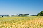
|
7130-302 WDPA: 555521814 |
Donau-Ries district | ⊙ | 374.00 | |||||
| Illdorfer, Kundinger, Eschlinger Leiten |
7332-301 WDPA: 555521901 |
District of Donau-Ries , Neuburg-Schrobenhausen | ⊙ | 77.00 | ||||||
| Jura forests north of Höchstädt |
|
7329-372 WDPA: 555521897 |
District of Donau-Ries , District of Dillingen on the Danube | ⊙ | 3,819.24 | |||||
|
Kesseltal with Kessel, Hahnenbach and Köhrlesbach |
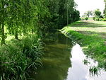
|
7229-371 WDPA: 555521854 |
District of Donau-Ries , District of Dillingen on the Danube | ⊙ | 212.33 | |||||
|
Mouse-ear colonies in the southern Franconian Alb |

|
7136-303 WDPA: 555521825 |
District of Donau-Ries , Eichstätt , Kelheim | also in the district of Neuburg-Schrobenhausen | ⊙ | 0.00 | ||||
|
Mouse-ear colonies in and on the edge of the Swabian Alb |
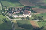
|
7028-301 WDPA: 555521784 |
District of Donau-Ries , District of Dillingen on the Danube | ⊙ | 0.00 | |||||
|
Mertinger Hell and surrounding wetlands |

|
7330-301 WDPA: 555521898 |
Donau-Ries district | ⊙ | 858.00 | |||||
| Upper course of the Ussel to Itzing |
7130-372 WDPA: 555521816 |
Donau-Ries district | ⊙ | 28.74 | ||||||
| Pfäfflinger meadows and Riedgraben with foliage |

|
7130-371 WDPA: 555521815 |
Donau-Ries district | ⊙ | 230.61 | |||||
|
Dry network on the edge of the Nördlinger Ries |

|
7128-371 WDPA: 555521812 |
Donau-Ries district | ⊙ | 948.97 | |||||
|
Wemdinger Ried |

|
7130-301 WDPA: 555521813 |
Donau-Ries district | ⊙ | 124.00 | |||||
|
Wörnitztal |

|
7029-371 WDPA: 555521786 |
Ansbach , district of Donau-Ries | ⊙ | 3,893.33 |
|
||||
|
Beech forest east of Krumbach |

|
7728-302 WDPA: 555522012 |
District of Günzburg | ⊙ | 182.00 | |||||
|
Leipheim moss |
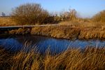
|
7527-371 WDPA: 555521960 |
District of Günzburg | ⊙ | 183.65 | |||||
|
Mouse-ear colonies in Eastern and Lower Allgäu |

|
7728-301 WDPA: 555522011 |
Günzburg , Ostallgäu , Unterallgäu | ⊙ | 0.00 | |||||
| Mindel slopes between the winemaker and Mindelzell |
7728-303 WDPA: 555522013 |
District of Günzburg | ⊙ | 87.00 | ||||||
|
Riedel landscape valley moors |
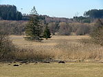
|
7628-301 WDPA: 555521982 |
District of Günzburg , District of Unterallgäu | ⊙ | 341.00 | |||||
| Stubenweiherbach |
7528-371 WDPA: 555521961 |
District of Günzburg | ⊙ | 4.29 |
|
|||||
| Tufa springs in the Allgäu Alpine Foreland |
8028-372 WDPA: 555522094 |
Kaufbeuren , Unterallgäu district | ⊙ | 10.99 | ||||||
|
Staffelwald near Irsee and Hammerschmiede clay pit |

|
8029-371 WDPA: 555522096 |
Kaufbeuren , Ostallgäu district | ⊙ | 329.89 |
|
||||
|
Allgäu Molassetobel |

|
8326-371 WDPA: 555522224 |
Lindau district (Bodensee) , Oberallgäu district | ⊙ | 936.69 | |||||
|
Shores of Lake Constance |
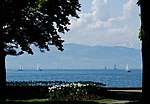
|
8423-301 WDPA: 320003 |
District of Lindau (Lake Constance) | ⊙ | 213.00 | |||||
|
Hammermoos near Heimenkirch |

|
8325-371 WDPA: 555522221 |
District of Lindau (Lake Constance) | ⊙ | 60.90 | |||||
|
Laiblach and Lindauer Oh |

|
8424-371 WDPA: 555522263 |
District of Lindau (Lake Constance) | ⊙ | 105.61 | |||||
|
Lindenberg moss |

|
8325-301 WDPA: 555522219 |
District of Lindau (Lake Constance) | ⊙ | 106.00 | |||||
| Maierhöfer Moos |
8326-372 WDPA: 555522225 |
District of Lindau (Lake Constance) | ⊙ | 27.52 | ||||||
|
Nature reserve 'Rohrachschlucht' |

|
8424-302 WDPA: 555522262 |
District of Lindau (Lake Constance) | ⊙ | 174.00 | |||||
| Osterholz near Rentershofen |
8325-372 WDPA: 555522222 |
District of Lindau (Lake Constance) | ⊙ | 47.16 | ||||||
| Sinswanger Moor north of Oberstaufen |
8426-371 WDPA: 555522266 |
Lindau district (Bodensee) , Oberallgäu district | ⊙ | 62.72 | ||||||
| Stockenweiler Weiher, Degermoos, Schwarzenbach |
8324-301 WDPA: 555522215 |
District of Lindau (Lake Constance) | ⊙ | 239.00 | ||||||
| Unterreitnauer Moos and NSG 'Mittelseemoos bei Wasserburg' |
8423-372 WDPA: 555522261 |
District of Lindau (Lake Constance) | ⊙ | 58.00 |
|
|||||
|
Benninger Ried |

|
8027-301 WDPA: 555522090 |
Memmingen , Unterallgäu district | ⊙ | 101.00 |
|
||||
| Nature reserve 'Wasenlöcher near Illerberg' |
7726-302 WDPA: 555522006 |
District of Neu-Ulm | ⊙ | 69.00 | ||||||
| Obenhausen reed and mussel brooks in the Rothtal |
7726-372 WDPA: 555522009 |
District of Neu-Ulm | ⊙ | 399.08 | ||||||
|
Lower Illerauen |

|
7726-371 WDPA: 555522008 |
District of Neu-Ulm | ⊙ | 834.10 |
|
||||
|
Allgäu high alps |

|
8528-301 WDPA: 555522288 |
District of Oberallgäu | ⊙ | 21,227.00 | |||||
| Engenkopfmoor |
8627-301 WDPA: 555522292 |
District of Oberallgäu | ⊙ | 94.00 | ||||||
| Felmer Moos, Großmoos and Gallmoos |
8427-371 WDPA: 555522268 |
District of Oberallgäu | ⊙ | 80.46 | ||||||
|
Grünten |

|
8427-301 WDPA: 555522267 |
District of Oberallgäu | ⊙ | 146.00 | |||||
| Häderichmoore |
8525-301 WDPA: 555522283 |
District of Oberallgäu | ⊙ | 89.00 | ||||||
|
High Ifen |

|
8626-301 WDPA: 4412 |
District of Oberallgäu | ⊙ | 2,451.00 | |||||
|
Group of horns |

|
8527-301 WDPA: 395975 |
District of Oberallgäu | ⊙ | 1,183.00 | |||||
| Chicken moss |
8428-301 WDPA: 555522269 |
District of Oberallgäu | ⊙ | 170.00 | ||||||
|
Iller breakthrough between Reicholzried and Lautrach |

|
8127-301 WDPA: 555522130 |
Oberallgäu , Unterallgäu | ⊙ | 968.00 | |||||
|
Kempter Forest with Upper Rottachtal |

|
8228-301 WDPA: 555522177 |
Oberallgäu , Ostallgäu | ⊙ | 4,096.00 | |||||
| Kürnach Forest |
8227-373 WDPA: 555522176 |
District of Oberallgäu | ⊙ | 2,759.61 | ||||||
|
Moors in the Wierlinger Forest |
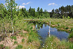
|
8327-301 WDPA: 555522226 |
District of Oberallgäu | ⊙ | 198.00 | |||||
|
Nagelfluhkette Hochgrat-Steineberg |

|
8426-302 WDPA: 555522265 |
District of Oberallgäu | ⊙ | 1,993.00 | |||||
|
Nature reserve 'Widdumer Weiher' and Wasenmoos |

|
8327-372 WDPA: 555522229 |
District of Oberallgäu | ⊙ | 34.86 | |||||
|
Upper Weißach Valley with Lanzenbach, Katzenbach and Mittelbach |

|
8426-301 WDPA: 555522264 |
District of Oberallgäu | ⊙ | 712.00 | |||||
| Piesenkopfmoore |
8526-302 WDPA: 555522285 |
District of Oberallgäu | ⊙ | 779.00 | ||||||
| Source corridor at Staig |
8227-301 WDPA: 555522174 |
District of Oberallgäu | ⊙ | 1.00 | ||||||
| Source corridors at Maisenbaindt |
8227-302 WDPA: 555522175 |
District of Oberallgäu | ⊙ | 1.00 | ||||||
|
Rottachberg and Rottach Gorge |

|
8327-304 WDPA: 555522228 |
District of Oberallgäu | ⊙ | 527.00 | |||||
|
Schlappolt |

|
8627-302 WDPA: 165402 |
District of Oberallgäu | ⊙ | 195.00 | |||||
| Schoenberger Oh |
8527-371 WDPA: 555522287 |
District of Oberallgäu | ⊙ | 29.56 | ||||||
|
Werdensteiner Moos |

|
8327-303 WDPA: 395763 |
District of Oberallgäu | ⊙ | 139.00 | |||||
|
Wertach breakthrough |

|
8329-301 WDPA: 555537965 |
Oberallgäu , Ostallgäu | ⊙ | 876.00 | |||||
| Wild river system Bolgenach |
8526-301 WDPA: 555522284 |
District of Oberallgäu | ⊙ | 164.00 |
|
|||||
|
Aggenstein |
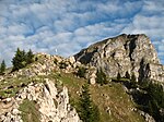
|
8429-304 WDPA: 81251 |
District of Ostallgäu | ⊙ | 130.00 | |||||
|
Alpine rim spring lakes |

|
8429-302 WDPA: 555522271 |
District of Ostallgäu | ⊙ | 233.00 | |||||
|
Ammer Mountains |
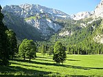
|
8431-371 WDPA: 4419 |
Garmisch-Partenkirchen , Ostallgäu | ⊙ | 27,581.80 | |||||
|
Attlesee |
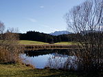
|
8329-304 WDPA: 81322 |
District of Ostallgäu | ⊙ | 69.00 | |||||
|
Elbsee |

|
8229-301 WDPA: 555522178 |
District of Ostallgäu | ⊙ | 151.00 | |||||
|
Falkenstein, Alatsee, Faulenbacher and Lech valleys |

|
8430-303 WDPA: 555522276 |
District of Ostallgäu | ⊙ | 987.00 | |||||
| Fronhalde and Holdersberg |
8229-302 WDPA: 555522179 |
District of Ostallgäu | ⊙ | 18.00 | ||||||
|
Gennachhauser Moor |

|
8130-301 WDPA: 555522133 |
District of Ostallgäu | ⊙ | 234.00 | |||||
| Gillenmoos |
8128-302 WDPA: 555522132 |
District of Ostallgäu | ⊙ | 86.00 | ||||||
|
Günzhangwälder Markt Rettenbach - Obergünzburg |
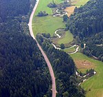
|
8128-301 WDPA: 555522131 |
Ostallgäu , Unterallgäu | ⊙ | 449.00 | |||||
| Semi-arid grassland on the Forggensee |
8330-302 WDPA: 555522234 |
District of Ostallgäu | ⊙ | 171.00 | ||||||
| Tuff swamps and fens in the Ostallgäu |
8430-372 WDPA: 555522277 |
District of Ostallgäu | ⊙ | 115.55 | ||||||
|
Kienberg with poor grass in the valley of the Steinacher Ach |
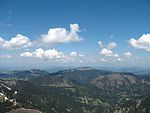
|
8429-303 WDPA: 555522272 |
District of Ostallgäu | ⊙ | 624.00 | |||||
| Mindel spring area |
8028-371 WDPA: 555522093 |
Ostallgäu , Unterallgäu | ⊙ | 81.68 | ||||||
|
Moors around Bernbeuren |

|
8230-371 WDPA: 555522181 |
Weilheim-Schongau , Ostallgäu | ⊙ | 325.95 | |||||
|
Nature reserve 'Bannwaldsee' |

|
8430-301 WDPA: 555522275 |
District of Ostallgäu | ⊙ | 558.00 | |||||
|
Upper Mindel |
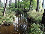
|
8028-373 WDPA: 555522095 |
Ostallgäu , Unterallgäu | ⊙ | 88.65 | |||||
| Pfrontener Wasenmoos and Moore near Hopferau |
8429-371 WDPA: 555522274 |
District of Ostallgäu | ⊙ | 158.44 | ||||||
| Meltwater channels and dead ice holes near Pfronten |
8429-301 WDPA: 555522270 |
District of Ostallgäu | ⊙ | 38.00 | ||||||
| Senkele |
8329-305 WDPA: 555522233 |
District of Ostallgäu | ⊙ | 159.00 | ||||||
|
Sulzschneider Moore |

|
8329-303 WDPA: 395806 |
District of Ostallgäu | ⊙ | 1,795.00 | |||||
|
Trauchberger Ach, moors and forests on the northern edge of the Ammer Mountains |

|
8331-303 WDPA: 555522239 |
Weilheim-Schongau , Ostallgäu | ⊙ | 1,129.00 | |||||
| Lower Halch |
8330-303 WDPA: 555522235 |
District of Ostallgäu | ⊙ | 120.00 | ||||||
| Original felt, Premer felt and cattle pastures |
8330-371 WDPA: 555522236 |
Weilheim-Schongau , Ostallgäu | ⊙ | 546.57 | ||||||
| Weihermoos wood people |
8329-302 WDPA: 555522230 |
District of Ostallgäu | ⊙ | 144.00 |
|
|||||
| Alte Günz near Tafertshofen |
7727-301 WDPA: 555522010 |
District of Unterallgäu | ⊙ | 20.00 | ||||||
| Angelberger Forest |
7829-301 WDPA: 555522039 |
District of Unterallgäu | ⊙ | 641.00 | ||||||
| Stocks of river mussels near arbors |
7927-371 WDPA: 555522065 |
District of Unterallgäu | ⊙ | 21.10 | ||||||
|
Bechstein bat population around Bad Wörishofen |

|
7929-301 WDPA: 555522066 |
District of Unterallgäu | ⊙ | 137.00 | |||||
| Trenches in the middle Mindeltal |
7828-371 WDPA: 555522038 |
District of Unterallgäu | ⊙ | 78.71 | ||||||
| Heimertinger Illerleite |
7926-301 WDPA: 555522063 |
District of Unterallgäu | ⊙ | 8.00 |
|
|||||
| Katzbrui |
8028-301 WDPA: 555522092 |
District of Unterallgäu | ⊙ | 44.00 |
|
|||||
|
Western Gunz |

|
8027-371 WDPA: 555522091 |
District of Unterallgäu | ⊙ | 142.22 | |||||
|
Wiedergeltinger grove |

|
7930-301 WDPA: 555522067 |
District of Unterallgäu | ⊙ | 26.00 |
|
||||
| Legend for fauna-flora-habitat | ||||||||||
See also
- List of nature reserves in Swabia (Bavaria)
- List of landscape protection areas in Swabia (Bavaria)
- List of EU bird sanctuaries in Swabia (Bavaria)
- List of geotopes in Swabia (Bavaria)
Web links
Commons : FFH areas in Swabia (Bavaria) - Collection of images, videos and audio files