List of geotopes in the Nienburg / Weser district
The list of geotopes in the district of Nienburg / Weser contains the geotopes in the district of Nienburg / Weser in Lower Saxony . Some of these geotopes are also protected as natural monuments (ND), landscape protection areas (LSG), nature reserves (NSG) or part of these.
| Geotope no. | designation | place | comment | Coordinates | image |
|---|---|---|---|---|---|
| 3320/06 | Sand pit | on Haß-Berg N Bühren, Liebenau | Sand pit. Length 50 m, width 50 m, height 10 m. Stratigraphy: Quaternary. Petrography: Compressed sands and gravel of the Weser central terrace and Elster ground moraine discordantly overlaid by periglacial slope formations. |
52 ° 38 '0.6 " N , 9 ° 8' 40.6" E | |
| 3320/08 | Sand pit | 2 km northwest Oyle, Marklohe | Sand pit. Length 300 m, width 150 m. Stratigraphy: Quaternary Pleistocene, Saale Glaciation and earlier Pleistocene. Petrography: river gravel, meltwater sand and ground moraine, strong stratification due to glacier compression. |
52 ° 39 '0 " N , 9 ° 6' 54.4" E | |
| 3320/09 | Sand pit | 1 km northwest Glissen, Binnen | Sand pit. Length 200 m, width 100 m. Stratigraphy: Quaternary Pleistocene, Saale Glaciation and earlier Pleistocene. Petrography: river gravel and meltwater sand, strong stratification due to glacial compression. |
52 ° 38 '34.4 " N , 9 ° 5' 3.5" E | |
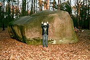
| 3321/01 | Giebichenstein | at Stöckse | Boulder. Length 7.5 m, width 4.5 m, height 2.75 m. Stratigraphy: Quaternary Pleistocene, Saale Ice Age. Petrography: granite. Natural monument ND-Ni 19. |
52 ° 38 '4.6 " N , 9 ° 18" 53.3 " E |
 more pictures |
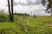
| 3321/03 | " Krähenmoor " raised bog | Sticks | High moor. 230.0 ha. Stratigraphy: Quaternary. Nature reserve NSG HA 103 "Krähenmoor II" |
52 ° 39 '24.8 " N , 9 ° 17' 58.6" E | |
| 3418/06 | Sand pit | Sand pit near Darlaten, Uchte | Soil profile. Height 2 m, size: 400 m². Stratigraphy: Quaternary. Petrography: Iron Podzol. Natural monument ND-Ni 32. |
52 ° 31 '59.2 " N , 8 ° 49' 52" E | |
| 3421/01 | Boulder | S of the Hespen mountain, Rehburg | Boulder. Length 2.9 m, width 0.5 m, height 1 m. Stratigraphy: Quaternary. Petrography: granite, gray, medium coarse, with light gray feldspar up to 1 cm in diameter. Natural monument ND-Ni 14. |
52 ° 30 '31.7 " N , 9 ° 15' 34.9" E | |
| 3421/02 | Boulder | Husum , W of the Brokeloher Mühle | Boulder. Length 3.5 m, width 3 m, height 1.3 m. Stratigraphy: Quaternary. Petrography: granite gneiss, red, banded by alkaline deposits. Natural monument ND-Ni 16. |
52 ° 31 '47.3 " N , 9 ° 12' 52.9" E | |
| 3421/04 | Boulder | Husum , 2.5 km SW of the Brokeloher mill | Boulder. Stratigraphy: Quaternary. Petrography: gray medium-grain granite gneiss. Natural monument ND-Ni 63. |
52 ° 31 '8.4 " N , 9 ° 12' 18.7" E | |
| 3421/05 | Boulder | Husum , 3 km N Rehburg | Boulder. Length 2 m, width 1.5 m, height 0.8 m. Stratigraphy: Quaternary. Petrography: gray-reddish medium-grain granite, feldspars up to 1 cm long, gray quartz up to 0.3 m. Natural monument ND-Ni 61. |
52 ° 30 '28.1 " N , 9 ° 13' 3" E | |
| 3421/06 | " Rehburger Moor " high moor | Sticks | High moor. 156.0 ha + 92.0 ha. Stratigraphy: Quaternary. In the nature reserve NSG-HA 042 "Rehburger Moore" |
52 ° 30 '49 " N , 9 ° 13' 7.3" E |
 more pictures |
| 3421/08 | Erratic block | Husum | Boulder. Length 2.8 m, width 2.4 m, height 1.3 m, weight 22 t. Stratigraphy: Quaternary - Pleistocene, Saale Cold Age / Drenthe Stage. Petrography: Gneiss granite, pale red from the Finnish-Scandinavian region. Natural monument ND-Ni 68. |
52 ° 33 '19.1 " N , 9 ° 13' 31.4" E | |
| 3422/02 | Boulders | 3 km southwest of Borstel, Linsburg | Boulder. Length 2.7 m, width 1.8 m, height 0.8 m. Stratigraphy: Quaternary. Petrography: 1–4) granite gneiss, gray, medium-grained with cm large feldspar, 5–6) eye gneiss, gray. Natural monument ND-Ni 18. |
52 ° 34 '29.3 " N , 9 ° 20' 29.4" E | |
| 3518/01 | Boulder | 2 km N Hauskämpen, Diepenau | Boulder. Length 1.5 m, width 1 m, height 0.9 m. Stratigraphy: Quaternary. Petrography: Pale red medium-grain granite with pale red feldspars up to approx. 0.5 cm in size and gray quartz up to 0.3 cm. Natural monument ND-Ni 64. |
52 ° 28 '14.9 " N , 8 ° 48' 34.6" E | |
| 3518/03 | Boulder | north of Warmsen, Diepenau | Boulder. Length 2.3 m, width 2.6 m, height 0.25 m. Stratigraphy: Quaternary. Petrography: Eye gneiss with abundant feldspar, probably a former megalithic slab. Natural monument ND-Ni 65. |
52 ° 27 '41.4 " N , 8 ° 49' 46.6" E | |
| 3519/02 | Gravel pit | 3.5 km southwest of Uchte | Gravel pit. Length 150 m, width 150 m. Stratigraphy: Quaternary Pleistocene, Saale Glaciation. Petrography: silt to fine sand with gravel pockets; Deposits from the ice - sand, gravelly; Middle terrace layers of the Weser. Natural monument ND-Ni 65. |
52 ° 28 ′ 5.2 " N , 8 ° 52 ′ 34" E | |
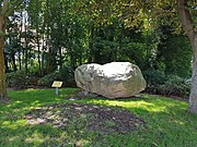
| 3519/04 | Boulder | Uchte , Straßenstern, Mühlenberg / Brinkstrasse / Am Teich | Boulder. Length 2 m, width 2.9 m, height 4 m, weight: 31 t. Stratigraphy: Quaternary - Pleistocene, Saale-Cold Age / Drenthe Stadium. Petrography: pale pink aplite granite (fine feldspar and quartz crystals) with coarser inclusions. |
52 ° 29 '49.1 " N , 8 ° 54' 36.9" E |
 more pictures |
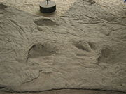
| 3521/02 | Dinosaur track | Münchehagen , Rehburg-Loccum | Traces of life. Length 27 m. Stratigraphy: Lower Cretaceous, Bückeberger Formation. Petrography: main sandstone (Obernkirchen sandstone), gray. Natural monument ND-Ni 67. |
52 ° 26 '28.7 " N , 9 ° 12' 1.4" E |
 more pictures |
| 3521/05 | Boulders | 3 km NW Rehburg at the junction to the Düsselburg | Boulder. Length 2 m, width 2 m, height 0.5 m. Stratigraphy: Quaternary. Petrography: gray granite gneiss, 2 sections of a block. |
52 ° 29 ′ 14.6 " N , 9 ° 11 ′ 37" E |
See also
- List of nature reserves in the Nienburg / Weser district
- List of landscape protection areas in the district of Nienburg / Weser
- List of natural monuments in the district of Nienburg / Weser
- List of protected landscape components in the Nienburg / Weser district
Web links
Commons : Geotopes in the Nienburg / Weser district - collection of images, videos and audio files
Individual evidence
- ↑ Giebichenstein , (pdf; 332 kB)
- ↑ Regulation text NSG HA 103 "Krähenmoor II" , accessed on April 26, 2019.
- ↑ Regulation text NSG HA 042 "Rehburger Moore" , accessed on April 26, 2019.
- ↑ Dinopark Münchehagen , (pdf; 550 kB)