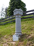
List of milestones in the district of Hof
The list of milestones in the district of Hof is an overview of the historical milestone pillars in the Upper Franconian district of Hof in Bavaria .
The historical milestones that have been preserved in the town and district of Hof are predominantly stone pillars. They emerged as landmarks at the roadside with the introduction of the metric length measure in Germany in 1868/72. The meter replaced the mile . With the stone pillars, the waypoints were also standardized. The pillars are usually round, about two meters high, and made of granite . They taper slightly upwards and close in a conical shape. The stones are now minor monuments and are sometimes also used as architectural monuments. The stones no longer serve as a guide in road traffic and were removed or relocated around 1980 for safety reasons, among other things.
List of milestones
| Location | description | labeling | view |
|---|---|---|---|
| Gattendorf | The kilometer stone was erected in front of the town hall as a small monument, the original location is elsewhere. |
14.6 to Ölsnitz 10 kilometers 10 to Hof |

|
| court | Schleizer Straße in the direction of Unterkotzau |
31.1 to Schleiz 105 kilometers 1.5 to Hof |

|
| Haidt | On federal highway 173 in the middle of the Hof district of Haidt |
23 to Plauen 140 kilometers 3.5 to Hof |

|
| Cold sweat | At the junction to Kühschwitz on the district road HO 5 between Kautendorf and Neukühschwitz |
10 to Hof 10 kilometers 4 to Rehau |

|
| Lichtenberg | Square column at the exit of Lichtenberg in the direction of Bad Lobenstein |
1.6 to Lichtenberg 45 kilometers 7.3 to Lobenstein |

|
| Oberkotzau | Entering the town from Fattigau , also a monument - the column is not in its original place, it was put up again later |
3.6 to Schwarzenbach aS 95 kilometers 8.5 to Hof |

|
| Rehau | On the state road St 2129 to Regnitzlosau at the entrance to Rehau at the level of the Rehau-Nord exit of the A 93 - the stone was removed in 1980 and kept in the road maintenance department in Hof. In 2003 it was put back in its original location. Square column. |
1.5 to Rehau 5 to Regnitzlosau |

|
| Schlegel | Entrance to the village, original position is 100 meters away |
2 to Münchberg 120 kilometers (to Nuremberg ) 19 to Hof |

|
| Schönlind | On the state road St 2192 between Rehau and Neuhausen after the junction to Schönlind, directly on the German-Czech border. The original kilometer column was lost during construction work. Because of the cross-border reference, the column that can be seen today was manufactured and erected as a replacement. | Old: 6 to Rehau 20 kilometers 6 to Asch New: 20 6 km to Asch 20 |

|
| Sparneck | Between Sparneck and Stockenroth |
1.3 to Sparneck 5 kilometers 5.5 to Münchberg |

|
| Tauperlitz | Entrance from Tauperlitz, coming from Hof or Döhlau |
5 to Hof 5 kilometers 9 to Rehau |

|
| Pots | At Bundesstraße 2 , in the town of Hofer Straße, at the junction towards the town center |
22 to Schleiz 112.5 kilometers 9 to Hof |

|
| Sub-deep green | Crossroads in the village: State road St 2198 runs as Untertiefengrüner Straße from Tiefengrün to Hirschberg in Thuringia . It branches off the state road St 2192 via Lamitz to Joditz . The stone was removed during construction work in 1971 and was in the building yard in Naila at the Bayreuth road construction authority until 2014. It was originally located across the street. |
15 to Hof 15 kilometers 0.5 to Hirschberg |

|
| Weißlenreuth | On Weißenlenreuther mountain of Konradsreuth Coming |
14 to Hof 125 kilometers -. - (to Nuremberg ) 7 to Münchberg |

|
Disappeared milestones
| Location | description | labeling |
|---|---|---|
| Bob green | A square kilometer stone pillar near Bobengrün was prepared in 1975, but removed in 1985. | |
| Volkmannsgrün | The kilometer column was removed during road construction work. |
10.6 to Naila 25 kilometers 11.3 to Münchberg |
| Rehau | A distant milestone was on Bundesstrasse 289 in Rehau, where it runs parallel to Mozartstrasse. |
Identical pillars
| Location | description | labeling | view |
|---|---|---|---|
| Helmbrechts | District border column at the parking lot on Staatsstrasse St 2195 to the natural open- air swimming pool of Helmbrechts, the original location was in the immediate vicinity. |
Border of the district offices Naila - Münchberg |

|
literature
- Hans Bucka , Oskar Heland : Landmarks - corridor and small monuments in the district of Hof . Hoermann, Hof 1991, ISBN 3-88267-040-1 .
Web links
Individual evidence
- ↑ Bucka, Heland, p. 15f.
- ^ City of Rehau: Monuments, waymarks and symbols in the cultural city of Rehau . Rehau 2005. p. 48.
- ↑ Article in the Frankenpost
- ↑ http://www.rehau-neuhausen.de/poststrasse.html
- ↑ Bucka, Heland, p. 29.
- ↑ Bucka, Heland, pp. 120f.