List of cultural monuments in Penig
The list of cultural monuments in Penig is a directory of cultural monuments in the Saxon city of Penig .
The city of Penig includes the districts of Dittmannsdorf, Arnsdorf, Amerika , Thierbach, Zinnberg, Tauscha, Chursdorf, Langenleuba-Oberhain, Wernsdorf, Niedersteinbach , Markersdorf, Obergräfenhain I and Obergräfenhain II.
Legend
- Image: shows a picture of the cultural monument
- Name: gives the name or the description of the cultural monument
- Location: gives the street and house number of the cultural monument (if available) and the location on a map
- Description: provides further information on the cultural monument
- Construction time: indicates the year of completion or the period of construction
America
| image | designation | location | Dating | description | ID |
|---|---|---|---|---|---|
| Individual monument of the Muldentalbahn (Obj. 09306202): railway embankment | (Map) | 1875 (railway body) | Embankment of the Muldentalbahn between km 22.2 and 22.4 east of America station with paved embankment to the impact slope of the Mulde, exposed route with optimal adaptation to the landscape, of importance in terms of traffic, technology and railway history |
09306142 |
|
 More pictures |
Material component of the material population Muldentalbahn ( Obj. 09306181 ), subsection Penig, OT America with the individual monuments: two railway embankments (Obj. 09306142), railway keeper's house (Obj. 09306141) and the stop with reception building and goods shed as well as telegraph masts 081064 ) as well as the aggregate part: road bridge | Muldentalstrasse (map) |
1875 (road bridge) | Totality with all railway systems, including track systems with substructure and superstructure, route kilometers, telecommunication and signal systems, railway stations including all functional buildings, guard houses, bridges and culverts in the communities of Glauchau, Stadt (OT Glauchau, Kleinbernsdorf, Reinholdshain, Niederlungwitz), Limbach-Oberfrohna , City (OT Wolkenburg-Kaufungen, Herrndorf, Uhlsdorf), Remse (OT Remse), Waldenburg (OT Niederwinkel, Oberwinkel, Waldenburg), Lunzenau, city (OT Lunzenau, Berthelsdorf, Cossen, Rochsburg, Göritzhain), Penig, city (OT Markersdorf, Penig, America, Arnsdorf, Thierbach, Zinnberg), Rochlitz, city (OT Penna, Rochlitz, Zaßnitz), Seelitz (OT Fischheim, Seelitz, Biesern, Steudten), Colditz (OT Colditz, Lastau, Möseln, Sermuth, Zschetzsch) , Grimma, Stadt (OT Großbothen), standard gauge railway that is important for the industrial development of the Muldental and that shapes the landscape, economic history, railway history, landscape design and the region historically significant |
09306140 |
 |
Memorial for fallen employees of the Bernhard Schmidt company (First World War) | Muldentalstrasse (map) |
after 1918 (war memorial) | Part of the America cotton mill, of local historical importance |
09300375 |
 |
Official residence | Muldentalstrasse 6 (map) |
around 1900 (official residence) | Residential building with a striking clinker facade for the higher-ranking employees of the America spinning mill, of local and architectural importance |
08961075 |
 More pictures |
Individual monument of the Muldentalbahn (Obj. 09306140): reception building and goods shed as well as telegraph poles | Muldentalstrasse 12 (map) |
1899 (station building), around 1900 (telegraph masts), 1875 (goods shed) | Goods shed from the time the Glauchau – Wurzen railway line (Muldentalbahn) was built (1875) and a brick entrance building from 1899 with platform roofing, originally only designed as a stop for goods traffic at the industrial site, later expanded to become a train station, in the industrial-historical context of the America of large factory settlement founded in 1835 local and railway historical significance |
08961064 |
 |
Porter's house and gate post of the former cotton mill | Muldentalstrasse 14 (map) |
around 1900 (gatehouse), around 1900 (gate entrance) | Remains of the enclosure and gate system of the upper guard of the self-contained cotton mill area, the house is a small clinker building typical of the time with decorations and as part of the cotton mill of local historical importance |
08961065 |
| Administration building of a former cotton mill | Muldentalstrasse 15 (map) |
around 1900 (administration building) | Part of the America cotton mill, half-timbered building from around 1900 with a wide roof overhang, formerly built as an office, used as a factory kindergarten from 1949/50, of local and industrial significance |
08961066 |
|
| Storage and garage building of a cotton mill | Muldentalstrasse 21 (map) |
around 1890 (warehouse) | Formerly part of the American cotton spinning industrial colony, elongated plastered building with a gable roof and central ridge turret with clock, numerous conversions due to changing use, also used as a workshop from the 1920s, of architectural and local significance |
08961067 |
Arnsdorf
| image | designation | location | Dating | description | ID |
|---|---|---|---|---|---|
| The aggregate component of the aggregate Muldentalbahn ( Obj. 09306181 ), subsection Penig, OT Arnsdorf with the individual monuments of the railway embankment (Obj. 09306544) and road bridge (Obj. 09306545) as well as the aggregate parts of the railway body, kilometering, signaling systems | (Map) | 1875 (railway body) | Totality with all railway systems, including track systems with substructure and superstructure, route kilometers, telecommunication and signal systems, railway stations including all functional buildings, guard houses, bridges and culverts in the communities of Glauchau, Stadt (OT Glauchau, Kleinbernsdorf, Reinholdshain, Niederlungwitz), Limbach-Oberfrohna , City (OT Wolkenburg-Kaufungen, Herrndorf, Uhlsdorf), Remse (OT Remse), Waldenburg (OT Niederwinkel, Oberwinkel, Waldenburg), Lunzenau, city (OT Lunzenau, Berthelsdorf, Cossen, Rochsburg, Göritzhain), Penig, city (OT Markersdorf, Penig, America, Arnsdorf, Thierbach, Zinnberg), Rochlitz, city (OT Penna, Rochlitz, Zaßnitz), Seelitz (OT Fischheim, Seelitz, Biesern, Steudten), Colditz (OT Colditz, Lastau, Möseln, Sermuth, Zschetzsch) , Grimma, Stadt (OT Großbothen), standard gauge railway that is important for the industrial development of the Muldental and that shapes the landscape, economic history, railway history, landscape design and the region historically significant |
09306202 |
|
 |
Individual monument of the Muldentalbahn as a whole (Obj. 09306169): road bridge | (Map) | 1875 (road bridge) | Quarry stone masonry carried out, built at km 22 to cross the Glauchau– Wurzen railway line (Muldentalbahn), of significance in terms of railway history and technology |
09306545 |
| Hydroelectric power plant as an additional system for the spinning mill in America, with keeper's house (with pergola), turbine house (with trolley from Unruh & Liebig / Leipzig), fish-bellied weir with forged chain and inlet | (Map) | 1934–1935 (hydroelectric power station), 1936 (weir), 1957 (renewal of the crown) | Unique system from the 1930s of great technical and historical importance, weir crown renewed in 1957 after flooding |
08961773 |
|
| Muldentalbahn (totality; see Obj. 09306202); Railway embankment, largely original masonry made of granite blocks, at km 21.4 of the Glauchau – Wurzen railway line (Muldentalbahn) | (Map) | 1875 (railway body) | of importance in terms of railway and transport history |
09306544 |
|
| Fountain | (Map) | 19th century (fountain) | Well located in the field with a cover made of field stones, of architectural and socio-historical importance; Quarry stone fountain |
08961087 |
|
 |
Residential house, northern side building and eastern barn of a four-sided courtyard, with enclosure | Am Berg 12 (map) |
inscribed 1910 (residential building), inscribed 1904 (side building), inscribed 1904 (barn) | stately, villa-like house with reform style elements from around 1910, remarkable courtyard, of architectural and economic importance; Manor (former) |
08961055 |
 |
Transformer house | Am Berg 14 (behind) (map) |
around 1920 (transformer station) | "Borna type", transformer building typical for the area, evidence of the electrification of Saxony, significant in terms of technology history |
08961056 |
| South-eastern side building of a three-sided courtyard | Am Dorfbach 9 (map) |
2nd half of the 18th century (side building) | rare half-timbered construction of a remarkable farm building with a striking effect on the street scene, of importance in terms of building history; stately outbuilding of a three-sided courtyard |
08961063 |
|
| Southern stable house, two side buildings and barn of a four-sided courtyard as well as bridge and avenue | Am Dorfbach 12 | End of 18th century (stable house), vault around 1800 (stable house), 2nd half of 19th century (both side buildings), 2nd half of 19th century (barn), keystone marked 1808 (access bridge) | stately courtyard complex with an almost defensive character, of architectural and local importance, and due to its elevated position it has a decisive impact on the townscape |
08961091 |
|
| Residential stable house, side building, barn and archway of a four-sided courtyard | At fire department depot 8 (map) |
Kern 18th century (stable house), 18th century (side building), 18th century (barn) | typical regional farm with an older half-timbered house, a rarity, of importance in terms of building history and house history; old building fabric |
08961061 |
|
| Residential stable house and barn of a three-sided courtyard, with memorial plaque | Eduard-Bilz-Weg 2 (map) |
around 1700 (stable house) | Residential stable house with a rare half-timbered construction, the house where Eduard Bilz was born, the father of folk naturopathy, of significance in terms of building history, house history and local history |
08961057 |
|
| South-western side building (with upper arbor) of a four-sided courtyard | Eduard-Bilz-Weg 3 (map) |
18th century (side building) | Remarkable half-timbered building of rarity, of architectural significance |
08961058 |
|
| North-eastern side building of a four-sided courtyard | Mühlenstrasse 15 | 1st half of the 19th century (side building) | Remarkable half-timbered building, decisively characterizing the townscape, situated above the stream, historically important |
08961059 |
|
| Eastern and southern side buildings, northern barn and archway of a four-sided courtyard | Rochsburger Strasse 11 (map) |
1st half of the 19th century (side building), beginning of the 19th century (barn), marked 1854 (archway) | typical regional courtyard, all three buildings in half-timbered construction, of architectural and local importance; Barn, two stable barns and archway of a four-sided courtyard as elementary components of the closed courtyard |
08961082 |
|
| Western stable house, southern side building and eastern barn of a four-sided courtyard | Rochsburger Strasse 13 (map) |
According to information 1792 (stable house), end of 18th century (barn), around 1800 (side building) | largely original substance of a beautiful half-timbered ensemble, of importance in terms of building history, local history and shaping the townscape |
08961083 |
Chursdorf
| image | designation | location | Dating | description | ID |
|---|---|---|---|---|---|
| Hydroelectric power plant as an additional system for the spinning mill in America, with keeper's house (with pergola), turbine house (with trolley from Unruh & Liebig / Leipzig), fish-bellied weir with forged chain and inlet | (Map) | 1934–1935 (hydroelectric power station), 1936 (weir), 1957 (renewal of the crown) | Unique system from the 1930s of great technical and historical importance, weir crown renewed in 1957 after flooding |
08961773 |
|
| Residential stable house in a four-sided courtyard | Chursdorfer Strasse 15 (formerly Dorfstrasse 3) (map) |
End of the 18th century (stable house) | Typical regional farmhouse with clad half-timbered upper floor, of architectural and domestic importance |
08962899 |
|
| South-eastern barn and western side building of a four-sided courtyard | Chursdorfer Strasse 76 (formerly Dorfstrasse 64) (map) |
marked 1842 (side building), 18th century (barn) | both buildings in half-timbered construction, of local importance |
08964284 |
|
 More pictures |
Memorial for the fallen of the First World War, war memorial German-French. War and three stone crosses | Chursdorfer Straße 90 (near) (formerly Dorfstraße 60 (near)) (map) |
inscribed 1871 (war memorial German-French war), after 1918 (war memorial 1st World War) | of local importance; War memorial, gravestone, a stone cross and two stumps |
08964192 |
| Two side buildings with upper arbor of a three-sided courtyard | Chursdorfer Strasse 108 (formerly Dorfstrasse 49) (map) |
marked 1755 (western side building), end of the 18th century (southern side building) | Most of the original preserved half-timbered buildings with impressive upper arbors, unique in the village, of architectural and local significance |
08963729 |
|
| Half-timbered upper floor (courtyard side) of a stable house | Chursdorfer Straße 160 (former Dorfstraße 43a) (map) |
around 1650 (half-timbered) | Example of the timber construction of the 17th century, of importance in terms of building history and house history |
08963320 |
|
| House of a farm | Landgutweg 18 (formerly Dorfstrasse 12) (map) |
1719 according to the owner's statement (farmhouse), 1721 Dendro (farmhouse) | one of the oldest houses in the village with a half-timbered upper floor, of importance in terms of building history, house history and local history |
08962909 |
|
 |
restaurant | To Höllmühle 6 (map) |
in the core 17./18. Century (guest house) | Historic resting place with half-timbered house at Höllteich, of architectural and local significance |
08962594 |
Langenleuba-Oberhain
| image | designation | location | Dating | description | ID |
|---|---|---|---|---|---|
 More pictures |
Reception building and farm building of the Langenleuba-Oberhain train station | At station 5; 7 (card) |
1876 (station building), 1876 (farm building) | Type-built station building on the Rochlitz – Penig branch line (6632/6432, see RP), of architectural and railway historical importance, partially demolished in 2010 as part of the new A72 motorway construction |
08955447 |
 More pictures |
Side building (No. 1, stable barn) and side building (No. 3) of an inn | At the inn 1; 3 (card) |
around 1800 (side building) | Half-timbered buildings that shape the street scene with architectural, local and local historical significance; Weber's inn |
08955422 |
| Four-sided courtyard with western residential stable, southern side building, northern drive-through barn and eastern barn | At the Leuba 19 (map) |
End of 18th century (stable house), end of 18th century (side building), end of 18th century (drive-through barn), end of 18th century (barn) | Closed half-timbered courtyard from around 1800, an important part of the local structure, of importance in terms of building and local history |
08955427 |
|
| Eastern stable house and southern side building of a former four-sided courtyard | At the Leuba 26 (map) |
around 1800 (stable house), 1st half of the 19th century (side building) | Both buildings in typical regional half-timbered construction, of architectural and local importance |
08955576 |
|
| Residential stable of a three-sided courtyard | At the Leuba 33 (map) |
1st half of the 19th century (stable house) | Half-timbered building typical of the region and the time, of architectural and local importance |
08955430 |
|
| Northern drive-through barn of a four-sided courtyard | At the Leuba 36 (map) |
marked 1824 (drive-through barn) | Half-timbered building, largely preserved in its original form, of architectural significance, characterizing the townscape due to its elevated position |
08955429 |
|
| Former stable house, southern side building and western barn of a four-sided courtyard | At the Leuba 49 (map) |
End of the 18th century (stable house), marked 1831 (stable barn), 1st half of the 19th century (barn) | all buildings in typical regional half-timbered construction, part of the older village structure, of architectural and local significance |
08955431 |
|
| Residential stable house, side building and enclosure of a three-sided courtyard | At the Leuba 73 (map) |
Mid-19th century (residential stable), mid-19th century (side building) | Residential stable house typical of the time, plastered construction, side building typical of the region, half-timbered building, historically important, decisively shaping the street scene |
08955432 |
|
| Eastern stable house of a farm | At the Leuba 87 (map) |
marked 1880 (stable house) | building from the late 19th century that has largely been preserved in its original form; stately stable house, solid and half-timbered construction combined |
08955434 |
|
| Western stable house and southern drive-through barn of a four-sided courtyard | At the Leuba 92 (map) |
around 1800 or end of the 18th century (residential stable house) | Good example of the half-timbered construction, largely in its original state of preservation, decisively shaping the townscape, significant in terms of building history and local history |
08955437 |
|
| Side building (with upper arbor) of a farm | At the Leuba 95 (map) |
End of 18th century (side building) | Half-timbered building with upper arbor that has largely been preserved in its original form, rarity, of architectural significance |
08955435 |
|
| Residential stable of a three-sided courtyard | At the Leuba 99 (map) |
presumably marked 1841 (stable house) | Half-timbered building typical of the region, an important part of the old local structure, of architectural significance |
08955436 |
|
| Half-timbered gable of a farmhouse | At the Leuba 105 (map) |
End of 18th century (farmhouse) | decorative, striving half-timbered gable with a picture-defining character and significance in terms of building history |
08955577 |
|
| North and south side buildings of a four-sided courtyard | At the Leuba 115 (map) |
around 1800 (north side building), marked 1819 (south side building) | Half-timbered buildings typical of the time, largely preserved in their original state, of significance in terms of architectural and local history; good example of wood construction |
08955438 |
|
| Northern side building with upper arbor of a four-sided courtyard | At the Leuba 118 (map) |
End of 18th century (side building) | Half-timbered building with a protruding upper floor and a rare upper arbor, of architectural significance |
08955439 |
|
| Inn with hall extension | At the Leuba 125 (map) |
marked 1881 (Gasthof-Saal) | Plastered building with hall over an angled floor plan, the hall with elaborate window frames, of architectural and local significance; Inn with lavishly decorated dance hall |
08955440 |
|
| Barn of a two-sided yard | At the Leuba 127 (map) |
2nd half of the 19th century (barn) | Half-timbered barn that characterizes the site and is of architectural significance |
08955575 |
|
| Southern side building of a four-sided courtyard | At the Leuba 150 (map) |
18th century (side building) | largely originally preserved building with ambitious half-timbering, of importance in terms of building history, house history and local history; good example of the old timber construction |
08955441 |
|
| Two side buildings of a four-sided courtyard | Buttermilk Triangle 3a (card) |
2nd half of 17th century (side building), 2nd half of 19th century (side building) | both buildings in half-timbered construction, the southwest side building with rare curly St. Andrew's crosses, of architectural and house-historical importance |
08955442 |
|
| Residential building | Buttermilkwinkel 8 (card) |
Mid 19th century (residential building) | Almost original, typical regional residential building with a completely preserved structure, attractive alternation between the light-colored plaster and the red porphyry tufa, important in terms of building history |
08955569 |
|
| Drive-through barn and barn of a four-sided courtyard | Buttermilkwinkel 10 (card) |
End of 18th century (drive-through barn), 2nd half of 19th century (barn) | structural remains of a former four-sided courtyard, largely preserved in its original form, image-defining half-timbered buildings, of architectural and local significance |
08955443 |
|
| Cottage | Buttermilkwinkel 15 (map) |
1st half of the 19th century (cottage) | regional and time-typical half-timbered house with plastered upper floor, of importance in terms of architectural history and the appearance of the street; the local house |
08955568 |
|
| Side building and drive-through barn of a four-sided courtyard | Buttermilkwinkel 18a (map) |
around 1720 (side building), around 1848 (drive-through barn) | Half-timbered construction that is very rare in the district, part of the oldest development, of architectural and house-historical importance |
08955444 |
|
| Side building and drive-through barn of a four-sided courtyard | Buttermilchwinkel 21 (map) |
1707 Dendro (barn), 1st half of the 19th century (side building) | Examples of older timber construction methods that have been preserved largely unchanged and of significance in terms of building history, house history and local history |
08955446 |
|
 More pictures |
Church with furnishings, churchyard with all parts of the enclosure, memorial for the fallen of World War I, OdF memorial and all wrought iron grave enclosures | Kirchberg (map) |
12th century (choir tower of the church), 1885 (church, new building of the hall), after 1918 (war memorial), after 1945 (VdN / OdF) | Choir tower church, plastered quarry stone building with hall with high arched windows, of architectural and local significance; re. 1936 (west gable), church: Romanesque core, nave early 16th century. |
08955424 |
 More pictures |
Rectory (No. 4) and side building (No. 2) of the former parish farm with retaining walls and fence columns | Kirchberg 2; 4 (card) |
1st half of the 18th century (rectory), marked 1741 (parish barn) | characteristic half-timbered buildings as part of the church school, church and parsonage ensemble, of importance in terms of building history, local history and local history |
08955423 |
 More pictures |
Church school and fountain next to the school | Kirchberg 6 (map) |
2nd half of the 19th century, older core (house), marked 1720 (fountain) | old church school of Langenleuba-Oberhain, striking half-timbered building as part of the ensemble around the church and parsonage, significance in terms of building history, the townscape and its history |
08955425 |
| Cottage | Oberhainer Strasse 1 (map) |
1st half of the 19th century (cottage) | Half-timbered building on the Leubabach, important in terms of architectural history and the appearance of the streets, largely preserved unchanged |
08955448 |
|
| Eastern stable house, drive-through barn with upper arbor and western barn of a four-sided courtyard | Oberhainer Strasse 2 (map) |
18th century (stable house), marked 1791 (drive-through barn), 18th century (barn) | Half-timbered buildings typical of the region with rarity value, hardly disturbed original substance, of importance in terms of building history, local history and the local image |
08955449 |
|
| South side building with upper arbor and western barn of a four-sided courtyard | Oberhainer Strasse 18a (map) |
around 1790 (side building), around 1800 (barn) | Oberlaube a rarity, a half-timbered barn that defines the townscape, is of importance in terms of building history |
08955450 |
|
| Residential building (former inn) | Oberhainer Strasse 22 (map) |
1st half of the 19th century (residential building) | half-timbered construction typical of the time with architectural and local historical significance; former inn |
08955572 |
|
| Side building (No. 24b) and former drive-through barn (No. 24a) of a three-sided courtyard | Oberhainer Strasse 24a; 24b (card) |
marked 1792 (side building), 2nd half of the 19th century (barn) | Upper floors in half-timbered houses, an important part of the old local structure, of architectural and local significance |
08955451 |
|
| Cottage property | Oberhainer Strasse 35 (map) |
1st half of the 19th century (cottage) | Small half-timbered house directly on Dorfstrasse, decisively shaping the image as well as part of the floodplain development, historically important |
08955454 |
|
| Eastern stable house and two side buildings | Oberhainer Strasse 36 (map) |
Sign in the gable marked 1829 (stable house), around 1830 (side building) | largely authentically preserved half-timbered building with architectural and local significance; ensemble well preserved in the original sense |
08955452 |
|
| Side building (with upper arbor) of a former four-sided courtyard | Oberhainer Strasse 40 (map) |
2nd half of the 18th century (side building) | An example of a typical regional half-timbered building with preserved upper arbor, largely unchanged, of importance in terms of architectural and local history |
09306531 |
|
| Residential stable house | Oberhainer Strasse 42 (map) |
Kern end of the 18th century (residential stable house) | Largely original, stately half-timbered house with an extraordinary construction, rarity value, of importance in terms of building history, house history and local history |
08955453 |
|
| Residential stable house and side building (with upper arbor) of a four-sided courtyard | Oberhainer Strasse 62 (map) |
End of the 18th century (residential stable house), marked 1820, in the core probably older (side building) | Part of the old local structure, historically important; very good, unchanged example of the wood construction, rarity value |
08955455 |
|
| Southern drive-through barn and angled side building of a four-sided courtyard | Oberhainer Strasse 67 (map) |
marked 1844 (drive-through barn), 1st half of the 19th century (side building) | Very well-preserved ensemble of half-timbered buildings, of local importance |
08955459 |
|
| Four-sided courtyard with western residential stable house, southern side building, northern drive-through barn and barn as well as stone and courtyard tree | Oberhainer Strasse 70 (map) |
Inscribed 1867 (stable house), 2nd half of 18th century (side building), beginning of 19th century (drive-through barn), 2nd half of 18th century (barn) | wooden courtyard, largely preserved in its original form, of importance in terms of building history, local history and shaping the townscape; Stone, good ensemble of wood construction, with house tree (red beech) |
08955456 |
|
| Eastern stable house and western barn of a four-sided courtyard | Oberhainer Strasse 74 (map) |
Early 19th century (stable house), early 19th century (barn) | stately half-timbered buildings of architectural and local significance, defining the townscape |
08955458 |
|
| Four-sided courtyard with residential stable house (No. 80, 80a), two side buildings (No. 78) and barn | Oberhainer Strasse 78; 80; 80a (card) |
around 1800 (stable house), 18th century (stable barn), 2nd half of 19th century (stable barn), keystone marked 1836 (barn) | The half-timbered courtyard, which has largely been preserved in its original form, is of importance in terms of building history, local history and characterizing the townscape |
08955460 |
|
| Eastern stable house, southern side building and western barn of a four-sided courtyard | Oberhainer Strasse 82 (map) |
End of 18th century (stable house), lintel marked 1838 (stable house), end of 19th century (side building), end of 18th century (barn) | Well-preserved buildings in half-timbered buildings, an example of the old timber construction, of architectural and local importance |
08955461 |
|
| Four-sided courtyard with residential stable house to the north, side building to the east with upper arbor and two barns | Oberhainer Strasse 84 (map) |
End of 18th century (side building), 1st half of 19th century (stable barn), 1st half of 19th century (barn) | The wooden courtyard, which has largely been preserved in its original form, is of importance in terms of building history, local history and characterizing the townscape |
08955462 |
|
| Northern side building and eastern barn of a four-sided courtyard | Oberhainer Strasse 90 (map) |
marked 1870 (barn), 2nd half of the 19th century (side building) | well-preserved half-timbered construction typical of the region, of importance in terms of building history and local history; good original substance |
08955463 |
|
| Eastern and western side buildings and northern barn of a four-sided courtyard | Oberhainer Strasse 92 (map) |
marked 1898 (side building), early 19th century (barn), marked 1826 (stable barn) | Well-preserved half-timbered substance, of importance in terms of building history and local history |
08955464 |
|
| Residential stable house (surrounding area) of a farm | Oberhainer Strasse 96 (map) |
End of the 18th century (stable house) | Unique half-timbered building with surrounding framework in the place, of architectural and house-historical importance |
08955465 |
Markersdorf
| image | designation | location | Dating | description | ID |
|---|---|---|---|---|---|
| The aggregate component of the aggregate Muldentalbahn ( Obj. 09306181 ), subsection Penig, OT Markersdorf with the aggregate part: passage | (Map) | 1875 (passage) | Totality with all railway systems, including track systems with substructure and superstructure, route kilometers, telecommunication and signal systems, railway stations including all functional buildings, guard houses, bridges and culverts in the communities of Glauchau, Stadt (OT Glauchau, Kleinbernsdorf, Reinholdshain, Niederlungwitz), Limbach-Oberfrohna , City (OT Wolkenburg-Kaufungen, Herrndorf, Uhlsdorf), Remse (OT Remse), Waldenburg (OT Niederwinkel, Oberwinkel, Waldenburg), Lunzenau, city (OT Lunzenau, Berthelsdorf, Cossen, Rochsburg, Göritzhain), Penig, city (OT Markersdorf, Penig, America, Arnsdorf, Thierbach, Zinnberg), Rochlitz, city (OT Penna, Rochlitz, Zaßnitz), Seelitz (OT Fischheim, Seelitz, Biesern, Steudten), Colditz (OT Colditz, Lastau, Möseln, Sermuth, Zschetzsch) , Grimma, Stadt (OT Großbothen), standard gauge railway that is important for the industrial development of the Muldental and that shapes the landscape, economic history, railway history, landscape design and the region historically significant |
09306133 |
|
 More pictures |
Church with furnishings, churchyard and enclosure | Obere Dorfstrasse (map) |
Core 12./13. Century, changed (church) | Late Romanesque hall church with a striking roof turret, of architectural and local significance; Church with churchyard and enclosure, branch church from Penig 1539 and 1940. Church: typical Saxon village church with a narrow hall, small entrance porch and eight-sided roof turret with high, pointed helmet. Plastered quarry stone building, slate roofing, three windows on the east wall, inside: flat-roofed, somewhat square nave, slightly recessed, rectangular choir with late Gothic ribbed vault, there keystone with a large rose (coat of arms of the burgraves of Altenburg, also of the city of Penig) |
08960929 |
| Cottage | Obere Dorfstrasse 10 (map) |
1st half of the 19th century (cottage) | Upper floor half-timbered, located in the Dorfau, indispensable for the townscape, of architectural significance |
08960930 |
|
| South side building with upper arbor of a four-sided courtyard | Obere Dorfstrasse 17 (map) |
around 1750 (side building) | Remarkable building with 11jochiger Oberlaube, rarity, building and house history of importance |
08960927 |
|
| Individual monument of the Muldentalbahn ( Obj. 09306181 ): embankment | Peniger Strasse (map) |
1875 (railway body) | Retaining wall between rail kilometers 17.5 and 17.7 of the Glauchau – Wurzen railway line (Muldentalbahn), embossed quarry stone masonry with buttresses in the lower area, high-lying exposed track structure with an imposing effect, of significance in terms of railway history and technology |
09306120 |
|
| Southern side building with upper arbor and eastern gatehouse with the Kumthalle of a four-sided courtyard | Untere Dorfstrasse 3 (map) |
around 1750 (side building), around 1830 (side building) | Remarkable courtyard buildings, largely preserved in their original form, the Oberlaube as a rare type of construction, of importance in terms of building history, house history and the appearance of the town |
08960926 |
|
| Residential stable of a former four-sided courtyard | Untere Dorfstrasse 9 (map) |
End of the 18th century (stable house) | Example of timber construction, largely unchanged, of significance in terms of building history and local history |
08960925 |
Niedersteinbach
| image | designation | location | Dating | description | ID |
|---|---|---|---|---|---|
 More pictures |
Landmark | Altenburger Strasse (map) |
19th century, today renewed (boundary stone) | Porphyry stone with Albertine and Ernestine coats of arms (renewed), initials SG above the Saxon coat of arms, refers to the division of the electorate in 1485, which is of regional historical importance |
08955397 |
| South side building of a farm | Altenburger Strasse 6 (map) |
1st half of the 19th century (side building) | Half-timbered building typical of the region, good example of timber construction, of architectural significance |
08955398 |
|
| Residential stable of a three-sided courtyard | Altenburger Strasse 9; 9a (card) |
2nd half of the 19th century (stable house) | representative, elongated plastered building with porphyry walls, decisively characterizing the street scene, of importance in terms of local history |
08955400 |
|
 More pictures |
Railway viaduct | Altenburger Strasse 9a (behind) (map) |
1870s (railway bridge) | Altenburg – Langenleuba-Oberhain railway line, seven-arched plastered stone bridge with clinker decorative elements, shaping the landscape, of significance in terms of building history, technology history and railway history |
08955399 |
 More pictures |
Church with furnishings, churchyard, seven tombs, memorial to the fallen of World War I and cemetery enclosure with gate | Karl-von-Hase-Strasse (map) |
Early 13th century (choir tower, apse of the church), 18th century (tomb), after 1918 (war memorial) | Choir tower church with baroque furnishings, of architectural and local significance |
08955406 |
 |
Luther linden tree with memorial stone | Karl-von-Hase-Strasse 2 (near) (map) |
1883 (memorial tree), 1917 (memorial stone) | Memorial tree planted on the occasion of the 400th anniversary of the reformer Martin Luther, porphyry stone with Luther Rose (1571-1971), personal history, cultural history and local history important monument Text Luther trees were commemorating the person of Martin Luther and the work of the Reformer planted. The best-known example is the Luther oak in Lutherstadt Wittenberg, where Luther burned his copy of the papal bull threatening exsurgeon Domine in 1520. In 1883, on the occasion of Martin Luther's 400th birthday, Luther linden trees were planted in many of the mostly Protestant-Lutheran towns. These trees are mostly in places in front of churches or other centrally located locations. Further Luther linden trees were planted in 1917 on the occasion of the 400th anniversary of the Reformation and in 1933 for the 450th birthday of Martin Luther. The complex in Niedersteinbach, consisting of linden tree and memorial stone, reminds of Luther himself, of a church / religious memorial that was widespread in 1883 and of an important event for the town of Niedersteinbach. It is therefore significant in terms of personal history, cultural history and local history LfD / 2017 |
08955402 |
 |
Rectory, side building and font | Karl-von-Hase-Strasse 4 (map) |
1710 (rectory) | Remarkable building with two half-timbered upper floors, of importance in terms of building history, house history and local history, location that shapes the townscape |
08955407 |
 More pictures |
school | Karl-von-Hase-Strasse 6 (map) |
1890s (school) | Typical plastered building with a simple facade structure, of local history, the building will be demolished from the end of May 2020 |
08955571 |
| Former poor house | Karl-von-Hase-Strasse 7 (map) |
1st half of the 19th century, older core (poor house) | Typical regional building with half-timbered upper floor, of architectural and local significance |
08955570 |
|
| House and angled side building of a four-sided courtyard | Karl-von-Hase-Strasse 10 (map) |
1740, according to the inscription (stable house), around 1840 (side building) | Example of half-timbered construction, of importance in terms of building history and local history |
08955584 |
|
| Northern and southern side buildings as well as eastern barn of a four-sided courtyard | Karl-von-Hase-Strasse 19 (map) |
around 1828 (barn) | all three buildings in typical regional half-timbered construction, defining the image due to their elevated position, well-preserved building fabric, of architectural and economic importance |
08955403 |
|
| Eastern and western side buildings of a four-sided courtyard | Karl-von-Hase-Strasse 23 (map) |
1st half of the 19th century (east barn), 2nd half of the 19th century (west barn) | Half-timbered buildings typical of the region with good original substance, of architectural and economic importance |
08955404 |
|
| Former poor house | Small page 3 (card) |
18th century (poor house) | Half-timbered house with rammed earth ground floor, directly on the Steinbach, an indispensable part of the local structure, of local and local importance |
08955396 |
|
| Western house, eastern side building and northern barn of a four-sided courtyard | Small page 7 (card) |
inscribed 1884 (farmhouse), 1st half of the 19th century (stable barn), 1820 (barn) | a typical regional farm with a defining effect on the townscape, of importance in terms of building history and local history; massive house, barn and stable barn of a four-sided courtyard |
08955395 |
|
| Eastern side building (with upper arbor) and archway of a four-sided courtyard | Small page 13 (card) |
around 1700 (side building), marked 1850 (archway) | Half-timbered building from around 1700 with a seven-bay upper arbor, of architectural and house-historical importance, rarity; Archway and barn of a four-sided courtyard |
08955394 |
|
 |
Waystone | Obersteinbacher Strasse (map) |
19th century (Wegestein) | with directions to Obersteinbach, Niedersteinbach and Markersdorf, height approx. 60 cm, porphyry, of importance for the history of traffic |
08955408 |
| Eastern stable house and southern side building of a four-sided courtyard | Obersteinbacher Strasse 22 (map) |
around 1800 (stable house), marked 1790 (side building) | Example of very elaborate wooden construction, ambitious half-timbered buildings, location that defines the townscape, of importance in terms of building history and local history |
08955409 |
|
| South-eastern side building of a four-sided courtyard | Obersteinbacher Strasse 29 (map) |
marked 1780 (side building) | good example of the half-timbered construction, largely in its original state of preservation, of architectural significance |
08955585 |
|
| Eastern and western side buildings, southern barn, well and courtyard paving of a four-sided courtyard | Obersteinbacher Strasse 68; 70 (card) |
1886–1887 (side building) | stately, closed, preserved courtyard complex, of architectural and local importance; typical example of the economic boom at the end of the 19th century. |
08955573 |
|
| Northern residential stable and eastern side building of a four-sided courtyard | Obersteinbacher Strasse 72 (map) |
around 1800 (stable house), 2nd half of the 19th century (side building) | Both buildings in half-timbered construction, historically important, decisive effect on the townscape |
08955410 |
|
| Residential stable house and barn of a farm | Untere Hauptstrasse 8 (map) |
End of 18th century (stable house), 1st half of 19th century (side building) | Residential stable house with striving half-timbering, side building also in wood construction, of architectural and local importance |
08955401 |
|
| Residential stable house (surrounding area), side building and gate pillars of a three-sided courtyard | Untere Hauptstrasse 22; 22a (card) |
marked 1730 (stable house), marked 1849 (side building) | Residential stable house in a rare half-timbered construction, courtyard that defines the townscape, important in terms of building history and house history |
08955393 |
Obergräfenhain
| image | designation | location | Dating | description | ID |
|---|---|---|---|---|---|
 |
viaduct | (Map) | 1870s (railway bridge) | Railway bridge on the Rochlitz – Penig railway line (6632/6432, see RP), of significance in terms of railway history |
08955467 |
| Western stable house, southern and northern side buildings of a four-sided courtyard as well as courtyard paving and archway | Hauptstrasse 1 (map) |
marked 1848 (stable house), end of the 19th century (side building), lintel marked 1788 (stable barn) | Stately residential stable house with half-timbered upper floor facing the courtyard, of importance in terms of architectural history and character of the townscape |
08955466 |
|
 |
Church with furnishings, churchyard and enclosure as well as a memorial for the fallen of the First World War | Obergräfenhainer Strasse (map) |
Kern 12th century (church), marked 1752 (church), around 1600 (baptism), end of 18th century (organ), after 1918 (war memorial) | Choir tower church with semicircular apse, of architectural and local significance |
08955474 |
 |
Waystone | Obergräfenhainer Strasse (map) |
marked 1839 (Wegestein) | gabled porphyry stone with pointing gesture in different directions, of importance in terms of traffic history |
08955487 |
| Western stable house and side building of a farm | Obergräfenhainer Strasse 3 (map) |
inscribed 1832, older core (stable house), inscribed 1783 (side building) | Half-timbered buildings typical of the region and the time, example of the older timber construction, of architectural and local significance |
08955469 |
|
| Residential building | Obergräfenhainer Strasse 12 (map) |
1st half of the 19th century (residential building) | Small half-timbered building that has largely been preserved in its original form and is of importance in terms of building history and local history |
08955468 |
|
| Southern gatehouse and northern drive-through barn of a three-sided courtyard | Obergräfenhainer Strasse 15 (map) |
End of the 18th century (gatehouse), marked 1787 (barn) | Typical farm buildings from the end of the 18th century, largely preserved in their original state, of significance in terms of architectural history |
08955470 |
|
| Rectory, side building, barn, gate entrance and garden gate of a rectory as well as a manual pump | Obergräfenhainer Strasse 25 (map) |
marked 1699 (rectory), around 1800 (parish barn), marked 1842 (archway) | Attractive architectural ensemble together with church, churchyard and school, of importance in terms of building history, house history and local history |
08955472 |
|
| Eastern stable house, northern and southern side buildings and barn of a four-sided courtyard | Obergräfenhainer Strasse 29 (map) |
Mid-19th century (residential stable), 1st half of 19th century (northern side building), mid-19th century (southern side building), 1st half of 19th century (barn) | Timber and regionally typical courtyard complex in half-timbered construction, an important part of the town center with architectural and local history significance |
08955473 |
|
| school | Obergräfenhainer Strasse 31 (map) |
marked 1840 (school) | In the ensemble with the church and rectory, the plastered structure determining the town center, architectural and site historical significance |
08955471 |
|
| Residential stable house | Obergräfenhainer Strasse 35 (map) |
marked 1821 (stable house) | Half-timbered construction, largely unchanged, of significance in terms of architectural history |
08955476 |
|
| Two side buildings and a barn of a four-sided courtyard | Obergräfenhainer Strasse 42 (map) |
2nd half of 19th century (side building), 1st half of 19th century (stable barn), 2nd half of 19th century (barn) | stately half-timbered buildings with architectural and local historical value |
08955475 |
|
| Southern side building and northern drive-through barn of a four-sided courtyard | Obergräfenhainer Strasse 52 (map) |
2nd half of the 19th century (side building), 1st half of the 19th century (barn) | Both buildings in typical regional half-timbered construction, of importance in terms of architectural history and the appearance of the streets |
08955477 |
|
| Residential stable house, side building, drive-through barn, barn and archway of a four-sided courtyard | Obergräfenhainer Strasse 62 (map) |
inscribed 1799 (stable house), around 1850 (side building), around 1850 (barn), around 1850 (drive-through barn), inscribed 1765 (gate entrance) | Closed courtyard, which is well preserved in its substance and structure, is an important part of the local structure, is of importance in terms of building history, local history and has a decisive impact on the townscape |
08955479 |
|
| House of a homestead | Obergräfenhainer Strasse 69 (map) |
Ceiling beam marked 1825 (residential building) | Upper floor half-timbered structure, of importance in terms of building history and character of the townscape |
08955480 |
|
| Western stable house and southern side building of a four-sided courtyard | Obergräfenhainer Strasse 73 (map) |
around 1800 (stable house), 1st half of the 18th century (side building) | Half-timbered buildings typical of the time and region, half-timbered construction of the side building with rarity value, of architectural and house-historical importance |
08955482 |
|
| Residential stable house in a four-sided courtyard | Obergräfenhainer Strasse 74 (map) |
End of the 18th century (stable house) | Stately building with a high hipped roof, of importance in terms of building history and house history and shaping the townscape |
08955481 |
|
| Residential stable house, two side buildings (the northern one with an upper arbor) and stable barn of a four-sided courtyard | Obergräfenhainer Strasse 75 (map) |
1st half of the 19th century (residential stable house), around 1840 (side building), marked 1842 (stable barn), mid 19th century (stable barn) | Closed courtyard complex, well preserved in its substance and structure, as an important part of the local structure, half-timbered buildings typical of the region and the time, the upper arbor with rarity, of importance in terms of building history, local history and the appearance of the town |
08955483 |
|
| Stable house of a farm | Obergräfenhainer Strasse 81 (map) |
End of the 18th century (stable house) | Half-timbered farmhouse that has largely been preserved in its original form, an example of wood construction, of local history |
08955484 |
|
| Southern drive-through barn of a four-sided courtyard | Obergräfenhainer Strasse 96 (map) |
Early 19th century (barn) | Half-timbered building, largely preserved in its original form, with architectural significance |
08955486 |
Swap
| image | designation | location | Dating | description | ID |
|---|---|---|---|---|---|
| Residential stable house, archway and side building of a Hakenhof | Hofstrasse 9 (formerly Dorfstrasse 39) (map) |
Kern end of the 18th century (residential stable house), marked 1827 (residential stable house), 1733 Dendro (side building), marked 1865 (gate entrance) | Very good example of timber construction, rarity, important in terms of building history and local history |
08961040 |
|
 More pictures |
Memorial to those who fell in the Franco-Prussian War and the First World War | Tauschaer Straße 26 (next to) (map) |
inscribed 1895 (war memorial German-French war), after 1918 (war memorial 1st World War) | of local importance |
08961041 |
| Residential stable house, two side buildings and two archways of a farm | Tauschaer Strasse 45 (formerly Dorfstrasse 87) (map) |
around 1860 (residential stable), around 1800 (south side building), 1st half of the 19th century (north side building), marked 1866 (gate entrance) | good original substance, elementary component of the local structure, of importance in terms of building history and local history |
08961043 |
|
| Side building (with upper arbor) of a four-sided courtyard | Tauschaer Strasse 50 (formerly Dorfstrasse 27) (map) |
around 1790 (side building) | Half-timbered building with a rarity, good state of preservation, of importance in terms of building history and character of the townscape |
08961044 |
|
| Cottage | Tauschaer Strasse 82 (formerly Dorfstrasse 19) (map) |
Core 18th century (cottage) | Upper floor half-timbered structure, of importance in terms of building history and character of the townscape |
08961042 |
|
| Residential stable house, side building (with passage) and barn of a four-sided courtyard | Tauschaer Strasse 90 (formerly Dorfstrasse 12) (map) |
around 1800 (stable house), inscribed 1802 (side building), 2nd half of the 19th century (barn) | Residential stable house and side building in half-timbered construction typical of the region, of architectural and economic importance |
08961045 |
|
| Residential stable house, two side buildings and barn of a four-sided courtyard | Tauschaer Strasse 124 (formerly Dorfstrasse 9) (map) |
2nd half of 17th century (stable house), around 1800 (side building), 18th century (barn) | Small farm with a half-timbered stable house with St. Andrew's crosses, rarity, significant in terms of building history and local history |
08961046 |
|
| South side building (with upper arbor) of a former four-sided courtyard | Tauschaer Strasse 128 (formerly Dorfstrasse 8) (map) |
marked 1776 (side building) | Rare type of construction, of importance in terms of building history and local history |
08961047 |
|
| Northwest residential stable of a four-sided courtyard | Zur Lochmühle 24 (formerly Dorfstrasse 69) (map) |
Early 19th century (stable house) | Local historical value, an important component of the old village development, of architectural significance |
08961038 |
Thierbach
| image | designation | location | Dating | description | ID |
|---|---|---|---|---|---|
| Individual monument of the Muldentalbahn as a whole (Obj. 09306205): Railway bridge | (Map) | 1875 (railway bridge) | parallel-belt steel girder bridge on the Glauchau – Penig railway line (Muldentalbahn), km 15.7 to 15.8, designed as a solid wall girder bridge in riveted construction, spanning the Zwickau Mulde on two supporting pillars, exposed location, of technical and transport historical importance |
09306117 |
|
| Residential stable house, barn and shed of a farm | Markersdorfer Strasse 14 (map) |
around 1720 (cottage) | Half-timbered stable house, part of the older local development, of architectural and local importance |
08960941 |
|
 |
Material component of the material population Muldentalbahn ( Obj. 09306181 ), section Penig, OT Thierbach with the individual monument: Thierbach-Zinnberg stop with stop signal (Peniger Straße, next to house no. 45, Obj. 09306119) | Peniger Strasse (map) |
1875 (railway body) | Totality with all railway systems, including track systems with substructure and superstructure, route kilometers, telecommunication and signal systems, railway stations including all functional buildings, guard houses, bridges and culverts in the communities of Glauchau, Stadt (OT Glauchau, Kleinbernsdorf, Reinholdshain, Niederlungwitz), Limbach-Oberfrohna , City (OT Wolkenburg-Kaufungen, Herrndorf, Uhlsdorf), Remse (OT Remse), Waldenburg (OT Niederwinkel, Oberwinkel, Waldenburg), Lunzenau, city (OT Lunzenau, Berthelsdorf, Cossen, Rochsburg, Göritzhain), Penig, city (OT Markersdorf, Penig, America, Arnsdorf, Thierbach, Zinnberg), Rochlitz, city (OT Penna, Rochlitz, Zaßnitz), Seelitz (OT Fischheim, Seelitz, Biesern, Steudten), Colditz (OT Colditz, Lastau, Möseln, Sermuth, Zschetzsch) , Grimma, Stadt (OT Großbothen), standard gauge railway that is important for the industrial development of the Muldental and that shapes the landscape, economic history, railway history, landscape design and the region historically significant |
09306204 |
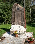 |
Memorial to the fallen of the First World War | Peniger Strasse 44 (next to) (map) |
after 1918 (war memorial) | of local importance |
08960932 |
 |
Individual monument of the Muldentalbahn as a whole (Obj. 09306204): Waiting hall at the stop, with a stop signal | Peniger Strasse 45 (next to) (map) |
around 1910 (waiting hall) | Railway keeper's house, railway kilometer 16.51, important in terms of railway history and technology |
09306119 |
 More pictures |
Mill and turbine house | Peniger Strasse 46; 48 (card) |
1860–1870 (mill), 1881–1882 (turbine house) | Mighty structure on the banks of the Zwickauer Mulde, of importance in terms of architectural, local and technological history |
08960933 |
Wernsdorf
| image | designation | location | Dating | description | ID |
|---|---|---|---|---|---|
 |
Memorial stone for the victims of the Penig subcamp | (Map) | after 1945 (memorial and memorial) | Burial place ?, historically significant |
08955420 |
| Residential stable house | Wernsdorfer Strasse 1 (map) |
1st half of the 18th century (stable house) | Half-timbered building, largely preserved in its original form, with significance in terms of building history and house history |
08955414 |
|
| Side building (with passage) of a four-sided courtyard | Wernsdorfer Strasse 3 (map) |
around 1750 (side building) | with a protruding half-timbered upper floor, important in terms of building history and local history |
08955415 |
|
| Western side building and northern barn of a four-sided courtyard | Wernsdorfer Strasse 7 (map) |
1st half of the 19th century (side building), marked 1836 (barn) | Both buildings in typical regional half-timbered construction, of architectural and local importance |
08955416 |
|
| Cottage | Wernsdorfer Strasse 9 (map) |
18th century (cottage) | small half-timbered building, of importance in terms of building history and local history |
08955417 |
|
| Northern side building and western barn of a four-sided courtyard | Wernsdorfer Strasse 15 (map) |
2nd half of the 19th century (north-east side building), 1911 (north-west side building) | Side building in half-timbered construction, historically important, decisively defining the townscape |
08955574 |
|
| Residential stable house | Wernsdorfer Strasse 18 (map) |
around 1800 (stable house) | Half-timbered building at a crucial place in the street, of architectural and local significance |
08955418 |
|
| Barn of a farm | Wernsdorfer Strasse 21 (map) |
Early 19th century (barn) | The half-timbered barn at the entrance to the village, which is characteristic of the town, is of importance in terms of local history |
08955419 |
|
| Two side buildings (one with a passage) and barn of a four-sided courtyard | Wernsdorfer Strasse 30a (map) |
around 1755 (north side building), marked 1755 (south side building), around 1755 (barn) | good example of rare wood construction, of architectural and economic importance |
08955411 |
|
| Residential stable house, side building and barn of a four-sided courtyard | Wernsdorfer Strasse 32 (map) |
Door lintel marked 1880 (stable house) | Stately courtyard with a massive stable house with elaborate gable ornamentation, all buildings with porphyry walls, of importance in terms of the history of the building and of the townscape |
08955412 |
|
| Western side building of a four-sided courtyard | Wernsdorfer Strasse 36 (map) |
1st half of the 18th century (side building) | imposing building with protruding half-timbered upper floor, of architectural and local importance |
08955413 |
Pewter mountain
| image | designation | location | Dating | description | ID |
|---|---|---|---|---|---|
| Individual monument of the Muldentalbahn as a whole (Obj. 09306205): Railway bridge | (Map) | 1875 (railway bridge) | parallel-belt steel girder bridge on the Glauchau – Penig railway line (Muldentalbahn), km 15.7 to 15.8, designed as a solid wall girder bridge in riveted construction, spanning the Zwickau Mulde on two supporting pillars, exposed location, of technical and transport historical importance |
09306117 |
|
| Material component of the material population Muldentalbahn ( obj. 09306181 ), subsection Penig, OT Zinnberg with the individual monument: railway bridge (obj. 09306117) | (Map) | 1875 (railway body) | Totality with all railway systems, including track systems with substructure and superstructure, route kilometers, telecommunication and signal systems, railway stations including all functional buildings, guard houses, bridges and culverts in the communities of Glauchau, Stadt (OT Glauchau, Kleinbernsdorf, Reinholdshain, Niederlungwitz), Limbach-Oberfrohna , City (OT Wolkenburg-Kaufungen, Herrndorf, Uhlsdorf), Remse (OT Remse), Waldenburg (OT Niederwinkel, Oberwinkel, Waldenburg), Lunzenau, city (OT Lunzenau, Berthelsdorf, Cossen, Rochsburg, Göritzhain), Penig, city (OT Markersdorf, Penig, America, Arnsdorf, Thierbach, Zinnberg), Rochlitz, city (OT Penna, Rochlitz, Zaßnitz), Seelitz (OT Fischheim, Seelitz, Biesern, Steudten), Colditz (OT Colditz, Lastau, Möseln, Sermuth, Zschetzsch) , Grimma, Stadt (OT Großbothen), standard gauge railway that is important for the industrial development of the Muldental and that shapes the landscape, economic history, railway history, landscape design and the region historically significant |
09306205 |
|
| Cottage | Dorfstrasse 9 (map) |
1st half of the 19th century (cottage) | Upper floor half-timbered, of importance in terms of building history and the appearance of the street |
08960937 |
|
| Individual features of the totality of the Zinnberg castle ruins (Obj. 09300358): Castle ruins with remains of masonry from the former keep | Dorfstrasse 15 (behind) (map) |
first mention 1280 (castle ruins) | of local historical importance |
08960939 |
|
| Material entity of the Zinnberg castle ruins with the following individual monuments: Castle ruins with the remains of masonry from the former keep (Obj. 08960939) and the castle hill (entity part) | Dorfstrasse 15 (behind) (map) |
first mention 1280 (castle) | of local historical importance |
09300358 |
|
| Residential stable house, northern side building with Kumthalle and southern side building of a four-sided courtyard | Dorfstrasse 24 (map) |
marked 1829 (stable house), marked 1871 (side building), 2nd half of the 19th century (stable barn) | All half-timbered buildings, exposed location, of architectural and local importance |
08960935 |
|
| Residential building | Dorfstrasse 26 (map) |
marked 1842 (residential building) | one of the few examples of the wood construction in the village, of architectural significance, decisively dated for the street scene |
08960934 |
|
| Residential stable house | Dorfstrasse 32 (map) |
Early 19th century (stable house) | Half-timbered farmhouse, defining the image due to its elevated location, well-preserved substance, of architectural and local significance |
08960936 |
Penig
| image | designation | location | Dating | description | ID |
|---|---|---|---|---|---|
 More pictures |
Monument protection area city center Penig (proposal) | (Map) | Monument protection area city center Penig |
09247640 |
|
| Individual monument of the Muldentalbahn ( Obj. 09306181 ): embankment | (Map) | 1875 (railway body) | Retaining wall between rail kilometers 17.5 and 17.7 of the Glauchau – Wurzen railway line (Muldentalbahn), embossed quarry stone masonry with buttresses in the lower area, high-lying exposed track structure with an imposing effect, of significance in terms of railway history and technology |
09306120 |
|
| Remains of the city fortifications | (Map) | from 1486 (city wall) | Part of the medieval city wall in quarry stone masonry with ruins of a fortification tower, of urban and local historical value |
09235139 |
|
 More pictures |
Mulden weir | (Map) | 1969 (military) | Fixed weir, consists of a flexible, inflatable rubber body, for the first time in GDR, 2002 installation of a fish ladder and commissioning of a hydropower plant, of local and technical significance; Mulden weir on the Zwickauer Mulde |
09235472 |
| Individual monument of the Muldentalbahn as a whole ( Obj. 09306181 ): signal system with connection unit to the signal box | (Map) | 2nd half of the 20th century (signal systems) | Main signal at the railway kilometer 17.7, railway line Glauchau – Wurzen (Muldentalbahn), of importance for traffic and railway history |
09306134 |
|
| Material component of the material population Muldentalbahn ( Obj. 09306181 ), section Penig, OT Penig with the individual monuments: Railway embankment (Obj. 09306139), with reception building, goods shed, two signal boxes, level crossing, three main signals, track system, station guard's house (Bahnhofstrasse 16135148). , Railway bridge (Dittmannsdorfer Straße, Obj. 09306138), railway embankment (Obj. 09306120), signal system (Obj. 09306134) and the aggregate parts: two railway bridges | Amerikaweg (map) |
1875 (passage) | Totality with all railway systems, including track systems with substructure and superstructure, route kilometers, telecommunication and signal systems, railway stations including all functional buildings, guard houses, bridges and culverts in the communities of Glauchau, Stadt (OT Glauchau, Kleinbernsdorf, Reinholdshain, Niederlungwitz), Limbach-Oberfrohna , City (OT Wolkenburg-Kaufungen, Herrndorf, Uhlsdorf), Remse (OT Remse), Waldenburg (OT Niederwinkel, Oberwinkel, Waldenburg), Lunzenau, city (OT Lunzenau, Berthelsdorf, Cossen, Rochsburg, Göritzhain), Penig, city (OT Markersdorf, Penig, America, Arnsdorf, Thierbach, Zinnberg), Rochlitz, city (OT Penna, Rochlitz, Zaßnitz), Seelitz (OT Fischheim, Seelitz, Biesern, Steudten), Colditz (OT Colditz, Lastau, Möseln, Sermuth, Zschetzsch) , Grimma, Stadt (OT Großbothen), standard gauge railway that is important for the industrial development of the Muldental and that shapes the landscape, economic history, railway history, landscape design and the region historically significant |
09306169 |
|
| Individual monument of the Muldentalbahn (Obj. 09306169): railway embankment | Amerikaweg (map) |
1875 (railway body) | Lining wall of the Mulde valley railway embankment towards the Mulde between railway kilometers 21.2 and 21.4, exposed routing that characterizes the landscape, of significance in terms of railway and transport history |
09306139 |
|
 |
obelisk | Amerikaweg (map) |
1838 (monument) | in memory of the battles around the Peniger Muldenübergang from October 6th to 9th, 1813, historically significant; Obelisk "White Lace", on so-called "Hühnerberg" |
09235118 |
| Individual monument of the Muldentalbahn as a whole (Obj. 09306169): Railway keeper's house | Amerikaweg 4 (map) |
1875 (gatekeeper house) | Type construction, largely preserved in its original form, at km 21.4 of the Glauchau– Wurzen railway line (Muldentalbahn), of importance in terms of railway and transport history |
09306141 |
|
| Subject aggregate cotton spinning mill America with the following individual monuments: Turbine hall cotton mill America: turbine hall (No. 6), spinning mill (No. 7) and workshop building with locksmith's shop and forge, porter's house with gate entrance (No. 5), weir system with weir, upper and lower ditch of the mill ditch , two riflemen as well as bank reinforcement on the Zwickauer Mulde (Obj. 08961080) and residential building as a whole | Amerikaweg 5; 6; 7 (card) |
around 1900 (gatehouse), 1870 (dormitory) | as part of the former industrial colony of local and social historical importance |
08961078 |
|
| Individual features of the aggregate cotton mill America (Obj. 08961078): Turbine hall (No. 6), spinning mill (No. 7) and workshop building with locksmith's shop and forge, porter's house with gate entrance, weir system with weir, upper and lower trenches of the mill ditch, two gates and bank reinforcement on the Zwickauer Mulde | Amerikaweg 6; 7 (card) |
1836 (spinning mill), 1910–1911 (turbine house), 1870 (metalworking shop and forge), 1930s (water element), around 1910 (bank reinforcement) | as part of the former industrial colony of local, social and technological historical importance |
08961080 |
|
| File cutting with technical equipment | Amerikaweg 7 (map) |
19th century (technical equipment) | The oldest and only completely preserved file carving workshop of the last still active file cutter Bruno Bannat in Germany with machines, tools and equipment, today the Stahlbau Steinbrunner museum (formerly Penig, Thierbacher Straße 4 / courtyard building), housed in the rear part of the building of the workshop with metalworking and forge 158K Outstanding importance in terms of industrial history and technology history, rarity |
08961770 |
|
 |
Residential building in closed development | Bahnhofstrasse 9 (map) |
around 1880 (residential building) | Center-stressed plastered facade with a dwelling, of architectural significance |
09235147 |
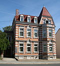 |
Residential house in open development | Bahnhofstrasse 10 (map) |
around 1890 (residential building) | Distinctive residential building with an elaborate clinker stone facade, of importance in terms of building history and urban development |
09235132 |
 |
Residential building in closed development | Bahnhofstrasse 11 (map) |
around 1880 (residential building) | Center-stressed plastered facade with a dwelling, of architectural significance |
09235149 |
 |
Post office in open development | Bahnhofstrasse 12 (map) |
1889 (post) | representative historicizing clinker brick building, of architectural and local significance |
09235133 |
 |
Residential building in closed development | Bahnhofstrasse 13 (map) |
around 1880 (residential building) | with shop, plastered building typical of the time with a gabled central projection, of importance in terms of building history and urban development history |
09235150 |
 |
Residential house in a corner and closed development | Bahnhofstrasse 15 (map) |
around 1880 (residential building) | striking corner building with historicizing plastered facade, of importance in terms of building history and urban development history |
09235152 |
 |
School, former district court | Bahnhofstrasse 16 (map) |
1884 (school) | Stately school building with historicizing clinker brick facade, of importance in terms of architectural history, local history and the street picture |
09235135 |
 |
villa | Bahnhofstrasse 17 (map) |
around 1890 (villa) | Residential building typical of the time with a historicizing plastered facade, of architectural significance |
09235153 |
 More pictures |
Individual features of the Muldentalbahn as a whole (Obj. 09306169): reception building with roofed house platform, goods shed, two signal boxes, level crossing, three main signals and station guard's house at Penig station | Bahnhofstrasse 161 (map) |
1870–1872 (station building), around 1920 (station keeper's house), 1908 (signal box), 2nd half of the 20th century (form signal) | Glauchau – Wurzen railway line (Muldentalbahn), km 18.505, of regional, transport and technological history |
09235148 |
 |
Double house in a formerly closed development | Brauhausgasse 5; 7 (card) |
marked 1837 (double dwelling) | characteristic, Biedermeier residential building with modest facade decor, of architectural significance; originally with a coal shop in closed development |
09235160 |
 |
Residential building in closed development | Brückenstrasse 3 (map) |
2nd half of the 19th century (residential building) | with a shop, a striking plastered building with subsequent conversion to a department store, of importance in terms of building history and urban planning |
09235102 |
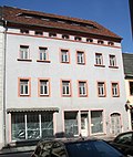 |
Residential building in closed development | Brückenstrasse 5 (map) |
2nd half of the 19th century, essentially older (residential building) | with a shop, a simple plastered building typical of the time with architectural and urban significance |
09235101 |
 |
Residential house in a corner and closed development | Brückenstrasse 6 (map) |
around 1800 (residential building) | with shop, broad plastered building with arched portal typical of the time, of importance in terms of building history and urban planning |
09235043 |
 More pictures |
Residential building in closed development | Brückenstrasse 12 (map) |
Kern 18th century (residential building), after 1933 renovation (savings bank) | The core of the baroque structure, which was converted into a savings bank after 1933, is of architectural and urban significance |
09235159 |
 |
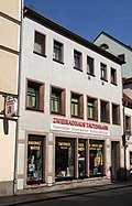
Residential building in closed development | Brückenstrasse 13 (map) |
17th century (residential building) | with a shop front, in the core baroque, later several times overformed plastered building with a striking bay window, of importance in terms of building history and house history |
09235095 |
 |
Residential building in closed development | Brückenstrasse 15 (map) |
16th century (residential building) | with shop, striking renaissance building with remodeling of the 19th century, of architectural and house history of importance |
09235096 |
 More pictures |
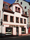
Residential building in closed development | Brueckenstrasse 16 (map) |
around 1930, possibly older in the core (residential building) | with shop front, characteristic façade from around 1930 with a central bay window, significant in terms of building history and urban development history |
09235100 |
 |
Residential house in semi-open development | Brückenstrasse 17 (map) |
18th century (residential building) | with shop, characteristic residential building from the 18th century. with a distinctive dwelling, of architectural and urban significance |
09235097 |
 |
Residential building in closed development | Brückenstrasse 20 (map) |
1st half of the 19th century (residential building) | with a shop, plastered building with a historicizing facade, historically important |
09235098 |
 |
Residential building in closed development | Brückenstrasse 22 (map) |
18th century (residential building) | with shop front, simple baroque residential building with a gable roof, of importance in terms of building history and urban planning |
09235094 |
 |
Residential house in a corner and closed development | Brückenstrasse 26 (map) |
around 1750 (residential building) | with shops, baroque residential buildings with distinctive dwelling houses, of architectural and urban importance |
09235093 |
 |
Residential house in a corner and closed development | Chemnitzer Strasse 1; 3 (card) |
1711 Dendro (residential house) | with shop, structural unit with Obergasse 23, broad-based building as part of the old city structure, of importance in terms of building history and urban planning |
09235006 |
 |
Two houses at a corner in closed development, side building and barn | Chemnitzer Strasse 9; 11 (card) |
18th century (residential building) | One of the last farmhouses in the village preserved in its historical structure, residential houses in a location that characterizes the street scene, significance in terms of local history and building history |
09235007 |
 |
Residential building in closed development | Chemnitzer Strasse 17 (map) |
around 1750 (residential building) | with a shop, small-town housing as part of the old city structure, of importance in terms of building history and local development |
09306474 |
| Residential building in closed development | Chemnitzer Strasse 19 (map) |
around 1750 (residential building) | distinctive small-town residential building as part of the old city structure, of importance in terms of building history and local development |
09235008 |
|
| Individual features of the entity Ev. City church Penig with old and new cemetery (Obj. 09235016): gatehouse (Chemnitzer Straße 28), ten tombs and hall of honor for the fallen of the First World War on the old cemetery (A), mortuary on Zinnberger Straße, double pillar gate and a tomb on the New cemetery (B) as well as all enclosure walls in the area of the old and new cemetery | Chemnitzer Strasse 28 (map) |
18./19. Century (tombstones), around 1910 (Castorf grave complex), around 1920 (Winkler grave complex), around 1920 (New cemetery morgue), around 1920 (cemetery gate house) | Of importance in terms of building history, art history and local history |
09300106 |
|
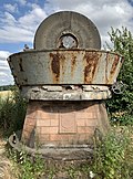 |
Pan mill (a second pan mill installed at the entrance of the Penig paper mill Flinschstrasse 7-11, see Obj. 09235053) | Chemnitzer Strasse 121 (near) (map) |
1st half of the 20th century (pan mill) | Formerly part of the technical equipment of the Penig patent paper mill, of importance in terms of technology and local history |
09306875 |
| Individual monument of the Muldentalbahn (Obj. 09306169): Railway bridge | Dittmannsdorfer Strasse (map) |
1875 (railway bridge) | Round arch bridge with retaining walls made of quarry stone, built at km 19.222 of the Glauchau – Wurzen railway line (Muldentalbahn), of significance in terms of railway and engineering history |
09306138 |
|
| Villa with enclosure | Dittmannsdorfer Strasse 37 (map) |
around 1903 (villa) | typical plastered building in reform style with ornamental framework, of architectural significance; Villa Linda |
09235120 |
|
| Residential house in open development | Dittmannsdorfer Strasse 51 (map) |
around 1650 (residential building) | Half-timbered building with curved St. Andrew's crosses, of importance in terms of building history, house history and the street scene |
08961049 |
|
| Southern stable house in a four-sided courtyard | Dittmannsdorfer Strasse 70 (map) |
marked 1801 (stable house) | Half-timbered building typical of the region, an important part of the old town development, of architectural and local importance |
08961050 |
|
| Western side building and northern drive-through barn of a farm (both with upper arbor) | Dittmannsdorfer Strasse 81 (map) |
marked 1774 (side building), around 1774 (barn) | Both buildings in typical regional half-timbered construction, the Oberlauben with rarity value, of architectural and local significance |
08961051 |
|
 |
Memorial to the fallen of the First and Second World Wars | Dittmannsdorfer Straße 84 (next to) (map) |
after 1945 (war memorial) | of local importance |
08961053 |
| North-eastern barn of a four-sided courtyard | Dittmannsdorfer Strasse 99 (map) |
around 1800 (barn) | half-timbered barn typical of the region, of local importance; good example of the wood construction in place |
08961052 |
|
 More pictures |
Residential house in a corner and semi-open development | Narrow Alley 1 (map) |
marked 1759 (residential house) | Former gatekeeper house, of architectural and city history |
09235018 |
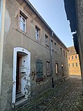 More pictures |
Residential house in a corner and closed development | Narrow Alley 2 (map) |
around 1750 (residential building) | Local, broad plastered building as part of the old city structure, of importance in terms of building history and urban planning |
09235019 |
 More pictures |
Residential building in closed development | Narrow Alley 4 (map) |
1802 (residential building) | Local plastered construction as part of the old urban structure, of importance in terms of building history and urban development history |
09235020 |
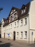 |
Residential building in closed development | Flinschstrasse 1 (map) |
around 1910 (residential building) | Typical plastered building with a dwelling, probably used as company apartments for the Penig paper mill, see also the residential building at Flinschstraße 3, of importance in terms of building history and the history of local development |
09235112 |
 |
Residential building in closed development | Flinschstrasse 3 (map) |
around 1910 (residential building) | Typical plastered building with half-timbered ornamental gable, probably used as company apartments for the Penig paper mill, see also residential building at Flinschstrasse 1, of importance in terms of building history and the history of local development |
09235113 |
 More pictures |
Three production buildings, turbine house and switchgear house of a factory as well as a display collection of historical laboratory equipment and screen rollers, furthermore pan mill (a second pan mill from the paper factory is now on Chemnitzer Strasse at no. 121, see object 09306875) | Flinschstrasse 7-11 (map) |
Inscribed 1882 (factory building), around 1900 (factory building), around 1880 (factory building), 1st half of the 20th century (Kollergang), around 1925 (turbine house) | The oldest, still producing location for paper production in Germany (since 1537), production building in various construction phases with high-quality design, the founder of the machine paper factory was the important Saxon paper manufacturer and paper dealer Ferdinand Traugott Flinsch, production of high-quality paper for the trading and printing city of Leipzig, valuable collection of watermark rollers (dandy rolls) used on site and historical laboratory equipment for testing the paper quality, location of extraordinary technical and industrial history as well as local and architectural historical importance Monument text Protected goods: 1. Production building: around 1897, formerly calendering and sorting
, three-storey, elongated yellow clinker brick building in historicist forms, 28 axes, vertical structure through high segmental arched windows on the ground floor, two axes in each of the two upper floors combined by pilaster strips, the two central axes and the outer axes emphasized by a slight protrusion, and originally gable closures, the window height decreasing with the storeys, horizontal structure through the cornice between the ground floor and the first floor, strong eaves cornice, flat roof, interior construction with cap ceilings on cast-iron supports, followed by: 2nd production building (Flinschstrasse): around 1882, calender room, paper room I (cutting and sorting room) , Paper Hall II (equipment, lines), three-storey, elongated red brick building, vertical structure through high segmental arched windows on the ground floor, formerly stand-alone building, connecting structure designed as a doorway with clinker brick, gate entrance: design with Sa nd stone cuboid, arch, keystones marked "1537" on the left and "1882" on the right as well as the coat of arms stone in the middle (unknown), later the transformer station housed in the building, the interior heavily reshaped, isolated cast-iron supports visible from the original interior structure, 3rd production building: (facing the courtyard, second row , center): paper loading room, paper hall III, originally two-storey building, later (after 1872) an additional storey and partly raised like a tower, lower storeys plastered and structured in plaster and porphyry tufa, more recent addition made of clinker brick, segmented arched window, entrance area with arcade structure, right entrance with original Front door, left entrance clogged, relief Peniger Rose, high water marks, inside representative straight pillar staircase, wrought iron banisters in classicist forms (functional information according to Heino Castorf: Die Patentpapierfabrik zu Penig, 1897), 4th turbine house: around 1915, plastered building with saddle roof, reform style at 191 0/15, porphyry plinth, in the northwest representative gable design with double pilaster framing and large triangular gable above console cornice, this decorated with a relief figure of a papermaker, large window openings, including three-part segmented arched window in the gable front, in front of it a wall fountain to commemorate the three-part factory members who fell in World War I. Sandstone with two bronze panels, in the middle a well basin, above it a crowned cartouche with a wreathed armorial cartouche with a water-spouting lion head, planting, between the production building under the 3rd and 4th connecting corridor on the first floor, 5th switchgear house: southeast of the turbine house under the 4th, around 1915 probably including the existing building fabric (machine building ) erected (older cast iron column visible inside), hall-like structure, in the reform style around 1910/15, on the south-eastern gable side large, eight-part segmented arched window with glass blocks, eaves side also large, six-part windows, crooked hip roof, facade de structured by cornices, plastered, partially renovated, heavily changed inside, 6th pan mill (at the main gate, Flinschstrasse): trough with two stones, for shredding waste paper and recycling, first half of the 20th century, manufacturer: Ernst Hoffmann / Niederschlema , Drive power 30 kW, input quantity 600 kg, mass of the stone 3 tons (information according to the information board on the pan mill), taken out of production in 1987, restored and set up as a reminder of the centuries-old tradition of Penig as a site of paper production Examination of the paper quality and Peniger dandy rolls (10 watermark rollers / screen rollers from the years 1897 - 1940, no longer in use due to changed production processes), great historical significance. Regarding monument value: A paper mill has been proven to be the location of a paper mill since 1537 and is still producing today, making it the oldest paper factory in Germany. With the takeover of the mill in 1834/35 by the important Saxon paper manufacturer and trader Ferdinand Traugott Flinsch (1792–1849, sole owner from 1836) from a papermaker, expansion into a paper factory and the production of high-quality paper, especially for the book printing and trade fair city Leipzig, the factory achieved great importance in industrial history. Various innovations are connected with the development of the Peniger paper mill, for example the paper for the first German paper money, the “Electoral Saxon Cash Billets”, and the first fourdrinier paper machine from the Bryan Donkin company from England were built here. Based on the current building stock of the factory, which includes various construction development phases between 1880 and 1925, it is above all paper production in the age of industrialization that can be clearly understood. Up to five paper machines were set up in the factory at the same time and required a large number of production buildings. The factory buildings are partly lavishly designed in accordance with the respective architectural conception and are of architectural importance. The turbine house refers to the generation of energy in the past. In addition, about 400 m south of the factory, the gas station has been preserved, which supplied the factory with gas between 1863 and 1920 and, from 1865, also the city of Penig (importance in terms of supply history). As the largest commercial enterprise in the area, the history of the paper mill is closely related to the history of Penig, which also gives it great significance for the city's history. From the former branch factories in Wilischthal, Reisewitz and in Wolkenstein (wood grinding shop) none of the buildings worthy of a monument have been preserved. |
09235053 |
 More pictures |
Post mileage | Friedensstrasse (map) |
1732–1736 (post distance column) | Copy of a distance column, historically significant Monument text Copy of a distance column from Electoral Saxony, marked 1731, made of Rochlitz porphyry, in the typical form (labeled with distance information) obelisk on a base, with coat of arms, "AR" monogram and post horn mark. The column was made around 1732 by Steinmetz Hertel from Hilbersdorfer Porphyrtuff, but was not erected until 1736 on the Poststrasse Leipzig-Chemnitz-Annaberg, but is labeled 1731. Column was originally at the Topfanger in front of the Chemnitzer Tor, is a typical gate pillar with two adjacent inscriptions. Restored in 1880 by the sculptor Eichler from Waldenburg, destroyed in 1941 (accident), original pieces have been lost since 1948, a copy made from Rochlitz porphyry, erected in 1988. In 1722, the Electorate of Saxony began to erect the Saxon post-mile pillars. Elector Friedrich August I wanted to build a modern traffic and transport control system in the electorate in order to promote trade and economy. He entrusted Magister Adam Friedrich Zürner (1679–1742) with the implementation. The system of post mile pillars comprised distance pillars, quarter milestones, half and full mile pillars. The distance columns should be set up in the cities in front of the city gates, later only on the marketplaces. Quarter milestones, half and full mile pillars were set up along the Poststrasse. They received a consecutive numbering (row number), starting from the beginning of the measurement. The all-mile columns were set up outside the cities on the post roads at a distance of 1 mile (= 9.062 km). The distance pillars were marked with the monogram "AR" for "Augustus Rex", the Electoral Saxon and Polish-Lithuanian double coat of arms and the Polish royal crown. The full mile, half mile columns and quarter milestones were all similarly labeled, none of them had a coat of arms, but the monogram "AR". The distances were given in hours (1 hour = ½ post mile = 4.531 km). This mile system was the first European traffic management system. The pillar considered here is of great importance in the history of traffic as part of the nationally significant postal system. LfD / 2013 |
09235138 |
| Residential house in semi-open development | Friedensstrasse 13 (map) |
around 1800 (residential building) | simple and yet important residential building as part of the old local structure, of importance in terms of building history and local development |
09235051 |
|
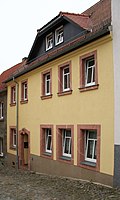 |
Residential building in closed development | Friedensstrasse 15 (map) |
around 1800 (residential building) | simple and yet important residential building as part of the old local structure, of importance in terms of building history and local development |
09235050 |
 |
Residential building in closed development | Friedensstrasse 21 (map) |
around 1800 (residential building) | simple and yet important residential building as part of the old local structure, of importance in terms of building history and local development |
09235049 |
 |
Individual monument of the entity Ev. City church Penig with old and new cemetery (Obj. 09235016): cemetery gate house | Friedensstrasse 23 (map) |
around 1790 (cemetery gate house) | As a residential building with access to the Old Cemetery (A), it is of architectural, urban and urban significance |
09235048 |
 More pictures |
Consolidation of St. Aegidius Church and Altpenig cemetery with the following individual monument: Church (Obj. 09235124, same address) as well as the funeral hall and churchyard wall as an entirety | Kirchgasse 4 (map) |
1st half of the 19th century (mortuary) | Of importance in terms of building history, art history and local history |
09235125 |
 More pictures |
Individual monument of the whole of St. Aegidius Church and Altpenig churchyard (Obj. 09235125, same address): Church with furnishings | Kirchgasse 4 (map) |
2nd half of the 12th century (church), 1st half of the 15th century (choir closes), around 1500 (baptism), around 1510 (crucifix), around 1500 (single figure) | Romanesque hall church with baroque ridge turret, as the original parish church of Altpenig of architectural, art-historical and local significance |
09235124 |
 |
Residential house in a corner and closed development | Long mountain 2 (map) |
1st third of the 18th century (residential building) | Baroque residential building with valuable old building fabric in the core, later redesigned, of importance in terms of building history, house history and urban planning |
09235055 |
 |
Residential house in closed development and rear building | Long mountain 3 (map) |
1755 (residential house) | striking building with a prominent portal as part of the baroque urban structure, of architectural and urban importance |
09235054 |
 |
Residential building in closed development | Langer Berg 5 (map) |
around 1750 (residential building) | Half-timbered building typical of the time as part of the baroque city structure, of importance in terms of architectural and site development |
09235056 |
 |
Residential building in closed development | Langer Berg 6 (map) |
around 1800 (residential building) | distinctive building as part of the baroque urban structure, of importance in terms of architectural and site development |
09236512 |
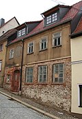 |
Residential building in closed development | Langer Berg 12 (map) |
2nd half of the 18th century (residential building) | Half-timbered building typical of the time as part of the baroque city structure, of importance in terms of architectural and site development |
09235058 |
| Residential building in closed development | Langer Berg 13 (map) |
Mid 18th century (residential building) | distinctive residential building as part of the baroque urban structure, of importance in terms of building history and local development |
09300111 |
|
 |
Residential house in a formerly closed development | Langer Berg 15 (map) |
1st half of the 18th century (residential building) | Half-timbered building typical of the time as part of the baroque city structure, of importance in terms of architectural and site development |
09235057 |
 |
Residential house in semi-open development | Leipziger Strasse 1 (map) |
around 1700 (residential building) | with shop, stately half-timbered building with a street-defining gable, of importance in terms of building history and local development |
09235131 |
 |
Residential building in closed development | Leipziger Strasse 4 (map) |
around 1750 (residential building) | with shop, typical regional housing with porphyry cladding as part of the baroque city structure, of importance in terms of building history and the history of local development |
09235156 |
 |
Residential building in closed development | Leipziger Strasse 6 (map) |
around 1800 (residential building) | with a shop, simple residential building as part of the baroque urban structure, of importance in terms of building history and local development |
09235157 |
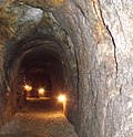 |
Mountains of cellars | Leipziger Strasse 52a (formerly Uhlandstrasse 7 (bei)) (map) |
1511 to 1562 (cellars) | extensive, partly two-storey, corridor-like mountain cellars, of urban historical and mining significance |
09235123 |
 |
Apartment building in half-open development | Lunzenauer Strasse 14 (map) |
around 1890 (tenement) | with shop, example of the Wilhelminian style development in the city center, of importance in terms of building history and local development |
09235130 |
 |
Residential building in closed development and two rear buildings (western part of the northern rear building belonging to Lutherplatz 2, parcel 347/1) | Lutherplatz 2; 4 (card) |
18th century (residential building) | with shop, former trading yard, in the core a building from the 18th century. with later renovations, of architectural and local significance |
09235164 |
 |
Hotel in a corner and semi-open development | Lutherplatz 5 (map) |
18th century (hotel) | Standing in a prominent position, a baroque building with a distinctive portal, of architectural and local significance |
09235001 |
 |
Residential building in closed development | Lutherplatz 6 (map) |
marked 1730 (residential building) | charming, small-town baroque building with a rich portal, of importance in terms of building history and local development |
09235165 |
 |
Residential building in closed development | Lutherplatz 8 (map) |
around 1800 (residential building) | Residential building typical of the time as part of the baroque urban structure, of importance in terms of building history and the history of local development |
09235166 |
 |
Residential building in closed development | Lutherplatz 9 (map) |
around 1800 (residential building) | late baroque residential building as part of the old city structure, of importance in terms of building history and local development |
09235003 |
| Residential house in a formerly closed development | Lutherplatz 10 (map) |
2nd half of the 18th century, later remodeled (residential building) | with a shop, a striking, essentially baroque residential building with later renovations, residential building with architectural and urban significance |
09299984 |
|
 |
Residential house in closed development, with extension in the courtyard | Mandelgasse 7 (map) |
around 1800 (residential building) | Small-town residential building, largely preserved in its original form, of significance in terms of building history and local development |
09235061 |
 |
Residential building in closed development | Mandelgasse 9 (map) |
around 1750 (residential building) | small-town housing from the 18th century with later renovations, today a Biedermeier facade with a beautiful door leaf, of importance in terms of building history and site development |
09235062 |
 |
House in a corner and closed development with back building | Market 1 (map) |
16th century (residential building), 18th century (rear building) | with shop, house from the 16th century with a classical remodeling of the façade, as part of the marketplace development, of importance in terms of building history and shaping the street scene |
09235104 |
 |
Residential building in closed development | Market 3 (map) |
before 1800 (residential building) | with shop, small-town residential building in a central location on the market, significant in terms of building history and local development |
09235105 |
| Residential building in closed development | Market 5 (map) |
after 1748 (residential building) | Baroque plastered building with groined vaults, of great importance in terms of urban development, architectural and urban development |
09235169 |
|
 More pictures |
Town hall in half-open development | Market 6 (map) |
1545–1546 (town hall), reconstruction in 1716 (town hall) | Rebuilt in Renaissance style after a fire of 1716, stately building with a three-part main portal, characteristic gable and distinctive roof turret, as a dominant part of the marketplace development in terms of architectural history, characterizing the square and of importance in terms of local history |
09235092 |
 |
Residential building in closed development | Market 7 (map) |
1536 (residential building) | Former family house and inn "Goldener Stern", high-quality Renaissance building with many original details, as part of the marketplace development, of importance in terms of building history, house history and the appearance of the square |
09235106 |
| Residential house in closed development and two courtyard buildings | Market 9 (map) |
18th century (residential building) | Baroque residential building as part of the marketplace development, of importance in terms of building history and site development |
09235107 |
|
 |
Residential building in closed development | Market 14 (map) |
Late 18th century (residential building) | with pharmacy, the core of the baroque structure with facade design from the 19th century, as part of the marketplace development, of significance in terms of building history and local development |
09235083 |
 |
Residential building in closed development | Markt 16 (map) |
around 1800 (residential building) | with a shop, late baroque building with a distinctive dwarf house, as part of the marketplace development, of importance in terms of building history and site development |
09235082 |
| Residential house in semi-open development | Marktgäßchen 2 (formerly Marktgasse 2) (map) |
around 1800 (residential building) | small-town, late-baroque residential building with architectural and urban significance |
09235089 |
|
 |
Residential building in closed development | Neugasse 14 | around 1800 (residential building) | Small town development typical of the time of architectural and urban development value |
09235127 |
 |
Residential building | Neugasse 30; 32 (card) |
1st third of the 19th century (residential building) | Presumably a former farm workers' house to the north of the town, elongated plastered building with a distinctive crooked hip roof, of importance in terms of building history, local history and shaping the street scene |
09235128 |
 |
Residential building in closed development | Obergasse 7 (map) |
1743, later remodeled (residential building) | at its core a baroque, small-town residential building with later remodeling, of importance in terms of architectural and local development |
09235167 |
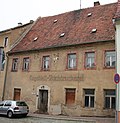 |
Residential house in closed development and two back buildings | Obergasse 11 (map) |
1st half of the 18th century (residential building) | at its core a baroque, small-town residential building with later remodeling, of importance in terms of architectural and local development |
09235168 |
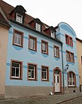 |
Residential building in closed development | Obergasse 23 (map) |
1712 (residential building) | Structural unit with Chemnitzer Straße 1, 3, essentially a baroque house with facade design from the early 20th century, of importance in terms of building history and local development |
09235004 |
 More pictures |
Entity Ev. City church Penig with old and new cemetery consisting of the following individual monuments: Church "Our dear women on the mountain" with furnishings (Obj. 09235046, Pfarrberg), Friedhofstorhaus (Obj. 09235048, Friedensstraße 23), Torhaus (Chemnitzer Straße 28), ten tombs and hall of honor for the fallen of the First World War on the Old Cemetery (A), morgue on Zinnberger Straße, double pillar gate and a tomb on the New Cemetery (B) as well as all enclosure walls in the area of the Old and New Cemetery (Obj. 09300106, Pfarrberg) , plus the cemetery design with avenues (garden monument) | Pfarrberg (map) |
1st third of the 20th century (cemetery), around 1920 (double column gate system) | of building history, art history, local history and townscape-defining significance |
09235016 |
 More pictures |
Individual monument of the entity Ev. City church Penig with old and new cemetery (Obj. 09235016): Church "Our dear women on the mountain" with furnishings | Pfarrberg (map) |
1515 (church), 1688 (field ceiling), 1564, inscribed (altar), 15th century, in the vestibule (baptism), donated in 1609 (baptism) | late Gothic church building with valuable furnishings, hall church with architectural, art-historical, local history and decisive importance for the cityscape; City church with field ceiling from 1688 |
09235046 |
 |
Individual features of the entity Ev. City church Penig with old and new cemetery (Obj. 09235016): gatehouse (Chemnitzer Straße 28), ten tombs and hall of honor for the fallen of the First World War on the old cemetery (A), mortuary on Zinnberger Straße, double pillar gate and a tomb on the New cemetery (B) as well as all enclosure walls in the area of the old and new cemetery | Pfarrberg (map) |
18./19. Century (tombstones), around 1910 (Castorf grave complex), around 1920 (Winkler grave complex), around 1920 (New cemetery morgue), around 1920 (cemetery gate house) | Of importance in terms of building history, art history and local history |
09300106 |
 |
Parish Hall | Pfarrberg 4; 6 (card) |
around 1790 (parish hall) | stately plastered building with a characteristic hipped roof, elevated and, together with the church and the rectory, defining the city's silhouette, and also of importance in terms of building history and local history |
09235044 |
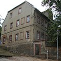 |
Rectory and barn of a rectory | Pfarrberg 8 (map) |
18th century (rectory), 18th century (parish barn) | representative baroque parsonage with period equipment and associated barn of great architectural and local historical importance |
09235045 |
| Villa with enclosure | Poststrasse 3 (map) |
Late 19th century (rental villa) | One of the few villa buildings in Penig, a striking plastered building with a historicizing facade and characteristic tower, of importance in terms of building history and local development |
09300110 |
|
 |
Apartment house in open development with fencing | Poststrasse 6 (map) |
around 1900 (tenement) | distinctive residential building with clinker and stone facade typical of the time, of importance in terms of building history and local development |
09235731 |
 |
Apartment house in open development with fencing | Poststrasse 8 (map) |
around 1890 (tenement) | Stately residential building with a historicizing facade in clinker construction, significant in terms of building history and urban development |
09235134 |
| Town barn | Reitzenhainer Straße 11 (next to) (map) |
2nd half of the 18th century (town barn) | Quarry stone masonry with porphyry tufa elements, two-door, the last evidence of the former barn buildings in the Chemnitz suburb, of urban history |
09306841 |
|
 More pictures |
milestone | Reitzenhainer Straße 17 (bei) (map) |
after 1858 (Stationsstein) | offset, worked original station stone with a replica of a crown, roughly hewn sandstone, of importance for the history of traffic; originally on Poststraße Leipzig-Prague, added in 1986 and put back up again |
09235171 |
| Town barns | Barn plan 2; 3; 4; 5; 6; 8th; 10; 12; 14; 16; 18 (card) |
19th century (town barn) | Despite certain structural changes, double rows of town barns, which are now a rare testimony to the originally rural character of the town, are still well-preserved and of urban historical importance |
09235017 |
|
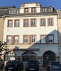 More pictures |
Residential building in closed development | Schloßplatz 1 (map) |
18th century (residential building) | with a shop, baroque residential building as part of the Schlossplatz development, of importance in terms of building history and local development |
09235108 |
 |
Door portal | Schloßplatz 2 (map) |
around 1720 (portal) | Remarkable segment arch portal with keystone and floral reliefs in the spandrels, typical regional component in porphyry tuff, of architectural and local significance |
09235081 |
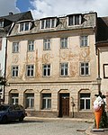 |
Residential building in closed development | Schloßplatz 3 (map) |
18th century (residential building) | Baroque residential building with facade design from around 1910, as part of the baroque palace square development of significance in terms of building history and site development |
09235109 |
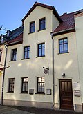 |
Residential building in closed development | Schloßplatz 4 (map) |
18th century (residential building) | small-town housing from the 18th century with later renovations, as part of the baroque palace square development, of significance in terms of building history and local development |
09235080 |
 |
Residential building in closed development | Schloßplatz 5 (map) |
16th century (residential building) | small-town residential building from the 16th century. with later renovations, as part of the Schloßplatz development, of importance in terms of building history, house history and site development history |
09235110 |
 |
Residential building in closed development | Schloßplatz 6 (map) |
around 1700 (residential building) | Baroque residential building, as part of the baroque palace square development of importance in terms of building history and local development |
09235079 |
 |
Residential building in closed development | Schlossplatz 7 (map) |
1748 (residential building) | with a shop, baroque residential building, as part of the baroque palace square development of importance in terms of building history and local development; Cafe Winkler |
09235111 |
 |
Residential building in closed development | Schlossplatz 8 (map) |
End of 17th century (residential building) | a building from the late 17th century With a characteristic portal, as part of the baroque palace square development, of importance in terms of building history, house history and site development history |
09235078 |
 |
Residential house in a formerly closed development | Schloßplatz 9 (map) |
marked 1748 (residential house) | Stately former trading yard with an artistically valuable and rare portal, Field Marshal Blücher stayed in the house during the passage of the Prussian troops in 1806, as part of the baroque palace square development of building history, house history and site development history |
09235076 |
 |
Residential building in closed development | Schloßplatz 10 (map) |
1st half of the 18th century (residential building) | Baroque residential building typical of the area, as part of the baroque palace square development of significance in terms of building history and site development |
09235077 |
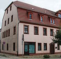 |
Residential house in a corner and semi-open development | Schloßplatz 12 (map) |
1st half of the 18th century (residential building) | with a shop, a striking residential building in a striking urban location in the immediate vicinity of the New Palace, as part of the baroque palace square development of significance in terms of building history and site development |
09235075 |
 More pictures |
lock | Schloßstraße 1 (formerly Mühlgraben 18) (map) |
around 1612 (castle) | former moated castle (castrum), today three-wing complex with various construction phases, of extremely high importance in terms of urban, regional and architectural history; Old castle |
09235041 |
 More pictures |
Castle (formerly), later the administration and production building of the Penig paper mill | Schlossstrasse 5 (map) |
2nd half of the 18th century (castle) | The stately building bordering the Schlossplatz to the north, with several renovation phases, of structural and urban history and, as a former paper mill, of economic importance; New lock |
09235074 |
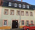 |
Residential building in closed development | Schlossstrasse 8 (map) |
around 1800 (residential building) | Small-town residential building, part of a baroque street that has been preserved as a whole, of importance in terms of building history and the history of local development; Plastered building of baroque origin with urban value |
09236515 |
 |
Residential building in closed development | Schlossstrasse 11 (map) |
1797 (residential house) | Small-town residential building typical of the time, part of a baroque street that has been preserved in a closed structure, of significance in terms of building history and the history of local development |
09235071 |
 |
Residential building in closed development | Schloßstraße 13 (map) |
around 1820 (residential building) | Small-town residential building with a Biedermeier façade, one of the last built buildings on a baroque street that has been preserved as a closed structure, probably used as company apartments for the Penig paper mill, of significance in terms of building history and local development |
09235068 |
 |
Residential house in almost closed development | Schloßstraße 14 (map) |
1802 (residential building) | Small-town residential building typical of the time, part of a baroque street that has been preserved in a closed structure, of significance in terms of building history and the history of local development |
09235072 |
 |
Residential building in closed development | Schloßstraße 15 (map) |
around 1820 (residential building) | Small-town residential building with a Biedermeier façade, one of the last built buildings on a baroque street that has been preserved as a closed structure, probably used as company apartments for the Penig paper mill, of significance in terms of building history and local development |
09235069 |
 More pictures |
House in a corner and almost closed development | Schloßstraße 16 (map) |
2nd half of the 18th century (residential building) | Baroque residential building typical of the time, of importance in terms of building history and site development |
09235070 |
| Residential house in a corner and closed development | Schloßstraße 18 (map) |
around 1750, later reshaped (residential building) | Baroque residential buildings delimiting Schloßstraße, characterizing the street scene, of importance in terms of building history and local development |
09235067 |
|
 |
Residential building in closed development | Schulgasse 5 (map) |
1749 (residential building) | Small-town half-timbered building in the historic city center, of importance in terms of local development |
09235009 |
 |
Residential building in closed development | Schulgasse 7 (map) |
around 1750 (residential building) | Typical small-town baroque building in the historic city center, of importance in terms of architectural and site development |
09235012 |
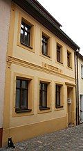 |
Residential building in closed development | Schulgasse 8 (map) |
around 1750 (residential building) | small-town housing from the 18th century with later renovations, of importance in terms of building history and local development |
09235011 |
 |
Residential house in semi-open development | Schulgasse 15 (map) |
1st half of the 18th century, later remodeled (residential building) | Baroque residential building, despite structural changes, important for the townscape due to its dominant location near the town church, of architectural significance |
09235015 |
 |
School with gym and outside staircase (stairs between Schützenhausweg and school building) | Schützenhausweg 4 (map) |
High school with gym; Outside staircase previously individually protected as ID09235136 |
09235103 |
|
 |
school | Schützenhausweg 5 (map) |
1891 (school) | Representative school building in clinker construction in a dominant urban development location, of importance in terms of building history, local history and social history |
09235137 |
 |
Schützenhaus with annex (later culture house) and shooting range | Schützenhausweg 8 (formerly Zinnberger Straße 8) (map) |
around 1900 (shooting range), around 1900 (shooting range) | stately, time-typical building in clinker construction with architectural, local and social historical significance |
09235119 |
| Semi-open residential building with two back buildings | Step Mountain 7 (map) |
2nd half of 18th century (residential building), 2nd half of 18th century (rear building), 2nd half of 18th century (rear building) | Half-timbered building in a prominent urban development location, historically significant ensemble in a very good original condition (only structurally changed on the eaves side of the house) |
09299985 |
|
 |
Residential building in closed development | Step Mountain 10 (map) |
around 1800 (residential building) | Residential building in a striking location in terms of urban development, of significance in terms of building history |
09235161 |
 |
Residential house in semi-open development | Step Mountain 18 (map) |
2nd half of the 18th century (residential building) | Baroque half-timbered building, largely authentically preserved, in a precise urban location at the foot of the town church, of architectural significance |
09235162 |
 |
Former town estate with residential house, gatehouse, side building and barn as well as remnants of the north-western enclosure | Uhlandstrasse 8 (map) |
marked 1679 (Stadtgut), end of the 19th century (enclosure) | Closed baroque four-sided courtyard with architectural, urban and economic significance |
09235122 |
| Residential house in open development | Uhlandstraße 10 (next to) (map) |
around 1880 (residential building) | clinker brick building typical of the time, presumably company apartments in an associated factory, of architectural significance |
09235121 |
|
| Apartment building in a corner in a semi-open development | Wiesenstrasse 2 (map) |
around 1900 (tenement) | with shop, striking residential building in clinker construction, of importance in terms of building history and site development |
09235154 |
|
| Transformer station | Zinnberger Strasse (map) |
around 1920 (transformer station) | A tower-like building set into the cemetery wall as evidence of the electrification of the place, of importance in terms of building history and technology |
09300131 |
|
| villa | Zinnberger Strasse 21 (map) |
1929 (villa) | Plastered building characterized by the New Objectivity in very good original condition, historically significant. Monument text 1929, based on a design by the Chemnitz architects Kornfeld & Benirschke for Paul Chemnitzer in Penig. Singular for Penig in its formal language. Two-storey plastered building characterized by the New Objectivity (partly also with jamb) on an irregular floor plan, flat-topped. The building gives the impression that it has been assembled from several structures. The lower parts of the building were emphasized horizontally by a wide, colored plaster band. The result is an attractive contrast to the higher, undivided structures. The base and basement are faced with clinker bricks. No original furnishings have been preserved inside. In Penig, this single-family house is the only building that was designed by the Chemnitz architects' office, which is known for industrial and church buildings. Its sophisticated design explains the architectural value of this building. It is worthy of a monument because of its singularity and authenticity. LfD / 2011 |
09303924 |
|
 |
Residential building in closed development | Zöllnergasse 1 (map) |
Late 18th century (residential building) | with a shop, late baroque residential building as part of the old city structure, of importance in terms of building history and local development |
09235084 |
 |
Residential building in closed development | Zöllnergasse 2 (map) |
around 1800, later redesigned (residential building) | Small-town, late-baroque house with a slightly reshaped facade, of importance in terms of building history and local development |
09235085 |
 |
Residential building in closed development | Zöllnergasse 3 (map) |
1803 (residential building) | Small-town, late-baroque residential building with architectural and site development significance |
09235086 |
Former cultural monuments
| image | designation | location | Dating | description | ID |
|---|---|---|---|---|---|
| Elektro Lautrich | Arnsdorf, Am Berg 2 (map) |
2nd half of the 18th century | Half-timbered ancillary building of a four-sided courtyard, building structure that defines the townscape above Dorfstrasse |
08961084 |
|
| Half-timbered residential stable house | Arnsdorf, Am Dorfbach 18 (map) |
End of 18th century | Half-timbered residential stable of a small three-sided courtyard, largely original structure, part of the old village development |
08961062 |
|
| Half-timbered house-making | Arnsdorf, Am Dorfbach 24 (map) |
Early 19th century | Half-timbered houses in the Aue, elementary for the townscape |
08961086 |
|
 |
Half-timbered house-making | Arnsdorf, Am Dorfbach 28 (map) |
Early 19th century | Half-timbered houses in the floodplain, with a cottage garden and picket fence, an elementary part of the floodplain development |
08961085 |
| Half-timbered outbuildings | Arnsdorf, Am Dorfbach 34 (map) |
2nd half of the 19th century | Half-timbered auxiliary building of a three-sided courtyard, important structure of a large multi-sided courtyard for the townscape |
08961060 |
|
| Half-timbered house | Arnsdorf, Am Dorfbach 40 (map) |
Early 19th century | Half-timbered auxiliary building of a three-sided courtyard, important structure of a large multi-sided courtyard for the townscape |
08961054 |
|
| Half-timbered house | Langenleuba-Oberhain, An der Leuba 18 (map) |
1st half of the 19th century | Half-timbered cottage with a beautiful exposed framework, significance in terms of local history |
08955426 |
|
| Half-timbered house | Langenleuba-Oberhain, An der Leuba 34 (map) |
around 1800 | Half-timbered house, located in the Aue des Erlsbach, characterizing the street |
08955428 |
|
| Residential stable house | Langenleuba-Oberhain, An der Leuba 62 (map) |
End of the 19th century | residential stable house that characterizes the street |
08955433 |
|
| Drive-through barn | Langenleuba-Oberhain, Buttermilchwinkel 19 (map) |
18th century | Drive-through barn of a four-sided courtyard, scientific and documentary value |
08955445 |
|
| Half-timbered residential stable house | Langenleuba-Oberhain, Oberhainer Strasse 72 (map) |
End of 17th century, re. 1828 (door frame) | Half-timbered stable house with curved St. Andrew's crosses, rarity, strongly defining the townscape |
08955457 |
|
| Half-timbered residential building | Zinnberg, Dorfstrasse 5 (map) |
Early 19th century | Half-timbered house (day laborer's house), part of the old village development |
08960938 |
|
| double-arched railway bridge over the Zwickauer Mulde | America industrial colony | Early 20th century |
08961079 |
||
| Bath house, first aid station | America industrial colony | re. 1896–1897 (plate) | Sanitary and bath house, supply and hygiene facility |
08961077 |
|
| Spinning mill building | America industrial colony | Cellar 1870, hall construction 1934/1935 | Machine hall with shed roof, symbol of the machine age and the intensification of production |
08961076 |
|
| kitchen | America industrial colony | around 1890 | Kitchen building |
08961074 |
|
| Production building | America industrial colony | 1865 | Mighty, simple production building, part of the younger factory complex |
08961073 |
|
| Boiler house | America industrial colony | 1870/1880 | Flat, single-storey boiler house and 42 m high chimney, part of the colony, symbol of the dawning steam engine age |
08961072 |
|
| Director's villa | America industrial colony | 1890 | Stately villa-like building on a hillside |
08961068 |
|
 |
Tenement block | Industrial Colony America, Muldenstrasse 7, 8, 9, 10 (map) |
Early 20th century | mighty, long block of tenements for the workers of the American industrial colony |
08961081 |
| Half-timbered outbuildings | Chursdorf, Dorfstrasse 58 (map) |
around 1800, mid-19th century | Half-timbered outbuilding of a farm (stable barn), good example of wood construction |
08963739 |
|
| Half-timbered residential stable house | Chursdorf, Dorfstrasse 72 (map) |
18th century, gable inscribed. 1922, 19th century barn | Half-timbered residential stable and barn of a four-sided courtyard, characterizing the town through its elevated position, old construction |
08964428 |
|
| Cottage | Markersdorf, Obere Dorfstrasse 13 (map) |
around 1800 and first half of the 19th century | small cottage, elementary part of the floodplain, local historical value |
08960928 |
|
| barn | Markersdorf, Untere Dorfstrasse 8 (map) |
re. 1859 | stately barn of a three-sided courtyard, completing part of the local structure consisting of multi-sided courtyards |
08960940 |
|
| Residential stable house | Markersdorf, Untere Dorfstrasse 18 (map) |
18th century | Small cottage (residential stable) in the floodplain, an important part of the local structure, old building fabric |
08960931 |
|
| Residential stable house | Obergräfenhain, Obergräfenhainer Straße 37 (map) |
Early 19th century | Half-timbered stable house on a hooked ground plan, scientific-documentary value |
08955488 |
|
| Four-sided courtyard | Obergräfenhain, Obergräfenhainer Strasse 54 (map) |
re. 1857 (residential stable), archway as well | Stately residential stable and archway of a four-sided courtyard, largely unchanged building fabric |
08955478 |
|
| Barn | Obergräfenhain, Obergräfenhainer Straße 92 (map) |
around 1843 | Barn of a four-sided farm, local historical value |
08955485
|
|
| Half milestone | Penig, B 175 | Half milestone and war memorial for those who fell in the First World War |
09235047 |
||
 |
Residential building | Penig, Brückenstraße 18 (map) |
around 1870 | Residential building, former department store? |
09235099 |
| Factory complex | Penig, Chemnitzer Strasse 98 (map) |
1928/1929 | Factory complex, formerly the Harzer company |
09235357 |
|
 |
School building | Penig, Dittmannsdorfer Straße 79 (map) |
around 1890 | two-storey school building, dominating the townscape |
08961088 |
| Barn | Penig, Dittmannsdorfer Straße 82 (map) |
2nd half of the 19th century | large barn of a three-sided farm completes the farm |
08961090 |
|
| Residential building | Penig, Flinschstrasse 18 | around 1800 | Residential building in closed development |
09235114 |
|
 More pictures |
Residential building | Penig, Flinschstrasse 22 (map) |
around 1880 | Residential building in closed development |
09235115 |
| Residential building | Penig, Friedensstrasse 9 (map) |
around 1790 (residential building) | Residential building in closed development |
09235052 |
|
| Residential building | Penig, Leipziger Strasse 12 (map) |
around 1800 | Residential house in closed development, originally with shop (vacant, in poor condition) |
09235158 |
|
 |
Residential building | Penig, Lutherplatz 7 (map) |
re. 1713 | House in closed development with shop |
09235002 |
| Residential building | Penig, Mandelgasse 1 | 1761 | Residential building in closed development |
09235060 |
|
| Residential building | Penig, Mandelgasse 8 (map) |
around 1760 | Residential house in corner location with shop in closed development, empty building plot (2019) |
09235059 |
|
 |
Residential building | Penig, Mandelgasse 18 (map) |
18th century | Residential building in closed development |
09235063 |
| Residential building | Penig, Mandelgasse 20 (map) |
1806 | Residential building in closed development |
09235064 |
|
| Residential building | Penig, Mandelgasse 22 | around 1800 | Residential building in closed development |
09235065 |
|
| Administration building | Penig, Mandelgasse 24 | 2nd half of the 18th century | Manufacturing and administration building, former mangle, later textile printing company |
09235066 |
|
| Residential building | Penig, market 8 | around 1800 | Residential building in closed development |
09235090 |
|
| Residential building | Penig, market 10 | around 1700 | House in closed development with shop |
09235091 |
|
| Residential building | Penig, Marktgasse 1 | 18th century | Residential building in closed development |
09235087 |
|
| Residential building | Penig, Mühlgraben 5 (map) |
re. 1712 | Residential building in closed development |
09235042 |
|
| Mühlgraben 10 | around 1800 | Residential building in closed development. Demolished in August 2016. |
|
||
 |
Residential building | Penig, Neugasse 8 (map) |
around 1800 | Residential building in closed development |
09235126 |
 |
Residential building | Penig, Obergasse 8 (map) |
re. 1733 | Residential house in closed development, simple, slightly modified baroque plastered building |
9236513 |
| Residential building | Penig, Obergasse 15 (map) |
around 1750 | Residential house in closed development, status 2011: building demolished |
09235005 |
|
| Tenement house | Penig, Poststrasse 1 (map) |
around 1890 | Apartment building in closed development in corner location, status 2011: building demolished, private parking space on the area |
09235129 |
|
 |
Residential building | Penig, Schloßstraße 10 (map) |
around 1800 | Residential house in closed development with a rear building, baroque plastered building, redesigned with urban development value |
09236514 |
 |
Residential building | Penig, Schloßstraße 12 (map) |
around 1800 | Residential building in closed development |
09235073 |
| Residential building | Penig, Schulgasse 2 (map) |
re. 1839 | Residential building in closed development |
09235010 |
|
| Residential building | Penig, Schulgasse 13 (map) |
around 1750 | Residential building in closed development |
09235013 |
|
 |
Residential building | Penig ,stufenberg 16 (map) |
around 1800 | Residential building in closed development |
09235163 |
| Residential building | Penig, Thierbacher Strasse 1 (map) |
1st half of the 19th century | House with shop in a corner |
09235146 |
|
 |
Residential building | Penig, Wiesenstrasse 3 (map) |
1877 | Residential building in closed development |
09235155 |
swell
- Annex 2 of the land use plan of the City of Penig, status November 2004 (LRA) with additions April 2005 (City of Penig)
Web links
Individual evidence
- ↑ Uwe Lemke: Old buildings are threatened with the wrecking ball . In: Free Press . May 12, 2020, p. 10 .
- ↑ Excavators bite into a house in the Peniger Center , Freie Presse from August 17, 2016