List of cultural monuments in Schönefeld-Ost
The list of cultural monuments in Schönefeld-Ost contains the cultural monuments of the Leipzig district of Schönefeld-Ost that were recorded in the list of monuments by the State Office for the Preservation of Monuments in Saxony as of 2017.
Legend
- Image: shows a picture of the cultural monument and, if applicable, a link to further photos of the cultural monument in the Wikimedia Commons media archive
- Designation: Name, designation or the type of cultural monument
-
Location: If available, street name and house number of the cultural monument; The list is basically sorted according to this address. The map link leads to various map displays and gives the coordinates of the cultural monument.
- Map view to set coordinates. In this map view, cultural monuments are shown without coordinates with a red marker and can be placed on the map. Cultural monuments without a picture are marked with a blue marker, cultural monuments with a picture are marked with a green marker.
- Dating: indicates the year of completion or the date of the first mention or the period of construction
- Description: structural and historical details of the cultural monument, preferably the monument properties
-
ID: is awarded by the State Office for the Preservation of Monuments in Saxony. It clearly identifies the cultural monument. The link leads to a PDF document from the State Office for the Preservation of Monuments in Saxony, which summarizes the information on the monument, contains a map sketch and often a detailed description. For former cultural monuments sometimes no ID is given, if one is given, this is the former ID. The corresponding link leads to an empty document at the state office. The following icon can also be found in the ID column
 ; this leads to information on this cultural monument at Wikidata .
List of cultural monuments in Schönefeld-Ost
| image | designation | location | Dating | description | ID |
|---|---|---|---|---|---|
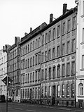
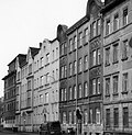
| Three row houses in a residential complex, with original path coverings and access stairs in the front gardens and front garden at Bautzner Straße 55 | Bautzner Strasse 33; 35; 37; 39; 41; 43; 45; 47; 49; 51; 53; 55 (card) |
1954-1957 (row house), 1954-1957 (front garden) | Plastered facade with quarry stone base, remarkable document of socialist housing construction in the 1950s (type buildings, type 511 and 32), built for the workers' housing association (AWG) of VEB Starkstromanlagenbau Leipzig, of scientific, documentary and architectural historical interest |
09260145 |
|
 |
Hand lever pump with well shaft and cover plate | Gorkistraße (map) |
1915 (manual pump) | Manual pump ; Birdcage type, of local significance |
09260098 |
| School with a front yard | Gorkistraße 15 (map) |
1898 (school) | Clinker brick facade with sandstone portal, cast-iron staircase, effective educational building in an exposed location in terms of urban planning, of architectural and socio-historical importance |
09260038 |
|
| Material entirety Schönefeld cemetery, with the following individual monuments: chapel, tombs, morgue and urn system of the Mariannenstiftung (individual monument list - Obj. 09260535), further horticultural designed cemetery complex and with the following elements: wrought iron grave monument surrounds and two outbuildings at the cemetery entrance | Gorkistraße 19; 21 (card) |
inscribed 1744, in the core (cemetery buildings), 1856-1858, inscribed 1857 (cemetery chapel), 1897 (mortuary), 1909 (cemetery extension) | the two administration buildings at the main entrance were rebuilt in 2002 (formerly there were two buildings from 1744), of importance in terms of building history, garden history and local history |
09305927 |
|
| Individual features and aggregate: Chapel, tombs, morgue and urn system of the Mariannenstiftung (see also aggregate document - Obj. 09305927) | Gorkistraße 19; 21 (card) |
1856-1858, marked 1857 (cemetery chapel), 1897 (mortuary) | neo-Gothic chapel, morgue, striking clinker building, of architectural and local significance |
09260535 |
|
| Two school buildings, with a front garden and fencing, as well as paved roads | Gorkistraße 25 (map) |
1878 (school), 1892 (school expansion) | Plastered facade with sandstone and molded stone structure, effective educational building in an exposed location, testimony to the development of the area, of importance in terms of building history and social history |
09260004 |
|
 |
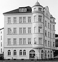
Apartment building in semi-open development and in a corner | Gorkistraße 27 (map) |
around 1905 (tenement) | with shop, head building with semicircular corner cores, plastered facade, of architectural significance |
09260096 |
| Apartment building in closed development | Gorkistraße 29 (map) |
around 1880 (tenement) | Clinker brick facade, Art Nouveau stencil painting in the stairwell, of importance in terms of building history |
09260091 |
|
| Apartment building in closed development | Gorkistraße 31 (map) |
around 1885 (tenement) | with gate passage, clinker brick facade with bay window, stencil painting inside, of architectural significance |
09260092 |
|
| Residential house in open development | Gorkistraße 45 (map) |
around 1870 (residential building) | Formerly with a shop, two-storey plastered building from the early founding period, saddle roof with two small roof houses, of significance in terms of local development |
09260093 |
|
| Apartment building in open development and in a corner, wash house building in the courtyard | Gorkistraße 51 (map) |
around 1885 (tenement) | with corner shutter, historicizing clinker plaster facade, corner bay window, of architectural significance |
09260103 |
|
| Residential house in open development and in a corner location, with front garden | Heinrich-Büchner-Strasse 2 (map) |
around 1935 (residential building) | Plastered facade with stand bay, important in terms of building history |
09260144 |
|
 |
Apartment building in half-open development | Löbauer Strasse 59 (map) |
around 1920 (tenement) | Plastered facade, two oriels, in the traditionalist style, of architectural significance |
09260104 |
 |
Double tenement house in closed development | Löbauer Strasse 61; 63 (map) |
around 1920 (double tenement house) | Plastered facade, two oriels, in the traditionalist style, of architectural significance |
09260105 |
 |
Apartment building in closed development and in a corner | Löbauer Strasse 65 (map) |
around 1920 (tenement) | Plastered facade, in the traditionalist style, original blinds, important from an architectural point of view |
09260099 |
| Society house in open development, formerly the club house of a garden club | Schulzeweg 1 (map) |
1927 (club house) | striking plastered facade, of local and architectural interest |
09260151 |
|
 |
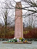
Memorial to the victims of fascism, with obelisk, surrounding wall, pedestal, cherry tree avenue, three plane trees and meadow | Theklaer Strasse (map) |
1958 (monument) | near the old location of Abtnaundorf, in memory of resistance fighters against National Socialism, who were murdered here on April 18, 1945, historical value, testimony value, importance for popular education |
09260369 |
 More pictures |
Apelstein No. 30 (V) | Theklaer Straße 42 (in front) (map) |
inscribed 1863 (memorial stone) | near the old location of Abtnaundorf, memorial stone in memory of the battles of the Battle of Nations near Leipzig in 1813, conquest of Schönefeld on October 18 by 30,000 men under the Russian General Langeron, historically significant |
09294134 |
 More pictures |
Deutsche Bahn AG; Leipzig-Thekla station: station reception building (no.110) and signal box (no.112) | Theklaer Strasse 110; 112 (card) |
1905 (reception building) | Station building plastered facade with natural stone integration, of importance in terms of building history, local history and traffic history |
09260368 |
 More pictures |
Apelstein No. 41 (N) | Torgauer Strasse (map) |
inscribed 1863 (memorial stone) | Apelstein in the Volksgarten Sellerhausen, memorial stone in memory of the battles of the Battle of the Nations near Leipzig in 1813, French defense line in the northeast under Marshal Ney, historically significant |
09305883 |
 More pictures |
Volkspark with water basin | Torgauer Strasse (map) |
1894-1895 (Volksgarten) | old location Sellerhausen, park bounded by Volksgartenstraße and railway tracks, with a historical network of paths and old trees, design of the facility by the city gardening director Wittenberg, importance for garden history |
09260152 |
| Apartment building in semi-open development, with side entrance gate | Volksgartenstrasse 4 (map) |
around 1910 (tenement) | Plastered facade with box bay, important from an architectural point of view |
09260097 |
|
 |
Apartment building in closed development | Volksgartenstrasse 6 (map) |
around 1910 (tenement) | Plastered facade, with balconies on the courtyard side, of architectural significance |
09260095 |
 |
Apartment building in closed development | Volksgartenstrasse 8 (map) |
around 1910 (tenement) | Plastered facade, with balconies on the courtyard side, of architectural significance |
09260094 |
| Apartment building in half-open development | Volksgartenstrasse 9 (map) |
around 1900 (tenement) | with gate passage, clinker brick facade with molded stone structure, of architectural significance |
09260003 |
|
 |
Apartment building in closed development | Volksgartenstrasse 10 (map) |
around 1910 (tenement) | Plastered facade, important in terms of building history |
09260102 |
| Apartment building in closed development | Volksgartenstrasse 11 (map) |
around 1900 (tenement) | Kinker facade with molded stone, of architectural significance |
09260002 |
|
 |
Apartment building in closed development | Volksgartenstrasse 12 (map) |
around 1910 (tenement) | Plastered facade, important in terms of building history |
09260101 |
| Apartment building in a semi-open area in a corner | Volksgartenstrasse 13 (map) |
around 1930 (tenement) | Plastered facade, two bay windows, colored staircase windows, with balconies to the courtyard, of architectural significance |
09260001 |
|
| Apartment building in closed development | Volksgartenstrasse 14 (map) |
around 1910 (tenement) | Plastered facade, important in terms of building history |
09260100 |
|
| Substation | Volksgartenstrasse 49 (map) |
1930s (substation) | Multi-wing structure of a power station, plastered facade, of technical significance |
09260150 |
Former cultural monuments
| image | designation | location | Dating | description | ID |
|---|---|---|---|---|---|
| Fallen memorial | Theklaer Strasse | after 1918 (memorial stone) | Fallen memorial (granite boulder with inscription) |
09260913 |
swell
- State Office for the Preservation of Monuments Saxony Dynamic web application: Overview of the monuments listed in Saxony. In the dialog box, the location “Leipzig, City; Schönefeld-Ost “can be selected, then an address-specific selection takes place. Alternatively, the ID can also be used. As soon as a selection has been made, further information about the selected object can be displayed and other monuments can be selected via the interactive map.
- Thomas Noack, Thomas Trajkovits, Norbert Baron, Peter Leonhardt: Cultural monuments of the city of Leipzig. (Contributions to urban development 35), City of Leipzig, Department of Urban Development and Construction, Leipzig 2002
Web links
Commons : Cultural monuments in Schönefeld-Ost - collection of images