List of cultural monuments in Wahren
The list of cultural monuments in Wahren contains the cultural monuments of the Leipzig district of Wahren , which were recorded in the list of monuments by the State Office for the Preservation of Monuments of Saxony as of June 20, 2013.
Legend
- Name: gives the name, the description or the type of the cultural monument.
- Address: states the street name and, if available, the house number of the cultural monument. The list is basically sorted according to this address. The link "Map" leads to various map displays and gives the coordinates of the cultural monument.
- Dating: indicates the date; the year of completion or the period of construction. Sorting by year is possible.
- Description: Provides structural and historical details of the cultural monument, preferably the characteristics of the monument.
- ID: Indicates the object ID of the cultural monument assigned by the State Office for the Preservation of Monuments in Saxony .
List of cultural monuments in Wahren
| image | designation | location | Dating | description | ID |
|---|---|---|---|---|---|
 More pictures |
Railway overpass | (Map) | 1902–1905 (railway bridge) | Railway overpass over the Luppe as part of the large railway freight ring, route 6380 Leipzig / Leutzsch-Leipzig / Wahren (route kilometers 1525; yellow clinker arches with a total length of 179 m) |
09290718 |
 |
Railway overpass | (Map) | 1906/1907 (railway bridge) | Railway overpass of the large railway freight ring next to the youth hostel at Auensee ; between the Wahren Viaduct and the series of arches over the Luppe (yellow brick building) |
09297743 |
| So-called. Dog water bridge | (Map) | 1911/1914 (railway bridge) | So-called dog water bridge at the Auensee in Leipzig-Wahren |
09299262 |
|
 |
Obelisk and employees | Am Fischerhaus 1 (map) |
Obelisk and employees in the garden plot in the corner of Georg-Schumann-Straße |
09297606 |
|
 |
Residential building | Am Hirtenhaus 3 (map) |
around 1850 (residential building) | Residential house in open development (mud brick, plaster facade); one of the last adobe houses in the old town center, meaning for the history of the district and research into Saxon folk architecture |
09297681 |
 |
Tenement house | At milestone 1 (map) |
around 1890 (tenement) | Apartment building in closed development (clinker brick facade) |
09298707 |
 |
Tenement house | At milestone 3 (map) |
around 1890 (tenement) | Apartment building in closed development (clinker brick facade) |
09297687 |
| Tenement house | At milestone 4 (map) |
around 1903 (tenement) | Apartment building in closed development with house passage (plastered facade; all windows; stucco in the house passage; apartment doors with overhangs) |
09297690 |
|
 |
Tenement house | At milestone 5 (map) |
around 1880 (tenement) | Apartment building in closed development (clinker brick facade; stencil painting in the entrance area) |
09297673 |
| Tenement house | At milestone 6 (map) |
around 1895 (tenement) | Apartment building in closed development with a passage (clinker brick facade) |
09297689 |
|
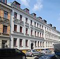 |
Tenement house | At milestone 7 (map) |
around 1890 (tenement) | Apartment building in closed development (plastered facade; stencil painting in the entrance area) |
09297672 |
| Tenement house | At milestone 8 (map) |
around 1885 (tenement) | Apartment building in closed development with house passage (plastered facade) |
09297688 |
|
| Tenement house | At milestone 12 (map) |
around 1895 (tenement) | Apartment building in closed development (plastered facade) |
09262417 |
|
 |
Tenement house | At milestone 13 (map) |
1898–1899 (tenement house) | Apartment building in closed development with shop (plastered facade); Significant in terms of local building history and district development history |
09297668 |
| Tenement house | At milestone 14 (map) |
around 1903 (tenement) | Apartment building in closed development with shop (clinker brick facade) |
09297671 |
|
 |
Tenement house | At milestone 15 (map) |
around 1890 (tenement) | Apartment building in closed development (clinker brick facade) |
09297667 |
| Tenement house | At milestone 16 (map) |
around 1890 (tenement) | Apartment building in closed development with gate passage (clinker brick facade; Prussian caps in the gate passage; apartment doors with overhead portals) |
09297670 |
|
| Tenement houses | Am Pfarrfelde 2; 4 (card) |
1920/1930 (tenement) | Apartment buildings in a residential complex with front gardens (plastered facade; see Linkelstrasse 32–40 and Gottlaßstrasse 23–37) |
09264517 |
|
 |
Tenement houses | Am Zuckmantel 1; 3; 5; 7; 9; 11 (card) |
around 1925 (residential complex) | Apartment buildings in a residential complex with a green inner courtyard in the corner of Friedrich-Bosse-Strasse 86-92 (see also Georg-Schumann-Strasse 351/353 and Linkelstrasse 2a-2f) |
09297677 |
 |
Residential complex | Am Zuckmantel 2 (card) |
around 1928 (residential complex) | Residential complex in semi-open development in the corner of Friedrich-Bosse-Straße 74-78 with front garden (see also Lucknerstraße 1) |
09297639 |
 |
Double tenement house | Am Zuckmantel 8; 10 (card) |
around 1930 (double tenement house) | Double apartment building of a residential complex in semi-open development in the corner at Georg-Schumann-Straße 345 and front garden to the street "Am Zuckmantel" (plastered facade) |
09297634 |
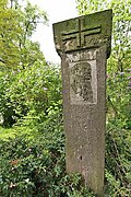 |
Sandstone pillar |
At the Elster 33 (map) |
around 1920 (monument) | Sandstone column on a quarry stone hill commemorating Friedrich-Ludwig-Jahn with a portrait relief and inscription and formerly with an inscription plaque on the hill (in front of the canoe section of TSV 1893 eV Leipzig-Wahren) |
09299001 |
| Rental villa | Buchfinkenweg 23 (map) |
1906 (rental villa) | Rental villa in open development, formerly a nursery house for a nursery (plastered facade; country style; see also Buchfinkenweg 80) |
09298986 |
|
| Rental villa | Buchfinkenweg 80 (map) |
1906 (rental villa) | Rental villa in open development, formerly part of a nursery (plastered facade; country house style) |
09298987 |
|
 |
Factory building | Claußbruchstrasse 5; 7 (card) |
around 1870 (factory) | Factory building on an L-shaped floor plan and location on the Elster with gate passage, paving in the courtyard and two towers (clinker brick facade) |
09297656 |
 |
Tenement house | Claußbruchstrasse 9 (map) |
around 1875 (tenement) | Apartment building in closed development with house passage (plastered facade; house overhead light with etched panes; almost all winter windows preserved) |
09297652 |
 |
Double tenement house | Friedrich-Bosse-Strasse 68; 70 (card) |
around 1900 (double tenement house) | Double apartment building in open development with front garden; Clinker facade |
09297642 |
 |
Residential complex | Friedrich-Bosse-Strasse 74; 76; 78 (card) |
around 1928 (residential complex) | Residential complex in semi-open development in corner location Am Zuckmantel 2 and in corner location Lucknerstraße 1 with front garden (plastered facade) |
09297640 |
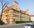 |
Double tenement house | Friedrich-Bosse-Strasse 84; 86 (card) |
around 1925 (double tenement house) | Double apartment building in a semi-open development in a corner location Am Zuckmantel 1 -11 (see also Friedrich-Bosse-Straße 90/92, Linkelstraße 2a-2f, Georg Schumann-Straße 351/353; plastered facade) |
09297738 |
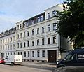 |
Tenement house | Friedrich-Bosse-Strasse 85 (map) |
around 1885 (tenement) | Apartment building in half-open development with gate passage; Plaster facade, wooden panels and paving in the gate passage |
09297644 |
| villa | Friedrich-Bosse-Strasse 87a (map) |
around 1885 (villa) | Villa with enclosure and garden; Plaster facade |
09297645 |
|
 |
Double tenement house | Friedrich-Bosse-Strasse 90; 92 (card) |
around 1925 (tenement) | Double apartment building in a residential complex on the corner at Linkelstrasse 2a-2f (see also Friedrich-Bosse-Strasse 84/86 and Am Zuckmantel 1/11 and Georg-Schumann-Strasse 351/353); Plaster facade |
09297680 |
 |
Tenement house | Friedrich-Bosse-Strasse 99 (map) |
around 1925 (tenement) | Tenement house in semi-open development; Clinker facade |
09297679 |
 |
Tenement house | Friedrich-Bosse-Strasse 101 (map) |
around 1900 (tenement) | Apartment building in closed development with gate passage and wash house in the courtyard; yellow clinker facade |
09292942 |
 |
Residential complex | Georg-Schumann-Strasse 306; 308; 310; 312 (card) |
re. 1939 (residential complex) | Residential complex in open development in the corner of Hopfenbergstrasse 2 with a passage and in the corner of Paul-Ernst-Strasse 1 with a front garden to Hopfenbergstrasse (plastered facade) |
09297635 |
 |
Tenement house | Georg-Schumann-Strasse 316 (map) |
around 1911 (tenement) | Apartment building in closed development (plastered facade) |
09297638 |
 |
Tenement house | Georg-Schumann-Strasse 320 (map) |
around 1905 (tenement) | Apartment building in closed development (plastered facade) |
09297730 |
 |
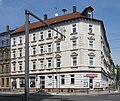
Tenement house | Georg-Schumann-Strasse 324 (map) |
re. 1908 (tenement) | Apartment building in closed development in the corner of Linkelstrasse with shops (clinker brick facade; apartment doors with overhangs) |
09297732 |
 |
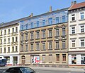
Tenement house | Georg-Schumann-Strasse 326 (map) |
1893–1894 (tenement) | Apartment building in closed development in the corner of Linkelstraße with shop and corner restaurant (plastered facade); effective corner construction |
09297731 |
 |
Tenement house | Georg-Schumann-Strasse 328 (map) |
around 1895 (tenement) | Apartment building in closed development with passage and shop (clinker brick facade; all windows) |
09297733 |
 |
Tenement house | Georg-Schumann-Strasse 330 (map) |
around 1895 (tenement) | Apartment building in closed development with shops (plastered facade; all windows) |
09297734 |
 |
Tenement house | Georg-Schumann-Strasse 332 (map) |
around 1890 (tenement) | Apartment building in closed development in the corner of Am Meilenstein with shops (clinker brick facade; stucco in the entrance area; apartment doors with overhangs) |
09297735 |
| Double tenement house | Georg-Schumann-Strasse 333; 335 (card) |
around 1890 (tenement) | Double apartment building in open development (clinker brick facade) |
09297749 |
|
| Factory building | Georg-Schumann-Strasse 335 (map) |
1910/1915 (factory) | Factory building in the rear position (plastered facade) |
09297643 |
|
 |
Parish and Dominican Church | Georg-Schumann-Strasse 336 (map) |
1951–1952 (church) | Parish and Dominican church; Simple church building from the post-war period, plastered facade, architect: Andreas Marquart, of architectural and religious significance |
09297691 |
| Tenement house | Georg-Schumann-Strasse 337 (map) |
around 1890 (tenement) | Apartment building in half-open development (clinker brick facade; stencil painting in the stairwell) |
09297629 |
|
| Double tenement house | Georg-Schumann-Strasse 339 (map) |
around 1900 (double tenement house) | Double apartment building in semi-open development in the corner of Lucknerstrasse 8 with front garden facing Lucknerstrasse (plastered facade) |
09297630 |
|
 |
Cemetery True | Georg-Schumann-Strasse 340 (map) |
from 1881 (cemetery); 1914 (chapel) | Wahren cemetery with chapel and extension (plastered building; colored lead glass windows), enclosure and grave monuments from the beginning of the 20th century |
09297648 |
 |
Memorial to the fallen of the First World War | Georg-Schumann-Strasse 340 (map) |
after 1918 (First World War) | Memorial to the fallen of the First World War; of local importance, made of granite |
09297649 |
| Tenement house | Georg-Schumann-Strasse 341 (map) |
around 1890 (tenement) | Apartment building in semi-open development in the corner of Lucknerstraße with shop and corner restaurant as well as front garden to Lucknerstraße (clinker brick facade; stucco throat in the entrance area; shop; porch door) |
09297631 |
|
| Tenement house | Georg-Schumann-Strasse 343 (map) |
around 1885 (tenement) | Apartment building in half-open development with shops (plastered facade); Wilhelminian style residential construction with scientific and local historical value |
09297632 |
|
| Tenement house | Georg-Schumann-Strasse 345 (map) |
1929–1930 (tenement) | Apartment building of a residential complex in semi-open development in the corner on Zuckmantel 8/10 with front garden facing the street Am Zuckmantel (plastered facade) |
09297633 |
|
| Double tenement house | Georg-Schumann-Strasse 351; 353 (card) |
1910/1915 (double tenement house) | Double apartment building in a residential complex with a green inner courtyard in the corner at Am Zuckmantel 1–11 with a corner shop (see Linkelstraße 2a-2f and Friedrich-Bosse-Straße 84–92) (plastered facade; front doors with polished panes) |
09297676 |
|
 |
Tenement house | Georg-Schumann-Strasse 355 (map) |
re. 1915 (tenement) | Apartment building in closed development in the corner of Pater-Aurelius-Platz with pharmacy (plastered facade) |
09300572 |
 More pictures |
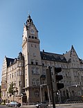
town hall | Georg-Schumann-Strasse 357 (map) |
1905–1907 (town hall) | Town hall in the corner of Linkelstrasse with furnishings (plastered facade with sandstone structure; effective neo-renaissance building with high corner tower) |
09297736 |
| Tenement house | Georg-Schumann-Strasse 359 (map) |
re. 1911 (tenement) | Apartment building in closed development with gate passage and shop (plastered facade; porch door; apartment doors with overhangs; stencil painting in the staircase; lead-glazed staircase windows) |
09297628 |
|
| Tenement house | Georg-Schumann-Strasse 361 (map) |
around 1915 (tenement) | Apartment building in a formerly closed development with shops (plastered facade; stucco and painting in the entrance area; vestibule door) |
09297627 |
|
| Tenement house | Georg-Schumann-Strasse 373 (map) |
around 1915 (tenement) | Apartment building in semi-open development in the corner of Wartenburgstrasse with shops and front garden in Wartenburgstrasse (plastered facade; stencil painting in the entrance area) |
09297626 |
|
| Tenement house | Georg-Schumann-Strasse 381 (map) |
around 1905 (tenement) | Apartment building in closed development (clinker brick facade) |
09297620 |
|
| Tenement house | Georg-Schumann-Strasse 383 (map) |
around 1905 (tenement) | Apartment building in half-open development (clinker brick facade; stencil painting in the stairwell) |
09297621 |
|
| Tenement house | Georg-Schumann-Strasse 385 (map) |
around 1900 (tenement) | Apartment building in closed development with a passage (clinker brick facade) |
09297622 |
|
| Tenement house | Georg-Schumann-Strasse 387 (map) |
around 1900 (tenement) | Apartment building in closed development (plastered facade; stencil painting in the stairwell and in the entrance area) |
09297623 |
|
| Tenement house | Georg-Schumann-Strasse 389 (map) |
around 1900 (tenement) | Apartment building in closed development (clinker brick facade; stencil painting in the entrance area) |
09297624 |
|
 |
Tenement house | Georg-Schumann-Strasse 390 (map) |
around 1885 (tenement) | Apartment building in open development in the corner of Pittlerstrasse with corner shop (plastered facade; stucco throat in the entrance area) |
09297692 |
| Three tenement houses | Georg-Schumann-Strasse 391a; 393; 395 (card) |
around 1938 (tenement) | Three apartment buildings in a residential complex in semi-open development with a gate passage (plastered facade; one shop original) |
09297611 |
|
 |
Tenement house | Gottlaßstrasse 1 (map) |
around 1910 (tenement) | Apartment building in semi-open development in the corner of Georg-Schumann-Straße with corner shop and front garden in Gottlaßstraße (plastered facade) |
09297729 |
| Tenement house | Gottlaßstrasse 4 (map) |
around 1915 (tenement) | Apartment building in half-open development with enclosure and front garden (plastered facade) |
09297856 |
|
| Tenement house | Gottlaßstrasse 6 (map) |
around 1915 (tenement) | Apartment building in closed development with fencing and front garden (plastered facade; wall tiles with decor and terrazzo with mosaic in the entrance area; porch door) |
09292652 |
|
 |
Residential complex | Gottlaßstrasse 23; 25; 27; 29; 31; 33; 35; 37 (card) |
1920/1930 (tenement) | Housing complex in open development with front garden (plastered facade; see Linkelstraße 32–40 and Am Pfarrfelde 2/4) |
09264516 |
 More pictures |
Reinforced concrete bridge on the Auensee | Gustav-Esche-Strasse (map) |
1914 (road bridge) | Reinforced concrete bridge on the Auensee |
09298655 |
 More pictures |
Pleasure and excursion restaurant | Gustav-Esche-Strasse 6 (map) |
1913 (restaurant) | Amusement and excursion restaurant with entrance gate and house on the bridge (plastered facade) |
09297702 |
 |
steam train | Gustav-Esche-Strasse 8 (map) |
re. 1925 (locomotive) | Steam train; technical monument, memorial value, value for popular education |
09299399 |
| Station building | Gustav-Esche-Strasse 8 (map) |
1951 (passenger station) | Station building with historical equipment and technical equipment (including switch box, post telephone, track diagram signal box) as well as bells at the barrier post, barrier with lattice curtains at post 3, barrier with wooden poles at post 1 to the farmer's bridge towards Am Hirtenhaus |
09300284 |
|
| Factory building | Hendelweg 11; 13; 15; 17 (map) |
1899–1900 (factory) | Factory building on the Elster with two-storey side wing, in the rear of the property (clinker brick facade); Factory building that shapes the landscape and is important for the history of the district's development in Wahren, evidence of the famous Leipzig tobacco shop |
09297742 |
|
 |
Tenement house | Hermundurenstrasse 2 (map) |
around 1935 (tenement) | Apartment building in open development (plastered facade; shutters) |
09297750 |
| Tenement house | Hopfenbergstrasse 2 (map) |
re. 1939 (tenement) | Apartment building in semi-open development in the corner at Georg-Schumann-Straße 306–312 with front garden and passage (see also Paul-Ernst-Straße 1/3; plastered facade) |
09297636 |
|
| Block of flats | Hopfenbergstrasse 4; 6; 8th; 10; 12; 14 (card) |
around 1928 (tenement) | Apartment block in open development with front garden (plastered facade) |
09298982 |
|
| Tenement house | Hopfenbergstrasse 16 (map) |
around 1928 (tenement) | Apartment building in closed development in the corner of Paul-Ernst-Straße 19-23 with front garden (small residential complex; lead-glazed staircase windows; front door with polished panes) |
09297747 |
|
| Cellar of the former Mirus brickworks | Huefnerstrasse 2 (map) |
2nd half of the 19th century (cellars); 1932 (residential building); around 1880 (residential building) | Basement of the former Mirus brickworks with access stairs, formerly also two residential buildings connected at an angle; Cellar of local and economic value |
09292083 |
|
 |
Double tenement house | Landhausstrasse 2; 4 (card) |
around 1925 (tenement) | Double apartment building in open development with front garden (plastered facade) |
09297727 |
 |
Arch bridge | Linkelstrasse (map) |
1902 (railway bridge) | Arched bridge in a grooved steel framework construction and retaining walls in the corner at Damaschkestrasse (railway overpass, route 6403 Magdeburg Hbf. - Leipzig Hbf .; importance for traffic history; same type see also Pittlerstrasse) |
09263839 |
 |
Bakery building | Linkelstrasse 1 (map) |
1908 (bakery); 1886 (tenement house) | Bakery building as well as courtyard entrance and paving of a residential and commercial building plot in semi-open development in the corner of Stahmelner Strasse (plastered facade; deletion of tenement house 2007) |
09297651 |
 |
Tenement houses | Linkelstrasse 2a; 2 B; 2c; 2d; 2e; 2f (card) |
around 1925 (tenement) | Apartment buildings in a residential complex (see also Friedrich-Bosse-Straße 84–92, Georg-Schumann-Straße 351/353 and Am Zuckmantel 1–11; plastered facade) |
09262782 |
 |
Tenement house | Linkelstrasse 4 (map) |
around 1910 (tenement) | Apartment building in closed development with shop (plastered facade; front door with polished panes and skylight; vestibule door; leaded glass window and stencil painting in the stairwell) |
09297660 |
| Residential building | Linkelstrasse 7 (map) |
before 1800 (residential building) | House and forge; belongs to the last evidence of the old Wahrener local situation |
09299631 |
|
 |
Tenement house | Linkelstrasse 8 (map) |
re. 1911 (tenement) | Apartment building in closed development (plastered facade; vestibule door) |
09297661 |
 |
Tenement house | Linkelstrasse 10 (map) |
around 1910 (tenement) | Apartment building in closed development with passage and shop (plastered facade; apartment doors with overhangs; lead-glazed staircase windows) |
09297746 |
 |
Tenement house | Linkelstrasse 12 (map) |
around 1905 (tenement) | Apartment building in closed development with shop (plastered facade; stucco in the entrance area; apartment doors with overhangs; stencil painting in the stairwell) |
09297662 |
 |
Tenement house | Linkelstrasse 14 (map) |
around 1905 (tenement) | Apartment building in closed development with shop (plastered facade; stucco in the entrance area; porch door) |
09297663 |
 |
Tenement house | Linkelstrasse 16 (map) |
around 1908 (tenement) | Apartment building in closed development with shop (clinker brick facade) |
09297664 |
 |
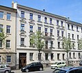
Tenement house | Linkelstrasse 23 (map) |
around 1900 (tenement) | Apartment building in closed development with gate passage and shop (clinker brick facade; two original shop posts; wooden panels in the gate passage) |
09297745 |
 |
Tenement house | Linkelstrasse 31 (map) |
1897–1898 (apartment building); 1898 (outbuilding) | Apartment building in closed development with gate passage, shop and above-average building-related equipment as well as two-storey auxiliary building in the courtyard (plastered facade); Of importance in terms of local history, equipment of particular scientific and documentary value |
09303647 |
 |
Tenement houses | Linkelstrasse 32; 34; 36; 38; 40 (card) |
1920/1930 (tenement) | Apartment buildings in a residential complex in the corner of Am Pfarrfelde (plastered facade; see also Am Pfarrfelde 2/4 and Gottlaßstraße 23–37) |
09264515 |
 |
Tenement house | Linkelstrasse 33 (map) |
around 1890 (tenement) | Apartment building in closed development (plastered facade; stencil painting in the stairwell) |
09297744 |
 |
Tenement house | Linkelstrasse 37 (map) |
around 1890 (tenement) | Apartment building in closed development with shop (clinker brick facade; stucco throat in the entrance area) |
09297665 |
 |
Factory building | Linkelstrasse 59 (map) |
around 1903 (factory) | Factory building, most recently the Soviet Army, in the corner of the rail entrance for goods handling at the Wahren stop (clinker buildings; the main building in Linkelstraße formerly Dux-Automobile by Max Fricke in 1916 with the adjoining hall from 1938, with an industrial hammer as a technical monument) |
09297737 |
 |
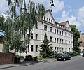
Tenement houses | Lucknerstrasse 1 (map) |
around 1928 (residential complex) | Apartment buildings in a residential complex in semi-open development with a front garden in the corner of Friedrich-Bosse-Straße 74-78 (see also Am Zuckmantel 2; plastered facade) |
09297641 |
 |
Double tenement house | Lucknerstrasse 3; 5 (card) |
around 1915 (double tenement house) | Double apartment building in open development with front garden (plastered facade; stairwell window with remains of colored leaded glazing) |
09262035 |
 |
Double tenement house | Lucknerstrasse 4; 6 (card) |
around 1905 (double tenement house) | Double apartment building in open development with front garden (clinker brick facade) |
09297646 |
 |
Double tenement house | Lucknerstrasse 8 (map) |
around 1900 (double tenement house) | Double apartment building in a semi-open development in the corner at Georg-Schumann-Straße 339 with a front garden in Lucknerstraße (plastered facade; front door with polished panes) |
09297748 |
 |
Tenement house | Ölhafenstrasse 1 (map) |
1890/1900 (tenement house) | Apartment building in semi-open development on the corner of Hirtenholtzstraße, formerly with corner shop (clinker plaster facade) |
09296899 |
 |
Tenement house | Ölhafenstrasse 7 (map) |
around 1905 (tenement) | Apartment building in semi-open development on the corner of Georg-Schumann-Straße with corner shop and front garden in Ölhafenstraße (clinker brick facade; apartment doors with overhead portals) |
09297619 |
| Tenement house | Ölhafenstrasse 10 (map) |
around 1915 (tenement) | Apartment building in semi-open development with front garden (plastered facade; apartment doors with over-portals) |
09297618 |
|
 |
Main school building and toilet block | Sacrificial Path 1 (map) |
around 1895 (school) | Main building of the school and toilet block in the courtyard; (Clinker brick facade; vestibule door with etched panes) |
09294691 |
| Residential building | Sacrificial Path 4 (map) |
around 1720 (residential building) | Single storey residential building; on the Kirchberg near the Gnadenkirche Wahren, part of the old town center development |
09293937 |
|
 |
Half-timbered residential building | Sacrificial Path 6 (map) |
around 1720 (residential building) | Half-timbered house; in the old location of Wahren, near the Gnadenkirche |
09299424 |
| Bus shelter | Pater-Aurelius-Platz (map) |
1915/1916 (bus shelter) | Bus shelter with sales counter, lounge for conductors and toilet (plastered facade) |
09264071 |
|
 |
Erratic memorial stone | Pater-Aurelius-Platz (map) |
around 1930 (memorial stone) | Boulder memorial stone with inscription in the corner of Linkelstrasse and Georg-Schumann-Strasse |
09297768 |
 More pictures |
Apelstein | Pater-Aurelius-Platz (map) |
1862, re. 1863, 1938 (memorial stone) | Apelstein No. 20 (V); Memorial stone to commemorate the battles of the Battle of Nations near Leipzig in 1813, in the corner at Georg-Schumann-Strasse, 21,000 men of the 1st Prussian Army Corps under General von Yorck, historically significant |
09294137 |
 |
Tenement houses | Pater-Aurelius-Platz 2; 3; 4 (card) |
re. 1915 (residential complex) | Apartment buildings in a residential complex in closed development, with a green inner courtyard (plastered facade) |
09297675 |
| Double tenement house | Pater-Gordian-Strasse 1; 3 (card) |
around 1905 (double tenement house) | Double apartment building in open development with front garden (clinker brick / plaster facade) |
09263198 |
|
| Block of flats | Pater Gordian Street 5; 7; 9 (card) |
around 1905 (tenement) | Apartment block of a residential complex in open development with front garden (plastered facade) |
09298008 |
|
| Double tenement house | 11 Pater Gordian Street; 13 (card) |
around 1905 (double tenement house) | Double tenement house in half-open development with front garden (plastered clinker facade) |
09296907 |
|
 More pictures |
Station building and two signal boxes | Pater-Gordian-Strasse 15 (map) |
1884 (train station) | Station building and two signal boxes next to Lützschenaer Straße (clinker buildings) and toilet block |
09294133 |
 |
Rental villa | Pater-Gordian-Strasse 40 (map) |
re. 1912 (villa) | Rental villa in semi-open development on the corner of Landhausstrasse with front garden (plastered facade) |
09298984 |
| Tenement house | Pater-Gordian-Strasse 70 (map) |
around 1935 (tenement) | Apartment building in closed development with front garden (plastered facade) |
09297724 |
|
| Tenement houses | 72 Pater Gordian Street; 74; 76; 78; 80; 82; 84; 86 (card) |
re. 1935 (tenement) | Apartment buildings in a residential complex with a front garden, No. 86 in corner position, extended Wilhelmstrasse (plastered facade) |
09297725 |
|
 |
Double tenement house | Paul-Ernst-Strasse 1; 3 (card) |
re. 1939 (double tenement house) | Double apartment building in a residential complex in the corner at Georg-Schumann-Straße 306-312 with a passage and front garden (see also Hopfenbergstraße 2; plastered facade) |
09297637 |
 |
Block of flats | Paul-Ernst-Strasse 19; 21; 23 (card) |
around 1928 (tenement) | Apartment block in the corner of Hopfenbergstrasse 16 with garages at Paul-Ernst-Strasse 19 (plastered facade; leaded glass windows in the stairwell) |
09297647 |
| Duplex house | Pferdnerstrasse 25 (map) |
around 1930 (twin house) | Double residential building in open development in the corner of Pittlerstrasse 1 with front garden (plastered facade; small leaded glass windows) |
09297609 |
|
| Duplex house | Pferdnerstrasse 27 (map) |
around 1930 (twin house) | Double house in open development in corner location Zehmenstraße 16 with front garden (plastered facade; small leaded glass windows) |
09297608 |
|
 More pictures |
Water tower preserve | Pirolweg 7 (map) |
1908/1909 (water supply and sewage system) | Wahren water tower (600 m³ capacity); Technical monument, of social and historical importance, value for popular education |
09297740 |
 |
Two arch bridges | Pittlerstrasse (map) |
1902 (railway bridge) | Two arched bridges, one behind the other, in riveted steel truss construction with connected supports, in the corner of Lützschenaer Straße (route 6403 Magdeburg Hbf. - Halle Hbf. - Leipzig Hbf .; route kilometers 112,550; railway overpass of traffic history; see Linkelstrasse) |
09263840 |
| Duplex house | Pittlerstrasse 1 (map) |
around 1930 (twin house) | Double house in open development in the corner of Pferdnerstraße 25 (plastered facade) |
09297610 |
|
| Tenement house | Pittlerstrasse 4 (map) |
1936 (tenement) | Apartment building in a small residential complex, see Hermundurenstraße 12 and Pferdnerstraße 19–23 (plastered facade) |
09297615 |
|
| Tenement house | Pittlerstrasse 12; 14; 16 (card) |
around 1905 (tenement) | Group of tenement houses in open development with front gardens (plastered facade; stucco valley in the entrance area with terrazzo; porch door; apartment doors with overhangs; lead glass windows in the stairwell) |
09297693 |
|
 |
Tenement house | Pittlerstrasse 15; 17; 19 (card) |
re. 1909 (house no.15); around 1915 (house no.17, 19) | Group of tenement houses in half-open development with front garden (plastered facade) |
09297694 |
| Tenement house | Pittlerstrasse 18 (map) |
around 1890 (tenement) | Apartment building in half-open development with front garden (plastered facade) |
09297697 |
|
| Tenement house | Pittlerstrasse 20 (map) |
around 1890 (tenement) | Apartment building in closed development with front garden (plastered facade) |
09297698 |
|
| Tenement house | Pittlerstrasse 22 (map) |
around 1890 (tenement) | Apartment building in half-open development with front garden (plastered facade) |
09297699 |
|
 |
Office building | Pittlerstrasse 25 (map) |
since 1899 (factory) | The office building is located directly on the works tracks, with a front garden (clinker brick facade) |
09297700 |
|
|
main building | Pittlerstrasse 26 (map) |
1899 & 1909 & 1912 & 1936 (administration) | Main building with extension and hall A, B and C of the company Pittler-Tornos Werkzeugmaschinen GmbH as well as transformer house and enclosure |
09263881 |
 |
Workshop | Pittlerstrasse 27; 29 (card) |
around 1900 (factory building) | Factory hall with skylight (clinker brick facade, today Prebena) |
09296736 |
 |
Factory building | Pittlerstrasse 32 (map) |
1890-1910 (factory); 1909 (director's residence) | Small factory building, paving, driveway, enclosure, factory owner's villa in country house style, plastered facade; Half-timbered structure, quarry stone base, original empty |
09297723 |
 |
factory | Pittlerstrasse 33 (map) |
1900–1925 (factory) | Factory with courtyard building and extension, courtyard building with connecting passage and paving of the entrance road (yellow clinker brick facade) |
09297701 |
 More pictures |
church | Rittergutsstrasse (map) |
1101/1150 (church) | Church with furnishings and a cemetery with a memorial for the fallen and tombs |
09264520 |
 |
Block of flats | Rittergutsstrasse 1; 3; 5 (card) |
1925/1930 (tenement) | Apartment block in open development in the corner of Am alten Gasthof (entrance doors with polished panes; lead glass windows in the stairwell; plastered facade) |
09296871 |
 |
Residential building | Rittergutsstrasse 2 (map) |
19th century (residential building) | Residential building with driveway and ancillary building (half-hipped roof, half-timbered upper floor); As a vicarage Wahren of prominent local and local historical importance, an indispensable part of the historical town center |
09297683 |
| Residential building | Rittergutsstrasse 6 (map) |
19th century (residential building) | Residential house in open development (half-timbered) |
09297684 |
|
| Residential building | Rittergutsstrasse 7 (map) |
re. 1698 (residential house) | Residential house in open development in corner location at the old inn (gable half-timbered; half-hipped roof; adobe), demolished |
09297685 |
|
 |
Residential building | Rittergutsstrasse 11 (map) |
1st half of the 18th century (residential building) | Residential house in open development, facing the street (half-timbered building with hipped roof) and small factory building of the former Kniesche fur factory in the rear (plastered clinker facade; inside cast iron supports) |
09297686 |
 |
Tenement house | Rittergutsstrasse 15 (map) |
around 1911 (tenement) | Apartment building in half-open development, formerly with a café (plastered facade) |
09297657 |
 |
Tenement house | Rittergutsstrasse 17 (map) |
around 1915 (tenement) | Apartment building in closed development (plastered facade) |
09297658 |
 |
Tenement house | Rittergutsstrasse 19 (map) |
1912–1913 (tenement house) | Tenement house in semi-open development; Plaster facade; Porch door with skylight; Painting and stucco in the entrance area |
09297659 |
 |
Manor of the manor Wahren | Rittergutsstrasse 23 (map) |
around 1749/1750 (manor) | Baroque mansion of the manor Wahren (plastered facade) |
09262723 |
| Half of a twin house | Rotkehlchenweg 11 (map) |
1928 (twin house) | Half of a twin house in the Sonnenhöhe settlement (plastered facade) |
09292196 |
|
 |
Tenement house | Schillerplatz 8 (map) |
around 1915 (tenement) | Apartment building in closed development with front garden (plastered facade) |
09297617 |
 |
Factory building | Stahmelner Strasse 9 (map) |
around 1880 (factory building) | Factory building in open development with gate passage and shop (clinker facade; inner courtyard) |
09298983 |
 |
Former Mill property | Stahmelner Strasse 35; 37 (card) |
around 1860 (mill) | Former mill property with farm building, formerly angled building (plastered facade) |
09297616 |
 |
Residential building | Stahmelner Strasse 39 (map) |
around 1850 (residential building) | Residential house in open development, belonging to the Wahren mill; Plaster facade |
09297607 |
| Tenement house | Stammerstrasse 5 (map) |
around 1904 (tenement) | Apartment building in closed development in the corner of Am Meilenstein street (clinker brick facade) |
09297666 |
|
| Tenement houses | Wartenburgstrasse 4; 6; 8th; 10; 12; 14 (card) |
around 1928 (residential complex) | Apartment houses in a residential complex with front gardens and fencing (plastered facade) |
09297650 |
|
 |
villa | Wendenstrasse 2 (map) |
Villa with gate entrance, garden, park (plastered facade, the associated subscriber home demolished in 2006) |
09297682 |
|
| Aggregate railway settlement | Wiskenstrasse 9; 11; 13; 15 (card) |
1936–1937 (totality) | Material entirety of the railway housing estate Wiskenstraße with the single monument block of flats with front garden, in corner location Koloniestraße and Dähnhardtstraße (plastered facade) and the double rented houses Dähnhardtstraße 1/3 as well as Koloniestraße 2/4 and 6/8 (all material parts); Housing estate of the railway construction cooperative (see also list of individual monuments obj 09297726) |
09300976 |
|
| Block of flats | Wiskenstrasse 9; 11; 13; 15 (card) |
1936–1937 (tenement) | Individual monument and aggregate: block of flats in open development with front garden, in corner location Koloniestraße and Dähnhardtstraße (plastered facade); Housing complex of the railway construction cooperative (see also general document obj 09300976) |
09297726 |
|
| Duplex house | Zehmenstrasse 16 (map) |
around 1930 (twin house) | Double house in open development in the corner of Pferdnerstraße 27 with front garden (plastered facade; see also Pferdnerstraße 25 and Pittlerstraße 1) |
09297612 |
swell
- State Office for the Preservation of Monuments Saxony Dynamic web application: Overview of the monuments listed in Saxony. In the dialog box, the location “Leipzig, City; True ”must be selected, then an address-specific selection takes place. Alternatively, the ID can also be used. As soon as a selection has been made, further information about the selected object can be displayed and other monuments can be selected via the interactive map.
- Thomas Noack, Thomas Trajkovits, Norbert Baron, Peter Leonhardt: Cultural monuments of the city of Leipzig. (Contributions to urban development 35), City of Leipzig, Department of Urban Development and Construction, Leipzig 2002
Web links
Commons : Cultural Monuments in Wahren - Collection of Images