List of cultural monuments in Leipzig center
The list of cultural monuments in Leipzig-Mitte (center) contains the cultural monuments of the Leipzig district "Center", which were recorded in the list of monuments by the State Office for the Preservation of Monuments of Saxony as of June 20, 2013.
Legend
- Image: shows a picture of the cultural monument and, if applicable, a link to further photos of the cultural monument in the Wikimedia Commons media archive
- Designation: Name, designation or the type of cultural monument
-
Location: If available, street name and house number of the cultural monument; The list is basically sorted according to this address. The map link leads to various map displays and gives the coordinates of the cultural monument.
- Map view to set coordinates. In this map view, cultural monuments are shown without coordinates with a red marker and can be placed on the map. Cultural monuments without a picture are marked with a blue marker, cultural monuments with a picture are marked with a green marker.
- Dating: indicates the year of completion or the date of the first mention or the period of construction
- Description: structural and historical details of the cultural monument, preferably the monument properties
-
ID: is awarded by the State Office for the Preservation of Monuments in Saxony. It clearly identifies the cultural monument. The link leads to a PDF document from the State Office for the Preservation of Monuments in Saxony, which summarizes the information on the monument, contains a map sketch and often a detailed description. For former cultural monuments sometimes no ID is given, if one is given, this is the former ID. The corresponding link leads to an empty document at the state office. The following icon can also be found in the ID column
 ; this leads to information on this cultural monument at Wikidata .
List of cultural monuments in Leipzig-Mitte (center)
| image | designation | location | Dating | description | ID |
|---|---|---|---|---|---|
 |
Parks | (Map) | around 1905 | Promenadenring: parks at Martin-Luther-Ring, Dittrichring and Goerdelerring = western section of the Promenadenring. Plants in today's scope and type executed under gardening director Carl Hampel .
Significance in terms of local development history, gardening and urban planning. |
09298255 |
| Public address system (city radio) | (Map) | around 1980 | Loudspeaker column at the museum memorial in the "Round Corner" . Formerly part of the public address system of the Leipzig city radio, testimony to urban communication and an important document of the events on October 9, 1989.
Significance in terms of local history, technology history and contemporary history |
08967704 |
|
 More pictures |
Epitaphs and tombstones | Augustusplatz (map) |
16th, 17th and 18th centuries | Epitaphs and tombstones from the former university church , recovered before the explosion in 1968, exhibited again in the new university building (2006–2012).
Of local, personal, cultural and artistic importance. |
09292749 |
 More pictures |
Fountain system, ( Mende fountain ) | Augustusplatz (map) |
1886 (auxiliary system) | Elongated quadruple basin, in the middle an obelisk with bronze figures arranged on several levels, distinctive, cityscape-defining location in front of the Gewandhaus.
Artistically important.
|
09290005 |
 More pictures |
Concert building ( Gewandhaus ) | Augustusplatz 8 (map) |
1976-1981 | Concert building (with equipment). Multi-part structure with a dominating Great Hall, generous glass front on the square, behind it the foyer and staircase, otherwise the facade design is characterized by sandstone cladding, interior design incorporating contemporary works of art in relation to the function of the building, including the monumental ceiling painting Gesang vom Leben by Sighard Gille , the only new concert hall in the GDR.
Structurally, musically and artistically as well as of importance in terms of urban development. |
09292751 |
 More pictures |
Skyscraper ( city skyscraper ) |
Augustusplatz 9 (map) |
1968–1975 (university) | Former high-rise building of the Karl Marx University, on the site of the war-damaged and blown up Augusteum, dominant of Leipzig city center; monolithic sliding construction with steel-aluminum curtain wall, significantly changed in appearance as part of the redesign to the city high-rise, no original equipment preserved, characterizing the townscape and of local history. |
08967684 |
 More pictures |
Opera house | Augustusplatz 12 (map) |
1956-1960 | Opera house with original interior and spacious terraces facing the swan pond.
Rarity and historical value, of outstanding importance for the history of architecture, artistic and documentary-scientific value as the only new music theater building in the GDR.
|
09290006
|
 More pictures |
Commercial building ( King Albert House ) |
Barefoot alley 2; 4; 6; 8 (card) |
1912/1913 | Commercial building in closed development in the corner of Markt, with a courtyard. Reinforced concrete skeleton construction stretching far into the depths, plastered facade in the reform style around 1910, Art Nouveau echoes, ground floor zone with ceramic cladding, accentuating building decorations typical of the time and style, two likewise architecturally designed atriums, connected by passages, architect: Emil Franz Hänsel.
An important part of the historical market development, of importance in terms of local development as well as building history and architectural design |
09298345 |
 |
Residential building in closed development | Barefoot Alley 3 (map) |
1509-1510 | Originally part of the side wing of a through-house (see Markt 10), spun off in 1585 and converted into a residential building, simple plastered facade, 19th century shop area.
Local and architectural significance |
09298204 |
 |
Residential building in closed development | Barefoot Alley 5 (map) |
1509-1510 | Originally part of the side wing of a through-house (see Markt 10), spun off in 1585 and converted into a residential building, simple plastered facade, 19th century shop area.
Local and architectural significance |
09298205 |
 More pictures |
Residential building in closed development | Barefoot Alley 7 (map) |
1509-1510 | Originally part of the side wing of a through-house (see Markt 10), spun off in 1585 and converted into a residential building, simple plastered facade, 19th century shop area.
Local and architectural significance |
09298206 |
 More pictures |
Restaurant Zills Tunnel Residential and commercial building in closed development | Barfußgäßchen 9, in the corner at Klostergasse 18 (map) |
1887-1888 | Plaster-sandstone facade in neo-Renaissance forms.
Local development history, building history and architectural art as well as cultural history importance.
|
09298212 |
 More pictures |
Residential and commercial building in closed development, part of the trifugium | Barfußgäßchen 11, in the corner of Klostergasse (map) |
1904-1905 | Plastered sandstone facade in various forms of the fading historicism with Art Nouveau elements
Significance in terms of local development, building history and architectural art
|
09298208 |
 More pictures |
Lipsia-Haus residential and commercial building | Barfußgäßchen 12, in the corner of Dittrichring and Kleine Fleischergasse (map) |
1908-1909 | Sandstone plaster facade in Baroque forms, with influences from the reform style around 1910
Local development, architectural and architectural importance.
|
09298209 |
 |
Residential and commercial building in closed development (part of the trifugium ) | Barfußgäßchen 13 (map) |
1904-1906 | Plaster-stone facade between historicalism and Art Nouveau, small-scale structure in the upper facade area, central emphasis by bay windows and steep roof house
Of importance in terms of local development and building history |
09298210 |
 |
House sign owl | Böttchergäßchen 3 (map) |
re. 1547 (owl); 17th century (swan) | Swan (no. 12), owl (no. 13, comes from the Goldene Eule house, Brühl 25) and Goldene Sonne (no. 14) as house signs at the house entrance from Brühl; Golden Sun; from 11/2007 in the Leipzig City History Museum / House Sign Collection |
09298443 |
| House sign owl | Böttchergäßchen 3 (map) |
re. 1666 (house sign) | House sign owl on console marked 1666, with the new building by Peek & Cloppenburg taken over in the Leipzig City History Museum |
09290941 |
|
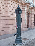 |
Manual pump |
Bruehl (map) |
before 1890, 2012 re-installation | Hand lever pump with well shaft and cover plate in front of the Romanushaus
Significant in local history |
09291088 |
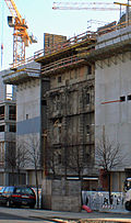 |
Kaufhaus am Brühl (formerly): Remnants of the facade at Höfe am Brühl | Bruehl 1; 3 in the corner of Richard-Wagner-Platz and Richard-Wagner-Straße (map) |
1908 (department store); 1927 (facade part), 1966–1968 (aluminum facade) | Remnants of the facade of a former department store and cladding of the GDR aluminum facade (curved, windowless facade design made of hyperbolic paraboloid elements, design: Harry Müller ) and memorial plaque for Richard Wagner . 2010 unnecessary demolition of the department store for a new shopping center.
Remembrance value, documentation value, historical value, architectural and artistic as well as urban planning and personal history significance.
|
09298214 |
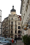 |
Residential and commercial building in closed development | Brühl 4, on the corner of Hainstrasse (map) |
1899-1900 | Stately plastered building with sandstone structures, decoration in neo-baroque forms, one of the earliest Leipzig buildings in Hennebique style, characterizing the cityscape.
Significance in terms of local development, architecture and building history.
|
09298215 |
 More pictures |
Office and commercial building in closed development with shops and a doorway | Bruehl 14; 16 (card) |
1910/1911 | Elegant, symmetrically structured plaster facade in the forms of Art Nouveau and reform architecture around 1910, two shops
Local development history, architectural history and architectural significance.
|
09298217 |
 More pictures |
Bürgerpalais ( Romanushaus ) |
Brühl 18 in corner location Katharinenstraße 23 (map) |
1701–1704 (residential and commercial building) | City palace with courtyard; Magnificent bourgeois palace, richly decorated plastered facades, main front facing the Brühl with a three-axis template, angled corner with corner bay, reconstructed roof belvedere, Leipzig's most prominent baroque town house, master builder: Johann Gregor Fuchs
Of local, architectural and architectural importance |
09298219 |
 More pictures |
Gloecks Haus : Commercial building in closed development | Brühl 52 in the corner of Nikolaistraße (map) |
1909-1910 | Building in the reform style that characterizes the street scene around 1910, shell limestone facade, with a shop area, evidence of Leipzig's history as a center of the fur trade
Significance in terms of local development, architectural, architectural and urban development. |
09298220 |
 More pictures |
Business building Gebr. Felsenstein Business building in closed development | Brühl 54 in the corner of Nikolaistraße (map) |
1909–1910 including a building from 1896 | Elaborately structured limestone facade in the reform style around 1910, corner emphasis by bay windows and corner tower, shop area
Local development, architectural, architectural and urban significance
|
09298229 |
 More pictures |
Commercial building (with two house numbers) in closed development | Bruehl 56; 58 (card) |
1877 | Clinker facade with sandstone and clinker brick structure
Of importance in terms of local development and architectural history
|
09298221 |
 |
Commercial building in closed development (clinker brick facade) | Bruehl 62 (map) |
1892-1893 | Late historic clinker brick facade with sandstone and clinker brick structure, with shop
Significance of local development and architectural history.
|
09298224 |
 More pictures |
Commercial building in closed development with house passage | Brühl 64 (map) |
1892-1893 | Late historic clinker brick facade with sandstone and clinker brick structure
Significance of local development and architectural history.
|
09298225 |
 More pictures |
Residential and commercial building in closed development | Bruehl 66 (map) |
1899-1900 | Built as a hotel, clinker brick facade in neo-Gothic style, sandstone inclusions.
Of importance in terms of local development and architectural history
|
09298226 |
 |
Commercial building in a formerly closed development with courtyard buildings | Brühl 68 (map) |
1913-1914 | Richly structured plaster facade with artificial stone elements, courtyard building brick facade, in the reform style around 1910, architect: Johann Gustav Pflaume, former trading house for tobacco goods Martin Lentschner, the name "Jewish hostel" can be verified for the first time in 1673.
Of importance in terms of local development and building history |
09298227 |
 |
Commercial building in closed development | Bruehl 74 (map) |
1909-1910 | Richly structured sandstone facade, in the reform style around 1910, typical office building of a Leipzig tobacco shop.
Significant in terms of building history and site development
|
09298228 |
| Cellar vault of the Pleißenburg and connecting corridor to the New Town Hall and remains of the old fortress wall in the area of Burgplatz / Markgrafenstraße | Burgplatz (map) |
16th century (cellars) & 1897–1905 (fortress) | Extensive, vaulted cellars predominantly in brick masonry, partly also quarry stone, important evidence of the history of the Pleißenburg and Leipzig as a fortified city and military site, of local and regional importance as well as architectural history |
09292752 |
|
 More pictures |
Fountain ( Rathausbrunnen ) |
Burgplatz (map) |
1908 (auxiliary system), 1908 (fountain) | Fountain commemorating the consecration of the New Town Hall on October 7, 1905 (shell limestone and cast bronze); Popularly designed ornamental fountain made of shell limestone and bronze elements, installation in memory of the consecration of the New Town Hall on October 7, 1905, design: Georg Wrba, local historical and artistic significance monument text The design for the new building of the town hall included an ornamental fountain in 1899 as an urban accent on the re-entrant Corner at Burgplatz, which was not carried out for financial reasons. In 1906 citizens of Leipzig offered the financing. The costs for the foundation and for the water supply were borne by municipal foundation funds (Großmann Foundation, Natalie Beuth Foundation, Grassi Foundation). The order for the design and sculptural execution went to the sculptor Georg Wrba (Dresden), who had already worked on the sculptural design of the New Town Hall under Hugo Licht. The bronze casting was done by the Dresden company Milde & Co. The foundation was created by the cement construction business Rudolph Wolle. The fountain was unveiled on October 7, 1908 on the occasion of the third anniversary of the inauguration of the New Town Hall. In 1980 the well was switched off, renovated and put back into operation in 1991. In connection with the construction of an underground car park under Burgplatz, the temporary dismantling took place in 1995–1999, combined with a fundamental renovation in terms of monument preservation. The stone elements are made of shell limestone, which was also used in the construction of the New Town Hall. The three-dimensional ornaments (33 sculptures based on 26 models) and the crowning group are cast bronze. The total height of the well is 6.73 m. The octagonal fountain basin stands on a single-level base. The pool walls are provided with mirrors. In the middle of the basin, a baluster-shaped, curved column rises on the massive, square well, which tapers to an octagon in the upper third. Bronze tondi with relief portraits in half-profile are attached to three sides of the well. They show the Lord Mayors Bruno Tröndlin (east side - all round: DR. BRUNO TRÖDLIN) and Otto Georgi (north side - all round: DR.OTTO GEORGI) as well as the city planning director Hugo Licht (south side - all round: DR. HUGO LICHT). On the reverse a medallion with the inscription: ZUR / REMINDER / AN DIE / INAUGURATION OF / NEW TOWN HALL / ON / 7TH OCTOBER / 1905. The upper octagonal part of the well is surrounded by a bronze ring, which consists of pairs of figures based on German fairy tales that used to emit 140 water jets: "Hans my hedgehog", "Thumbling", "Hansel and Gretel", "Snow White", "The golden roebuck", "Swinigel and Hase", "The Two Brothers", "The Devil's Russian Brother". Cartridges made of rams' heads and various animals are arranged between the figures. On the column capital adorned with decorative ornamentation (egg stick, checkerboard cuboid) four water-spraying, bronze ram heads as consoles of the square cover plate, which carries the larger than life bronze figure of a flute player (2.28 mh). This is shown in a forward step position with an unclothed, athletic upper body. His shirt slipped off. He wears knee-free pants and sturdy shoes. Three children and two dogs are playing at his feet. The town hall fountain is an attractively designed fountain system that gives the view of the New Town Hall on Burgplatz an additional accent and serves to enhance the urban space. With the content-related references to the popular treasure trove of legends and fairy tales at the beginning of the 20th century, it is clearly recognizable as the work of the time it was created. Georg Wrba, who is one of the well-known sculptors of the 20th century and who was particularly active and experienced in applied sculpture, ensured a high-quality implementation of the building project, whereby his previous participation in the town hall building certainly had a beneficial effect. Due to the conditions in which it was created and its artistic characteristics, the object acquires local historical and artistic importance. LfD / 2017 |
09298231 |
 More pictures |
Townhouse | Burgplatz 1 (map) |
1908–1912 (administration building), 1908–1912 connecting bridge to the New Town Hall (pedestrian bridge) | Town house in the corner of Lotterstrasse, Martin-Luther-Ring 8, 8a, 10 and Markgrafenstrasse 3, with inner courtyard and connecting bridge to the New Town Hall over Lotterstrasse; Elaborately designed building complex with shell limestone facades in the reform style around 1910, accentuating sculptural jewelry, registry office with sophisticated interior design, architect: Hugo Licht, significance in terms of local history, architectural history and artistic as well as urban development |
09298232 |
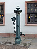 |
Manual pump | Burgstrasse (map) |
before 1890 (hand lever pump) | Hand pump with well shaft and cover plate in front of the Thüringer Hof inn (Gothic type), of local history |
09292753 |
 More pictures |
Commercial building in closed development | Burgstrasse 1; 3; 5 (card) |
1907–1910 (residential and commercial building) | in the corner of Thomaskirchhof 10; Natural stone facade, lead-glazed staircase windows, building with inner courtyard, facade design in the style of the German neo-renaissance, street-defining location, architect: Peter Dybwad, of importance in terms of local development, architectural history and architectural design |
09298234 |
 |
Residential building in closed development | Burgstrasse 2 (map) |
around 1850 (residential building) | in the corner of Thomaskirchhof 12, formerly with a pharmacy, today with a museum (plastered facade) |
09298239 |
 |
Stair tower (of the former Goldene Fahne house ) | Burgstrasse 4 (map) |
1580 (stair tower) | Stair tower and portal in the rear, tower included in a new GDR building, plastered facade, stone made of Rochlitz porphyry tuff, portal on a back alley, of architectural and local significance |
09298236 |
 |
Spolia and pieces of the Thüringer Hof residential and commercial building in closed development | Burgstrasse 19; 21 (card) |
End of the 19th century (lamp), 16th century (portal), end of the 19th century (architectural sculpture) | in the corner of Sporergäßchen; Late medieval natural stone arch and historicist door, cooper figure on the corner, arm on Burgstrasse and Sporergäßchen, of importance in terms of craftsmanship, artistry and local history |
09303119 |
 |
Mast with surveillance camera | Dittrichring (map) |
1980s (military construction) | Mast with surveillance camera in front of the entrance to the former Leipzig district authority of the GDR Ministry for State Security in front of Dittrichring 24 |
09294775 |
 More pictures |
Old Bach monument | Dittrichring (in front of No. 6) (map) |
1843 (monument) | Richly designed sandstone monument with portrait bust and reliefs, in memory of the composer and Thomaskantor Johann Sebastian Bach (1685–1750), initiator and donor of the Bach monument, the composer and Gewandhaus Kapellmeister Felix Mendelssohn Bartholdy was of personal, musical, cultural and art historical and artistic importance The monument, completed in December 1842 and inaugurated on April 23, 1843, is the world's first for the Leipzig Thomaskantor Johann Sebastian Bach. The monument was created exclusively at the suggestion and instigation of Felix Mendelssohn Bartholdy, who campaigned for the rediscovery and maintenance of Bach's music. Mendelssohn organized concerts to finance the monument. He received support for his project from Robert Schumann. Mendelssohn took care of the artistic execution down to the last detail. The city only took on the preparation of the monument site, including the foundations. Mendelssohn had his painter friend Eduard Bendemann made the design for the monument in Dresden. The painter Julius Hübner and the sculptor Ernst Rietschel, who, like Bendemann, taught at the Dresden Art Academy, were involved in an advisory capacity. The artistic and practical realization was then the sole responsibility of Julius Huebner, to whom Mendelssohn had turned after Eduard Bendemann's sick leave. The execution was entrusted to the stonemason Friedrich Moritz Hiller in Dresden-Antonstadt on Huebner's recommendation. The figurative representations were made by the sculptor Hermann Knaur in Leipzig, a student of Ernst Rietschel. For the composer's bust, Knaur apparently followed the Bach portrait painted by Elias Gottlob Haußmann in 1746 (at that time owned by the Thomas School). The suggestion for the lattice framing of the monument came from City Councilor Fleischer, who was in charge of the monument issue on the part of the council. Mendelssohn paid 115 thalers for the bars alone. A site not far from where the composer lived and worked was chosen as the monument site. It was initially located in the "garden behind the Thomas School" and later became part of the public promenade. Together with the monument to Johann Adam Hiller from 1832, the Bach monument in front of the west side of the St. Thomas Church, which was still being built at the time, formed a kind of grove of honor in Leipzig's musical history, which later only found an indirect addition through the New Bach Monument on St. Thomas Church Courtyard (1908) . In connection with redesigning measures in the area of the promenade, the Bach monument was moved a little southwards to its present location in 1888 and rotated 180 degrees. With the demolition of the old Thomas School in 1902, the monument lost one of its essential authentic reference points. 1994 restoration of the lattice frame 1994, 2000 renovation of the monument area. The approximately three-and-a-half-meter-high statue made of Pirna sandstone, including the ornamental wrought-iron lattice frame, is a detailed combination of architectural elements with elements of decorative and figurative sculpture. It has a clear three-part structure: a smooth octagonal base over two steps, above it a higher central part formed from bundled and free-standing columns, as a conclusion to rich tabernacle-like top with a distinctive cross roof and gothic finial. In the main view facing north today, the essay shows the somewhat larger than life, almost fully plastic bust of musician, labeled: "JS Bach". On the other sides of the essay there are reliefs that depict various areas of Bach's work in figure scenes with long-clad female winged creatures (genii): performing artist, especially organist (east side), composer, especially for church music (south side) and teacher and cantor ( West side). The monument site is covered with small paving and is enclosed by an ornamental grille. The old Bach monument is an important testimony to the culture of remembrance of the 19th century. Its connection between the Thomaskantor Bach and the Gewandhauskapellmeister Mendelssohn makes it a world-class monument. It refers both to Bach's work in Leipzig and to Mendelssohn's outstanding contribution to the rediscovery and re-performance of Bach's works, and thus it is of great personal and musical history. From an art-historical and artistic point of view, it is relevant to both the development of the personal monument and the activities of the artists involved. LfD / 2016 (using a manuscript by Stefan Voerkel) |
09290058 |
 More pictures |
Fountain Märchenbrunnen in the parks of the Promenade ring |
Dittrichring (map) |
1906 (fountain) & 1965 (auxiliary system) | with two-step curved substructure, middle section and two wings; designed in the form of a wall fountain, natural stone and bronze elements, three-part structure, in the center a grotto niche with a group of figures, to the side of the grotto wall pieces with benches, as visual artistic equipment an integral part of the park area of the promenade ring, artistically and art-historically significant monument text The fountain, which was inaugurated in 1906, was funded by the Financed by the Municipal Art Fund. The Leipzig sculptor Josef Mágr (1861–1924) was responsible for the design. The bronze was cast by Brückner and Noack, the keystone was made by the sculptor Schliemann. The stone masonry was done by Riedel und Keller. In 1907 master locksmith Hermann Pfeifer made a protective and decorative grille, required by the forest and plant deputation. 1923 During the Second World War, the bronze parts, which had previously been stored in a museum for reasons of protection, were melted down as a metal donation. In 1965, the Leipzig artists Elfriede Ducke (1925–2015) and Hanna Studnitzka (1917–2006) recreated the two children's figures with the duck and the two reliefs based on the historical original. 1996 Fountain reconstruction in the course of the renovation of the ring green (original design by Horticultural Director Carl Hampel). The fountain system consists of a 10 m wide wall construction in shell limestone standing on a two-tiered base, in the middle of which there is an arched, cave-like niche (height approx. 4 m) with a fountain basin and a group of figures. On the side wall pieces there are stone benches, which are secured to the niche with wrought iron protective grids. The architecture of the fountain is leaning against the natural embankment and integrated into the landscaping of the green area of the promenade ring. In the semicircular fountain basin lies a base stone with the life-size figures of Gretel kneeling to face a duck and Hansel, who is holding his sister's shoulder. The apex of the grotto is a keystone with a relief of the witch, above a raven. The wall of the grotto niche is decorated with reliefs of animal heads and mythical creatures. Above the stone benches on the side walls, rectangular bronze reliefs are set in: on the left the lost children find the gnawing house, on the right their return to their parents. Stylized gingerbreads decorate the top of the outer pillars. The fountain is a high-quality example of the design of a public green zone with visual artistic elements in the sense of a total work of art. The popular design refers to the world of fairy tales and legends that was popular around the turn of the century. It is also a testimony to the work of Josef Mágr, who was one of the most important representatives of Art Nouveau in Leipzig and who mainly worked in the field of architectural sculpture. Due to the reconstruction in the 1960s, it also stands for the work of the two Leipzig artists Elfriede Ducke and Hanna Studnitzka, who played a notable role in Leipzig sculpture. For these reasons, the object is a cultural monument of artistic and art historical importance. LfD / 2017 |
09298253 |
 |
Memorial for directors of the Ratsfreischule | Dittrichring (in front of Dittrichring 4 in the enclosures of the Promenadenring) (map) |
re. 1892 (monument) | Erected in memory of the first directors of the Ratsfreischule, granite and bronze, part of the design of the promenade ring, of local, cultural, personal and artistic significance Monument text The Plato-Dolz monument was honored in 1892 on the occasion of the 100th anniversary of the Ratsfreischule Leipzig the first directors of the Ratsfreischule Karl Gottlieb Plato and Johann Christian Dolz. The Ratsfreischule was the first municipal, tuition-free elementary school in Leipzig. Initially, children of poor parents were taught here. The initiative to found the school came from Mayor Carl Wilhelm Müller and Superintendent Johann Georg Rosenmüller. The erection of the memorial for the anniversary was financed by the former students. The sculptor Hermann Knaur (1811–1872), once a student at the Ratsfreischule, and the architect Georg Weidenbach were responsible for the design. Since Knaur died in 1872, the construction of the monument had obviously been planned and in preparation for some time. The monument is shaped like a three-sided obelisk made of red granite that rises above a pedestal. On a bronze intermediate piece, portrait medallions of the directors Plato and Dolz can be seen or the inscription on the occasion of the monument setting can be read, surrounded by renaissance jewelery forms. The capital-like crowning of the monument is also made of bronze, but in contrast to the intermediate piece tends more towards the neo-baroque. The monument is included in the green design of the promenade ring. With its reminder function of the history of the Ratsfreischule and its first directors, the monument embodies a testimony to the local and personal history. It also documents the monument culture at the end of the 19th century and refers to the work of the sculptor Hermann Knaur, who played an important role in the sculpture and monument creation of Leipzig in the 19th century. LfD / 2017 |
09290057 |
| Road paving | Dittrichring (so-called round corner in front of Dittrichring 22/24) (map) |
around 1955 (pavement) | Paving the street and footpath; in front of the entrance to the former Leipzig district authority of the Ministry for State Security of the GDR, cinder block pavement, partly asphalt pavement, granite slabs walkway, partly framed with mosaic paving, four whip lights with concrete poles, of historical importance around 1955 (pavement), around 1980 (safety and signal systems) |
09299189 |
|
 |
Hand lever pump with well shaft and cover plate | Dittrichring (map) |
before 1891 (hand lever pump) | in the corner Thomaskirchhof, on the footpath of the green area, opposite the main entrance to the Thomaskirche, of local historical importance |
09291023 |
 More pictures |
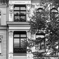
Residential and commercial building in closed development | Dittrichring 2 (map) |
1875–1876 (residential building) | Historic plastered building with stucco and sandstone decorations, striking corner tower to emphasize the location that characterizes the street scene, architect: Arwed Roßbach, significance in terms of building history, building art and the history of the site, monument text June 11, 1875 Building application by building contractor Franz Traugott Anton Schauer. The architect Arwed Rossbach (Bauer & Rossbach) provided the drafts for the building project. October 16, 1876 Revision of the completed building. Renovation work in the following period mainly affected the shops on the ground floor. In addition, there were occasional divisions of apartments in the years of the GDR. Comprehensive renovation in 1993, since then mainly used as a commercial building. Four-and-a-half-story corner building with a plan in the form of a dragon square, built in brickwork, plastered, parts of the facade decoration made of stucco and sandstone. Inside a courtyard that takes up the building's layout. A round corner tower is inserted between the obtuse-angled facades on Dittrichring and Schulstrasse, which effectively underlines the building's prominent urban position. The facades are designed the same. The ground floor and the entrance hall - combined by rusticated pillars - form the base zone, which appears strongly open with shop windows and house and shop entrances. The first and second floors rise above a cornice and are also conceived as a unit. A plaster groove covers the central zone. Their rectangular windows with finely profiled frames. In addition, to emphasize the center of each facade, an oriel extending over both floors is adorned with renaissance grotesques, and on top of the oriels balconies for the III. First floor. This is clearly raised with arched windows and pilasters, and a strong cornice with a tooth cut also contributes to this. A cornice on consoles closes off the façade at the top. As with some of the neighboring houses, the flat sloping roof is concealed by attics, here with balusters. On the corner tower, which is crowned by a domed roof, the décor gains much in plasticity, and it shows more clearly baroque tendencies than the rest of the facade decoration. The first and second floors are combined here by a column arrangement. French doors on the first floor with segment roofing, the window frames on the second floor with cartouche decorations. On the entablature carried by the columns stand in the III. Upper floor caryatids, which also support an entablature, above blasted gable with cartouche and dating: 1875. The house entrance on Dittrichring is relatively inconspicuous in the shop area of the ground floor and entresol, the house gate is ironed and provided with artistic bars. The house entrance is also a passage to the courtyard. The building has two stairwells, arranged on the main axis of the floor plan. Behind the corner tower is the main staircase on the courtyard side, and in the opposite corner there is a side staircase, probably originally for servants. The upper floors originally contained two apartments each, the main rooms of which faced the street. The courtyard-facing parts of the building accommodated the bedrooms and utility rooms. The round salon in the corner tower belonged to one of the two apartments. During the renovation in 1993, restoration of a historical wall and ceiling design from around 1895 (reconstruction of the first version not possible due to insufficient findings): pilasters with panels, ceiling fields with stucco rosettes, painting in red and green tones, accentuating grotesques. In the stairwell ceiling mirror with piece of flowers in free painting. In the shop or business space of the corner tower bronze figure "Roman Bocciaspieler", 1904, August Kraus (1868–1934, Berlin), loan from the Museum of Fine Arts Leipzig (original location in front of the east front of the museum building on Augustusplatz, installation 1909). The apartment and commercial building built by Arwed Rossbach is one of the most remarkable buildings of its time and type in downtown Leipzig, with particular reference to its urban presence. LfD / 2013 |
09298241 |
 More pictures |
Residential and commercial building in closed development | Dittrichring 4 (map) |
1875–1876 (residential building) | formerly with ballroom in the courtyard (plastered facade); Historic plastered building in Neo-Renaissance forms, with sandstone and stucco elements, facade decoration largely reconstructed, significance in terms of site development and building history Monument text June 2, 1875 Building application by the architect Ottomar Jummel on his own behalf (or client Dr. A. Trietzschler, July 1, 1875 repeated) , July 29, 1876 building inspection protocol. 1883 Conversion of the ground floor and mezzanine floor to create ancillary rooms, executed by master mason H. Br. Oehlschlegel. From 1905 (?) Hotel "Reichshof". 1932 property of the "Kreisverband Leipzig der Schreber- und Gartenvereine e. V. ”In 1938, due to extensive damage, the facade was renovated to a significant extent, the client“ Stadtgruppe Leipzig der Kleingärtner e. V. “, construction management architect Alfred Uttecht (Leipzig). Building badly damaged in the bombing raid on Dec. 4, 1943. During the GDR period “Central House for Cultural Work Leipzig”. 2004 Renewal of the facade. Four-and-a-half-story brick building with a plastered facade, plus decorative and structural elements in stucco and sandstone (largely lost in the original version), flat saddle roof. There was once a hall in the courtyard that burned down in 1943 and was subsequently removed. The front building and hall were connected by a narrow intermediate building. The ground floor originally opened in the middle with three shop windows of the same size, the arched closed entrances to the side. Already in 1883 the entrance situation changed, since then the middle entrance exists. The structure and decoration of the facade were once noticeably three-dimensional, the newly created historicizing facade design was less powerful in its individual forms. Broad strip of cornice between the ground floor and the entrance hall. The first and second floors, which rise above a strong cornice with a tooth cut, are connected by colossal pilasters. The side axes stand out decisively and open with balcony doors. The floor cornice in the back of the central area creates a certain balance to the verticality of the pilaster structure. The pilasters carry a bilge-like, again clearly three-dimensional cornice, which forms the dividing line to the third floor. This also has balcony doors in the outer axes, which were once framed by Hermen pilasters and, like the other balcony doors, were protected with elaborate bars. The remaining windows on the third floor have rounded arches, originally enriched with festoons. Above the cornice, which with its side projections follows the facade profile, originally a flat gable roof, which has now been replaced by a disfiguring roof extension. The ground floor, courtyard buildings and cellars initially served as a restaurant. The restaurant operator lived in the Entresol. The upper floors probably contained two apartments each. The later use as a hotel and then as an office building brought some changes inside. Today the building contains apartments and business premises again. Despite the eventful history of the building, some interior features from the early days have been preserved: stucco decoration and decorative tiles in the entrance area, decorative painting in the entrance area and in the stairwell, wooden stairs, apartment entrance doors. LfD / 2013 |
09298242 |
 More pictures |
Residential and commercial building | Dittrichring 6 (map) |
1875–1876 (residential and commercial building) | Residential and commercial building in closed development with gate passage and shops, rear building and side wing (lavishly decorated plastered stucco facade) |
09298243 |
 More pictures |
Residential and commercial building | Dittrichring 8 (map) |
1875–1876 (residential building) | Residential and commercial building in closed development in the corner of Thomaskirchhof |
09298244 |
 More pictures |
Residential and commercial building | Dittrichring 10 (card) |
1903–1904 (residential and commercial building) | Residential and commercial building in closed development with gate passage (magnificent Art Nouveau building) |
09298245 |
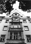 |
Parish and residential building | Dittrichring 12 (map) |
1902–1904 (parish office) | Parish and residential building with community hall in closed development, with gate passage (plastered facade with sandstone structure) |
09298246 |
 More pictures |
Residential and commercial building | Dittrichring 14 (map) |
1905–1906 (residential and commercial building); re. 1905 (residential and commercial building) | Residential and commercial building in closed development (sandstone facade) |
09298247 |
 |
Residential and commercial building | Dittrichring 16 (map) |
1904–1905 (residential building) | Residential and commercial building |
09298248 |
 More pictures |
Residential and commercial building | Dittrichring 18; 20; 20a (card) |
re. 1908 (residential and commercial building) | Residential and commercial building in open development and on a U-shaped floor plan, in the corner of Matthäikirchhof; (Plastered facades) |
09298249 |
 More pictures |
Office building ( "round corner" ) |
Dittrichring 22; 24 (card) |
1912/1913, around 1955 and 1980s (commercial building) | Office building of the former Leipziger Feuerversicherung with entrance to the Leipzig district administration of the Ministry for State Security of the GDR (round corner) and the main entrance opposite the mast with surveillance camera as well as an administrative building built to the north in the 1950s (address: Goerdelerring 20) with a large hall; high national history and memory value, great value for popular education, scientifically of great interest. |
09298250 |
 More pictures |
Richard Wagner Memorial | Georgiring (map) |
1983 (monument) | Richard Wagner Memorial (also Georgiring, Swan Pond) |
09290142 |
 More pictures |
Swan pond | Georgiring (map) |
1784 & 1960–1965 & 1997/1998 (Park) | Swan pond as part of the promenade ring, which goes back to Carl Friedrich Dauthe , between Goethestrasse and Georgiring, opera house and Willy-Brandt-Platz (renovated in 1997/1998) |
09290128 |
 More pictures |
Monument to Richard Wagner | Goerdelerring (map) |
1904 (monument) | Memorial for Richard Wagner, formerly in the Klingerhain of the Palmengarten park, made of Lasa marble with reliefs in an antique style depicting music, poetry and acting on the front, side depictions of Parsifal, Kundry, Siegfried, Mime and a dragon (unfinished, design Max Klinger , 2010 relocation to the new location); Part of an artistically significant total work of art of supraregional importance, importance for popular education, art history and city history |
09298201 |
 More pictures |
Gable relief | Goethestrasse (map) |
1864–1868 (pictorial work) | Gable relief from the former New Theater , placed in front of the opera terrace; Unique evidence in terms of urban history, the last remaining remnant of the New Theater on Augustusplatz, of interest in terms of architecture and art history |
09298449 |
 More pictures |
Monument to the Leipzig-Dresden Railway | Goethestrasse (map) |
1876 (monument) | Monument to the Leipzig-Dresden Railway (also Georgiring, Swan Pond) |
09290141 |
 More pictures |
Department store ( Königsbau ) |
Goethestrasse 1 (map) |
1911 & 1948–1950 & 1998/1999 (commercial building) | Department store in closed development in the corner of Grimmaische Strasse |
09298256 |
 More pictures |
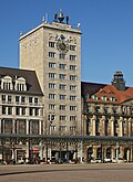
Bank and commercial building ( Krochhochhaus ) | Goethestrasse 2 (map) |
1927–1928 (commercial building) | Bank and commercial building in closed development, high-rise building with passage, top of a bell-ringer sculpture and passenger elevator with sliding safety device (compressed air), from 2010 Egyptian Museum of the University of Leipzig in the former counter hall; Supraregional historical and architectural-historical importance, architect: German Bestelmeyer , Munich, rarity, extraordinary urban development value |
09298257 |
 More pictures |
Commercial building | Goethestrasse 3–5 (map) |
1910–1911 (office building) | Commercial building (with three house numbers) in closed development |
09298258 |
 More pictures |
University administration building | Goethestrasse 7a; 7b; 7c (card) |
1860/1861 and late 19th century (Palais) | University administration building (see also: Ritterstraße 26) |
09298259 |
 More pictures |
Former trade fair palace | Grimmaische Strasse 1; 3; 5; 7 (card) |
1908/1909 (exhibition center) | Former trade fair palace in open development, with inner courtyard, passageways and shops (see also Reichsstraße 1–9, Salzgäßchen 6, Naschmarkt 3), today a hotel; one of the earliest trade fair palaces in the city, rarity, historical testimony, significance for popular education, architectural value, of architectural and local significance |
09298261 |
 More pictures |
Commercial building complex | Grimmaische Strasse 2; 4 (card) |
1912–1914 (exhibition center) | Commercial building complex in closed development with passage ( Mädlerpassage ) and restaurant Auerbachs Keller (sa: Neumarkt 14) |
09298264 |
| House facade | Grimmaische Strasse 6 (map) |
Late 19th century (commercial building) | Facade of a former commercial building in a closed development |
09298268 |
|
 More pictures |
Facade of a former trade fair palace (Zentral-Messepalast) | Grimmaische Strasse 8 (map) |
1912–1914 (exhibition center) | Facade of a former trade fair palace in closed development in the corner of Neumarkt 2–4 (shell limestone facade) |
09298276 |
 More pictures |
Extension of a trade fair building | Grimmaische Strasse 9; 11 (card) |
1904 (residential and commercial building) | Extension of the exhibition building at Reichsstrasse 2 (plastered facade) |
09298266 |
 More pictures |
patio | Grimmaische Strasse 13; 15 ( Hansahaus ) (map) |
1904/1906 (No. 13); 1909 (courtyard roofing No. 13) | Historic inner courtyard with magnificent portals and skylight construction; |
09298269
|
 More pictures |
Round bay window (copy) | Grimmaische Strasse 17 (map) |
1558 (bay window); 1983–1986 (copy) | Copy of a two-storey round bay window from the former princely house, the so-called princely house bay window (residential and commercial building not a monument); historically of importance as evidence of the cultivation of heritage in the GDR, artistically of interest, worth remembering |
09303664 |
| Residential and commercial building | Grimmaische Strasse 19 (map) |
1976–1983 (residential and commercial building) | Residential and commercial building in the corner of Nikolaistraße 2 and Nikolaikirchhof with a mural Flora in der Waage in the pharmacy and the baroque house sign of a golden lion, formerly the district pharmacy |
09302373 |
|
 |
Commercial building | Grimmaische Strasse 21 (map) |
1907/1908 (commercial building) | Commercial building in closed development (also Nikolaikirchhof 5; sandstone facade) |
09298272 |
| Former exhibition center | Grimmaische Strasse 26 (map) |
1928 (commercial building) | Former trade fair building in closed development |
09298271 |
|
| Residential and commercial building | Grosse Fleischergasse 2 (map) |
1826–1832 (residential building) | Residential and commercial building in half-open development in the corner of Richard-Wagner-Platz 1, with passage and courtyard building (plastered facade) |
09298278 |
|
| Hotel Bürgerhof | Grosse Fleischergasse 4 (map) |
Hotel Bürgerhof, today a commercial building in half-open development (plastered facade) |
09298281 |
||
 More pictures |
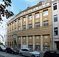
Former exhibition center ( Jägerhof ) | Grosse Fleischergasse 11; 13 (card) |
1913/1914 (exhibition center) | Former exhibition building, today residential and commercial building in a formerly closed development, with passage to Hainstrasse 17-19 and cinema (plastered facade) |
09298282 |
 |
Residential and commercial building | Grosse Fleischergasse 19 (map) |
around 1900 (residential and commercial building) | Residential and commercial building in semi-open development, with passage (clinker brick facade) |
09299169 |
 More pictures |
Residential and trading house ( Barthels Hof ) | Hainstrasse 1 (map) |
1747–1750 and 1870/71 (residential building) | Residential and trading house in closed development with a courtyard (see Markt 8 and Kleine Fleischergasse 2; plastered facade; formerly Haus zur Goldenen Schlange) |
09298285 |
 |
Residential and commercial building | Hainstrasse 2; 2a (card) |
around 1900 (residential and commercial building) | Residential and commercial building in closed development (see Markt 7; plastered facade) |
09298288 |
 More pictures |
Residential and trading house ( Webers Hof ) | Hainstrasse 3 (map) |
1662, later changed (residential building) | Residential and trading house in closed development with passage to Barthels Hof (plastered facade) |
09298290 |
 |
Residential building | Hainstrasse 4 (map) |
18th century, changed around 1900 (residential building) | Residential house in closed development with a shop area (plastered facade) |
09298291 |
| Commercial building | Hainstrasse 5 (map) |
1905–1907 (commercial building) | Commercial building in closed development (also Kleine Fleischergasse 8) |
09298303 |
|
| Remnants of a demolished house | Hainstrasse 6 (map) |
16th, 18th and 19th centuries (wall) | Remnants of the house demolished in 1994 (gable walls, cellar, painted wooden beam ceilings) included in the new building |
09298292 |
|
 More pictures |
Residential and commercial building | Hainstrasse 8 (map) |
around 1550 (residential building) | Residential and commercial building in closed development with shop (plastered facade) |
09298293 |
 More pictures |
Residential and commercial building | Hainstrasse 9 (map) |
re. 1909 (residential and commercial building) | Residential and commercial building in closed development with passage and small courtyard as well as original pharmacy equipment (eagle pharmacy), (sandstone facade) |
09298294 |
 More pictures |
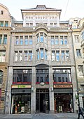
Residential and commercial building ( Großer Joachimsthal ) |
Hainstrasse 10 (map) |
1906/1907 (residential and commercial building) | Residential and commercial building in closed development (sandstone facade); |
09298295 |
 More pictures |
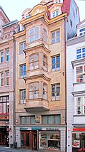
Residential and commercial property (Grauer Wolf) |
Hainstrasse 11 (map) |
Residential and commercial building plot in closed development with passage and shops (limestone facade) |
09298296 |
|
 More pictures |
Residential building | Hainstrasse 13 (map) |
1746 (residential building) | House in closed development with shop |
09298298 |
 More pictures |
Residential and commercial building ( Blue and Golden Star ) | Hainstrasse 14 (map) |
around 1875 (residential and commercial building) | Residential and commercial building in closed development with passage and shops (plastered facade) |
09298299 |
 More pictures |
Residential building | Hainstrasse 15 (map) |
1695 (residential building) | Baroque residential building in closed development with courtyard building (transom walls in the southwest corner around 1695; plastered facade) |
09298300 |
 More pictures |
Former hotel | Hainstrasse 16; 18 (card) |
1847/48, rebuilt 1891/92 (hotel) | Former hotel in closed development, later administrative building of the Leipzig Trade Fair, with halls and shop area (plastered facade); outstanding artistic, architectural and historical significance, memorable value, rarity |
09298301 |
 More pictures |
Former exhibition center ( Jägerhof ) | Hainstrasse 17; 17a; 17b; 19 (card) |
1913/1914 (exhibition center) | Former trade fair building in semi-open development with passage to Große Fleischergasse 11–13 (limestone facade) |
09298283 |
| Commercial building | Hainstrasse 20; 22; 24 (card) |
re. 1911/1912 (office building) | Commercial building in closed development (plastered facade) |
09298302 |
|
|
|
Sales pavilion | Hainstrasse 23 (map) |
around 1960 (pavilion), 2012 demolition for the construction of the " Hainspitze " house | Large sales pavilion between Hainstrasse and Großer Fleischergasse with a curved main front, generously glazed |
09299168 |
 More pictures |
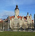
Town Hall ( New Town Hall ) | Hugo-Licht-Strasse 2 (map) |
1899–1905 (administration building) | Town hall with furnishings, tower and council cellar; monumental administration building in the quarter with Lotterstraße and Burgplatz, address at Martin-Luther-Ring 4/6 |
09299638 |
 More pictures |
Manual pump | Katharinenstrasse (map) |
after 1850 (hand lever pump) | Hand lever pump with well shaft and cover plate in front of No. 9 (type Delphin) |
09294778 |
 More pictures |
Residential building | Katharinenstrasse 3 (map) |
1708–1710 (residential building) | Residential house in closed development with a shop area (plastered facade) |
09298305 |
 More pictures |
Neon advertising for the penguin milk bar | Katharinenstrasse 4 (map) |
around 1975 (advertisement) | Neon advertising for the Pinguin-Milchbar (penguin boom and lettering); Rarity value, memorable value, document of the GDR advertising history |
09261917 |
| Isolator neon advertising | Katharinenstrasse 10 (map) |
around 1970 (advertisement) | Insulator neon advertising in the north foyer of the Museum of Fine Arts Leipzig (formerly on the gable of the apartment building Talstrasse 3 on Prager Strasse) |
09261580 |
|
 More pictures |
Residential and trading house | Katharinenstrasse 11 (map) |
16th century (residential building) | Residential and trading house with three historical wings, passage, courtyard and furnishings, spot relief ins. 1535; Rarity value, scientific-documentary value, architectural and artistic with high value (plastered facade) |
09298306 |
 |
Residential and commercial building | Katharinenstrasse 13 (map) |
re. 1896 (residential and commercial building) | Residential and commercial building in closed development with passage (natural stone plaster facade) |
09298307 |
 |
Commercial building | Katharinenstrasse 15 (map) |
1911/1912, re. 1912 (office building) | Commercial building in closed development |
09298308 |
 More pictures |
Handelshof | Katharinenstrasse 17 (map) |
1910/1911 (office building) | Trading courtyard in closed development, with passage and shops; (Sandstone facade) |
09298311 |
 More pictures |
Residential and trading house | Katharinenstrasse 19 (map) |
1748/1749 (residential building) | Residential and trading house in closed development with gate passage and shops as well as courtyard building; (Plaster facade) |
09298309 |
 More pictures |
Residential and trading house | Katharinenstrasse 21 (map) |
1750–1752 (residential building) | Residential and trading house in closed development with gate passage and courtyard building; (Plaster facade) |
09298310 |
 More pictures |
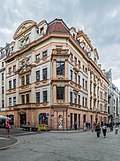
City Palace | Katharinenstrasse 23 (map) |
1701–1704 (palace) | Magnificent bourgeois city palace in the corner of Brühl with gate passage and shops as well as courtyard buildings and courtyard (plastered facade) |
09298219 |
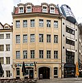
 More pictures |
Fountain | Kleine Fleischergasse (map) |
1913 (secondary facility) | Fountain in a small square, made of red granite |
09298417 |
 |
Residential and trading house | Kleine Fleischergasse 2 (map) |
1747–1750, 1870/1871 (residential house) | Residential and trading house in closed development with through courtyard (see Markt 8 and Hainstrasse 1) and connection to Webers Hof (plastered facade) |
09298287 |
 More pictures |
Residential and commercial building ( Zum Arabischen Coffe Baum ) | Kleine Fleischergasse 4 (map) |
around 1570, 1694, 1718 (residential building) | Residential and commercial building in closed development with courtyard wings (since 1694 or 1711 coffee house; plastered facade) |
09298312 |
| House sign | Kleine Fleischergasse 6 (map) |
around 1800 (accessories) | House sign with a ship on a new building from GDR times |
09298313 |
|
 More pictures |
Commercial building ( Kleines Joachimsthal ) | Kleine Fleischergasse 8 (map) |
1905-1907, re. 1906 (commercial building) | Commercial building in closed development with passage (see Hainstraße 5; plastered facade) |
09298304 |
| Residential and commercial building | Klostergasse 3 (map) |
around 1880 (residential building) | Residential and commercial building with restaurant; only the facade and the rear are protected (building gutted) |
09298314 |
|
 More pictures |
Residential and trading house | Klostergasse 5 (map) |
1753–1755 (residential building) | Residential and trading house as a four-wing complex, in closed development with gate passage (plastered facade) |
09298315 |
 More pictures |
Commercial building | Klostergasse 16 (map) |
around 1885 (office building) | Commercial building in semi-open development with passage to Markt 10 (sandstone plaster facade) |
09298316 |
|
|
Commercial building | Klostergasse 18 (map) |
1887/1888 (residential building) | Commercial building in closed development in the corner of Barfußgäßchen 9 with restaurant (plastered sandstone facade) |
09298213 |
 More pictures |
Former trade fair palace | Kupfergasse 1 (map) |
1893–1901 (exhibition center) (municipal department store) | Former trade fair palace in open development with inner courtyard (see Neumarkt 9–19 and Universitätsstraße 16; plastered facade) |
09298452 |
 More pictures |
Former exhibition center | Kupfergasse 2 (map) |
1912/1913 (exhibition hall) ( Dresdner Hof ) | Former trade fair building in closed development in the corner of Neumarkt, today dormitory with a shop area (see Neumarkt 21–27; cabaret in the basement) |
09298318 |
 |
Thaer Monument: Monument to the agricultural scientist Albrecht Daniel Thaer (1752-1828) | Kurt-Masur-Platz (map) |
1850, erection (monument) | Bronze figure of the scholar in contemporary clothing, related to classical models through habitus and gestures, marble base reconstructed, sculptor: Ernst Rietschel, of personal history and artistic importance |
09295759 |
 More pictures |
Moritzbastei: fortifications | Kurt-Masur-Platz 1 (map) |
1549/1550 (fortifications) | Renaissance fortifications with a large coat of arms, today the Leipzig University student club |
09298415 |
| Spherical pyramid: memorial to the Thirty Years War | Kurt-Masur-Platz 9 (near) (map) |
around 1640 (monument) | Memorial to the memory of the battles for Leipzig in the Thirty Years War, piled up from cannonballs, with inscription plaque made of cast steel; Unique historical record, memorable value, importance for popular education |
09299643 |
|
 More pictures |
Town Hall ( New Town Hall ) | Lotterstrasse 1 (map) |
Built 1899–1905 (town hall) | New Leipzig City Hall with Ratskeller restaurant (see Martin-Luther-Ring 4/6) |
09299669 |
 More pictures |
Manual pump | Magazingasse (map) |
after 1910 (hand lever pump) | Hand lever pump with well shaft and cover plate corner Neumarkt (bird cage type) |
09290375 |
 More pictures |
Residential and commercial building | Magazingasse 1 (map) |
1911 (office building) | Residential and commercial building in closed development in corner location Neumarkt 31–33 (limestone facade) |
09298322 |
 |
Residential and commercial building | Magazingasse 2 (map) |
1860 (office building) | Residential and commercial building in closed development in the corner of Neumarkt (see also: Schillerstraße 4; natural stone facade) |
09298324 |
 More pictures |
Accumulator house | Magazingasse 3 (map) |
1894/1895 (power station) | Accumulator house (representative clinker brick building; monument to the history of technology) |
09298327 |
 More pictures |
Commercial building | Magazingasse 4 (map) |
1862–1864 (commercial building) | Commercial building in closed development (see Schillerstraße 5) |
09298328 |
 More pictures |
Commercial building | Magazingasse 6 (map) |
1863 (residential and commercial building) | Commercial building in semi-open development (see Schillerstraße 6; sandstone facade) |
09298330 |
| Commercial building | Magazingasse 7 (map) |
around 1920 (office building) | Commercial building |
09298332 |
|
 |
Bank building | Markgrafenstrasse 1 (map) |
1898–1901 (bank building) | Bank building in the corner (see also Martin-Luther-Ring 2); Building in an exposed location (natural stone facade) |
09298333 |
 More pictures |
Commercial building ( Merkurhaus ) | Markgrafenstrasse 2 (map) |
1937 (commercial building) | Commercial building in a formerly closed development on the corner of Petersstrasse (see also: Schloßgasse 3–5); |
09298336 |
| Administrative building | Markgrafenstrasse 3; 5 (card) |
1908–1912 (administration building) | Municipal administration building in the corner of Burgplatz 1 (see also Martin-Luther-Ring 8-10 and Lotterstraße; shell limestone facade) |
09298335 |
|
 More pictures |
Residential and commercial building | Markgrafenstrasse 10 (map) |
1900–1901 (residential and commercial building) | Residential and commercial building in closed development with a shop area (see also: Schulstrasse 3; sandstone facade) |
09298338 |
 |
Pavement | Market (map) |
1924 (pavement) | Historic street pavement with city arms made of different colored stones; of urban history and artistic importance |
09290352 |
 More pictures |
Staircase | Market (map) |
1924 (exhibition center); 1986–1988 (new hall); 1924 (staircase) | Representative staircase in the former, only underground exhibition hall in the world (stone made of Rochlitz porphyry tuff; Art Deco decoration; the hall demolished in connection with the construction of the City Tunnel ) |
09298340 |
 More pictures |
Old City Hall Leipzig | Market 1 (map) |
1556 (town hall); re. 1909 (town hall); 1918 (Bötticher / Bormann) | Old City Hall Leipzig in open development with city history museum and shop area, fountain, memorial plaque; stately renaissance building, high architectural and architectural historical value, significance for the city's history |
09298341 |
 More pictures |
facade | Market 4 (map) |
1555, 1963/1964 (reconstruction) | Reconstructed facade of the Alte Waage |
09298342 |
 |
Bank building | Market 5 (map) |
1909 (bank building) | Bank building in closed development (shell limestone facade) |
09298343 |
 |
Residential and commercial building | Market 6 (map) |
1922 (residential and commercial building) | Residential and commercial building in closed development with access via No. 5 (shell limestone plaster facade) |
09298344 |
 |
House facades and roof | Market 7 (map) |
around 1580, 1820 (renovation) | Facades and roof of a residential and commercial building in closed development in the corner of Hainstrasse 2 (plastered facade) |
09298289 |
 |
Residential and trading house | Market 8 (map) |
1747–1750, 1870/71 (residential house) | Residential and trading house in closed development with a courtyard (see also: Hainstrasse 1 and Kleine Fleischergasse 2; plastered facade) |
09298286 |
 More pictures |
Commercial building ( King Albert House ) |
Market 9 (map) |
1912/1913 (office building) | Commercial building in closed development in the corner of Barfußgäßchen 2–8 with a courtyard |
09298345 |
 |
Residential and commercial building | Market 10; 10a; 10b; 10c (card) |
1846 (office building) | Residential and commercial building in closed development with a courtyard to Klostergasse 16 (richly decorated plastered facade) |
09298317 |
 More pictures |
Residential building | Markt 17 (map) |
around 1560 (office building) | Residential building (plastered facade) with shops and passage; 1706/1707 remodeled in baroque style, accommodation for various kings, with passage and staircase spindle |
09298346 |
| Park | Martin Luther Ring (map) |
Park (see Dittrichring) |
09292774 |
||
| Underground toilet facility | Martin Luther Ring (map) |
around 1905 (public lavatory) | Underground toilet facility in the promenade, opposite the Hugo-Licht-Strasse confluence (exits with white facing bricks) |
09301282 |
|
 More pictures |
Bank building | Martin-Luther-Ring 2 (map) |
1898–1901 (bank building) | Bank building in the corner (see also Markgrafenstrasse 1); Building in an exposed location (natural stone facade) |
09298334 |
 More pictures |
Town Hall ( New Town Hall ) | Martin Luther Ring 4; 6 (card) |
1899–1905 (town hall); 1936 (paternoster) | New Leipzig City Hall, multi-wing administrative building with tower and inner courtyards and original furnishings, u. a. Paternoster (shell limestone facade, see Hugo-Licht-Straße 2); Great historicism building with Art Nouveau character as a unique historical document of the city of Leipzig, memorable and documentary value, wide-spread urban development accent on the edge of the old town center, also the remains of the former Pleißenburg of high scientific and documentary value |
09298347 |
| Administrative building | Martin Luther Ring 8; 8a; 10 (card) |
1908–1912 (administration building) | Municipal administration building with registry office (see Burgplatz 1 and Markgrafenstraße 3) |
09298233 |
|
 More pictures |
Lion fountain | Naschmarkt (map) |
1820 (fountain) | Löwenbrunnen, hand lever pump with well shaft on Grimmaische Strasse |
09298442 |
 More pictures |
Goethe monument | Naschmarkt (map) |
1903 (inauguration) | Goethe monument in a designed complex; (Bronze sculpture of the poet in period costume, on natural stone plinth with substructure) |
09298441 |
 More pictures |
Exchange building | Naschmarkt 2 (map) |
1678 application for establishment (stock exchange) | Exchange building, with flight of stairs and fencing; baroque plastered building with representative staircase and sculptures, oldest meeting house of the Leipzig merchants and first baroque building in Leipzig, of architectural and artistic interest, value for popular education, high scientific and documentary value, criterion of rarity |
09298440 |
 More pictures |
Manual pump | Neumarkt (map) |
1910 (manual pump) | Hand pump with well shaft and cover plate in front of No. 2 at the corner of Grimmaische Strasse (Gothic style); re-erected after renovation in 2002 |
09294781 |
 More pictures |
Manual pump | Neumarkt (map) |
1910 (manual pump) | Hand lever pump with well shaft and cover plate in front of No. 24 (type Großer Löwe) |
09294780 |
| House facade | Neumarkt 2 (map) |
around 1880 (office building) | Facade of a former commercial building in a closed development |
09298348 |
|
 More pictures |
House facade ( central exhibition palace ) |
Neumarkt 2 (map) |
1912–1914 (exhibition center) | Facade of a former trade fair palace in closed development in the corner of Grimmaische Strasse (shell limestone facade) |
09298277 |
 More pictures |
Former trade fair palace | Neumarkt 9 (map) |
1893–1901 (exhibition center) | Former trade fair palace in the corner of Kupfergasse 1 and Universitätsstraße 16 with inner courtyard, passageways (plastered facade) |
09298453 |
 |
Exhibition building | Neumarkt 14 (map) |
1912–1914 (exhibition center) | s. Grimmaische Strasse 2-4 |
09298265 |
 More pictures |
House facade (Messehof) | Neumarkt 16; 18 (card) |
1949/50 (exhibition building) | Facade of a former trade fair building with a shop area (see also Petersstrasse 15; gutting of the building complex in 2006 and distorting changes by widening the passage) |
09298349 |
 More pictures |
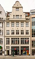
Former fair building at Dresdner Hof | Neumarkt 21; 23; 25; 27 (card) |
1912/1913 (exhibition center) | Former trade fair building in a closed area on the corner of Kupfergasse 2, today a dormitory, with a shop area; |
09298319 |
 |
Residential and commercial building | Neumarkt 24 (map) |
around 1912 (residential and commercial building) | Residential and commercial building |
09298351 |
 |
Residential and commercial building | Neumarkt 26 (map) |
around 1910 (residential and commercial building) | Residential and commercial building in closed development in the corner of Preußergäßchen 13; |
09298360 |
 |
Facade of a department store | Neumarkt 28; 30 (card) |
re. 1868 (facade) | Facade of a department store in a closed development (department store house address: Petersstraße 31) |
09298352 |
 |
Residential and commercial building | Neumarkt 31; 33 (card) |
1911 (office building) | Residential and commercial building in closed development in the corner of Magazingasse 1 (limestone facade); |
09298323 |
 |
Residential and commercial building | Neumarkt 35 (map) |
1859–1862 (commercial building) | Residential and commercial building (see also: Schillerstraße 4 and Magazingasse 2) |
09298326 |
 |
House facade | Neumarkt 38 (map) |
re. 1868 (facade) | Facade of a residential and commercial building in closed development (today part of a department store); beautiful plastered facade with stucco decoration and sandstone inclusions, historically important |
09298355 |
| House facade and staircase | Neumarkt 40 (map) |
re. 1867 (facade) | Façade and staircase of a former residential and commercial building (with two house numbers, today part of a department store) in closed development and in the corner at Peterskirchhof 3; beautiful plastered facade with stucco decoration and sandstone structures, highlighted by corner bay windows, the very beautiful staircase demolished during renovation and reinserted into the new building, facade of architectural significance |
09298356 |
|
| Commercial building | Neumarkt 42 (map) |
1870 (commercial building) | s. Schillerstrasse 3 |
09298357 |
|
 More pictures |
Former community school | Nikolaikirchhof 2 (map) |
1553 & 1730 (school) | Former community school in closed development on the corner of Nikolaistraße, temporarily used by the University's Museum of Antiquities and Automatic Museum (seat of the Leipzig Cultural Foundation; plastered facade; stairwell and side wing demolished) |
09298363 |
 More pictures |
Residential, parish and community center | Nikolaikirchhof 3; 4 (card) |
1886/1887 (parish hall) | Residential, parish and community building (with two house numbers) in closed development in the corner of Ritterstraße; richly designed plaster facade with porphyry structure, monumental building with emphasis on the church square through gables and two oriels, corner emphasis through polygonal oriels with spire, in the style of the German Neo-Renaissance based on old Leipzig buildings, architect: Hugo Licht , building history, art history, artistically and characterizing the square significant |
09298364 |
 More pictures |
Nikolaikirche | Nikolaikirchhof 4b (map) |
1513, 1784–1797 (church) | Church (with equipment) |
09298362 |
 |
Commercial building | Nikolaikirchhof 5 (map) |
1907/1908 (commercial building) | Commercial building in closed development on the property with Grimmaische Strasse 21 (plastered facade) |
09298273 |
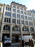
| More pictures | Commercial building | Nikolaistraße 3 (map) |
1928–1929 (commercial building) | Commercial building in closed development, extension of Specks Hof (Nikolaistraße 5/7 etc.) |
09298366 |
 More pictures |
Residential and commercial building | Nikolaistrasse 12; 14 (card) |
1911–1912 (commercial building) | Closed residential and commercial building with a passage and courtyard wings |
09298365 |
 More pictures |
Commercial building ( Golden Hand ) |
Nikolaistraße 16 (map) |
re. 1855 (commercial building) | Commercial building in closed development with passage and courtyard buildings (plastered facade) |
09298370 |
 More pictures |
Keystone | Nikolaistraße 18 (map) |
re. 1832 (accessory) | Keystone with a jumping horse as a house sign from the previous house Blue Horse |
09298371 |
 More pictures |
Business and manufacturing buildings | Nikolaistrasse 20; 22; 24; 26 (card) |
1895-1897 (No. 24); 1907-1908 (No. 20/22); 1907–1908 (No. 26) | Business and production building Oelßners Hof in closed development with a courtyard to Ritterstraße 23–29 (sandstone facade) |
09298382 |
 |
Commercial building | Nikolaistraße 25 (map) |
1913 (office building) | Commercial building in closed development |
09298372 |
 More pictures |
Commercial building ( zeppelin house ) | Nikolaistrasse 27; 29 (card) |
1911–1912 (commercial building) | Commercial building in closed development with passage and inner courtyard (limestone facade) |
09298373 |
 More pictures |
Commercial building | Nikolaistrasse 28; 30; 32 (card) |
re. 1907 (commercial building) | Steibs Hof commercial building in a formerly closed development with a passage and a magnificent shop zone (sandstone plaster facade) |
09298374 |
 More pictures |
Commercial building | Nikolaistrasse 33; 35; 37 (card) |
1912–1914 (commercial building) | Commercial building in closed development |
09298375 |
 More pictures |
Commercial building | Nikolaistraße 36 (map) |
1910–1911 (office building) | Commercial building in a formerly closed development (natural stone facade) |
09298376 |
| Commercial building | Nikolaistraße 38 (map) |
1897–1898 (commercial building) | Commercial building in closed development (sandstone facade) |
09298377 |
|
 More pictures |
"Blauer Hecht" commercial building |
Nikolaistrasse 39; 41; 43; 45 (card) |
1911–1912 (commercial building) | Commercial building and storage building in closed development with passage and shops (limestone facade) |
09298378 |
 More pictures |
Hotel construction | Nikolaistraße 42 (map) |
Hotel construction in closed development in the corner of Brühl and Richard-Wagner-Straße 7; strikingly structured plastered facade, characteristic construction between late historicism and reform style, of architectural and local significance, location opposite the main train station |
09298223 |
|
 More pictures |
Commercial building ( Selters house ) |
Nikolaistrasse 47; 49; 51 (card) |
1907–1908 (commercial building) | Commercial building in closed development with passage |
09298379 |
 More pictures |
Commercial building The black horseshoe |
Nikolaistraße 55 (map) |
1912–1913 (office building) | Commercial building in today's half-open development in the corner of Brühl (limestone facade) |
09298380 |
 More pictures |
Commercial building ( Harmelin House ) | Nikolaistrasse 57; 59 (card) |
1913–1914 (commercial building) | Commercial building in a formerly closed development in the corner of Richard-Wagner-Straße; Richly structured shell limestone facade in the reform style of the time around 1910, facade emphasized by several oriels, of architectural and local significance, location-defining location opposite the main station |
09298381 |
 More pictures |
Former exhibition center | Nikolaistrasse 5; 7; 9 (card) |
1908–1909 (exhibition center) | Former fair building in closed development (see Reichsstraße 4–6 and Schuhmachergäßchen 2–4) |
09298367 |
| Former exhibition center | Peterskirchhof 1 (map) |
re. 1914–1916 (exhibition center) | Former trade fair building in closed development on the corner at Petersstrasse 39-41 (shell limestone facade) |
09298388 |
|
| Former bank building | Peterskirchhof 2 (map) |
1886–1888 (bank building) | Former bank building, today a music school in a semi-open development in Petersstrasse, magnificent facade also facing Schillerstrasse (sandstone facade) |
09298384 |
|
| Facade and stairwell | Peterskirchhof 3 (map) |
around 1870 (residential and commercial building) | Façade and stairwell of a former residential and commercial building (with two house numbers, today part of a department store) in closed development and in corner location Neumarkt 30 (then a copy of the façade of the former house No. 3 with underground car park entrance to the Karstadt department store and here reliefs that formerly at the corner of Petersstrasse and Preussergäßchen); beautiful plastered facade with stucco decoration and sandstone structures, highlighted by corner bay windows, the very beautiful staircase demolished during renovation and reinserted into the new building, facade of architectural significance |
09298387 |
|
| Residential and commercial building | Peterskirchhof 4 (map) |
around 1870 (office building) | Residential and commercial building (see also: Schillerstraße 3 and Neumarkt 42) |
09298359 |
|
 More pictures |
House facade (Messehof) | Petersstrasse 15 (map) |
1949/1950 (exhibition center) | Façade of a former exhibition building (without a curtain glass front), in closed development, as well as entrance area with preserved natural stone facing and so-called mushroom pillar (see also: Neumarkt 16–18; gutting of the entire building in 2006 and disfiguring passage installation as well as disfiguring façade pre-glare above the entrance in 2007) |
09298350 |
 More pictures |
Commercial building | Petersstrasse 16 (map) |
1913 (office building) | Commercial building in closed development, access via Thomaskirchhof 8 (plastered facade) |
09298390 |
 More pictures |
Commercial building | Petersstrasse 18 (map) |
1912–1913 (office building) | Commercial building in closed development (sandstone facade) |
09298391 |
 More pictures |
House facade, walls and the rest of the stair spindle | Petersstrasse 20 (map) |
re. 1927–1929, partial demolition in 2004 (exhibition building) | Façade, surrounding walls of the atrium and the rest of the staircase spindles of the former Petershof exhibition center in closed development (also Burgstrasse 7–13 and Sporergäßchen 6–12 and Thomaskirchhof 9) as well as illuminated advertising for the “Capitol” cinema (in the Leipzig Contemporary History Forum); |
09298238 |
 |
Commercial building | Petersstrasse 22 (map) |
1910–1911 (office building) | Commercial building in closed development (plastered facade) |
09298392 |
 More pictures |
Residential and commercial building | Petersstrasse 24 (map) |
1749/1750 (residential and commercial building) | Residential and commercial building in closed development in the corner of Sporergäßchen, with inner courtyard and relief (plastered facade); To the Greenlander |
09298393 |
 More pictures |
Former exhibition center (Concentrahaus) | Petersstrasse 26 (map) |
1920 (exhibition building) | Former exhibition building in closed development in the corner of Sporergäßchen (plastered facade) |
09298394 |
 More pictures |
Residential and commercial building | Petersstrasse 30 (map) |
1884–1885 (residential and commercial building) | Residential and commercial building in closed development (clinker-sandstone facade) |
09298396 |
| Facades of a department store | Petersstrasse 31 (map) |
1914/1915 (department store) | Facades of a department store in closed development in the corner of Preußergäßchen 2–4 (see also Neumarkt) and today reliefs by Thiele in the entrance to the underground car park at the Peterskirchhof , the facades of former tenement houses at Neumarkt and Peterskirchhof together with the staircase in the corner building at Neumarkt / Peterskirchhof and iron candelabra in the courtyard; National value in terms of building history, importance in terms of urban history and urban development history |
09298353 |
|
 More pictures |
Former exhibition center (Three Kings) | Petersstrasse 32; 34 (card) |
1914–1916 (exhibition center) | Former trade fair building in closed development with shops and formerly gable-sided advertising for Margon water (plastered facade with natural stone integration) |
09298397 |
 More pictures |
Former exhibition center (Stentzlers Hof) | Petersstrasse 39; 41 (card) |
re. 1914–1916 (exhibition center) | Former trade fair building in closed development in the corner of Peterskirchhof with box oriel from 1690 and house sign "Goldener Hirsch" from the former property no. 37 (natural stone facade, see also: Peterskirchhof 1) |
09298389 |
 More pictures |
Bank building ( Reichsbank ) | Petersstrasse 43 (map) |
1886–1888 (bank building) | Former bank building, today a music school in a semi-open development in the corner of Peterskirchhof 2 and Schillerstraße, with the extension of the former Café Richter including the furnishings as well as the inner courtyard and enclosure at the Peterskirchhof; (Sandstone facade) |
09298386 |
 More pictures |
Residential and commercial building | Petersstrasse 46 (map) |
1887–1888 (residential and commercial building) | Residential and commercial building in closed development (sandstone facade) |
09298398 |
 More pictures |
House facades | Petersstrasse 48 (map) |
1887–1888 (facade) | Facades of a residential and commercial building in closed development in the corner of Schloßgasse 2–4 and equipment of the entrance area (plastered facade) |
09298399 |
| Facade of a department store | Preussergäßchen 2 (map) |
1914/1915 (facade); 1914/1915 (total component) | Facade of a department store (see Petersstrasse 31, Neumarkt 28/30 and Peterskirchhof 3); Building historical and artistic national value, urban history and urban core development historical importance, memorable value, documentation value. Designed by Philipp Schaefer |
09298354 |
|
| Residential and commercial building | Preußgäßchen 13 (map) |
around 1910 (residential and commercial building) | s. Neumarkt 26 |
09298361 |
|
 |
Residential and commercial building | Ratsfreischulstrasse 2 (map) |
around 1870 (residential and commercial building) | Residential and commercial building in closed development (plastered facade) |
09298418 |
 |
Residential and commercial building | Ratsfreischulstrasse 3 (map) |
1900–1901 (residential and commercial building) | Residential and commercial building in closed development (see also: Markgrafenstraße 10) |
09298339 |
 |
Residential and commercial building | Ratsfreischulstrasse 4 (map) |
around 1870 (residential building) | Residential and commercial building in closed development (plastered facade) |
09298419 |
 |
Residential and commercial building | Ratsfreischulstrasse 6 (map) |
around 1870 (residential building) | Residential and commercial building in closed development (plastered facade) |
09298420 |
 |
Residential and commercial building | Ratsfreischulstrasse 8 (map) |
around 1870 (residential building) | Residential and commercial building in closed development (plastered facade) |
09298421 |
 |
Residential and commercial building | Ratsfreischulstrasse 10 (map) |
around 1870 (residential building) | Residential and commercial building in closed development (plastered facade with rich stucco structure) |
09298422 |
 |
plastic | Reichsstrasse (map) |
re. 1968 (plastic) | "Young couple" sculpture by Klaus Schwabe in the green area opposite Reichsstrasse 11 |
09290496 |
 |
Messepalast | Reichsstrasse 1; 3; 5; 7; 9 (card) |
1908/1909 (exhibition center) | Messepalast (see Grimmaische Strasse 1–7, Salzgäßchen 6, Naschmarkt 3); |
09298262 |
 More pictures |
Mustermesse House Reichshof | Reichsstrasse 2 (map) |
1896 (residential and commercial building) | Model fair building, today a commercial building (see also Grimmaische Straße 9/11) |
09298267 |
 More pictures |
Former trade fair palace | Reichsstrasse 4; 6 (card) |
1908/1909 (exhibition center) | Former trade fair palace in closed development in the corner of Schuhmachergäßchen with a passage (see also Nikolaistraße 5-9 and Schuhmachergäßchen 2/4); in the fountain passage, formerly with a bronze figure by Victor Seifert and a memorial plaque from the previous building for the comedy poet Roderich Benedix |
09298368 |
| Fountain with bronze sculptures | Reichsstrasse 11 (map) |
1964 (secondary system) | Fountain with bronze sculptures in the inner courtyard of the new residential building in the corner of Katharinenstrasse 2 / Salzgäßchen / Sachsenplatz |
09290515 |
|
 More pictures |
Bronze seated figure | Richard-Wagner-Platz (map) |
1851 (monument) | Bronze seated figure ( Samuel Hahnemann ) on marble base with enclosure (in the enclosures of the promenade ring) |
09290060 |
 More pictures |
Three fountain sculptures | Richard-Wagner-Platz (map) |
1972 (fountain) | Stahl, the constructivist fountain sculptures by Harry Müller in the form of flowers ( dandelions ), once part of the open space design of Sachsenplatz, of art history and artistic importance |
09304873 |
 More pictures |
Residential and commercial building (Großer Blumenberg) | Richard-Wagner-Platz 1 (map) |
1826–1832, 1964 (residential building) | Residential and commercial building in semi-open development in the corner at Große Fleischergasse 2 with drive-through and rear building (plastered facade) |
09298279 |
 More pictures |
Hotel construction | Richard-Wagner-Strasse 7 (map) |
Hotel construction in closed development in the corner at Nikolaistraße 42 and Front zum Brühl; strikingly structured plastered facade, characteristic construction between late historicism and reform style, of architectural and local significance, location opposite the main train station |
09298280 |
|
| Commercial building | Richard-Wagner-Strasse 10 (map) |
1908–1909 (commercial building) | Commercial building in closed development in corner location Am Hallischen Tor (plastered facade) |
09298401 |
|
| Well shaft | Ritterstrasse (map) |
Well shaft with cover plate for a manual pump, in a corner position (next to the entrance to the Royal Palace) |
09298656 |
||
 More pictures |
Residential and commercial building | Ritterstrasse 5 (map) |
1896–1897 (residential and commercial building) | Residential and commercial building in closed development with courtyard buildings; representative historic clinker brick facade with sandstone structure, hood-crowned bay window and side elevation with stepped gable, historically important |
09298402 |
 More pictures |
House facade | Ritterstrasse 7 (map) |
1701–1703 (facade) | Facade of a former residential building; Baroque plastered facade with box oriel, of importance in terms of building history and urban development history |
09298403 |
 More pictures |
Geschwister-Scholl-Haus | Ritterstrasse 8; 10 (card) |
1909–1910 (university) | University building (with two house numbers) in closed development, with shop area; powerfully designed plastered facade with structure by Rochlitzer Porphyrtuff, main entrance and staircase particularly emphasized, in the reform style of the time around 1910, important work of the important architect Fritz Schumacher, pioneer of modern architecture, professor in Dresden and later city planning director in Hamburg, building history, art history, artistic and of local importance |
09298414 |
 More pictures |
Commercial building | Ritterstrasse 9; 11; 13 (card) |
1897–1898, 1910–1911 (commercial building) | Commercial building (with three house numbers) in a formerly closed development; Well structured and discreetly decorated plastered sandstone facade, the facade is emphasized by two gabled side elevations, in the late historic style, of architectural significance |
09298404 |
 More pictures |
Residential and commercial building (University of Leipzig Archeology) | Ritterstrasse 14 (map) |
1903/1904 (residential and commercial building) | Residential and commercial building in closed development; Sparsely designed sandstone plaster facade, emphasized by bay windows, stylistically between historicism, art and reform style, of importance in terms of building history |
09298405 |
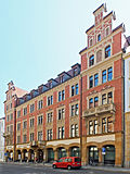 More pictures |
University building | Ritterstrasse 16; 18; 20; 22 (card) |
1891–1892 (university) | University building (with four house numbers) in closed development, with shop area; Clinker facade in the style of late historicism, predominantly neo-Gothic echoes, the two stepped gables that characterize the street space, design based on the previous building from 1517, the birthplace of the scholar and philosopher Gottfried Wilhelm Leibniz (1646-1716), architect of the new building: Arwed Roßbach , Leipzig, architectural history, of importance in terms of art history, university history and local history |
09298407 |
 More pictures |
Handelshof | Ritterstrasse 23; 25; 27; 29 (card) |
1895-1897 (No. 25-29); 1907–1908 (No. 23) | Handelshof in a formerly closed development with a courtyard to Nikolaistraße 20–26 (sandstone facade); |
09298383 |
 |
Residential building (university administration, former small college) |
Ritterstrasse 24 (map) |
1817, older in essence (residential building) | Residential house in closed development in corner location (plastered facade) |
09298408 |
 More pictures |
University administration building (Rectorate) (Royal Palace) | Ritterstrasse 26 (map) |
1860/61 and end of the 19th century, 1924 (monument to fallen soldiers) | University administration building (plastered facade) in closed development in the corner of Goethestrasse 7a – c, inside a memorial for those who fell in the First World War |
09298260 |
 |
Commercial building | Ritterstrasse 30; 32; 34; 36 (card) |
1898 (commercial building) | Commercial building (with four house numbers) in a formerly closed area in a corner; Magnificent Wilhelminian-era sandstone facade, corner emphasis, facade divided by a central projectile and monumental balconies, of architectural significance |
09298409 |
 |
Commercial building | Ritterstrasse 38; 40 (card) |
around 1895 (office building) | Commercial building in closed development with gate passage (sandstone facade) |
09298410 |
 |
Commercial building | Ritterstrasse 42 (map) |
around 1910 (office building) | Commercial building in closed development with passage (sandstone facade) |
09298411 |
 |
Commercial building | Ritterstrasse 44; 46; 48 (card) |
1906–1908 (commercial building) | Commercial building (with three house numbers) in closed development; richly structured and decorated sandstone facade, in the reform style of the time around 1910, presumably the seat of a tobacco shop (see also: Brühl 74), of architectural and local significance |
09298412 |
 |
Monument to Otto Koch | Roßplatz (map) |
1899 (monument) | Monument to Otto Koch in the promenade behind the Moritzbastei |
09290551 |
 More pictures |
Robert Schumann Monument | Roßplatz (map) |
1981 (monument; Neuguss) | Robert Schumann monument with medallion near the Moritzbastei; artistic value, memorable value, significance for the city's history |
09290552 |
 More pictures |
Former trade fair palace | Salzgäßchen 6 (map) |
1908/1909 & 1946/1947 (exhibition center) | Former trade fair palace and today's hotel in open development with passageways, inner courtyards and shop areas (see also: Grimmaische Straße 1–7, Reichsstraße 1–9, Salzgäßchen 9, Naschmarkt 3) |
09298263 |
 More pictures |
Monument to Gellert | Schillerstrasse (map) |
1909 (park) | Monument to Christian Fürchtegott Gellert based on a model by Oeser from 1774 |
09290580 |
 More pictures |
Memorial to Friedrich Schiller | Schillerstrasse (map) |
1914 (monument) | Memorial to Friedrich Schiller in the Lenné plant. |
09290579 |
 |
Residential and commercial building | Schillerstraße 3 (map) |
1861/1862 (commercial building) | Residential and commercial building in closed development in the corner of Neumarkt (see also Peterskirchhof 4) |
09298358
|
 More pictures |
Residential and commercial building | Schillerstraße 4 (map) |
1860 (office building) | Residential and commercial building in closed development in the corner of Neumarkt (see also: Magazingasse 2; elevator from 1929 as a technical monument; natural stone facade) |
09298325 |
 More pictures |
Commercial building | Schillerstraße 5 (map) |
1863 (office building) | Commercial building in closed development (see also: Magazingasse 4; sandstone plaster facade) |
09298329 |
 More pictures |
Residential and commercial building | Schillerstraße 6 (map) |
1863 (residential and commercial building) | Residential and commercial building in closed development with the Egyptian Museum of the University of Leipzig (see also: Magazingasse 6) |
09298331 |
| House facades | Schlossgasse 2; 4 (card) |
1887–1888 (facade) | Facades of a residential and commercial building in closed development in the corner at Petersstrasse 48 as well as the furnishings of the entrance area (plastered facade) |
09298400 |
|
 |
Commercial building | Schlossgasse 3; 5 (card) |
1937 (commercial building) | sa: Markgrafenstrasse 2 |
09298337 |
 More pictures |
Former exhibition center | Schuhmachergäßchen 1; 3 (card) |
1908/1909 (commercial building) | Former trade fair building in a formerly closed development on the corner of Reichsstraße with café and shops; Magnificent exhibition and commercial building in an exposed corner situation, rarity in terms of the unique facade decoration, memorable value, significance for the city's history and popular education |
09298423 |
 More pictures |
Former trade fair palace | Schuhmachergäßchen 2 (map) |
1908/1909 (exhibition center); 1945–1947 (December 4, 1945 war damage, then 1945–1947 reconstruction) | Former trade fair palace in closed development with a system of passages (see also: Reichsstraße 4/6 and Nikolaistraße 3–9); (Shell limestone facade) |
09298369 |
 More pictures |
Monument to Johann Sebastian Bach | Thomaskirchhof (map) |
1907–1908 (monument) | Memorial to the composer and Thomas Cantor Johann-Sebastian Bach; |
09298448 |
 |
Residential and commercial building | Thomaskirchhof 10 (map) |
re. 1909 (residential and commercial building) | Residential and commercial building in closed development in a corner, with inner courtyard (also Burgstrasse 1–5) |
09298235 |
 More pictures |
Residential and commercial building | Thomaskirchhof 11 (map) |
re. 1883 (residential and commercial building) | Residential and commercial building in closed development |
09298428 |
 More pictures |
Residential building | Thomaskirchhof 12 (map) |
around 1850 (residential building) | Residential building (sa: Burgstrasse 2) |
09298240 |
 More pictures |
Residential and commercial building | Thomaskirchhof 13 (map) |
re. 1886 (residential and commercial building) | Semi-open residential and commercial building (plastered facade); Scientifically and historically of particular importance, in terms of urban planning, an indispensable old building opposite St. Thomas Church in Leipzig |
09298429 |
 More pictures |
Residential and commercial building | Thomaskirchhof 14 (map) |
1598 (residential building) | Residential and commercial building in closed development; |
09298430 |
 |
Residential building | Thomaskirchhof 15 (map) |
1586 (residential building) | House in closed development with shops |
09298431 |
 More pictures |
Handelshof | Thomaskirchhof 16 (map) |
1586 (residential building) | Trading courtyard in closed development, four-winged with shops as well as Bach archive, concert hall, museum, formerly also cabaret and bar (plastered facade; venue of the Leipziger Pfeffermühle until 2008) |
09298432 |
 |
Residential and commercial building | Thomaskirchhof 17 (map) |
around 1870 (residential and commercial building) | Residential and commercial building in closed development with a shop area (plastered facade) |
09298425 |
 More pictures |
Thomashaus | Thomaskirchhof 18 (map) |
Parish office in open development, fencing, garden and memorial plaque on Dittrichring for Heinrich von Morungen (natural stone facade) |
09298433 |
|
 More pictures |
Thomas Church | Thomaskirchhof 19 (map) |
13./14. Century (church) | Thomaskirche, late Gothic hall church with furnishings, place of activity of Johann Sebastian Bach and the St. Thomas' Choir and relief plaque of the monument to Johann Adam Hiller from 1832 (older choir part; neo-Gothic western front) |
09290637 |
 More pictures |
Bank building | Thomaskirchhof 20 (map) |
1905 (bank building) | Bank building in closed development in the corner of Dittrichring with gate passage, shop area, bronze relief of the architect (natural stone facade). Bankhaus Meyer & Co. , architect Peter Dybwad |
09298434 |
 More pictures |
Residential and commercial building | Thomaskirchhof 21 (map) |
1903/1904 (residential and commercial building) | Residential and commercial building in closed development with gate passage and shop area (natural stone facade) |
09298435 |
 More pictures |
Former department store | Thomaskirchhof 22 (map) |
1903/1904 (department store) | Former department store, now a bank, in a closed development in the corner of Klostergasse, with a generous shop window front |
09298436 |
 More pictures |
Schinkeltor | Universitätsstrasse (map) |
1836 (part of the building) | Former entrance gate to the alma mater lipsiensius, so-called Schinkeltor |
09298447 |
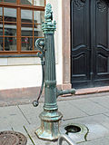 |
Manual pump | Universitätsstrasse (map) |
Hand lever pump with well shaft and cover plate in front of the municipal department store (Kleiner Löwe type) |
09262329 |
|
 More pictures |
Monument to Gottfried Wilhelm Leibniz | Universitätsstrasse (map) |
1883 (monument) | Memorial to Gottfried Wilhelm Leibniz in the inner courtyard of the university near the entrance to the new Paulinerkirche; |
09298446 |
 More pictures |
Former trade fair palace | Universitätsstrasse 16 (map) |
1883–1901 (exhibition center) | Former trade fair palace (municipal department store) in open development in the corner of Neumarkt 9 and Kupfergasse 1 as well as Gewandgäßchen, with inner courtyard and two original doors (plastered facade) |
09298437 |
 |
Residential high-rise | Universitätsstrasse 18; 20 (card) |
1962 (tenement) | Residential high-rise in closed development in the corner of Schillerstraße and Kupfergasse with an extremely significant accentuating character (the former illuminated advertising of the "LVZ" removed in 1998) |
09298451 |
 More pictures |
Monument to Carl Wilhelm Müller | Willy-Brandt-Platz (map) |
1819 (monument) | Memorial with medallion in memory of the Leipzig Mayor of Leipzig, Carl Wilhelm Müller , 2nd half of the 18th century (green area opposite the main train station) |
09290494 |
| Park | Willy-Brandt-Platz (map) |
from 1784 (Park) | Park created by Johann Carl Friedrich Dauthe (among others) (also Richard-Wagner-Straße), current condition: around 1915 (garden director Hampel) |
09293033 |
Detailed memorial texts
swell
- State Office for the Preservation of Monuments Saxony Dynamic web application: Overview of the monuments listed in Saxony. In the dialog box, the location “Leipzig, City; Center "must be selected, then an address-specific selection takes place. Alternatively, the ID can also be used. As soon as a selection has been made, further information about the selected object can be displayed and other monuments can be selected via the interactive map.
- Thomas Noack, Thomas Trajkovits, Norbert Baron, Peter Leonhardt: Cultural monuments of the city of Leipzig. (Contributions to urban development 35), City of Leipzig, Department of Urban Development and Construction, Leipzig 2002.