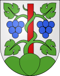
Meinisberg
| Meinisberg | |
|---|---|
| State : |
|
| Canton : |
|
| Administrative district : | Biel / Bienne |
| BFS no. : | 0390 |
| Postal code : | 2554 |
| Coordinates : | 593112 / 223199 |
| Height : | 445 m above sea level M. |
| Height range : | 426-563 m above sea level M. |
| Area : | 4.39 km² |
| Residents: | 1303 (December 31, 2018) |
| Population density : | 297 inhabitants per km² |
| Mayor : | Daniel Kruse ( SVP ) |
| Website: | www.meinisberg.ch |
|
Entrance to Meinisberg |
|
| Location of the municipality | |
Meinisberg (also: Meinisberg bei Biel ; French Montménil ) is a municipality in the Biel / Bienne administrative district in the canton of Bern in Switzerland . In addition to the residents' community, there is also a civic community .
geography
The neighboring communities starting from the north in a clockwise direction are Pieterlen , Lengnau BE , Büren an der Aare and Safnern . The community is located in the Bernese Seeland on the Häftli, a former loop of the Aare . Today the loop of the river is just a kind of lake, as the Nidau-Büren Canal shortens it. Like many communities in the Seeland, Meinisberg was raised slightly at the foot of the Büttenberg to protect it from flooding. The drained swamps could only be used after the Jura water corrections .
The total area of Meinisberg is 4.39 km² of which 1.06 km² are forest and wood. The unproductive area of the community is 0.21 km².
Meinisberg lies between 430 m above sea level. M. at Bockeggen and 551 m above sea level. M. on the mountain.
population
| Population development | |
|---|---|
| year | Residents |
| 1850 | 493 |
| 1880 | 528 |
| 1900 | 532 |
| 1920 | 609 |
| 1950 | 675 |
| 1970 | 980 |
| 1990 | 1,060 |
| 2000 | 1,195 |
| 2006 | 1,252 |
Of the 1252 inhabitants, who live in a total of 539 buildings, 123 are foreigners (9.8%), which is a rather small proportion by Swiss standards. Meinisberg's population growth is not very high. The church is growing slowly.
In addition to the residents' community, there is also a civic community . This owns a large part of the forest area of the village and is therefore probably the largest landowner in Meinisberg.
languages
Meinisberg is mostly German-speaking.
religion
Most of the population in Meinisberg belongs to the Reformed Christian faith. The parish hall in Meinisberg belongs to the parish of Pieterlen.
politics
The municipal council (executive) of Meinisberg consists of 7 members.
The municipal assembly (legislature) consists of all voters. Votes on community matters are usually carried out with an open hand.
The voting shares of the parties at the 2015 National Council elections were: SVP 41.3%, SP 17.3%, BDP 15.3%, FDP 6.4%, GPS 4.9%, glp 4.0%, EDU 4.0 %, EVP 2.6%, CVP 1.9%.
history
Regarding the origin of Meinisberg, there is information in the geographic lexicon of Switzerland about land sales and contracts from the years 1261 and 1321, the Historical Lexicon of Switzerland mentions first mentions in French and 1332 as Meynesberg .
Meinisberg was first mentioned in a document under the name Meinosberg on May 5, 1312. The said document is in the State Archives in Bern .
From 1913 to 1940 Meinisberg was the terminus of the narrow-gauge railway Biel-Meinisberg-Bahn .
photos
See also
literature
- Konrad Kunz: “From grassworm” to “orange arrow” , history of the narrow-gauge railway Biel-Meinisberg BMB, 1913–1940, Büren Association for Home Care, 2003
- Konrad Kunz: "Meinisberg - Eine Dorfgeschichte" , insight into the history and development of a village community, 2008
Web links
- Official website of the community of Meinisberg
- Anne-Marie Dubler : Meinisberg. In: Historical Lexicon of Switzerland .
Individual evidence
- ↑ Permanent resident population from STAT-TAB of the BfS , municipalities see also regional portraits 2020 on bfs.admin.ch, accessed on May 29, 2020
- ↑ Elections 2015: Results of the community ----. Canton of Bern, accessed on March 22, 2016
- ^ Charles Knapp, Maurice Borel, Victor Attinger, Heinrich Brunner, Société neuchâteloise de geographie (editor): Geographical Lexicon of Switzerland . Volume 3: Krailigen - Plentsch . Verlag Gebrüder Attinger, Neuenburg 1905, p. 331, keyword Meinisberg ( scan of the lexicon page ).
- ^ Anne-Marie Dubler: Meinisberg. In: Historical Lexicon of Switzerland .


