
Leuzigen
| Leuzigen | |
|---|---|
 |
|
| State : |
|
| Canton : |
|
| Administrative district : | Zealand |
| BFS no. : | 0388 |
| Postal code : | 3297 |
| Coordinates : | 601600 / 225048 |
| Height : | 456 m above sea level M. |
| Height range : | 426-574 m above sea level M. |
| Area : | 10.28 km² |
| Residents: | 1259 (December 31, 2018) |
| Population density : | 116 inhabitants per km² |
| Mayor : | Margrit Geissbühler ( FDP ) |
| Website: | www.leuzigen.ch |
 The Leuziger schoolhouse |
|
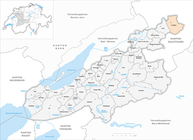
| Location of the municipality | |
  |
|
Leuzigen (formerly: Leuzingen) is a municipality in the Seeland administrative district in the canton of Bern in Switzerland . It consists of the actual village part and the hamlet of Brunnadern.
_und_Bauernhaus_(um_1925)_in_Leuzigen_BE.jpg)

What is special for the community is that there is also a civic community in addition to the residents' community .
geography
Leuzigen is 456 m above sea level. M. as the last village in the canton of Bern and therefore of the Seeland between the Aare and the beginnings of the Bucheggberg . It is surrounded on three sides by the canton of Solothurn. The village has only small differences in altitude of around 80 meters.
The northern boundary of the municipality is limited by the winding course of the Aare. From there, agricultural land first extends up to the A5 motorway. To the south of the autobahn and the disused Solothurn – Büren railway line that runs parallel to it, there are some new housing estates. The actual village consists of old farmhouses mixed with newer houses along the main road and the Bucheggbergstrasse to Bibern SO . Furthermore, behind the glacial moraine wall of the Längenberg there is still a settlement called Brunnader .
The neighboring communities starting from the north and moving clockwise are Bettlach , Selzach , Nennigkofen , Lüterkofen-Ichertswil , Buchegg and Arch .
population
| Population development | |||||||||
|---|---|---|---|---|---|---|---|---|---|
| year | 1764 | 1850 | 1900 | 1950 | 1960 | 2000 | 2007 | 2015 | 2018 |
| Residents | 518 | 1107 | 947 | 1154 | 1193 | 1157 | 1188 | 1216 | 1256 |
The population has fluctuated between 1100 and 1200 people for several years. Leuzigen is one of the smaller Bernese communities.
Especially in the upper part of the village some new houses have been built in recent years.
politics
Mayor is Margrit Geissbühler (as of January 2018)
The voting shares of the parties in the 2019 National Council election were: SVP 36.8%, BDP 15.5%, SP 10.3%, FDP 11.1%, GPS 6.7%, glp 7.7%, SD 1.1 %, EDU 2.2%, ACP uwP 3.9%, EVP 1.4%.
traffic
Leuzigen is well developed in terms of transport. The village is on Hauptstrasse 22 between Lyss and Solothurn (10 minutes).
In addition, the A5 autobahn runs through the Leuziger municipality near the Aare.
There are two motorway slip roads near the village. In the east (4 km away) it is the Solothurn-West driveway and in the west (3 km away) the Grenchen junction.
Leuzigen is connected to the public transport network. Every hour, as well as every half hour during rush hours in the morning and evening, buses commute between Solothurn and Zollikofen near Bern (line 8 or 888), replacing the Solothurn – Büren railway line , which was closed in 1994. Leuzigen is connected on the one hand with the next larger city Solothurn as well as with Büren and the whole Bucheggberg. In the neighboring village of Arch there is also an option to change to the network of the Grenchen bus companies.
history

On the western edge of the village was built in the 11th / 12th Century a Cluniac priory . Pope Gregory VII initiated a fundamental reform of the Church, which had strayed somewhat from the path of piety. The St. Ursenstift in Solothurn was converted from a monastery into a secular canon monastery in the 10th century . Apparently the nearby town of Leuzigen had been chosen because the monastery recognized certain grievances that should be counteracted in the spirit of the Cluniac reform .
The Reformation found its way into Leuzigen around 1530 .
Attractions
literature
Web links
- Official website of the community of Leuzigen
- Anne-Marie Dubler : Leuzigen. In: Historical Lexicon of Switzerland .
- Leuzigen civic community
Individual evidence
- ↑ Permanent resident population from STAT-TAB of the BfS , municipalities see also regional portraits 2020 on bfs.admin.ch, accessed on May 29, 2020
- ^ Results of the community of Leuzigen. State Chancellery of the Canton of Bern, October 20, 2019, accessed on August 17, 2020 .
- ↑ Bruno Amiet : From history of Solothurn , 1943
Aarberg | Arch | Barges | Shaking | Büetigen | Bühl | Büren an der Aare | Diessbach near Büren | Dotzigen | Epsach | Erlach | Dark hens | Gals | Gampelen | Grossaffoltern | Hagneck | Hermigen | Ins | Jens | Kallnach | Kappelen | Leuzigen | Lüscherz | Lyss | Meienried | Merzligen | Müntschemier | Oberwil near Büren | Radelfingen | Rapperswil | Rüti near Büren | Hatching | Seedorf | Siselen | Studen (BE) | Täuffelen | Riding | Tschugg | Vinelz | Walperswil | Wengi | Advertised
Former parishes: Bangerten | Busswil near Büren | Gas ore | Mullen | Niederried near Kallnach | Rubbing | Ruppoldsried
Canton of Bern | Administrative districts of the canton of Bern | Municipalities of the Canton of Bern