Mont-Vully
| Mont-Vully | |
|---|---|
| State : |
|
| Canton : |
|
| District : | lake |
| BFS no. : | 2284 |
| Postal code : | 1786 Sugiez 1787 Môtier 1787 Mur 1788 Praz 1789 Lugnorre |
| Coordinates : | 575178 / 201259 |
| Height : | 433 m above sea level M. |
| Height range : | 422–653 m above sea level M. |
| Area : | 17.51 km² |
| Residents: | 3819 (December 31, 2018) |
| Population density : | 218 inhabitants per km² |
| Website: | www.mont-vully.ch |
|
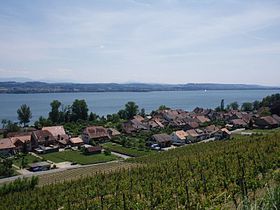
Praz (Vully) with the Murten lake |
|
| Location of the municipality | |
Mont-Vully is a political municipality in the canton of Friborg , Switzerland , that was founded on January 1, 2016. The new municipality located in the lake district emerged from the merger of the former municipalities of Bas-Vully and Haut-Vully . It is located on the Friborg part of Mont Vully and consists of the following localities on the north bank of Lake Murten :
Attractions
Web links
Commons : Mont-Vully - Collection of images, videos and audio files
Individual evidence
- ↑ Permanent and non-permanent resident population by year, canton, district, municipality, population type and gender (permanent resident population). In: bfs. admin.ch . Federal Statistical Office (FSO), August 31, 2019, accessed on December 22, 2019 .


