
Castle FR
| FR is the abbreviation for the canton of Friborg in Switzerland and is used to avoid confusion with other entries in the name Burg (disambiguation) . |
| Castle | ||
|---|---|---|
 |
||
| State : |
|
|
| Canton : |
|
|
| District : | lake | |
| Municipality : | Murten | |
| Postal code : | 3280 | |
| former BFS no. : | XXXX | |
| Coordinates : | 578020 / 198 068 | |
| Height : | 518 m above sea level M. | |
| Residents: | 167 (1970) | |
 Castle FR |
||
| map | ||
|
||


Burg , sometimes also called Burg bei Murten , is a town and formerly an independent political municipality in the lake district (French: District du Lac) of the canton of Friborg in Switzerland . The former French name of the village is Châtel . On January 1, 1975, Burg was incorporated into Murten .
geography
Castle is at 518 m above sea level. M. , two kilometers east of the district capital Murten (straight line). The farming village extends on the high plateau to the southeast of Lake Murten , west of Erosionstals the castle grave Bach , in the glacial Rhone glacier over-molded Molassehügelland of northern Freiburg Central Plateau between Lake Murten and the Saanen valley . The former municipal area comprised the Burg plateau with the valley of the Burggrabenbach brook.
population
With 167 inhabitants (1970), Burg was one of the small communities in the canton of Friborg before the merger. The residents are predominantly German-speaking. In 1850 the village had 216 inhabitants, in 1900 246 inhabitants. Thereafter, a continuous decrease in population was registered until 1970. To the castle belong the farmstead Schloss Oberburg, east of the moat, as well as some individual farms.
economy
Up until the second half of the 20th century, Burg was a predominantly agricultural village. Even today, arable farming , fruit growing and animal husbandry have an important place in the income structure of the population. In the last few decades the village has also developed into a residential community. Many employed people are therefore commuters who mainly work in the Murten region.
traffic
The village is only a short distance from the main road from Murten to Düdingen . The closest connection to the A1 motorway (Bern-Lausanne), which opened in 1997, is around 3 km from the town center.
history
The first written mention of the place took place in 1340 under the name Chastel . Later the names Castro (1394), Castro villa (1413) and Burg (1510) appeared. The castle has been under the rule of Murten since the Middle Ages . From the medieval castle, which was located on a ledge east of the castle moat valley, only a moat can be seen today. In 1475, the village came under the joint administration of the estates of Bern and Freiburg as part of the bailiwick of Murten.
After the collapse of the Ancien Régime (1798), Burg came to the canton of Friborg. During the Helvetic Republic and the following period it belonged to the Murten district before it was incorporated into the lake district in 1848 with the new cantonal constitution. The castle does not have its own church, it belongs to the parish of Murten. A manor house in Oberburg served as an orphanage for the lake district from 1892, but was closed and demolished in 1965 after two fires. With effect from January 1, 1975, Burg was incorporated into Murten.

Castle lies on a high plateau

In the village

The cemetery and in the background the village
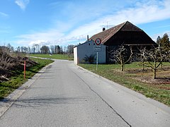
The neighboring Oberburg


Attractions
Web links
- Hermann Schöpfer: Castle near Murten. In: Historical Lexicon of Switzerland .
- Aerial views of the village
Gurwolf | Courtepin | Cressier | Fräschels | Galmiz | Gempenach | Greng | Gurmels | Kerzers | Kleinbösingen | Meyriez | Misery Courtion | Mont-Vully | Muntelier | Murten | Ried near Kerzers | Ulmiz . Former municipalities: Agriswil | Altavilla | Barberêche | Bas-Vully | Cans | Castle | Chandossel | Cordast | Cormérod | Corsalettes | Courlevon | Cournillens | Courtaman | Courtion | Coussiberlé | Grossgurmels | Grossguschelmuth | Guschelmuth | Haut-Vully | Jeuss | Small gurmel | Kleinguschelmuth | Liebistorf | Lurtigen | Misery | Monterschu | Salvenach | Villarepos | Wallenbuch | Wallenried .