
Altavilla FR
| FR is the abbreviation for the canton of Friborg in Switzerland and is used to avoid confusion with other entries of the name Altavilla . |
| Altavilla | ||
|---|---|---|
 |
||
| State : |
|
|
| Canton : |
|
|
| District : | lake | |
| Municipality : | Murten | |
| Postal code : | 3280 | |
| former BFS no. : | XXXX | |
| Coordinates : | 578 253 / 198098 | |
| Height : | 537 m above sea level M. | |
| Residents: | 117 (1990) | |
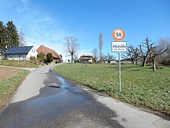
 Altavilla seen from the east |
||
| map | ||
|
||


Altavilla is a town and formerly an independent political municipality in the lake district (French: District du Lac) in the canton of Friborg in Switzerland . The former French name of the village was Hauteville; For Altavilla, the Germanized name Altenfüll was used earlier (this is also the name of the municipality of Hauteville FR ). On January 1, 1991 Altavilla was incorporated into Murten .
geography
Altavilla is 537 m above sea level. M. , three kilometers east of the district capital Murten (linear distance ). The farm village extends in a depression on the plateau of the southern Great Marsh , in the glacial Rhonegletscher overmolded Molassehügelland of northern Freiburger Midland between the Morat and Saanen valley . The former municipality area was around 0.7 km². It comprised the Altavilla basin, which is drained by a right side stream of the Burggrabenbach stream towards Lake Murten, as well as the surrounding forest heights Gultenholz ( 562 m above sea level , in the west), Buggli (up to 572 m above sea level , in the south) and Bloster ( 576 m above sea level , in the east).
population
With 117 inhabitants (1990), Altavilla was one of the small communities in the canton of Friborg before the merger. The residents are predominantly German-speaking. In 1850 the village had 180 inhabitants, in 1900 136 inhabitants. After a further steady decline in population, only 89 people were registered in 1970. Altavilla has a few individual farms.
economy
Altavilla was a predominantly agricultural village until the second half of the 20th century . Even today, arable farming , fruit growing and animal husbandry have an important place in the income structure of the population. In the last few decades the village has also developed into a residential community. Many employed people are therefore commuters who mainly work in the Murten region.
traffic
The village is located away from the larger thoroughfares, the main access is from the main road Murten - Bern . Altavilla is connected to the public transport network by the Transports publics Fribourgeois bus route , which runs from Murten to Gümmenen .
history
The Altavilla area was populated very early. Tumuli from the Hallstatt period were discovered in the Murtenwald east of the village , in which rich finds (lignite bracelets, bronze objects) were made. Some traces of settlement are also known from Roman times .
The place was first mentioned in a document in 1340 under the name Alta villa (high courtyard). Altavilla has been under the rule of Murten since the Middle Ages . In 1475, the village came under the joint administration of the estates of Bern and Freiburg as part of the bailiwick of Murten. The sandstone quarries north of the village, which were still in use until 1820, provided, among other things, the material for the construction of the curtain wall around the city of Murten. After the collapse of the Ancien Régime (1798) Altavilla came to the canton of Friborg. During the Helvetic Republic and the following period it belonged to the Murten district before it was incorporated into the lake district in 1848 with the new cantonal constitution. Altavilla does not have its own church, it belongs to the parish of Murten. With effect from January 1, 1991 Altavilla was incorporated into Murten.

Part of Altavilla seen from the south, behind the Chasseral

Altavilla with historical anti-tank barrier
Altavilla seen from the southwest

Memorial stone for the overall renovation of Murten-Altavilla, 1990–2007


Attractions
Web links
- Hermann Schöpfer: Altavilla. In: Historical Lexicon of Switzerland .
Gurwolf | Courtepin | Cressier | Fräschels | Galmiz | Gempenach | Greng | Gurmels | Kerzers | Kleinbösingen | Meyriez | Misery Courtion | Mont-Vully | Muntelier | Murten | Ried near Kerzers | Ulmiz . Former municipalities: Agriswil | Altavilla | Barberêche | Bas-Vully | Cans | Castle | Chandossel | Cordast | Cormérod | Corsalettes | Courlevon | Cournillens | Courtaman | Courtion | Coussiberlé | Grossgurmels | Grossguschelmuth | Guschelmuth | Haut-Vully | Jeuss | Small gurmel | Kleinguschelmuth | Liebistorf | Lurtigen | Misery | Monterschu | Salvenach | Villarepos | Wallenbuch | Wallenried .