Monts d'Ambazac
| Monts d'Ambazac | |
|---|---|
|
Location of the Monts d'Ambazac in the Massif Central |
|
|
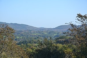
The Monts d'Ambazac near Razès |
|
| Highest peak | Puy de Sauvagnac ( 701 m ) |
| location | Département Creuse and Département Haute-Vienne , (Central France ) |
| part of | Massif Central |
| Coordinates | 46 ° 1 ' N , 1 ° 27' E |
| rock | Gneiss, granite |
| surface | 450 km² |
The Monts d'Ambazac are a small massif with a low mountain range that, together with the Massif de l'Arbre and the Monts de Blond, represent the western outpost of the French Massif Central . It is a central part of the Monts de la Marche in the Haute-Vienne department .
etymology
The Monts d'Ambazac are named after the small town Ambazac , which is in front of the massif in the south. Ambazac had 5639 inhabitants in 2015.
geography
The Monts d'Ambazac are mainly located in the Haute-Vienne department, but in the communes of Saint-Goussaud and Châtelus-le-Marcheix they still cover the Creuse department , where they are traditionally known as the Monts de Saint-Goussaud . Its east-west extension (between Bourganeuf and Nantiat ) is about 40 kilometers and its width in north-south direction (between Bessines-sur-Gartempe and Ambazac) is a good 15 kilometers. In general, the term Monts d'Ambazac is only used for its higher elevations, which occupy about a third of the previously circumscribed area and extend from the municipality of Compreignac in the west to the valley of the Taurion in the east.
The urban agglomeration of Limoges is located directly to the south of the Monts d'Ambazac. It is only 20 kilometers (as the crow flies) from the seat of the prefecture of the Haute-Vienne to the Puy de Sauvagnac in the commune of Saint-Léger-la-Montagne , the highest point in the Monts d'Ambazac at 701 meters above sea level. The chain can easily be viewed from several parts of Limoges - such as Beaubreuil or Panazol . The highest elevation in the section of the department of Creuse of the municipality of Saint-Goussaud belonging Puy de jouer with 694 meters. Other peaks in the Monts d'Ambazac are:
- Puy de la Feyte : 691 meters (Saint-Goussaud)
- Bois de Roche : 680 meters (Saint-Goussaud)
- Font aux Loups : 672 meters (Saint-Léger-la-Montagne)
- Puy de la Garde : 664 meters (Ambazac)
- Puy Giraud : 660 meters ( La Jonchère-Saint-Maurice - Saint-Léger-la-Montagne)
- Le Périgier : 651 meters (Châtelus-le-Marcheix)
- Les Clédières : 648 meters ( Jabreilles-les-Bordes )
- Puy de Roche Guette : 638 meters (Châtelus-le-Marcheix)
- Puy de Queuille : 625 meters (Saint-Léger-la-Montagne)
- Puy du Rio : 615 meters ( Laurière )
- Signal de Beausoleil : 587 meters (Compreignac), highest point west of the A20 motorway
- Puy du Chatelard : 565 meters (Jabreilles-les-Bordes)
- Le Gerbassou : 559 meters (Ambazac)
- Puy Nado : 552 meters ( Bersac-sur-Rivalier )
- Puy du Cluzeau : 552 meters ( Montboucher )
The following municipalities share the Monts d'Ambazac:
- In the Creuse department:
- Arrènes ,
- Châtelus-le-Marcheix,
- Masbaraud-Mérignat ,
- Montboucher,
- Saint-Goussaud,
- Saint-Pierre-Chérignat
- In the Haute-Vienne department:
- Ambazac,
- Bersac-sur-Rivalier,
- Bessines-sur-Gartempe,
- Les Billanges ,
- Bonnac-la-Côte ,
- Compreignac,
- Jabreilles-les-Bordes,
- La Jonchère-Saint-Maurice,
- Laurière,
- Razès ,
- Saint-Laurent-les-Églises ,
- Saint-Léger-la-Montagne,
- Saint-Pardoux ,
- Saint-Sulpice-Laurière ,
- Saint-Sylvestre
geology
The Monts d'Ambazac lie entirely on the crystalline basement of the northwestern Massif Central . The parautochthonous mica slate unit and the lower gneiss ceiling of the Limousin as well as their intrusiva, above all leuco granites and granites, are exposed . The parautochthonous mica schist - the deepest unit in structural geological terms - appear along the upper reaches of the Taurion near Châtelus-le-Marcheix. They are intruded here by the Saint-Goussaud leukogranite - an apophysis of the Saint-Sylvestre leukogranite - which further west underlies a large part of the Monts d'Ambazac. The lower gneiss cover that has slipped off the mica schists - mainly eye gneisses and migmatites - is exposed near Ambazac and southeast of Saint-Sylvestre. In addition to the Saint-Sylvestre leuco granite , the Brame granite and the Châteauponsac leuco granite are pending towards Nantiat .
The granitoids mentioned together form the 500 square kilometer Saint-Sylvestre massif , which was penetrated in the Upper Carboniferous around 325 million years ago.
Natural resources
The Saint-Sylvestre leukogranite contains uranium deposits that were once mined in 10 places: Bachellerie, Margnac, Vénachat, Gorces Saignedresse, Le Fraisse, Roudet, Santro, Fanay, Henriette and Champour . Mining on the last deposit at Vénachat ceased in 1995. The damage to the landscape caused by uranium mining is not too severe, but in some places significantly increased radioactivity was released.
From 1772 kaolin was mined in the Monts d'Ambazac , for example near Bonnac-la-Côte . Puy-Bernard near La Jonchère was the last remaining kaolin mine. It closed in 1964. What remains are immense pits that are gradually disappearing again under the vegetation.
Numerous pegmatites and quartz veins have also been mined in the past .
climate
The Monts d'Ambazac are under the influence of an oceanic climate, as their elevations are directly exposed to the tracks of the Atlantic disturbances. Annual precipitation amounts to 1,100 to 1,300 millimeters. Temperatures are relatively mild and cold spells are rare because of the moderating effects of the ocean. However, the snowfalls are more frequent than in the Vienne valley near Limoges and in some winters they can often occur one after the other. The Monts d'Ambazac often form a weather divide between northern and southern France. While there is gray and overcast weather in the Berry in the north, the sun can shine further south around Limoges.
ecology
The Monts d'Ambazac are mainly composed of deciduous and coniferous forests. In the interior of the massif with heights over 600 meters, beeches are predominant and take up a little more than 50 percent of the population. In lower altitudes they step back and only reach just under 20 percent. The remaining stock is made up of pedunculate oak , sessile oak and, secondarily, chestnuts .
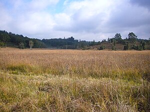
The villages and hamlets in the Monts d'Ambazac are mostly surrounded by meadows and pastures for cattle breeding. The wet and cold climate, particularly prevalent in winter, has favored the formation of moors, including the protected Les Dauges moors . Other moors can be found near Mallety in the commune of Saint-Léger-la-Montagne - the headwaters of the Couze and Lac de Saint-Pardoux - and near Friulouse at the foot of the Puy de Jouër in the commune of Saint-Goussaud.
In terms of landscape geography, the Monts d'Ambazac are clearly characterized by forests and meadows, with a network of wetlands, grazed slopes and wooded ridges. Rocky seas are relatively rare, exceptions are the impressive sea of Roche du Temple near Saint-Léger-la-Montagne and the protected chaos of Pierre Millier , which overlooks the lake of the same name near Saint-Sylvestre.
Because of their ecological diversity, the Monts d'Ambazac were designated as a protection zone (ZNIEFF type 2). Due to the large number of bat species , they also fall under Natura 2000 .
history
From the Paleolithic and Neolithic , relatively little has been preserved in the Monts d'Ambazac. Dolmen in the municipalities of Marsac , Ambazac and Mourioux-Vieilleville as well as a tumulus near Châtelus-le-Marcheix originate from the megalithic culture. The Bronze Age left its mark on the Lieu dolmen in the municipality of Ambazac. The municipality of Saint-Sulpice-Laurière was at the end of the 2nd millennium BC. An important bronze place.
Gallic oppida have been discovered in the municipality of Jabreilles-les-Bordes . The Puy de jouer in Saint-Goussaud was the Jupiter consecrated Roman sanctuary from which the remains are present even today.
In the 12th century, in the village of Grandmont near Saint-Sylvestre, Saint Stephen of Muret founded the Gregorian Reformed Catholic Order of the Grammontese , of which a treasure chest and dalmatics are kept in Ambazac.
In the Middle Ages , the Monts d'Ambazac was crossed by a secondary pilgrimage route that connected Argenton-sur-Creuse with the Via Lemovicensis at Saint-Léonard-de-Noblat . In the 15th century, the diocese of Limoges and the county of Marche divided the massif. The West was under external influence. In the following 16th century, the Généralités and the Pays d'élection were brought into being - but this did not result in a uniform administration for the Monts d'Ambazac. The parishes were now split into the Généralités of Limoges and Bourganeuf (Pays d'élection Limoges) on the one hand and the Généralité of Guéret (Pays d'élection Moulins) on the other.
During the French Revolution , the newly created communities in the Monts d'Ambazac were assigned to the districts of Saint-Léonard-de-Noblat, Limoges, Bellac and Bourganeuf .


