
Nature reserve Ruhraue Witten-Gedern
|
NSG Ruhraue Witten-Gedern
|
||
 View from the Ruhr Valley Cycle Path over the Gederweiden in the NSG |
||
| location | Witten and Herdecke , Ennepe-Ruhr-Kreis , NRW , Germany | |
| surface | 84.88 ha | |
| Identifier | EN-006 | |
| WDPA ID | 165254 | |
| Geographical location | 51 ° 24 ' N , 7 ° 21' E | |
|
||
| Sea level | from 80 m to 85 m | |
| Setup date | November 25, 1984 | |
| Framework plan | Landscape plan Ennepe-Ruhr-Kreis, Witten-Wetter-Herdecke area (1984) | |
| administration | Lower landscape authority of the Ennepe-Ruhr district | |

The nature reserve Ruhraue Witten-Gedern is an approximately 85 hectare nature reserve on the Ruhr , which is located across borders in the two district towns of Witten and Herdecke in North Rhine-Westphalia. It was set up in 1984 in the course of drawing up the landscape plan for the Ennepe-Ruhr district and has the object identifier EN-006. The area is named after the Gedern settlement area to the east .
About 98.5 percent of the protected area area belongs to the Witten urban area (districts Bommern and Annen ), about 1.5 percent to the Herdeck city area (districts Herdecke and Ende ).
area
Geographically, the nature reserve is part of the Ardey gate . It is roughly limited by two railway embankments , each of which runs along the edge on both sides of the Ruhraue. To the east, to the right of the Ruhr, run the Elberfeld – Dortmund railway line , on which ICE trains also run, and the 226 federal road . In the west, to the left of the Ruhr, run the Ruhr Valley Railway and the Witten – Schwelm (Elbschetalbahn) railway, as well as the Ruhr Valley Cycle Path .
The area is bordered by the towns of Wengern (city of Wetter (Ruhr) ) and Bommern (city of Witten) in the west and the Gedern settlement areas with the Obergedern estate (city of Witten) and the Mallinckrodt house (city of Herdecke) in the east .
At the northern tip of the nature reserve there is a campsite and in the river the so-called RWE island . The Amprion's 220 kV Herdecke-Süd overhead line also crosses the area; three masts stand within the protected area.

The NSG essentially comprises the two large floodplain areas characterized by grassland use , Gederweiden (approx. 48 ha) on the left and Ruhrweiden (approx. 28.5 ha) on the right side of the river. Between the two floodplains, the Ruhr itself is part of the nature reserve with a length of around 850 meters with around 5.5 hectares of water. The bank vegetation, which is dominated by pastures in many places , is even protected over a length of 2.8 km (from the confluence of the Selmkebach in the south to the level of the Bommeraner campsite Steger in the north). In the southeast, near Haus Mallinckrodt, an area of around 2.5 hectares is also included between the railway line and the main road in the nature reserve. There two tributaries flow to the Ruhr, which are more or less dammed up in front of the railway embankment. At the confluence of the nameless Siepens of Haus Mallinckrodt there is a partly swampy forest area and the Selmkebach is dammed into a 270 m long pond in front of its confluence with the Ruhr.
The Geder pastures in the west of the Ruhr are old agricultural areas that are still grazed with cattle and horses today. They belong to the drinking water protection area of the waterworks on the Ruhr Viaduct . On the western edge of Gederweiden, just below the embankment, an elongated runs oxbow lake of the Ruhr, which is partly silted and overgrown partly swampy mostly preserved, as open water. The oxbow lake is fed by both groundwater and laterally flowing streams, above all from the Deipenbecke coming from the LSG Elberg . The slowly flowing oxbow section that flows into the Ruhr in the north of the NSG is called Spiek . During floods , the geder willows serve as a retention area . Depending on the intensity of the flood, several flat banks or even large parts of the grassland are under water.
The eastern part of the NSG called Ruhrweiden was used for many decades as a water extraction site ( Mallinckrodt water extraction system ); 27 wells are embedded in the ground like a string of pearls along the shore. This area is kept open as a meadow area .
Protection goals
The nature reserve with its pastures, meadows and reed beds is an important resting and breeding area, especially for meadow and water birds . Over a hundred species of birds are known from the area. Many are endangered, some of them are Red List species . Several bat species, amphibians and reptiles also occur here.
The primary protection goals for the NSG are conservation
- Species-rich communities and diverse habitats of sometimes rare and endangered plants and animals,
- of the Ruhr valley arm because of its geographical and natural historical importance and
- the meadow landscape because of its rarity, special character and outstanding beauty.
tourism
There are no public roads through the nature reserve and entry is generally prohibited. Much of the area is also fenced off and / or grazed. Only water hikers on the Ruhr are allowed to cross the protected area, provided they stay away from the banks, make no noise and show consideration for the animal world, v. a. on breeding and resting migratory birds.
In the west of the area, on the left side of the Ruhr, a foot and cycle path runs in an elevated position on an old railway embankment , which forms a section of the Ruhr Valley Cycle Path (section Wengern to Bommern). From this path there are several good opportunities to look into the area and observe the fauna, possibly with the help of binoculars. Information boards are set up at some points.
The Berger monument , a lookout tower in Witten , also offers a scenic view of the area .
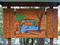
Information board about the NSG on the Ruhrtalradweg

Canada geese and barnacle geese in the north of the NSG

View from the Berger monument : the NSG begins behind the Ruhrinsel in the center of the picture.


Individual evidence
literature
- Dietrich Büscher: The Spiek near Witten-Bommern - a part of the Ruhraue that is worth protecting. In: Dortmund contributions to regional studies - natural science messages. Issue 19. Dortmund, 1985, pp. 71-78.
- Michael Sell: The Ruhraue nature reserve (“Spiek”) in Witten-Bommern. Landscape history, ecology, nature experience and conservation projects (= Heimat- und Geschichtsverein Bommern [Hrsg.]: Bommeraner Blätter . Issue 25). Witten 2011.
Web links

Old Ruhr-Katzenstein | At the Nockenberg | Bilstein (Ennepetal) | Deilbachtal | Elbschebach Witten Bommerholz | Felderbachtal | Freebach | Gevelsberg City Forest | Hardenstein | Hasper Bachtal | Heilenbeck Valley | Kermelbach | Klutert cave and Bismarck cave | Krabbenheider Bach in Gevelsberg | Maasbecke | Upper Felderbachtal | Upper Sprockhöveler Bachtal | Ruhraue Hattingen Winz | Ruhraue Witten-Gedern | Acid Epscheid | Southern Sprockhöveler Bachtal | Südholz | Brambecke Valley | Valley of the Ennepe | Valley of the Ennepe (Ennepetal) | Fastenbecke Valley | Lower Sprockhöveler Bachtal | Forest at the upper Paasbach | Valley of the Wolfsbecke | Wupperschleife Bilstein-Daipenbecke