best
| best | ||
|
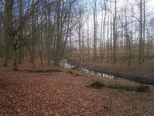
Norderbeste near Grabau |
||
| Data | ||
| Water code | DE : 96216 | |
| location | Stormarn district , Schleswig-Holstein , Germany | |
| River system | Trave | |
| Drain over | Trave → Baltic Sea | |
| River basin district | Schlei / Trave | |
| source | at Mollhagen 53 ° 43 ′ 10 ″ N , 10 ° 22 ′ 3 ″ E |
|
| Source height | 39.8 m above sea level NHN | |
| muzzle | in Bad Oldesloe in the Trave Coordinates: 53 ° 48 ′ 34 " N , 10 ° 22 ′ 39" E 53 ° 48 ′ 34 " N , 10 ° 22 ′ 39" E |
|
| Mouth height | 7 m above sea level NHN | |
| Height difference | 32.8 m | |
| Bottom slope | 2.2 ‰ | |
| length | 15 km | |
The best is a river in the Stormarn district , which flows into the Trave in Bad Oldesloe . The river was first mentioned as Horbinstenon in a description of the Limes Saxoniae in 1075 . According to Wolfgang Laur , the name can be understood as a derivation of rush .
Upper course
The source of the best is 44 m above sea level. NN near Mollhagen, a district of Steinburg (Stormarn) . It then flows in a fairly straight line 3.5 km to the A1 , which it crosses 1 km north of the Bargteheide exit . From there it meanders past the Rehbrook forest , into the mill pond of the Lasbek estate. This is also fed by Groot Beek and Lütt Beek.
South best
From the outflow of the mill pond of the Lasbeker Gut to the confluence with the Norderbeste, the river is now called Süderbeste and has a course with many turns. Over the next 1.8 km, the water from two forest streams is absorbed before the river is dammed again in the Kupfermühlenteich near Sattenfelde . From there it is another 4.5 km to the confluence with the Norderbeste. On this section, the inlet of the Sülsbek is 16 m above sea level. The Süderbeste is dammed twice for the scythe mill and the oil mill on the estate at Höltenklinken .
Norderbeste
| Norderbeste | ||
| location | Segeberg and Stormarn districts | |
| River system | Trave | |
| Drain over | Best → Trave → Baltic Sea | |
| Headwaters | Lunder Moor and Nienwohlder Moor | |
| Source height | 29 m above sea level NN | |
| confluence | with the southern best to the best 53 ° 47 ′ 13 ″ N , 10 ° 19 ′ 18 ″ E |
|
| Mouth height | 10.5 m | |
| Height difference | 18.5 m | |
| Bottom slope | 1.3 ‰ | |
| length | 14.6 km | |
| Flowing lakes | Grabauer See | |
The source of the Norderbeste is not specified, as the river arises from the outflowing waters of the Lunder Moors and the Nienwohlder Moors south of Itzstedt ; however, there is a marker in the moor that points to the source of the Norderbeste. The moors are located 29 m above sea level and are part of the watershed between the North and Baltic Seas. The Norderbeste flows east past Itzstedt and is dammed up at Borstel to the mill pond. After it has passed Tönnigstedt south to 20 m above sea level and Sülfeld north, it flows through the Grabauer See . Here, too, the Norderbeste used to drive a water mill. At Neritz , water is still taken up from the Mühlengrund before the confluence with the Süderbeste takes place shortly before the motorway crossing ( A 21 ). In the Sülfeld - Borstel area, the Norderbeste was renatured in 2008.
Lower course
After the merger south of Blumendorf , the Beste flows in a straight line towards Bad Oldesloe, where the Barnitz flows into the Quellenental. After a few turns in the city, the Beste joins the Trave. The lower course between the confluence and the mouth is five kilometers long.
history
The first copper mill near Oldesloe was built in 1515 by the Lübeck merchant Mathias Mulich .
From 1526 to 1549 Norder Best was the -best channel Alster with Alster connected so that a navigable link from Hamburg on the Alster, Alster-best channel Norder Best, Best, Travelodge of Lübeck was. The mouth of the canal, which is no longer continuous, is north of Sülfeld .
In the 16th century, further mills , copper hammers , a paper mill and other manufacturing operations developed around the Süderbeste , which knew how to use the energy of the flowing water of the Süderbeste economically. The establishment and leasing of these businesses brought the lords of Rohlfshagen and Höltenklinken additional income opportunities. The development was therefore very much promoted by the Trittau bailiff Moritz Rantzau († 1587) from the castle in Trittau , not least Rohlfshagen was an estate and temporary residence of his employer, Duke Adolf I of Holstein-Gottorf and Höltenklinken his own, which he from the knight Sievert Swyn had acquired. The Thirty Years War later disrupted this development. The last copper hammer on the Beste was still in use at the beginning of the 20th century.
literature
- Werner Neugebauer: Nice Holstein. Lübeck, Lübecker Nachrichten 1957, p. 377 ff.
- Hubertus Neuschäffer: Schleswig-Holstein's castles and mansions. Husum 1989. ISBN 3-88042-462-4


