Oberneulander Landstrasse
| Oberneulander Landstrasse | |
|---|---|
| Street in Bremen | |
| Oberneulander (Land-) Straße 1850 | |
| Basic data | |
| city | Bremen |
| district | Oberneuland |
| Cross streets | Am Hodenberger Deich, Schlepestr., Rickmersstr . Tilingweg, Hodenberger Str., Hohenkampsweg, Rockwinkler Heerstr., Gustav-Adolf-Schreiber- Weg, Carl-Dannemann- Weg, Fritz-Meier-Weg, Lindenweg , Auf der Alten Weide, Retbergweg, Höpkenweg , Am Querkamp, Rilkeweg , Maßolleweg, Barlachweg , Krintenpad, Im Holze, Von-Line-Str., Am Jürgens Holz, Kapitän-König -Weg, Aumundsdamm, Eeckenhöge, Oberneulander Heerstraße , Im Eichenholz, Hoffmanns Park, Waldgärtenweg, Rotbuchenweg , Gustav-Brandes-Weg, Lutz-Wolde -Weg, An den Wührden, Fohlenweide, Holländer Weg, Am Rüten |
| Buildings | Gut Hodenberg , Meyer am Boom restaurant , Hoogenkamp house , St. Johann , Caesar-Ichon manor , Schumacher house , Hofmeierhaus in Heinekens Park , Weyhausen house |
| use | |
| User groups | Cars, bikes and pedestrians |
| Road design | two lane road |
| Technical specifications | |
| Street length | 3800 meters |


The Oberneulander highway is a historical street in Bremen in the district Oberneuland . It leads from the street Am Hodenberger Deich to the street Am Lehester Deich . The road initially leads more in a north-south direction, then in an east-west direction and finally again in a north-south direction. The Holler Fleet accompanies the road to the south / west . It is the longest street in Bremen.
It is divided into the sub-areas:
- At the Hodenberger Deich to Oberneulander Heerstraße and
- Oberneulander Heerstraße to Am Lehester Deich
The cross streets were named as Am Hodenberger Deich after the estate of the Hodenberg family , Schlepestraße after the lawyer Lüder Schleppe (1675–1733), Tilingweg after the Oberneuland pastor (1739–1770) Johann Tiling (1712–1770), Hodenberger Straße after the Noble family Hodenberg, Hohenkampsweg after a field name, Rockwinkler Heerstraße after the village of Rockwinkel, Fritz-Meier-Weg (?), Auf der Alte Weide after a field name, Retbergweg after an old Bremen family who were related to the Liborius Diederich Post family, Am Querkamp after a location of the Kamp corridor , Maßolleweg after the local historian and member of the citizenship Wilhelm Maßolle, Krintenpad after the Korinthe , Im Holze after a field name, Von-Line-Straße after Mayor Line von Libonius, Am Jürgens Holz after a wood of the former Westenfeldschen Gutes, Aumundsdamm (?), Eeckenhöge = oak height, Im Eichenholz after a field name, Hoffmanns Park after the park from after 1889 by Th eodor Gustav Hoffman, Waldgärtenweg, Gustav-Brandes-Weg after the teacher Gustav Brandes (1877-1942), Lutz-Wolde-Weg after the lawyer and translator Georg Ludwig Wolde (1884-1949), An den Wührden after a Wurt = Wührde , Foal pasture after a pasture on a stud farm, Holländer Weg, who worked here, Am Rüten after a field name and Am Lehester Deich ; otherwise see the link to the streets.
history
Surname
The Oberneulander Landstrasse was named after the former village and today's district of Oberneuland. Oberneuland lay behind the Neuenland. Originally and until the beginning of the 20th century, the street was called Oberneulander Straße .
development
Oberneuland was mentioned as an overnigelant in 1113 , when the Dutch began to cultivate the Hollerland. Oberneuland belonged to the Goh Hollerland. In 1812 the village had 509 inhabitants, in 1905 around 950.
The estate of the noble family Hodenberg (also Hodenberghe ) had existed since 1149 . In the 15th century owned Ministerialengeschlecht of the Light, the Good, from 1810 the doctor Friedrich Engelken and operated a here care of the insane asylum , 1897 purchased the shipping family Rickmers the Good and Robert Rickmers (1864 to 1948) lived here. The estate was a meeting place for many artists. Ernst Müller-Scheeßel , Th. Hermann, Albert Ritterhoff and Heinrich Vogeler worked here. In 1936 Rickmers decreed that the estate would be converted into a foundation after his death.
The old, one-class parish school next to the church had to be demolished in 1819. A new building burned down in 1821 and was replaced in the same year. In 1860 a building with two classrooms was built there.
The former restaurant Meyer am Boom (No. 8) was considered to be Bremen's oldest inn and was closed at the end of 2014 after more than 300 years. In 1846, the Bremen Schützen- und Volksfest zu Oberneuland took place on a fairground set up behind the then Oberneuland excursion restaurant Jürgens' Holz , which also attracted national attention. It was repeated only once, in 1847, in the same form and in the same place.
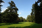
A number of larger parks were created along the street, such as Ichons Park from 1768, Park Gut Hodenberg from 1787, Heinekens Park from 1790, Höpkensruh from around 1800, Muhles Park from 1825 and Landgut Marwede from 1911 (for details, see buildings and Investments).
In the 1970 / 80s, many new buildings were built, including structures based on plans by Gerhard Müller-Menckens (Juergens Holz house and hotel complex, three Eekenhöge houses).
traffic
In local transport in Bremen , the bus route 33 (Horner Church - Im Holze - Sebaldsbrück) runs partly on Oberneulander Landstrasse.
Buildings and facilities
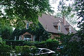
On the street there are mostly one and two-story buildings, which are mostly residential buildings.
- Oberneulander Landstrasse at the corner of Hodenberger Strasse No. 10: 1- and 2-storeys. Manor from 1767 on the Good Hodenberg and the seven-hectare landscape park with the Baroque tuff - Grotto of landscape architect Christian Roselius and the Pavilion at 1906th
- No. 8: 1-sch. Farmhouse of 1720, a thatched , Low German 2-stator half-timbered house with hipped as restaurant Meyer in the boom ( at the barrier the nearby border), even then with dispensing operation.
- No. 24: 1-sch. Brinksitzerhaus Oberneulander Landstrasse was built as a half-timbered farmhouse from 1833 with a barn for the farmer Elard Bartels.
- No. 27/29: 2-storey, 7-axis villa from 1924 based on plans by Rudolf Alexander Schröder from the Marwede estate with 1-storey. Annexes and park (1911) with an octagonal pavilion with a copper-covered bell dome built for Hermann Marwede ; later Hohenkamp mental hospital, today DRK Haus Hohenkamp nursing home .
- No. 33: 1-sch. Classicist hipped roof house from around 1720 with portico columns based on plans by Hinrich Kaars (?) built as Landhaus Hucke , rebuilt in 1874 as Haus Hoogenkamp based on plans by Johann Georg Poppe and in 1911 by architect Hans Haering.
- No. 37/41: Evangelical, neo-Gothic parish church of St. Johann from 1860 based on plans by Heinrich Müller as a successor to a Romanesque church from the 12th century.
- No. 37/41: Neo-Gothic cemetery chapel from 1905 based on plans by Hugo Wagner
- 65 to 69: Muhles Park, Höpkensruh, Böving'sches Landgut with Landhaus Böving , Landgut Muhle
- No. 65: Muhles Park with the 1-storey. classical Meierhof Böving from around 1815 and the pavilion; Rebuilt in 1922 according to plans by Walter Görig .
- No. 67: Hofmeierhaus in Muhles Park from around 1910 in reform style
- No. 69: Höpkens Ruh donated by the merchant and shipowner Johann Höpken (1801–1877), among other things with the seven hectare landscape park with the Linnaeus obelisk. Before that, from 1784 it was the Schultz estate, owned by the lawyer Dr. Johann Friedrich Schultze until it was bought by the Höpkens family in 1859.
- No. 70: 2-sch. classicist Caesar-Ichon country house and landscape park; from 1768 baroque estate Post and garden according to plans by gardener Gottlieb Altmann, from 1829 country residence of Senator Gerhard Caesar with the existing manor from 1843 according to plans by Anton Theodor Eggers and from 1912 estate of the Ichon family; 1975/77 new buildings for a retirement home complex including the Villa Ichon. The now English landscape garden was redesigned according to plans by Wilhelm Benque (1814–1895).
- No. 93: 1-sch. House Schumacher from around 1780 as a half-timbered building
- No. 141A: 1-gesch. Thatched summer house from 1930 with a crooked hip designed by Wilhelm Heinrich Rohmeyer from Fischerhude in a country house style for Mally Schmidt
- No. 151/153: Heinekens Park , 2.7 hectare park from after 1790 by and for Bremen's Mayor Christian Abraham Heineken with the planning assistance of gardener Gottlieb Altmann.
- No. 151: 1-sch. Haus Heineken from around 1790, rebuilt in 1871 according to plans by Gustav Runge .
- No. 151: Schumacher estate with the manor house
- No. 153: 1-sch. Hofmeierhaus from around 1790 for Heineken
- No. 183: 1-sch. Hipped roof house as Haus Weyhausen from 1914 according to plans by Rudolf Alexander Schröder and Diedrich Luley in reform style for Helene Weyhausen, Georg Schütte's mother-in-law.
- No. 189D: Gate from 1913 from the Schütte estate based on plans by Rudolf Alexander Schröder.
Other buildings and facilities worth mentioning
- No. 6: 1-sch. Residential house with a half-hip roof
- No. 22: 1-sch. House Hus Möhlenbrock in der Hell from 1909 with a mansard roof
- No. 25: Park and 1-gesch. Building of the Hubertus Reitverein Bremen , Hodenberger Str. 10
- Rockwinkeler Landstraße 5: Thatched Low German two- column half-timbered farm from around 1800, the Lür-Kropp-Hof , since 1970 the municipal Lür-Kropp Foundation .
- No. 36 and Rockwinkeler Heerstraße 4: 2-gesch. School Oberneuland , a primary school in old and new buildings.
- No. 43: 2-sch. Residential and inn with hipped roof, behind the cemetery and the above-mentioned cemetery chapel.
- No. 62: 1-sch. Half-timbered house
- No. 70: 3- / 4-layered Foundation residence Ichon-Park of the Bremer Heimstiftung from 1977 based on plans by Wilfried Turk , Volker Borchers and Rudi Richter.
- No. 85B: 1-gesch. Building of the riding club Rosenbusch Oberneuland.
- No. 101: 1-sch. Thatched half-timbered house with a crooked hip
- No. 104: 1-gesch. Building of the Green Gold Club Bremen from 1932; Multiple German, European and world champion in dancing.
- No. 143: 3-sch. Ecumenical grammar school in Bremen founded in 1981 by Erika Opelt-Stoevesandt .
- No. 145C: Riding and Driving Association Oberneuland
- No. 165: 1-sch. restaurant
- No. 166: 3-sch. postmodern residential building from the 1990s
- No. 174: 1-gesch. Half-timbered house with ancillary facilities
- No. 178: 1-sch. Sasu youth center of the Oberneuland citizens' initiative
Monuments, plaques
- No. 33: Garden sculptures from the 18th century
- No. 37/41: Memorial for those who died in both World Wars from 1923 based on plans by Hans Haering.
- No. 65: Garden vase in Muhles Park
- No. 69: Linnaeus Obelisk on Höpkensruh from around 1800 as a memory of the botanists Haller , Linné , Jaquin and Roth
- No. 151: Stone woman figure in Heinekens Park
See also
literature
- Herbert Black Forest : The Great Bremen Lexicon. 2nd, expanded and updated edition. In two volumes. Edition Temmen, Bremen 2003, ISBN 3-86108-693-X (first edition: 2002, supplementary volume A – Z. 2008, ISBN 978-3-86108-986-5 ).
- Monika Porsch: Bremen Street Lexicon. Complete edition. Schünemann, Bremen 2003, ISBN 3-7961-1850-X .
- Rudolf Stein : Classicism and Romanticism in the architecture of Bremen. Volume II, Hauschild, Bremen 1965.
Individual evidence
- ↑ See: Lüder Halenbeck: 50 excursions in the area around Bremen. Eduard Hampe publisher, Bremen 1893, pp. 117–119 ( URL , persistent URL at the State and University Library Bremen ).
- ^ Dehio Bremen / Lower Saxony 1992.
- ^ Dehio Bremen / Lower Saxony 1992.
- ↑ Architecture Guide Bremen: b.zb: 152
Coordinates: 53 ° 5 ′ 52 " N , 8 ° 55 ′ 32" E


