Oravský Podzámok
| Oravský Podzámok | ||
|---|---|---|
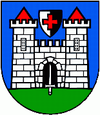
| coat of arms | map | |

|
|
|
| Basic data | ||
| State : | Slovakia | |
| Kraj : | Žilinský kraj | |
| Okres : | Dolny Kubin | |
| Region : | Orava | |
| Area : | 35.248 km² | |
| Residents : | 1,373 (Dec 31, 2019) | |
| Population density : | 39 inhabitants per km² | |
| Height : | 511 m nm | |
| Postal code : | 027 41 | |
| Telephone code : | 0 44 | |
| Geographic location : | 49 ° 16 ′ N , 19 ° 21 ′ E | |
| License plate : | DK | |
| Kód obce : | 509957 | |
| structure | ||
| Community type : | local community | |
| Structure of the municipality: | 3 parts of the community | |
| Administration (as of November 2018) | ||
| Mayor : | Jozef Záhora | |
| Address: | Obecný úrad Oravský Podzámok 61 02741 Oravský Podzámok |
|
| Website: | www.oravsky-podzamok.sk | |
| Statistics information on statistics.sk | ||
Oravský Podzámok (until 1927 without name addition in Slovak "Podzámok"; German lower castle - more rarely Arwa , Hungarian Árvaváralja ) is a municipality in northern Slovakia , in the Arwa region . It is located in the Arwa Valley , between the Oravská Magura and Oravská vrchovina massifs , about eleven kilometers from Dolný Kubín and 29 kilometers from the Polish border.
The place was first mentioned in writing in 1559 and developed from a settlement near the Arwaburg .
The municipality also includes the places Široká and Dolná Lehota (incorporated in 1974).
Personalities
- Ján Sinapius-Horčička (1625–1682), Slovak humanist and theologian
Web links
Commons : Oravský Podzámok - collection of pictures, videos and audio files


