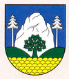
Vyšný Kubín
| Vyšný Kubín | ||
|---|---|---|
| coat of arms | map | |

|
|
|
| Basic data | ||
| State : | Slovakia | |
| Kraj : | Žilinský kraj | |
| Okres : | Dolny Kubin | |
| Region : | Orava | |
| Area : | 12.742 km² | |
| Residents : | 787 (Dec. 31, 2019) | |
| Population density : | 62 inhabitants per km² | |
| Height : | 468 m nm | |
| Postal code : | 027 01 | |
| Telephone code : | 0 44 | |
| Geographic location : | 49 ° 11 ′ N , 19 ° 18 ′ E | |
| License plate : | DK | |
| Kód obce : | 510181 | |
| structure | ||
| Community type : | local community | |
| Administration (as of November 2018) | ||
| Mayor : | Antonín Zámečník | |
| Address: | Obecný úrad Vyšný Kubín Hviezdoslavova 117/5 02701 Vyšný Kubín |
|
| Website: | www.vysnykubin.sk | |
| Statistics information on statistics.sk | ||
Vyšný Kubín (until 1927 also "Horný Kubín" in Slovak; German rarely Oberkubin , Hungarian Felsőkubin ) is a municipality in northern Slovakia . It is located at the foot of the Chočské vrchy about 3 km from Dolný Kubín .
The place was first mentioned in writing in 1325.
From 1986 to 1990 it belonged to Dolný Kubín as part of the municipality .
Personalities
- Pavol Országh Hviezdoslav (1849–1921), Slovak writer, born in Vyšný Kubín
- Margita Figuli (1909–1995), Slovak writer, born in Vyšný Kubín

