Veličná
| Veličná | ||
|---|---|---|
| coat of arms | map | |

|
|
|
| Basic data | ||
| State : | Slovakia | |
| Kraj : | Žilinský kraj | |
| Okres : | Dolny Kubin | |
| Region : | Orava | |
| Area : | 29,302 km² | |
| Residents : | 1,338 (Dec. 31, 2019) | |
| Population density : | 46 inhabitants per km² | |
| Height : | 484 m nm | |
| Postal code : | 027 54 | |
| Telephone code : | 0 43 | |
| Geographic location : | 49 ° 16 ′ N , 19 ° 21 ′ E | |
| License plate : | DK | |
| Kód obce : | 510165 | |
| structure | ||
| Community type : | local community | |
| Structure of the municipality: | 2 parts of the community | |
| Administration (as of November 2018) | ||
| Mayor : | Daniel Laura | |
| Address: | Obecný úrad Veličná 164 02754 Veličná |
|
| Website: | www.velicna.sk | |
| Statistics information on statistics.sk | ||
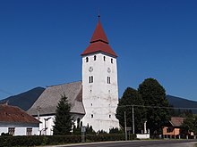
Veličná (up to 1927 Slovak also "Veľká Ves"; Hungarian Nagyfalu - older also Velicsna , the name means something like " big village") is a municipality in northern Slovakia in the Orava Valley in the Arwa (Slovak Orava ) region near the city Dolny Kubin .
The place was first mentioned in 1272 as Villa Magna . From about the 14th century until 1683 it was the seat of the county administration of Arwa county , after which it moved to Dolný Kubín.
In 1950 the village of Revišné was incorporated, which today forms one of the two parts of the municipality. From 1950 to 1959 Poruba-Geceľ (today Oravská Poruba ) was also part of the municipality.
Web links
Commons : Veličná - collection of images, videos and audio files

