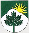
Jasenová
| Jasenová | ||
|---|---|---|
| coat of arms | map | |

|
|
|
| Basic data | ||
| State : | Slovakia | |
| Kraj : | Žilinský kraj | |
| Okres : | Dolny Kubin | |
| Region : | Orava | |
| Area : | 11.930 km² | |
| Residents : | 419 (Dec. 31, 2019) | |
| Population density : | 35 inhabitants per km² | |
| Height : | 537 m nm | |
| Postal code : | 027 01 ( Vyšný Kubín post office ) | |
| Telephone code : | 0 44 | |
| Geographic location : | 49 ° 11 ′ N , 19 ° 18 ′ E | |
| License plate : | DK | |
| Kód obce : | 509710 | |
| structure | ||
| Community type : | local community | |
| Administration (as of November 2018) | ||
| Mayor : | Rajmund Bradík | |
| Address: | Obecný úrad Jasenová 137 02701 Jasenová |
|
| Website: | www.jasenova.sk | |
| Statistics information on statistics.sk | ||
Jasenová (Hungarian Jaszenova ) is a municipality in the Okres Dolný Kubín within the Žilinský kraj in Slovakia .
The place lies between the mountains Oravská Magura in the north and Chočské vrchy in the south at the confluence of several streams. It is located off the main road 59 (E 77) between Dolný Kubín (5 km to the north) and Ružomberok (11 km to the south).
The place was first mentioned in writing in 1320, when the settlement was founded by the nobleman M. Bobrovnícky zu Liptau, an ancestor of the Čaplovič family. In the 16th century the rural district was added along the trade route to the Liptov , in 1618 the landlord family Bencúr settled in the village.
In 1860 and 1897 the place was devastated by devastating floods that came from the Choč Mountains . The classical Protestant church was built in 1836.
Personalities
- Ivan Branislav Zoch (1843–1921), Slovak physicist
- Martin Kukučín (1860–1928), Slovak writer
- Miloslav Krčméry (1860–1902), Protestant pastor and writer
- Ján Vávra (1900–1969), electrical engineer and physics teacher
- Ján Jamnický (1908–1972), director, screenwriter and teacher

