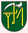
Oravská Poruba
| Oravská Poruba | ||
|---|---|---|
| coat of arms | map | |

|
|
|
| Basic data | ||
| State : | Slovakia | |
| Kraj : | Žilinský kraj | |
| Okres : | Dolny Kubin | |
| Region : | Orava | |
| Area : | 13.258 km² | |
| Residents : | 1,064 (Dec. 31, 2019) | |
| Population density : | 80 inhabitants per km² | |
| Height : | 470 m nm | |
| Postal code : | 027 54 ( Veličná post office ) | |
| Telephone code : | 0 44 | |
| Geographic location : | 49 ° 12 ' N , 19 ° 16' E | |
| License plate : | DK | |
| Kód obce : | 509922 | |
| structure | ||
| Community type : | local community | |
| Structure of the municipality: | 2 parts of the community | |
| Administration (as of November 2018) | ||
| Mayor : | Vladimír Kubišta | |
| Address: | Obecný úrad Oravská Poruba č. 290 027 54 Veličná |
|
| Website: | www.oravskaporuba.sk | |
| Statistics information on statistics.sk | ||
Oravská Poruba (Slovak until 1950 Poruba-Geceľ - until 1927 Poruba-Gecel ; Hungarian Poruba ) is a municipality in the north-center of Slovakia with 1064 inhabitants (as of December 31, 2019), in the Okres Dolný Kubín within the Žilinský kraj and also lies in the traditional Orava landscape .
geography
The village is located in the Oravská vrchovina mountains on the left bank of the Orava . The 13.26 km² large municipal area is mostly hilly and only forested in the peripheral areas. The center of the village lies at an altitude of 470 m nm and is four kilometers from Dolný Kubín .
Administratively, the municipality is divided into the municipality parts Oravská Poruba and Zábrež (incorporated in 1950). Geceľ (also spelled Gäceľ), which was incorporated after 1902 , is not part of the municipality.
history
Oravská Poruba was founded in a forest clearing in the early 14th century by the settlers from Veličná and was first mentioned in 1350 as Jablon . The name points to the brook, mentioned by name in 1347 as Jablonpataka . The current name is mentioned in 1393 and has been used as the only name since around 1547. The village belonged to the Arwaburg estate and was administered by hereditary judges Porubský and Zolo . According to a tax register, in 1547 the village had nine portals . In 1778 there were 256 inhabitants who were mainly employed in agriculture and as day laborers.
The place in Arwa County belonged to the Kingdom of Hungary until 1918 and then became part of Czechoslovakia or now Slovakia.
population
According to the 2011 census, Oravská Poruba had 1025 inhabitants, 1005 of whom were Slovaks and one Roma and one Czech. 18 residents did not provide any information. 620 residents supported the Evangelical Church AB, 316 residents the Roman Catholic Church, five residents the Evangelical Methodist Church and one resident each for the Greek Catholic Church and the Mormons. 45 residents had no denomination and 37 residents had no denomination.
Results after the 2001 census (911 inhabitants):
|
By ethnicity:
|
By denomination:
|
Buildings
Individual evidence
Web links
- Entry on e-obce.sk (Slovak)
