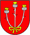
Leštiny
| Leštiny | ||
|---|---|---|
| coat of arms | map | |

|
|
|
| Basic data | ||
| State : | Slovakia | |
| Kraj : | Žilinský kraj | |
| Okres : | Dolny Kubin | |
| Region : | Orava | |
| Area : | 6.933 km² | |
| Residents : | 267 (Dec. 31, 2019) | |
| Population density : | 39 inhabitants per km² | |
| Height : | 484 m nm | |
| Postal code : | 027 01 ( Vyšný Kubín post office ) | |
| Telephone code : | 0 44 | |
| Geographic location : | 49 ° 11 ′ N , 19 ° 21 ′ E | |
| License plate : | DK | |
| Kód obce : | 509787 | |
| structure | ||
| Community type : | local community | |
| Administration (as of November 2018) | ||
| Mayor : | Miroslav Kovalčík | |
| Address: | Obecný úrad Leštiny 22 02701 Vyšný Kubín |
|
| Website: | www.obeclestiny.sk | |
| Statistics information on statistics.sk | ||
Leštiny (Hungarian Lestin - until 1882 Lestinye ) is a municipality in northern Slovakia . It is located between the Oravská Magura mountains in the north and Chočské vrchy in the south, on the banks of the Leštinský stream . It is seven kilometers from Dolný Kubín and 17 kilometers from Ružomberok .
It was first mentioned in writing in 1325. The Protestant wooden church (so-called articulate church ) from 1688, which was painted between the end of the 17th century and 1775, is worth seeing . The altar and the pulpit are from the beginning of the 18th century. In 2008 it was added to the UNESCO World Heritage List .
See also: List of listed objects in Leštiny
literature
- Ernst Hochberger: The big book of Slovakia . Hochberger, Sinn 1997, p. 413
Web links
Commons : Leštiny - collection of pictures, videos and audio files

