Pinar del Río
| Pinar del Río | |
|---|---|
|
Coordinates: 22 ° 25 ′ N , 83 ° 42 ′ W
Pinar del Río on the map of Cuba
|
|
| Basic data | |
| Country | Cuba |
| province | Pinar del Río |
| City foundation | 1669 |
| Residents | 191,328 (2015) |
| City insignia | |
| Detailed data | |
| surface | 730.94 km² |
| Population density | 262 inhabitants / km 2 |
| height | 60 m |
| prefix | + 53-48 |
| Time zone | UTC -5 |
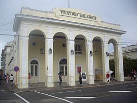
| Teatro Milanés | |
Pinar del Río is the capital of the province of the same name and is located in western Cuba about 150 kilometers from the capital Havana . It has 191,328 inhabitants (2015) and is located on the Río Guamá at an altitude of 60 meters above sea level. Pinar del Río is the "tobacco capital" of Cuba. Around 80 percent of the country's total production comes from this area. The electronics combine " Ernesto Che Guevara " also produces solar modules that can be exported here.
history
The place was founded in 1669 as "Nueva Filipina". Because of the surrounding pine forests and the nearby river Río Guamá, the name was later changed to "Pinar del Río" ("Pine grove on the river"). Before that, indigenous people from the Guanahatabeyes tribe lived in this region , but they were exterminated. The city grew rapidly because Cuban tobacco was in great demand. Nevertheless, shortly after the revolution , Pinar del Río was the poorest region in Cuba. In the meantime, however, this has changed, not least because of the relatively good infrastructure: after the revolution, Pinar del Río was connected to the Cuban East-West motorway ("autopista"), there is also a rail link and an airport. Today Pinar del Río is considered the wealthiest region in Cuba.
In 1896 the city was occupied by General Antonio Maceo . During the Cuban Missile Crisis , the region around Pinar del Río played a role again, as most of the Soviet missiles were stationed here.
Parish partnership
Attractions
Personalities
- Cirilio Villaverde (* 1812 in San Diego de Nuñez, Pinar del Río province), writer; wrote, among others, Cecilia Valdés
- Armando Valladares (born 1937), writer and former ambassador to the United States in the United Nations Commission on Human Rights
- Pedro Pablo Oliva (* 1949), national prize winner for sculpture, painter
- Abel Prieto (* 1950), politician, writer, editor and teacher
- Pedro Pérez (1952-2018), triple jumper
- Roberto Robaina (* 1956), painter and former politician
- Rene Capo (1961–2009), American judoka
- Julio Quintana Martínez (* 1962), former boxer
- Alberto Rodríguez Hernández (* 1963), former wrestler
- Alejandro Puerto (* 1964), former wrestler
- Mellow Man Ace (* 1967), American-Cuban rapper
- Omar Linares (* 1967), former baseball player and two-time Olympic champion
- Héctor Milián (* 1968), former wrestler
- Xiomara Rivero (* 1968), former javelin thrower
- Darsi Ferrer (1969–2017), doctor, independent journalist and dissident
- Vladimir Rivero Hernández (1971-2004), Cuban-Hungarian handball player
- Carlos Pintado (* 1974), Cuban-American poet, storyteller and journalist
- Jaliesky García (* 1975) Icelandic former handball player
- Michel López (* 1976), former super heavyweight boxer
- Yoel Romero (* 1977), MMA fighter and former wrestler
- Andry Laffita (born 1978), boxer
- Yosvany Falcón (* 1979), former cyclist
- Jorge Pupo (* 1982), water diver
- Yarelys Barrios (* 1983), discus thrower
- Yoan Pablo Hernández (* 1984), former Cuban-German boxer
- Yarianna Martínez (* 1984), triple jumper
- Diosmely Peña (* 1985), middle distance runner (800 meter distance)
- Yarisley Silva (* 1987), pole vaulter
- Roniel Iglesias (* 1988), boxer
- Aymée Martínez (* 1988), sprinter (400 meter run)
- Lisandra Teresa Ordaz Valdés (* 1988), chess player
- Idalys Ortíz (* 1989), heavyweight judoka
Web links
- Pinar del Río in the official Cuban online encyclopedia EcuRed (Spanish)
- National Bureau of Statistics and Information; Statistical yearbook of 2015; Area, population and population density .


