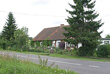
Pożarki
| Pożarki | ||
|---|---|---|

|
|
|
| Basic data | ||
| State : | Poland | |
| Voivodeship : | Warmia-Masuria | |
| Powiat : | Kętrzyn | |
| Gmina : | Kętrzyn | |
| Geographic location : | 54 ° 3 ' N , 21 ° 3' E | |
| Residents : | 180 | |
| Telephone code : | (+48) 89 | |
| License plate : | NKE | |
| Economy and Transport | ||
| Street : | Ext. 592 : Bartoszyce - Kętrzyn ↔ Giżycko | |
| Rail route : | no rail connection | |
| Next international airport : | Danzig | |
| Kaliningrad | ||
| Administration (as of 2008) | ||
| Village chief : | Marian wheel | |
Pożarki (German Pohiebels ) is a village in Poland in the Warmian-Masurian Voivodeship . It belongs to the powiat Kętrzyński , Gmina Kętrzyn (rural community Rastenburg) . The localities of Kwiedzina (Queden) , Martiany (Mertenheim) , Osewo (Wossau) , Owczarnia (sheep farm) and Pożarki itself belong to the Schulzenamt ( sołectwo ) Pożarki .
geography
Pożarki is located in northern Poland, about 30 kilometers south of the state border with the Russian Kaliningrad Oblast .
history
East of the place was a Prussian settlement. In the 19th century a settlement was established on the site of today's Pożarki. At the end of the Second World War , the Red Army marched into the area in 1945 . As a result of the war, the village became part of Poland. In the school year 1945/46 a two-class school was in operation again, in 1970 it was eight-class.
In 1954 Pożarki became the seat of a Gromada , which was dissolved again in 1957. Since 1973 Pożarki has been a Schulzenamt with five localities in the Kętrzyn municipality.
Population development
In 1900 there were 149 people living on the Pohiebels estate. In 1970 194 people were counted in the village.
Economy and Infrastructure
The village is located on Voivodship Road 592 which leads through Kętrzyn in the northwest after about ten kilometers. In the southeast the 592 ends after about 17 kilometers at Giżycko where it joins the national road 59 .
The nearest international airport is Kaliningrad Airport , which is located about 110 kilometers northwest on Russian territory. The nearest international airport on Polish territory is Lech Walesa Airport in Gdansk, about 200 kilometers to the west .
literature
- Tadeusz Swat: Dzieje Wsi . In: Aniela Bałanda and others: Kętrzyn. Z dziejów miasta i okolic . Pojezierze, Olsztyn 1978, p. 218 ( Seria monografii miast Warmii i Mazur ).
Web links
Individual evidence
- ↑ BIP Gmina Kętrzyn, Jednostki pomocnicze ( Memento of the original from August 21, 2009 in the Internet Archive ) Info: The archive link was inserted automatically and has not yet been checked. Please check the original and archive link according to the instructions and then remove this notice. , accessed Dec. 21, 2008
- ↑ gemeindeververzeichnis.de, community directory Germany 1900 - Rastenburg district , accessed on December 21, 2008
- ↑ Swat 1978, p. 218


