Qark Fier
| Qark : | Fier |
| Seat: | Fier |
| Former circles : | Fier , Lushnja and Mallakastra |
| Surface: | 1890 km² |
| Residents: | 310.331 Status: 2011 |
|
Population density: |
164 inhabitants / km² |
| Chairman: | |
| Qark Council: | 96 members |
| Members of Parliament : | 16 |
| ISO-3166-2 code: |
AL-04
|


The Qark Fier ( Albanian Qarku i Fierit ) is one of the twelve Qarks in Albania . It is located in central Albania and has an area of 1890 square kilometers. The capital is Fier .
geography
The Qark Fier covers an area in central Albania, large parts of the Myzeqe plain and the hills of the Mallakastra to the south . The Adriatic borders the Qark in the west. The Seman River runs through the area from east to west. In the southeast the Gjanica and Vjosa form the most important waters. In the northwest of the area lies the Karavasta lagoon , about a quarter of which, together with parts of the spit , is protected as the Divjaka-Karavasta National Park .
In the north, the Shkumbin forms the border with Qark Durrës . In the north-east lies the Qark Elbasan , east of the Qark Berat . In the south-east there is a short section of the border with Qark Gjirokastra . To the southwest the Vjosa forms the border to the Qark Vlora .
The agricultural town of Fier forms the economic and administrative center. The second largest city is Lushnja in the northeast.
Today the Qark is divided into the six municipalities Divjaka , Fier, Lushnja, Mallakastra , Patos and Roskovec . Until 2015, the area was divided into the districts of Fier , Lushnja and Mallakastra and 42 communities.
population
The 2011 census recorded a population of 310,331. In the previous ten years, almost 20% of the net residents left the region.
About 48.52% of the population are Muslims , in addition 1.01% are Bektashites . About 13.76% of the population are Orthodox and 1.98% Catholic Christians. Almost 0.11% are Protestant, 0.06% belong to other Christian denominations. 7.15% are believers without a denomination, 3.61% are atheists and 20.93% gave no information about their religious affiliation.
Politics and administration
The Qark Council (alb. Këshilli i Qarkut ) consists of 96 members.
The Qark Fier has 16 members out of a total of 140 for the legislative period of the Albanian parliament beginning in 2009 and 2013 .
| local community | Population (2011) | Old churches | circle |
|---|---|---|---|
| Divjaka | 34,254 | Divjaka, Grabjan, Gradishta, Rremas, Tërbuf | Lushnja |
| Fier | 120,655 | Cakran , Dërmenas, Fier, Frakull, Levan , Libofsha, Mbrostar, Portëz, Qënder, Topoja | Fier |
| Lushnja | 83,659 | Allkaj, Ballagat, Bubullima, Dushk, Fier Shegan, Golem, Hysgjokaj, Karbunara, Kolonja, Krutja, Lushnja | Lushnja |
| Mallakastra | 25,062 | Aranitas, Ballsh , Fratar, Greshica, Hekal, Kuta, Ngraçan, Qendër Dukas, Selita | Mallakastra |
| Patos | 22,959 | Patos, Ruzhdija, Zharëz | Fier |
| Roskovec | 21,742 | Kuman, Kurjan, Roskovec, Struma | Fier |
| circle | Capital | surface | Population (2011) |
Population (2001) |
Number of municipalities |
|---|---|---|---|---|---|
| Fier | Fier | 785 km² | 165.256 | 200,154 | 17th |
| Lushnja | Lushnja | 712 km² | 117.913 | 144.351 | 16 |
| Mallakastra | Ballsh | 388 km² | 25,062 | 39,881 | 9 |
Historic sites
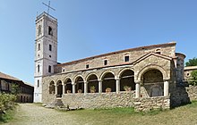
The Qark Fier is rich in ancient sites, of which Apollonia is the most famous. The Illyrian town of Byllis and the Christian-Orthodox monastery Ardenica (13th century) also belong to it. Prehistoric finds have been made at Cakran . Various fortified hill settlements can be found in the Mallakastra area.
Web links
Individual evidence
- ↑ a b c d Ines Nurja: Censusi i popullsisë dhe banesave / Population and Housing Census - Fier 2011 . Results Kryesore / Main Results. Ed .: INSTAT . Pjesa / Part 1. Adel Print, Tirana 2013 ( document [PDF; accessed on January 31, 2019]).
- ↑ INSTAT (Ed.): Population and Housing Census in Albania 2011: Preliminary Results . Tirana December 2011 ( online version [PDF; 5.8 MB ; accessed on January 3, 2020]).
- ^ Albania Districts. In: Statoids. Retrieved October 30, 2011 .
Coordinates: 40 ° 46 ′ N , 19 ° 37 ′ E

