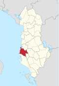
Circle Fier
| Circle : | Fier |
| Main place: | Fier |
| Qark : | Qark Fier |
| Surface: | 785 km² |
| Residents: | 165,356 as of 2011 |
|
Population density: |
210.64 inhabitants / km² |
| ISO-3166-2 code: | AL-FR |
| License plate : | FR |
The district of Fier ( Albanian : Rrethi i Fierit ) was one of the 36 administrative districts in Albania that were abolished in the summer of 2015 after an administrative reform. The area with an area of 785 square kilometers in the Qark of the same name had 165,356 inhabitants (2011 census), with the local administration even speaking of 263,701 inhabitants. The district was named after the capital Fier .
geography
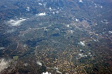
The county is located in the southern part of the very flat Myzeqe - level . Only in the southeast does it turn into hill country. The plain, north of Fier still loosened by the Ardenica hill, used to be a large swamp area.
With a population density of 235 inhabitants per square kilometer, the district was one of the five most densely populated districts in Albania. A large part of the population still does not live in cities. In addition to the main town of Fier with almost 60,000 inhabitants, Patos (15,000 inhabitants) and Roskovec (5000 inhabitants) are among the larger towns in the district. 11,722 people live in the large former community of Cakran in the far south of the district (2011 census).
economy
The oil deposits in the eastern area of the Fier district are of particular economic importance . In addition, the region is one of the agriculturally important areas of Albania.
The ruins of the ancient city of Apollonia are of great cultural and historical importance . The Adriatic coast is still hardly developed.
Communities
Today the area of the district belongs to the municipalities ( Bashkia ) Fier, Patos and Roskovec.
| Surname | Population (2011) | Community type | Heard today |
|---|---|---|---|
| Fier | 55,845 | Bashkia | Fier |
| Patos | 15,397 | Bashkia | Patos |
| Roskovec | 4,975 | Bashkia | Roskovec |
| Cakran | 11,722 | Komuna | Fier |
| Dermenas | 7,788 | Komuna | Fier |
| Frakull | 6,820 | Komuna | Fier |
| Kuman | 5,611 | Komuna | Roskovec |
| Kurjan | 3,618 | Komuna | Roskovec |
| Levan | 8,159 | Komuna | Fier |
| Libofsha | 6,149 | Komuna | Fier |
| Mbrostar | 7,460 | Komuna | Fier |
| Portëz | 8,259 | Komuna | Fier |
| Qënder Çlir | 4,207 | Komuna | Fier |
| Ruzhdija | 2,326 | Komuna | Patos |
| Strum | 7,538 | Komuna | Roskovec |
| Topoja | 4,246 | Komuna | Fier |
| Zharrës | 5,236 | Komuna | Patos |


