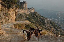
Kruja district
| Circle : | Kruja |
| Main place: | Kruja |
| Qark : | Qark Durrës |
| Surface: | 333 km² |
| Residents: | 59,814 as of 2011 |
|
Population density: |
179.62 inhabitants / km² |
| ISO-3166-2 code: | AL-KR |
| License plate : | KR |
The district of Kruja ( Albanian : Rrethi i Krujës ) was one of the 36 administrative districts of Albania that were abolished in the summer of 2015 after an administrative reform. The area with an area of 333 square kilometers belongs to the Qark Durrës and today forms the municipality of Kruja . In 2011 the district had 59,814 inhabitants. The district was named after the capital Kruja .
geography
The district comprised an area in the flat plain of the Ishëm river north of Tirana and in the east bordering Skanderbeg mountains , which reach an altitude of more than 1400 meters. In the northwest it ended a few kilometers from the coast of the Adriatic Sea . In the west the plain is closed by a chain of hills.
The place Fushë-Kruja ( Kruja plain ) developed into the new, unofficial center of the region, as the main place Kruja, located high above the plain on the mountain slope, is difficult to reach. In the last decades, numerous people have settled in the fertile and developed plain, so that the neighboring municipality of Thumana, which is adjacent to Fushë-Kruja, already had over 12,000 inhabitants, while the neighboring municipality of Nikël to the south had almost 10,000 inhabitants.
In Fushë-Kruja, the roads from Tirana ( SH 1 ) and Durrës ( SH 52 ) unite to form the only main traffic axis to northern Albania. A branch leads to Kruja.
North-east of Kruja is the small Qafë Shtama National Park . On an area of around 2000 hectares, there are forests, springs and a few small lakes in a beautiful mountain landscape .
In the village of Bilaj, west of Fushë-Kruja, a thermal spring rises from the alluvial soil of the plain, brought up by the Ishëm . The sulphurous water, which also contains calcium , sodium , iron and manganese , is 55 ° C warm. There is a small, simple healing center for spa guests.
economy
Thanks to the proximity to the capital Tirana and the central location within Albania, various economic sectors have developed in the Kruja district.
Business
The district had achieved fame in Tirana for one product in particular: furniture is produced in numerous places . One furniture shop after the other is lined up along the main streets.
The communists had already built a cement factory and other industrial facilities in Fushë-Kruja . The factories were built in easily accessible places on the plain, although many residents from Kruja also worked there, so as not to spoil the historical place with industrial plants. Building materials are still produced in the region.
tourism
The city of Kruja is one of the most important tourist places in the country. The castle was the ancestral seat of the national hero Skanderbeg , and from here he fought the Turks . Together with the old bazaar , the castle and its museums are a popular destination for day-trippers from Tirana. Souvenirs are offered in large numbers around the sights . Numerous restaurants and cafés are available to visitors, but hardly any of them stay overnight.
The old Illyrian settlement of Zgërdhesh , which lies on a hill below Kruja, has not yet been able to attract tourists .
In the pine forest on the road to Kruja many restaurants have emerged that allow trippers away the hours in the countryside.
traffic
In the southwest near the village of Rinas is Mother Teresa Airport , Albania's only international airport . While commuters from Tirana are mainly employed at the airport itself, a number of hotels , cafes and other services have sprung up around the airport that belong to or employ local residents.
New expressways connect Fushë-Kruja with the city of Lezha , which is halfway to Shkodra , and the highway from Tirana to Durrës near Vora . These roads are part of the new axis from central Albania to Kosovo ( A1 motorway ) and have been expanded in parts to four lanes.
The railway line to Shkodra runs through the district, but does not open up the important places. Only a sideline leads to the industrial facilities of Fushë-Kruja. Regular buses connect Fushë-Kruja with Tirana's center.
Communities
The municipalities of the district were combined in 2015 in the municipality of Kruja .
| Surname | Residents | Area (km²) | Community type |
|---|---|---|---|
| Kruja | 11,721 | 40 | Bashkia |
| Fushë-Kruja | 18,477 | 49 | Bashkia |
| Bubq | 5,951 | 50 | Komuna |
| Cudhi | 1,812 | 88 | Komuna |
| Kodër Thumana | 12,335 | 71 | Komuna |
| Nikël | 9,518 | 35 | Komuna |
Individual evidence
- ↑ a b Ines Nurja: Censusi i popullsisë dhe banesave / Population and Housing Census - Durrës 2011 . Results Kryesore / Main Results. Ed .: INSTAT . Pjesa / Part 1. Adel Print, Tirana 2013 ( instat.gov.al [PDF; 1.5 MB ; accessed on April 14, 2019]).
- ↑ Pushimet në Llixha Ujrat Termale. In: Agjencia Kombëtare e Turizmit. Archived from the original on June 3, 2013 ; Retrieved April 26, 2009 (Albanian).
- ^ Durres, a good business choice. (PDF) Durrës Chamber of Commerce and Industry, May 2009, archived from the original on February 22, 2015 ; accessed on February 2, 2014 .


