
Kavaja district
  |
|
| Circle : | Kavaja |
| Main place: | Kavaja |
| Qark : | Tirana County |
| Surface: | 393 km² |
| Residents: | 62,242 as of 2011 |
|
Population density: |
158.37 inhabitants / km² |
| ISO-3166-2 code: | AL-KA |
| License plate : | KJ |
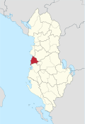
The district of Kavaja ( Albanian : Rrethi i Kavajës ) was one of the 36 administrative districts of Albania that were abolished in the summer of 2015 after an administrative reform. The district with an area of 393 km² belonged to the Qark Tirana . It had 62,242 inhabitants (2011). The district was named after the capital Kavaja .
geography

The district covered an area in central Albania on the Adriatic coast south of Durrës . A furrowed hill country with heights of up to 400 meters joins a wide coastal plain in the east. Shortly before the sea, the plain is divided again by a chain of hills, the Kodrat e Kryevidhit . The southern border of the county Lushnja was by the river Shkumbin formed. The Bashtova fortress , a well-preserved fort from the 15th century, is located on the plain at the mouth .
population
The region's population is rural. Outside the cities of Kavaja and Rrogozhina (a little over 5000 inhabitants) most of the inhabitants live from agriculture.
economy
traffic
Kavaja was founded on the route of important trade connections. Even today one of the most important connecting roads in the country runs through the district of Durrës and Tirana to southern Albania. This was expanded into one of the first highways in the country in 2000 . At Rrogozhina in the southeast the road and the railway line of Hekurudha e Shqipërisë share . To the west it goes through the Shkumbin Valley on the route of the ancient Via Egnatia to Elbasan and on to Lake Ohrid , to south-eastern Bania and North Macedonia (no railroad). To the south of Rrogozhina, the railroad and roads cross the Shkumbin and lead to Lushnja and southern Albania.
tourism
Tourism is likely to be an important source of income in the region . While the beach of Spilleja in the southwest is not yet very developed, a real boom has already started at Golem on the Bay of Durrës . Numerous hotels, apartment houses, holiday homes, restaurants, cafes and discos have been built in a pine forest directly between the main road and the beach .

Communities
The area of the former district today belongs to the municipalities ( Bashkia ) Kavaja and Rrogozhina .
| Surname | Residents | Community type | belongs to today |
|---|---|---|---|
| Kavaja | 20.192 | Bashkia | Kavaja |
| Rrogozhina | 7,049 | Bashkia | Rrogozhina |
| Golem | 6,994 | Komuna | Kavaja |
| Gosa | 4.120 | Komuna | Rrogozhina |
| Helmës | 3.139 | Komuna | Kavaja |
| Kryevidh | 4,662 | Komuna | Rrogozhina |
| Lekaj | 5.126 | Komuna | Rrogozhina |
| Luz i vogël | 4,735 | Komuna | Kavaja |
| Sinaballaj | 1,191 | Komuna | Rrogozhina |
| Synej | 5,034 | Komuna | Kavaja |
Individual evidence
- ↑ a b Ines Nurja: Censusi i popullsisë dhe banesave / Population and Housing Census - Tiranë 2011 . Results Kryesore / Main Results. Ed .: INSTAT . Pjesa / Part 1. Adel Print, Tirana 2013 ( instat.gov.al [PDF; accessed April 14, 2019]).

Berat | Bulqiza | Delvina | Devoll | Dibra | Durrës | Elbasan | Fier | Gjirokastra | Gramsh | Has | Kavaja | Kolonja | Korça | Kruja | Kuçova | Kukës | Kurbin | Lezha | Librazhd | Lushnja | Malësia e Madhe | Mallakastra | Mat | Mirdita | Peqin | Përmet | Pogradec | Puka | Saranda | Shkodra | Skrapar | Tepelena | Tirana | Tropoja | Vlora