District of Vlora
| Circle : | Vlora |
| Main place: | Vlora |
| Qark : | Vlora County |
| Surface: | 1609 km² |
| Residents: | 126,125 As of 2011 |
|
Population density: |
78.39 inhabitants / km² |
| ISO-3166-2 code: | AL-VL |
| License plate : | VL |
The district of Vlora ( Albanian Rrethi i Vlorës ) was one of the 36 administrative districts of Albania that were abolished in the summer of 2015 after an administrative reform. The area in the south of the country with an area of 1609 square kilometers belongs to the Qark of the same name . In 2011 it had 126,125 inhabitants and a population density of 78.4 inhabitants per square kilometer. It was named after the main town Vlora .
geography
The area of the Vlora County is located in the south-west of the country, the northern part on the coast of the Adriatic Sea , the southern part - known as the Albanian Riviera - on the coast of the Ionian Sea . The northern Adriatic coast is a very flat alluvial land area of the river Vjosa , which formed the border to the Fier district and the transition to the large central Albanian Myzeqe plain. South of the Vjosa is the large lagoon of Narta (4180 hectares), half of which is used for salt production . On the spit is the village of Zvërnec with its medieval church on an island in the lagoon.
To the south of the lagoon is the bay of Vlora . Apart from the north end, the bay is surrounded by hills and mountains - on one of them lies the Kanina Castle . In the opening to the sea lies the island of Sazan . To the south of it lies the approximately 15-kilometer-long Karaburun peninsula , the western tip of which, the Kepi i Gjuhëzës , marks the eastern end of the Strait of Otranto and thus the transition from the Adriatic to the Ionian Sea. The Italian mainland is around 70 kilometers away here.
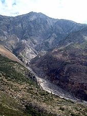
The cliffs of the Ionian Sea can only be reached via the Llogara Pass ( 1050 m above sea level ). Both the Karaburun Peninsula and the Riviera are dry, very arid areas. Significant erosion damage can be seen north of Himara , the main town of the Riviera . The Albanian Riviera includes various villages on the coast, including Palasa , Dhërmi , Vuno , Pilur and Qeparo , the majority of which are a few hundred meters above the beach. The Ceraunic Mountains on the Ionian coast rise steeply out of the water and reach a height of 2045 m above sea level in the Çika Mountains . A. ( Maja e Çikës - highest point of the circle). A small forest area around the Llogara Pass is protected as the Llogara National Park: around the pass there are numerous pine trees shaped by the wind .
Behind the Ceraunian Mountains lies the long valley of the Shushica , which rises at the southeast end of the district in the Kurvelesh region and flows into the Vjosa at the northern border. In the south, the Shushica is surrounded on both sides by high mountains. At the middle reaches these run out in hill country, which defines the whole hinterland of Vlora. Only along the Vjosa and around Selenica is flat land. Bitumen has been mined at Selenica for thousands of years . The hills around Vlora have been planted with many olive and citrus trees.
population
The majority of the population lives in Vlora, one of the largest cities in the country. The other areas are still very rural. Less than ten percent of the population belong to minorities. Many Greeks live in the area of Himara - how big their share is, but is controversial and is always a political issue. There are also Wallachians ( Aromanians ) and Roma . Around 40 percent of the population are Orthodox and Muslim . Around 15 percent are Bektashi .
economy
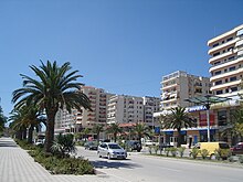
The economy of Vlora is quite diverse compared to many other districts in the country. Vlora is a service and trade center that also has a small port and attracts numerous beach holidaymakers in summer. The tourism has led to the south along the coast of the Bay of Vlora the city's numerous hotels and apartment houses were built.
Like Vlora, Himara and a few other villages on the Albanian Riviera are experiencing a tourism boom . The remote region had previously suffered particularly from emigration.
During the 1990s, Vlora lived particularly close to Italy: night after night, refugees and drugs were smuggled into Western Europe across the Adriatic . The speedboats were destroyed by the police and the Albanians are being helped by foreign authorities to fight organized crime . The Italian Guardia di Finanza operates from Vlora and Sazan in order to detect illegal activities as early as possible. It is believed that many of the new properties built in Vlorë were financed in large part by illegal activities.
Most of the hinterland is still dominated by agriculture and poorly developed. Bitumen is still extracted in Selenica and used for asphalt production outside Albania as well. In Narta salt is obtained. In Vlora there are also beginnings of a fishing industry , while in other places fish is only sold locally. The military still maintains bases at Vlora, Orikum and Himara. In the Pasha Liman Base in Orikum there is also a shipyard, the new boats for the Navy created.
A gas terminal and a thermal power station were built in the industrial area west of Vlorë .
traffic
In the north, the A2 motorway to Levan ensures good access. After the completion of the Fier bypass , Vlora will be continuously connected to Tirana via developed, multi-lane roads. The SH8 road to Himara and on to Saranda over the Llogara Pass has been gradually improved in recent years, but is still narrow and winding. There are projects to relieve the city center of through traffic. The rest of the district is only accessible by small, partly unpaved roads.
The port is currently not of great importance. Ferries only run to Brindisi and cargo handling is limited.
A section of the Albanian railway ends in Vlora - but the traffic is currently suspended. The Ferrovia Decauville a Valona , one of the oldest railway lines in the country, has been connecting the bitumen plant in Selenica with the port of Vlora since the 1920s. The 30 kilometer long narrow-gauge line is destroyed today.
Communities
The area of the district has been divided into the municipalities ( bashkia ) Vlora , Selenica and Himara since 2015 . The latter also includes other communities in the south of the Albanian Riviera that used to belong to the Saranda district .
| Surname | Residents | Community type | Belongs to Bashkia today |
|---|---|---|---|
| Vlora | 79,513 | Bashkia | Vlora |
| Himara | 2,822 | Bashkia | Himara |
| Orikum | 5,503 | Bashkia | Vlora |
| Selenica | 2,235 | Bashkia | Selenica |
| Poor | 2,965 | Komuna | Selenica |
| Brataj | 2,849 | Komuna | Selenica |
| Horë-Vranisht | 2,080 | Komuna | Himara |
| Kota | 3,516 | Komuna | Selenica |
| Novosela | 8,209 | Komuna | Vlora |
| Qendër | 7,621 | Komuna | Vlora |
| Sevaster | 1,720 | Komuna | Selenica |
| Shushica | 3,981 | Komuna | Vlora |
| Vllahina | 3.111 | Komuna | Selenica |
Individual evidence
- ↑ a b Ines Nurja: Censusi i popullsisë dhe banesave / Population and Housing Census - Vlorë 2011 . Results Kryesore / Main Results. Ed .: INSTAT . Pjesa / Part 1. Adel Print, Tirana 2013 ( instat.gov.al [PDF; accessed April 14, 2019]).


