
Ravelsbach
|
market community Ravelsbach
|
||
|---|---|---|
| coat of arms | Austria map | |
 |
|
|
| Basic data | ||
| Country: | Austria | |
| State : | Lower Austria | |
| Political District : | Hollabrunn | |
| License plate : | HL | |
| Surface: | 26.34 km² | |
| Coordinates : | 48 ° 33 ' N , 15 ° 51' E | |
| Height : | 265 m above sea level A. | |
| Residents : | 1,603 (January 1, 2020) | |
| Population density : | 61 inhabitants per km² | |
| Postal code : | 3720 | |
| Area code : | 02958 | |
| Community code : | 3 10 36 | |
| NUTS region | AT125 | |
| Address of the municipal administration: |
Hauptplatz 5 3720 Ravelsbach |
|
| Website: | ||
| politics | ||
| Mayor : | Walter Schmid ( ÖVP ) | |
|
Municipal Council : ( 2020 ) (19 members) |
||
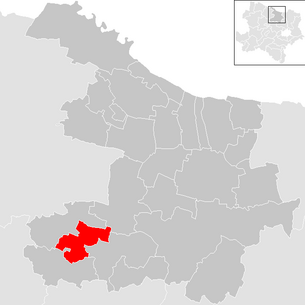
| Location of Ravelsbach in the Hollabrunn district | ||
  |
||
 Ravelsbach municipal office |
||
| Source: Municipal data from Statistics Austria | ||

Ravelsbach is a market town with 1603 inhabitants (as of January 1, 2020) in the Hollabrunn district in Lower Austria .
geography
Ravelsbach is located in the Weinviertel in Lower Austria . The area of the market town covers 26.34 square kilometers. 4.25 percent of the area is forested.
Community structure
The municipality includes the following seven localities (population in brackets as of January 1, 2020):
- Baierdorf (78)
- Gaindorf (260) with fly dance, Gillimühle and Ravelsbach train station
- Minichhofen (116)
- Oberravelsbach (131)
- Parisdorf (140)
- Pfaffstetten (215)
- Ravelsbach (663)
The community consists of the cadastral communities Baierdorf, Gaindorf, Minichofen, Oberravelsbach, Parisdorf, Pfaffstetten and Ravelsbach.
Ravelsbach is about 19 kilometers from the administrative seat of the district, the city of Hollabrunn , and about 50 kilometers from the state capital St. Pölten . The distance to the Czech border is just under 35 km. The Vienna city limits are approx. 50 km away.
Neighboring communities
history
colonization
The Ravelsbach area is an ancient settlement area. Fireplaces and tools from the Paleolithic were found, in the Neolithic a permanent settlement can be assumed. Excavations brought to light finds that can be seen in the Horn, Eggenburg and Krems museums as well as in the Lower Austrian State Museum and the Natural History Museum in Vienna .
Mention
The place comes into the light of history during the Frankish colonization by the Babenbergs. The actual year of foundation is not known.
In 1083 Ramuoldespach is mentioned for the first time in a pen letter. The name goes back, depending on the source, to a Raffolt, Romuald, Ramoult or Ramult, who lived by a stream named after him. This name later passed on to the place.
from history
1110 founded Margrave Leopold III. the saint the parish Ramuoltisbach , to which originally 32 localities belonged. Ravelsbach had thus become a center and developed differently from the surrounding villages. These developed on a rural basis, while trade and handicrafts flourished in Ravelsbach. In a Melker Urbar, Ravelsbach was already referred to as a market in 1314, but the collection decree is missing.
In 1339 a schoolmaster worked here. It is the first written mention of a schoolmaster in the Hollabrunn administrative district. At the same time there was already a bathing room in Ravelsbach, thus also a bathing agent (doctor).
Between 1425 and 1430 the population of Ravelsbach repeatedly suffered from Hussite invasions. In 1481 the Hungarian king Matthias Corvinus occupied the market with his troops. In 1493, the Roman-German King Maximilian Ravelsbach granted market rights for two annual markets.
The Swedes under General Torstenson camped in Ravelsbach during the Thirty Years War in 1645. A sgraffito on the Sternwirtshaus still reminds of this today. Between 1679 and 1680 the plague struck the place. Three years later, in 1683, the Turks pressed Ravelsbach.
The baroque parish church of Ravelsbach was built from 1721 to 1726 according to plans by Jakob Prandtauer . Ravelsbach was opened up in terms of transport in 1770 with the construction of Kaiserstraße (Reichsstraße). In a fire in 1786 a total of 17 residential and outbuildings as well as the falling helmet of the church tower in flames. A shooting society was first mentioned in 1796. During the French Wars between 1799 and 1813, Ravelsbach suffered from numerous recruits and billeting.
A total of 14 houses were cremated in a fire in Kremserstrasse in 1828. Four years later, and over 150 years after the plague, the city was ravaged by cholera in 1832 . Three people drowned in a flood in 1844.
In 1848 the peasants were liberated and the manor was dissolved. The community, which for centuries had been under the protection of the powerful Melk Abbey, now had to take its affairs into its own hands. The district office, tax office and notary's office took over the tasks of the manorial system. In 1850, the post office was built as a post office with mail and a gendarmerie post. In 1851 the district office of the district of Ravelsbach , later the district court, the tax office and the notary's office began their activities. Ravelsbach thus became the center of the judicial district of Ravelsbach .
In 1866 the first district road committee - a forerunner of the road maintenance authority - was elected for the first time. In the same year the place was occupied by Prussian soldiers; Cholera broke out again, this time claiming 40 lives.
The establishment of the Sparkasse in 1869 represents a milestone for the economic development of the community. In 1870 the Franz-Josefs-Bahn was completed, which connected Ravelsbach with Gmünd in one direction and Vienna in the other.
In the following years the place continued to grow. The Ravelsbach Volunteer Fire Brigade was founded in 1882. In 1889 the old town hall on the main square was demolished and a new one was built. The new school building was completed eight years later and a kindergarten was set up another two years later. The increasing importance of the place was taken into account by Ravelsbach in 1896 a stop also for the passenger traffic in the route network of the Kaiser-Franz-Josephs-Bahn . In 1909 it was connected to the telephone network and three years later the telephone service was introduced in the post office.
Because of the First World War , the parish had to give up the two large bells of the parish church in 1917 so that war material could be melted from them.
In 1921 a citizen school , a forerunner of the secondary school, was built, which was attended by talented children from the area, this was converted into a secondary school in 1927. In 1922 the district chamber of farmers was opened, in 1923 the place was connected to the power grid. With the annexation to the German Reich in 1938, the community day was dissolved. After the German Reich lost the Second World War , Ravelsbach was also occupied by the Russians in 1945. There was a command post in the village itself. In 1946 the Russians withdrew from Ravelsbach again.
The sports club was founded in 1947. 32 years after the two bells had to be handed in to be melted down, the new bells of the Ravelsbach parish church were consecrated in 1949. In 1954 the new kindergarten was opened. In 1957 a water pipeline was put into operation and Ravelsbach was connected to the water network.
The large municipality of Ravelsbach was created in 1967 through the unification of the towns of Ravelsbach, Oberravelsbach, Baierdorf and Parisdorf. In this, the secondary school was rebuilt in 1969 and the Jugenddeutschmeisterkapelle founded in 1970. In 1971 the towns of Gaindorf, Pfaffstetten and Minichhofen were added to the larger community. Due to the infrastructure now in place, Ravelsbach received level 1 of five levels in the central spatial planning program of the Lower Austrian provincial government in 1973.
In 1976 a sewage treatment plant was built at the site and the existing water supply system was expanded. In the following year, the teaching pool and indoor pool were completed and the new secondary school was officially opened. In 1979 the sports center was finally built.
The first apartment block of the newly built residential park was handed over to the tenants in 1982. In 1983 the 900th anniversary of the first mention of Ravelsbach was celebrated. The road maintenance depot was rebuilt from 1984 and finally reopened in 1986. The old road maintenance depot was bought by the municipality and adapted as a building yard. In 1991, both the tennis hall and the new fire and training center with an integrated gendarmerie post were built. In the same year the district court was closed. In 1992 the office building was rebuilt and the main square redesigned.
In 1993 the festival "500 years of the market town of Ravelsbach" was celebrated. In the same year, the Sparkassen Horn, Ravelsbach and Kirchberg merged to form a stock corporation, as a result of which the “Saglhof” court building was sold to the Sparkassen AG. In 1995 the municipality's own music school was founded, and the following year the culture trail was created. Finally, in 1998 the primary school building with a gym was opened.
In 2008, work began on restoring the youth home. The Ravelsbach train station has not been served since December 2015.
Population development
In the years from 1981 to 2001 the population increased due to high immigration. However, since 2001 the balance of migration and the birth balance have been negative.

politics
The municipal council has 19 members.
- With the municipal council elections in Lower Austria in 1990, the municipal council had the following distribution: 14 ÖVP and 5 SPÖ.
- With the municipal council elections in Lower Austria in 1995, the municipal council had the following distribution: 13 ÖVP and 6 SPÖ.
- With the municipal council elections in Lower Austria in 2000, the municipal council had the following distribution: 15 ÖVP and 4 SPÖ.
- With the municipal council elections in Lower Austria in 2005 , the municipal council had the following distribution: 13 ÖVP and 6 SPÖ.
- With the municipal council elections in Lower Austria in 2010 , the municipal council had the following distribution: 13 ÖVP and 6 SPÖ.
- With the municipal council elections in Lower Austria in 2015 , the municipal council had the following distribution: 14 ÖVP and 5 SPÖ.
- With the municipal council elections in Lower Austria 2020 , the municipal council has the following distribution: 14 ÖVP and 5 SPÖ.
- mayor
- since ? Walter Schmid (ÖVP)
Culture and sights


- Catholic parish church Ravelsbach Mariä Himmelfahrt: built from 1721 to 1726 according to the plans and under the direction of Jakob Prandtauer .
economy
In 2010 there were 69 agricultural and forestry operations in Ravelsbach, 35 of which were full-time farms that farmed 79 percent of the area. Eleven years before that there were 100 companies with 49 full-time jobs. In the manufacturing sector there were twelve companies with 66 employees, all of whom were employed in the construction industry. The service sector employed 243 people in eighty companies. More than half of them were employed in public and social services, 40 in trade (as of 2011).
traffic
- Train: The nearest train station is in Ziersdorf, six kilometers away. From here there are direct connections to Vienna, Gmünd and Ceske Velenice .
- Street: Horner Straße B4 runs through the market town .
education
In the market town there is a kindergarten, an elementary school and a new middle school .
health
A general practitioner and several specialists ordain in Ravelsbach. There is a pharmacy right in the center.
Personalities
- Sons and daughters of the church
- Johann Paul Schilck (1667–1745), master stonemason, was born in Ravelsbach.
- Georg Müller (1803–1863), Austrian composer and church musician, born in Ravelsbach.
- People related to the community
- Johann Michael Flor (1708-after 1755), plasterer, lived in Ravelsbach for decades
- Ulrich Petrak (1753–1814), poet, lived in Ravelsbach from 1789, died there
- Felix Mitterer (* 1948), Austrian playwright and actor, has lived in Ravelsbach since 2011
Web links
- 31036 - Ravelsbach. Community data, Statistics Austria .
Individual evidence
- ↑ Statistics Austria: Population on January 1st, 2020 by locality (area status on January 1st, 2020) , ( CSV )
- ↑ Church guide published by the Ravelsbach rectory, Gottfried Rennhofer Verlag, Korneuburg 2001
- ^ Statistics Austria, A look at the community Ravelsbach, population development. Retrieved October 17, 2019 .
- ^ Result of the municipal council election 1995 in Ravelsbach. Office of the Lower Austrian State Government, March 30, 2000, accessed on March 27, 2020 .
- ^ Election result of the municipal council election 2000 in Ravelsbach. Office of the Lower Austrian State Government, February 4, 2005, accessed on March 27, 2020 .
- ^ Result of the 2005 municipal council election in Ravelsbach. Office of the Lower Austrian State Government, March 4, 2005, accessed on March 27, 2020 .
- ^ Election result of the municipal council election 2010 in Ravelsbach. Office of the Lower Austrian State Government, October 8, 2010, accessed on March 27, 2020 .
- ^ Election result of the 2015 municipal council election in Ravelsbach. Office of the Lower Austrian State Government, December 1, 2015, accessed on March 27, 2020 .
- ↑ Results of the municipal council election 2020 in Ravelsbach. Office of the Lower Austrian State Government, January 26, 2020, accessed on March 27, 2020 .
- ^ Statistics Austria, A look at the community of Ravelsbach, agriculture and forestry operations. Retrieved October 17, 2019 .
- ^ Statistics Austria, A look at the community of Ravelsbach, workplaces. Retrieved October 17, 2019 .
- ^ Statistics Austria, A look at the community of Ravelsbach, employees. Retrieved October 17, 2019 .
- ^ ÖBB station information, Ziersdorf. Retrieved October 16, 2019 .
- ^ Marktgemeinde Ravelsbach, Our Ravelsbach, School and Education. Retrieved October 17, 2019 .
- ↑ Marktgemeinde Ravelsbach, Our Ravelsbach, Health and Social Affairs. Retrieved October 17, 2019 .

Alberndorf im Pulkautal | Göllersdorf | Digging | Guntersdorf | Hadres | Hardegg | Haugsdorf | Heldenberg | Hohenwarth-Mühlbach am Manhartsberg | Hollabrunn | Mailberg | Maissau | Nappersdorf-Kammersdorf | Pernersdorf | Pulkau | Ravelsbach | Retz | Retzbach | Schrattenthal | Seefeld-Kadolz | Sitzendorf an der Schmida | Wullersdorf | Zellerndorf | Ziersdorf
Cadastral communities: Baierdorf | Gaindorf | Minichhofen | Oberravelsbach | Parisdorf | Pfaffstetten | Ravelsbach
Locations: Baierdorf | Gaindorf | Minichhofen | Oberravelsbach | Parisdorf | Pfaffstetten | Ravelsbach
Market place: Ravelsbach Villages: Baierdorf | Gaindorf | Minichhofen | Oberravelsbach | Parisdorf | Pfaff Stetten Weiler: flying dance | Gillimühle Scattered houses: Ravelsbach train station Other locations: Ravelsbach Castle
Counting district: Ravelsbach | Parisdorf | Oberravelsbach | Baierdorf | Gaindorf | Minichhofen | Pfaffstetten