Hohenwarth-Mühlbach on Manhartsberg
|
market community Hohenwarth-Mühlbach a. M.
|
||
|---|---|---|
| coat of arms | Austria map | |
|
|
||
| Basic data | ||
| Country: | Austria | |
| State : | Lower Austria | |
| Political District : | Hollabrunn | |
| License plate : | HL | |
| Main town : | Hohenwarth | |
| Surface: | 43.54 km² | |
| Coordinates : | 48 ° 30 ′ N , 15 ° 49 ′ E | |
| Height : | 365 m above sea level A. | |
| Residents : | 1.310 (January 1, 2020) | |
| Population density : | 30 inhabitants per km² | |
| Postcodes : | 3472 or for Mühlbach, Bösendürnbach, Zemling, Olbersdorf 3473 or for Ebersbrunn 3711 | |
| Area code : | 02957 | |
| Community code : | 3 10 21 | |
| NUTS region | AT125 | |
| Address of the municipal administration: |
Hohenwarth 67 3472 Hohenwarth-Mühlbach a. M. |
|
| Website: | ||
| politics | ||
| Mayor : | Martin Gudenus ( ÖVP ) | |
|
Municipal Council : ( 2020 ) (19 members) |
||
| Location of Hohenwarth-Mühlbach a. M. in the Hollabrunn district | ||
| Source: Municipal data from Statistics Austria | ||
Hohenwarth-Mühlbach am Manhartsberg (official name: Hohenwarth-Mühlbach aM ) is a market town in the Hollabrunn district in Lower Austria with 1,310 inhabitants (as of January 1, 2020).
geography
The large community is located at the transition from the Waldviertel to the western Weinviertel on the slopes of the Manhartsberg . The area of the market town covers 43.59 square kilometers. 29.87 percent of the area is forested. Gscheinzbach flows through Mühlbach and the casting ditch rises at Hohenwarth .
Community structure
The municipality includes the following seven localities (population in brackets as of January 1, 2020):
- Bösendürnbach (77)
- Ebersbrunn (209)
- Hohenwarth (433)
- Mühlbach am Manhartsberg (213)
- Olbersdorf (57)
- Ronthal (121)
- Zemling (200)
The community consists of the cadastral communities Bösendürnbach, Burgfrieden , Ebersbrunn, Hohenwarth, Mühlbach am Manhartsberg, Olbersdorf, Ronthal and Zemling.
There are three parishes in the municipality - Hohenwarth, Mühlbach, Zemling - which were originally school locations.
Neighboring communities
history
A process of amalgamation of the municipalities began in 1968 and was completed on January 1, 1972. The former independent communities Bösendürnbach, Burgfrieden, Ebersbrunn, Hohenwarth, Mühlbach, Olbersdorf, Ronthal and Zemling were combined to form the large community Hohenwarth-Mühlbach am Manhartsberg.
In 1975 a memorial was set up in memory of Joseph Misson on the 100th anniversary of the death of the dialect poet and priest. In 2002 the memorial was redesigned into a museum. In 2003 the formerly baroque palace garden and the English landscape park of the Mühlbach Palace were opened to the public.
With the ordinance of January 1, 2019, street names were introduced for better orientation and accordingly new house numbering. Around 160 street names were worked out together with the residents. Before that, the houses that were newly built, regardless of where they were, were numbered consecutively, and a situation arose that overwhelmed even locals.
coat of arms
The quartered coat of arms shows a black open flight in the first and fourth golden fields and a golden three-pinned tower on a blue three-mountain in the other fields .
Population development
The migration balance has been positive or balanced since 1991 , so that the population remains constant despite the negative birth balance .

politics
The municipal council has 19 members.
- With the municipal council elections in Lower Austria in 1990, the municipal council had the following distribution: 14 ÖVP, 4 SPÖ and 1 other.
- With the municipal council elections in Lower Austria in 1995, the municipal council had the following distribution: 13 ÖVP, 5 SPÖ and 1 FPÖ.
- With the municipal council elections in Lower Austria in 2000, the municipal council had the following distribution: 14 ÖVP and 5 SPÖ.
- With the municipal council elections in Lower Austria in 2005 , the municipal council had the following distribution: 14 ÖVP and 5 SPÖ.
- With the municipal elections in Lower Austria in 2010 , the municipal council had the following distribution: 15 ÖVP and 4 SPÖ.
- With the municipal council elections in Lower Austria in 2015 , the municipal council had the following distribution: 14 ÖVP and 5 SPÖ.
- With the municipal council elections in Lower Austria 2020 , the municipal council has the following distribution: 14 ÖVP and 5 SPÖ.
- mayor
- 1895–1909 Leopold Diwald , Mayor of Hohenwarth
- until 2005 Josef Hagenbüchl (ÖVP)
- 2005–2015 Alfred Zeilinger (ÖVP)
- since 2015 Martin Gudenus (ÖVP)
Culture and sights
- Mühlbach Castle : First mentioned in 1083, the castle was destroyed in 1481 and rebuilt as a Renaissance castle in the second half of the 16th century . In the 19th century, the exterior and interior were remodeled in the style of historicism and the north wing was added. The castle is located in the center of the village of Mühlbach. The castle can only be viewed from the outside. Some of the rooms are shown to groups by prior arrangement by telephone. In addition, the castle is opened during events. Around the Mühlbach Castle there is a French garden, an English landscape park with rare trees, a pond from the 18th century and the former orangery. The castle park is freely accessible all year round.
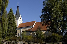
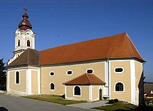
- Catholic parish church Hohenwarth Archangel Michael
- Catholic parish church Mühlbach am Manhartsberg hl. Martin
- Zemling Catholic parish church of the Visitation of the Virgin Mary
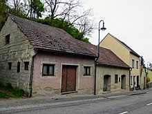
- Misson Museum: The Misson Museum is the cultural center of the region and is located in the house where Joseph Misson was born . In addition to the Misson Museum, there is also an important documentation archive of Lower Austrian dialect poetry, which was created in lifelong work by dialect and Misson researcher Walther Sohm .
economy
In 2010 there were 94 agricultural and forestry holdings, 44 of which were full-time farms that farmed 72 percent of the area. In 1999 there were 134 farms with 57 main occupations. In the manufacturing sector there were thirteen establishments employing 34 workers, mostly in construction. The service sector gave jobs to 124 people in 54 companies. Around a third was employed in trade and a third in social and public services (as of 2011).
Regional cooperation: The market town of Hohenwarth-Mühlbach is a member of the small region of Manhartsberg .
traffic
The Retzer Straße B35 leads through the village from Krems to Retz and on to the Czech border.
education
There is a kindergarten and a primary school in the community.
health
A general practitioner ordains in Hohenwarth-Mühlbach am Manhartsberg.
Personalities
- Sons and daughters of the church
- Joseph Misson (1803–1875), Catholic priest (Piarist) and Austrian dialect poet (ui dialect, epic “Da Naz”).
- Joseph Freiherr von Gudenus (since 1907: Count; since 1919: Joseph Gudenus; 1841–1919), 1896–1902 Land Marshal of the Lower Austrian Parliament
- Leopold Diwald (1862–1927), farmer and politician
- Ludwig Zack (1934–2015), priest and Federal President of Kolping Austria.
- Norbert Franz-Josef Tischelmayer (* 1945), freelance journalist in the wine sector
- People related to the community
- Walther Sohm (1909–2001), elementary school director, Lower Austrian homeland and dialect researcher, died in Bösendürnbach near Mühlbach am Manhartsberg
- Jürgen E. Schmidt (1937–2010), production manager and music producer, died in Zemling
literature
- Roman Freudenschuss: Historical ground plan (local history) of the settlement, castle and church of Zemling. Zemling community, Zemling 1965
Web links
- 31021 - Hohenwarth-Mühlbach on Manhartsberg. Community data, Statistics Austria .
Individual evidence
- ↑ The official spelling is specified or represented in the law on the division of the State of Lower Austria into municipalities, LGBl.No. 1030–94 of December 9, 2011 and on Statistics Austria: A look at the municipality
- ↑ Statistics Austria: Population on January 1st, 2020 by locality (area status on January 1st, 2020) , ( CSV )
- ↑ a b c Memorial of the country: community Hohenwarth-Mühlbach a. M. - local history ; accessed on 7 Jan. 2019
- ↑ Changes to the community from 1945 (associations, partitions, name and status changes). Statistics Austria, pp. 38, 54, 74 , accessed on February 6, 2019 .
- ↑ Marktgemeinde Hohenwarth-Mühlbach a. M .: Official change of address ; accessed on 7 Jan. 2019
- ↑ ORF-Online: 1,300 people get a new address ; accessed on 7 Jan. 2019
- ^ Statistics Austria, A look at the community of Hoehenwart-Mühlbach, population development. Retrieved October 17, 2019 .
- ^ Result of the local council election 1995 in Hohenwarth-Mühlbach am Manhartsberg. Office of the Lower Austrian State Government, March 30, 2000, accessed on March 26, 2020 .
- ^ Election result of the municipal council election 2000 in Hohenwarth-Mühlbach am Manhartsberg. Office of the Lower Austrian State Government, February 4, 2005, accessed on March 26, 2020 .
- ^ Election result of the municipal council election 2005 in Hohenwarth-Mühlbach am Manhartsberg. Office of the Lower Austrian State Government, March 4, 2005, accessed on March 26, 2020 .
- ^ Election result of the municipal council election 2010 in Hohenwarth-Mühlbach am Manhartsberg. Office of the Lower Austrian State Government, October 8, 2010, accessed on March 26, 2020 .
- ^ Election result of the 2015 municipal council election in Hohenwarth-Mühlbach am Manhartsberg. Office of the Lower Austrian State Government, December 1, 2015, accessed on March 26, 2020 .
- ↑ Results of the 2020 municipal council elections in Hohenwarth-Mühlbach am Manhartsberg. Office of the Lower Austrian State Government, January 26, 2020, accessed on March 26, 2020 .
- ↑ Entry about Schloss Mühlbach on Burgen-Austria
- ^ Information board opposite Mühlbach Castle, seen on April 24, 2015
- ^ Baroque garden and English landscape park in Mühlbach am Manhartsberg
- ↑ Statistics Austria, A look at the community of Hoehenwart-Mühlbach, agricultural and forestry operations. Retrieved October 17, 2019 .
- ^ Statistics Austria, A look at the community of Hoehenwart-Mühlbach, workplaces. Retrieved October 17, 2019 .
- ^ Statistics Austria, A look at the community of Hoehenwart-Mühlbach, employees. Retrieved October 17, 2019 .
- ↑ Google Maps, Hohenwarth-Mühlbach am Manhartsberg. Retrieved October 17, 2019 .
- ^ Community Hohenwarth-Mühlbach, Education & Social Affairs, Educational Institutions. Retrieved October 17, 2019 .
- ^ Community Hohenwarth-Mühlbach, Health & Social Affairs, Health Institutions. Retrieved October 17, 2019 .


