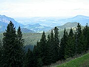
Roßfeld (Göllstock)
| Rossfeld (Rossfeld) | ||
|---|---|---|
|
Roßfeld, Salzachtaler side: Ahornbüchsenkogl - Hahnenkamm - Roßfeldgipfel - Zinkenkopf (secondary summit; left Göll, right Untersberg) |
||
| height | 1537 m above sea level A. | |
| location | Bavaria / Salzburg | |
| Mountains |
Göllstock , Berchtesgaden Alps |
|
| Coordinates | 47 ° 37 '41 " N , 13 ° 5' 43" E | |
|
|
||
| rock | Roßfeld Formation (pebbly sandstones , sandy marl ) | |
| Age of the rock | approx. 130 mya (lower chalk : Hauterivium - Barremium ) | |
| Development | Roßfeldhöhenringstrasse | |
| particularities | Type locality | |
The Roßfeld , also Rossfeld , summit 1537 m above sea level. A. , is a northern branch of the Göll on the Austrian-German border in the northeast of the Berchtesgaden Alps .
Location and landscape
The Roßfeld forms the north-grazing secondary ridge of the Göll between the Salzach and Berchtesgadener Ache , thus separating the Hallein basin from the "basin landscape" of the Berchtesgaden basin or the geomorphological unit of the Berchtesgaden basin . The western flank extends in the Berchtesgadener Land ( district of Berchtesgadener Land ) over part of the municipal area of Berchtesgaden (district Eck , including the Roßfeld ski hut ) and the community-free area Eck (including the Roßfeldalm as well as the Upper and Lower Ahornalm ). The eastern flank belongs to the localities Weißenbach and Gasteig von Kuchl im Tennengau (Hallein district).
In the Salzach Valley, concise as a mountain range, sloping 1000 m freely, the Roßfeld is only inconspicuous in the striking mountain frame of the Berchtesgaden valley basin and stretches gently and populated into the valley.
In the south it starts on the west ridge between the main summit ( Hoher Göll ) and Kehlsteinhaus . Then the ridge called the Hahnenkamm runs from the Ahornbüchsenkogl ( 1604 m above sea level ) to the Roßfeld summit. To the north it finds its foothills in the Zinken ( -kopf, -kogel ) ( 1336.2 m ) and in the Halleiner Dürrnberg and then turns, broken by the Berchtesgadener Ache / Königsseeache at Marktschellenberg and Hangender Stein , towards the Untersberg (Kienberggrat to the Geiereck ).
Göll – Roßfeld – Zinken – Dürrnberg-Zug, from the Trattberg
Josef Mayburger: Evening summer landscape in the Salzach Valley , 19th century (above Urstein Castle )
geology
The Roßfeld is a cover clod of pebbly sandstones and chert- bearing sandy marls that adjoins the limestone masses of the Göll , which is called the Roßfeld formation . Dating back to the time Hauterivium to Barremian of the lower chalk and is about 130 million years (mya) old. Just west of the summit is another Scholl group having Ladin Dolomite and Haselgebirge the Permian (230-260 mya), the northwestern flank then already shows the glacially shaped image of the Triassic Hallstatt and Reichenhaller formations (200-230 mya) that the Hallein Salt Mines produce.
The Roßfeld formation stretches northward along the Salzach Valley, is also found east of Kuchl and Golling ( Moldan -Gipswerke Grubach-Moosegg ) and from there on to the eastern edge of the Alps, as in the Saalachtal, for example on the Steinplatte . The geology of the entire Göll-Lammer mass , Hallstatt facies and the fault zone over the lower Lammertal - Gosau basin has not been fully clarified.
Development and conservation
The Roßfeldhöhenringstrasse runs through the Roßfeld with its alpine pastures up to the summit . The toll panoramic road leads east of the Hahnenkamm - Grates , although German federal private road , partly through Austria and offers a wide view into the Salzburger advantages and Limestone Alps to the Dachstein Mountains .
The Austrian section on this road has been designated as a landscape protection area Roßfeldstraße ( LSG 39 ) since 1960 or as an “agricultural cultural landscape or alpine region and cross-border recreation area in the form of a circular road for excursions”.
A summer toboggan run was set up from Dürrnberg - Gmerk on the northern side summit, the Zinkenkopf ( 1336 m above sea level ) .
In addition, the Roßfeld with its numerous altitude and forest roads as is mountain biking -Gelände and on the German side has long been used as a ski resort, which is also the possibility of a descent to upper and Unterau offers.
|
View of the Berchtesgadner Land, westward
|
View of the Tennengau, south-east
|
Web links
- rossfeld.info , German website of the sports and excursion mountain
proof
- Rossfeld . In: Salzburger Nachrichten : Salzburgwiki .
- ↑ a b Federal Agency for Nature Conservation : Landscape profile - 1600 Berchtesgaden Alps , last change: March 1, 2012, online at bfn.de
- ↑ For the " geomorphological unit of Berchtesgaden valley basin" see Planning Office Steinert, Landschafts + Ortsplanung (D-83236 Übersee): Markt Berchtesgaden - Land Use Plan with Landscape Planning , Chapter: 2.6 Landscape as a Protected Property ; Environmental reports from March 6, 2014 to March 6, 2016, PDF file p. 16 of 48 pages; In addition, multiple use of the terms “valley basin” and “valley basin communities” from p. 3, online at gemeinde.berchtesgaden.de
- ↑ cf. Oliver Josef Krische: The seat of the Alpine Haselgebirge Mélange: The geodynamic development of the central Northern Limestone Alps in the highest Upper Jura and in the Lower Cretaceous. Dissertation, Montanuniversität Leoben, 2012 ( abstract , mu online)
- ^ Roßfeldstrasse in the nature conservation book of the State of Salzburg


