
Sétif (province)
| Sétif | |
|---|---|
  |
|
| Basic data | |
| Country | Algeria |
| Capital | Sétif |
| surface | 6526 km² |
| Residents | 1,505,000 (2006 estimate) |
| density | 231 inhabitants per km² |
| ISO 3166-2 | DZ-19 |
Coordinates: 36 ° 16 ' N , 5 ° 32' E
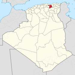
The province of Sétif ( Arabic ولاية سطيف, DMG Wilāyat Saṭīf , Central Atlas Tamazight ⴰⴳⴻⵣⴷⵓ ⵏ ⵙⵟⵉⴼ Agezdu n Sṭif ) is a province ( wilaya ) in north-eastern Algeria .
The province is located around 300 km east of the capital Algiers on an agricultural plateau at 1100 m above sea level, between the Kabylia and the Atlas Mountains . The area of the province is 6526 km².
The province has around 1,505,000 inhabitants (2006 estimate), so the population density is around 231 inhabitants / square kilometer.
The main town and administrative seat is the middle university town of Sétif , of the 60 municipalities, the town of El Eulma also has more than 100,000 inhabitants.
literature
- Teddy Alzieu: "De Bougie à Sétif: à travers la Kabylie ". A. Sutton, Saint-Cyr-sur-Loire 2004. 128 pp. ISBN 2-84910-148-6
- Said Madan¯i, Jordi Surinach: "Intermediate cities and sustainable development: the case of Setif - Algeria". Urban regions: governing interacting economic, housing, and transport systems, (2002), pp. 183–193. Utrecht: Koninklijk Nederlands Aadrijkskundig Genootschap
- Abdelaziz Zitouni: "Contribution à l'étude de l'influence des brise-vent sur les facteurs climatiques et la production céréalière en Algérie: (région des hautes plaines de Sétif)". Paris, Univ., Dissertation 1991. 188 Bl.
- E. Brossard: "Essai on the constitution physique et géologique des regions méridionales de la subdivision de Sétif (Algérie)". Paris, 1868
Web links
Adrar | Ain Defla | Ain Temouchent | Algiers | Annaba | Batna | Bechar | Bejaia | Béni Abbès | Biskra | Blida | Bordj Badji Mokhtar | Bordj Bou Arreridj | Bouira | Boumerdes | Chlef | Constantine | Djanet | Djelfa | El Bayadh | El Meniaa | El M'Ghair | El Oued | El Tarf | Ghardaia | Guelma | Illizi | In Guezzam | In Salah | Jijel | Khenchela | Laghouat | Medea | Mila | Mostaganem | M'Sila | Muaskar | Naama | Oran | Ouargla | Ouled Djellal | Relizane | Saida | Sétif | Sidi Bel Abbès | Skikda | Souk Ahras | Tamanrasset | Tebessa | Tiaret | Timimoun | Tindūf | Tipasa | Tissemsilt | Tizi Ouzou | Tlemcen | Touggourt | Umm al-Bawāqī