
Tindūf (Province)
| Tindūf | |
|---|---|
  |
|
| Basic data | |
| Country | Algeria |
| Capital | Tindūf |
| surface | 182,838 km² |
| Residents | 48,000 (2006 estimate) |
| density | 0.3 inhabitants per km² |
| ISO 3166-2 | DZ-37 |
Coordinates: 27 ° 53 ′ N , 8 ° 11 ′ W
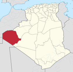
The province of Tindūf ( Arabic ولاية تندوف, DMG Wilāyat Tindūf , tamazight ⴰⴳⴻⵣⴷⵓ ⵏ ⵜⵉⵏⴷⵓⴼ Agezdu n Tinduf ) is a Wilaya (province) in the far west of Algeria .
The capital of the province is Tindūf .
The province is located in the Sahara and borders Morocco , the Democratic Arab Republic of the Sahara (Western Sahara) and Mauritania and covers an area of 182,838 km². This area represents the only Algerian land access to Western Sahara and is therefore of strategic importance. There are also ores and phosphates in this area , which were another reason for the outbreak of the Tindūf War between Morocco and Algeria in October 1963.
The official population is 48,000 (2006 estimate), so the population density would be around 0.3 inhabitants per square kilometer. This number does not include the residents of several large refugee camps who fled to the region in the wake of the Western Sahara conflict . The population of these camps is estimated at around 165,000. The headquarters of POLISARIO and the seat of the government-in-exile of the Democratic Arab Republic of Sahara are located in the Rabouni camp , which is also in the province.
Municipalities

The following municipalities are located in the province as self-governing bodies of the local community:
| Code ONS |
Commune |
Population 2008 |
Area (km²) |
|---|---|---|---|
| 3702 | Oum el Assel | 3183 | 88,865 |
| 3701 | Tindūf | 45,966 | 70.009 |
Individual evidence
- ↑ Wilaya de Tindouf: répartition de la population résidente des ménages ordinaires et collectifs, selon la commune de résidence et la dispersion, Recensement 2008
Web links
Adrar | Ain Defla | Ain Temouchent | Algiers | Annaba | Batna | Bechar | Bejaia | Béni Abbès | Biskra | Blida | Bordj Badji Mokhtar | Bordj Bou Arreridj | Bouira | Boumerdes | Chlef | Constantine | Djanet | Djelfa | El Bayadh | El Meniaa | El M'Ghair | El Oued | El Tarf | Ghardaia | Guelma | Illizi | In Guezzam | In Salah | Jijel | Khenchela | Laghouat | Medea | Mila | Mostaganem | M'Sila | Muaskar | Naama | Oran | Ouargla | Ouled Djellal | Relizane | Saida | Sétif | Sidi Bel Abbès | Skikda | Souk Ahras | Tamanrasset | Tebessa | Tiaret | Timimoun | Tindūf | Tipasa | Tissemsilt | Tizi Ouzou | Tlemcen | Touggourt | Umm al-Bawāqī